Soggy With A Chance Of Flash Flooding
When severe weather threatens, our minds don’t generally straight to flooding as a hazard. More often than not, we think of tornadoes, damaging winds, and hail.
But flooding is a hazard too; one that is more deadly than most realize. Quoted directly from the NWS’s Severe Weather 101 page, “Except for heat-related fatalities, more deaths occur from flooding than any other weather-related hazard.”
We will see a few potentially significant set-ups for flash flooding through the remainder of the work week.

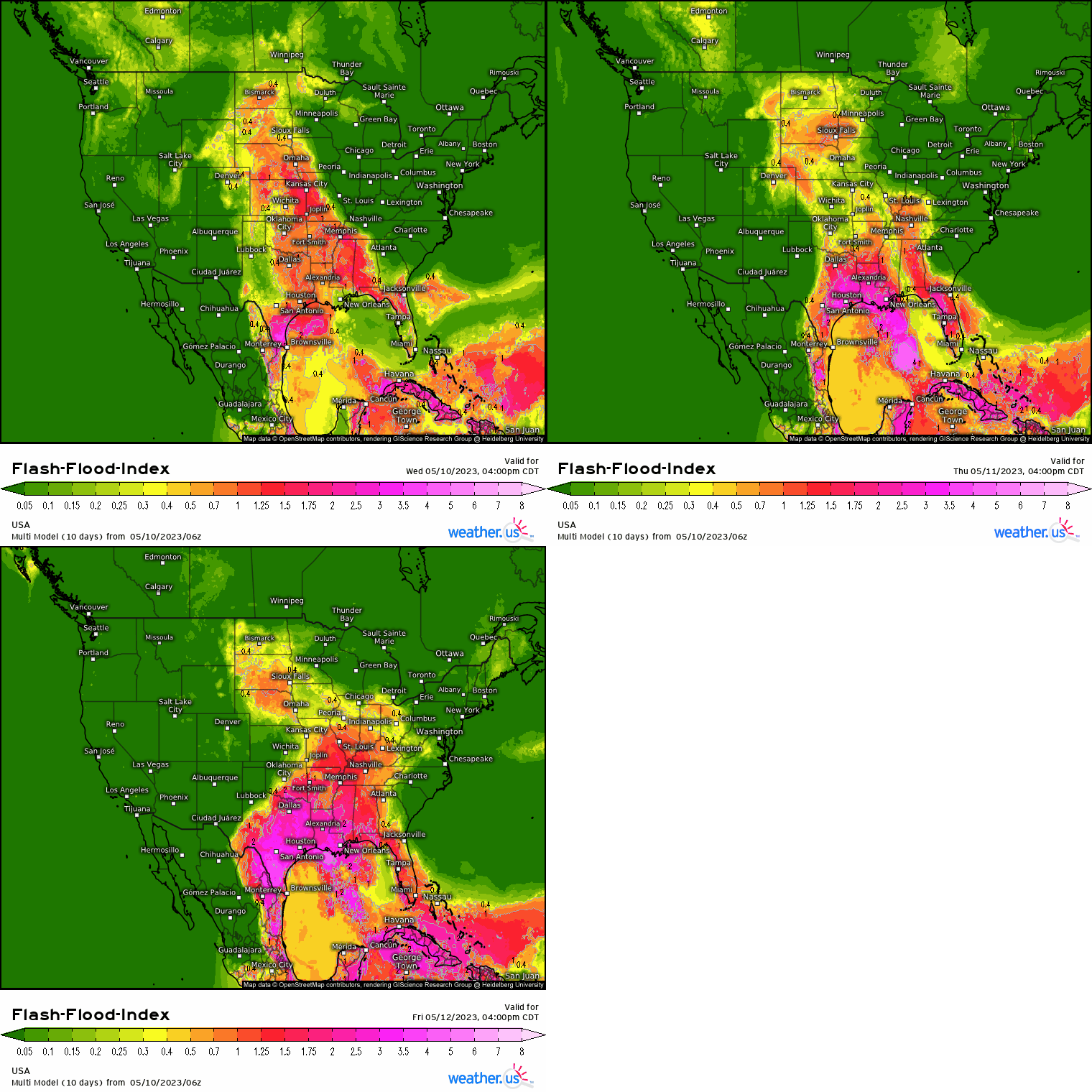
Today (Wednesday) will feature two regions with elevated chances: the Northern High Plains and the Mid-South.

A low will move into the Mid-South from Texas. Gulf moisture will then be pulled north and resulting convection will continuously train along the boundary. Simply put, storms will dump rainfall over the same regions multiple times throughout the day, leading to the chance of flash flooding – especially where soils are already saturated.
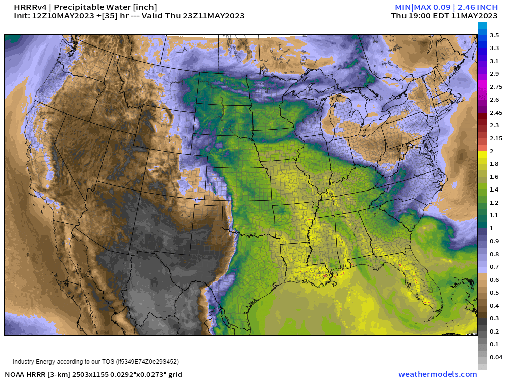
Further north in the Northern Plains, an incoming low will help to pull that Gulf moisture in. Upslope flow will aid in producing convection that, once it taps into the available moisture, will be capable of heavy rain. Storms may train along a boundary here as well, resulting in the potential for flash flooding.
On Thursday, the potential for flash flooding expands further over the Central/Northern High Plains and also into the Lower/Mid Mississippi River Valley. Additionally, the western side of Florida will be added to the risk.

The players remain the same for two of these regions:
In the MS River Valley, the low from the day before will continue northeastward. Gulf moisture is once again expected to meet up with the boundary as convection forms and potentially trains along it. Heavy rain will be possible regardless of training bands, but training will exacerbate the situation.
In the High Plains, the same system from Wednesday will slow and remain over the region, continuing to pull Gulf moisture northward. Once again, upslope flow will help produce convection that will tap into the anomalous moisture over the region. Locations that received heavy rainfall the day before will be particularly susceptible to flash flooding.
In western Florida, an old frontal boundary will provide a focus for storms to fire near. As storms tap into the deep moisture already available over the peninsula, heavy rain may lead to some localized flash flooding.
On Friday, the Northern Plains/High Plains are once again in play. We’ll also add in the Ohio Valley region and much of the Southern Plains.

The same low from the previous two days will continue to bring moisture north to the Northern Plains. Locations that received heavy rain on Wednesday, Thursday, or both will be at most risk for flash flooding.
In the Ohio Valley, the disturbance from previous days will continue to lift out to the northeast. Gulf moisture will continue to stream northward. Training is once again possible with the greatest flash flooding risk where ever these bands materialize.
In the Southern Plains (mostly south/central Texas), a slow-moving low will enter the region from the south. Convection that forms will be equally slow-moving and could result in storms lingering over a particular area for quite awhile. As you can imagine, rainfall can add up quickly in an instance like this. As this will likely occur in the evening/overnight hours, it’s vital to be aware and prepared if a flash flood warning is issued for your area and your property is vulnerable.

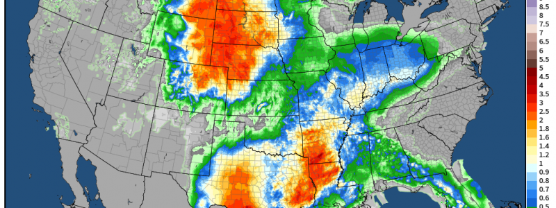
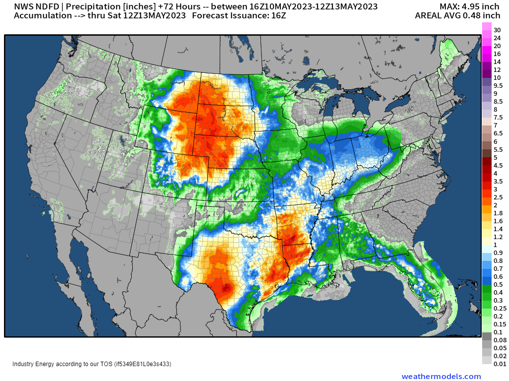
The precipitation forecast from the NWS paints a few “bullseyes” of 4 or more inches over the different regions I’ve discussed above. We can clearly identify south/central Texas (Friday), the Mid-South (Wednesday), and the Northern Plains/High Plains (Wednesday through Friday).
Unfortunately, the weekend will bring even more rainfall to these soon-to-be saturated regions. More on that in subsequent blogs.


