Soggy in the West, Warm Further East
We’re hitting the ground running this Monday morning as we have a few events of note to discuss this week.
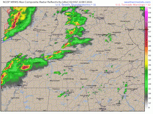
Before we get into that, however, I want to take a moment to recognize how truly unique, disastrous, and perhaps historic the weather was on Friday night.
The “Quad State Supercell” that tracked from roughly Little Rock, AR into North-Central Kentucky was like nothing we have seen in modern times. The full gif displaying the warnings from start to finish is available to view on Weathermodel’s Twitter feed as it is too large of a file to upload to this blog. It’s both awe-inspiring and absolutely horrifying to watch the progression. Surveys are on-going and in a few days to perhaps weeks, we’ll know just how historic this event was for certain.
I will absolutely be including this event in my end-of-the-year write up on the most impactful weather of 2021, so if you are interested in the meteorological evolution of the forecast and the supercell itself, be on the look out for that article in a few weeks.
But to the human component of all this – a few towns were very nearly completely wiped off the map. The death toll is still rising and probably won’t be fully known for awhile yet.
These people need all the help they can get right now. If you are searching for a way to help, or feel inclined to help, I’ve retweeted several threads listing ways to give aid on my personal twitter account (handle below in my bio). Read through the list and see if any are what you’re searching for.
Now, on to what’s ahead.
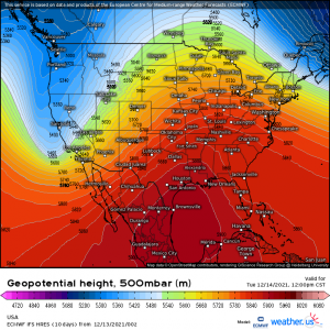
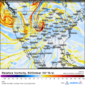
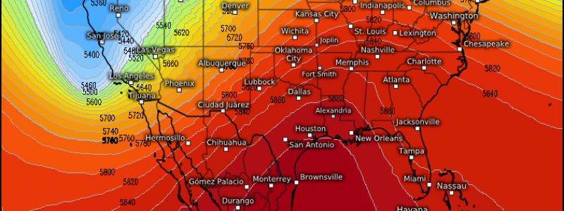
A rather amplified jet stream develops this week. A building ridge will facilitate some very warm weather for the eastern half of the US while a digging trough brings heavy rain and mountain snow to the West Coast. Let’s take a look.
Heat
As you can see from the image above, a strong ridge is forecast to begin building in as early as today. For those under it, this translates to temperatures much above normal.
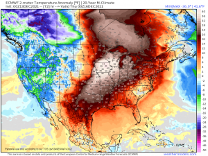
How much above normal? Both the GFS and the ECMWF suggest anomalies of highs of up to 40 degrees above average in places – mainly the Plains into the Great Lakes – by Wednesday. I’d say that’s significant, wouldn’t you?
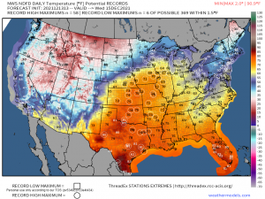
With so much anomalous warmth present, expect high temperature records to be broken.
Records from Texas all the way to the Great Lakes will be in jeopardy.
It doesn’t last, though, as a cold front will move through later Wednesday into Thursday and drop temperatures back near average.
Western Rain and Snow
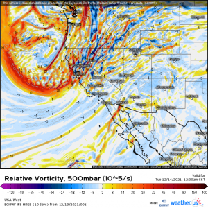
A powerful, digging trough is forecast to begin “coming ashore” today.
This trough will direct a river of moisture along its southern edge into the West Coast and, this time, central and southern California gets a piece of the action.
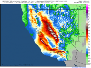
A decently large piece, in fact. Beneficial rain on the order of up to 2 inches (perhaps more locally) could fall across the parched state.
This sudden influx of moisture does have a downside, though. Heavy rain over parched earth can lead to mudslides, flash flooding, and debris flow in any existing burn scars. It’s something to be aware of in any travels you may have today and tomorrow. Be sure to keep up with conditions and don’t try to drive through floodwaters/avoid any areas prone to mudslides.
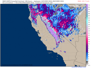
All this moisture will continue up into the mountains, adding to the snowpack.
And what a snowfall it will be! The highest elevations are expecting 5 to 8 FEET of snow! That’s fantastic news for a snowpack that has been severely lacking so far this season.
One last thing to mention before I conclude this blog for today:
The trough digging in to the West Coast will travel east by the middle of the week, becoming a potent-looking little shortwave over the Plains.
Both anomalous warmth and moisture will already be in place thanks to the ridge building in ahead of it.
As of right now, though, instability seems rather limited. However, with strong deep layer shear forecast, if that instability trends up in coming model runs, a severe threat could materialize.
I’m not saying that it definitely is a threat right now. In fact, the SPC states that they do not expect a severe threat, merely a few showers and thunderstorms.
But there’s no harm in monitoring it. As mentioned, with strong shear and above normal moisture in place, it won’t take more than a little positive change to instability for there to be some sort of issue here.
No need to worry right now as it doesn’t look particularly threatening. We’ll revisit this issue in a blog later this week if need be!
