Snow, Snow Go Away
It’s April 18th. Instead of warm spring days, blooming flowers, and singing birds, the Northeast is preparing for a significant snow storm – at least in the elevations.
Snow storms in the Northeast in April aren’t exactly unheard of, but they seemed more common 20-25ish years ago when I was growing up in Pennsylvania. Not that they don’t still happen, of course they do. It’s just that snow in April or even May was not such a big surprise back then versus now in our warming world.
I suppose its all a matter of perception though. When you’re longing for warmer weather, sometimes it seems as if its much colder than it is in reality. Small snow events can seem much larger to someone completely over winter.
Looking back through Monthly Temperature Anomalies for the month of April since 1981, a cooler than average April was only slightly more common pre-2000 than post-2000. Now, not all of those cooler-than-average Aprils featured snow storms, but you get where I’m going with this.
Anyway, back to today.
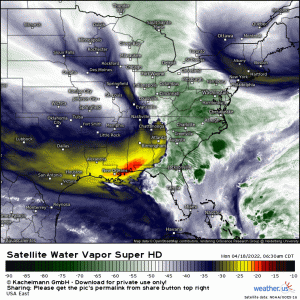
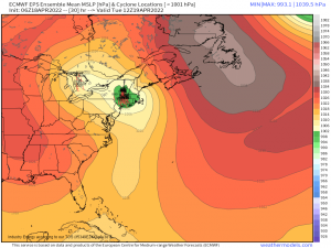
An area of low pressure over the Carolinas this morning will crawl up the coast today. As it does so, it will combine with a trough moving eastward over the Great Lakes region. The result: a Nor’easter.
Unfortunately for any coastal late-season snow-lovers, the center of the low is forecast to track inland. Coastal New England will be on the warm side of the storm while the elevations of the Northeast stay in the cold sector.
I mentioned before that this will be a significant storm for the elevations.
The elevations have the advantage in that it is naturally colder the higher above sea level you are.
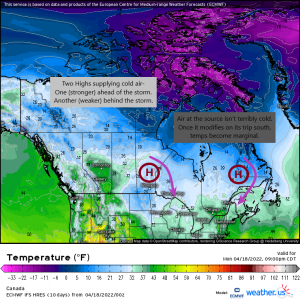
Sure, there are two highs sandwiching this storm – a strong one ahead of the storm and weaker, broader one behind it – both of which will funnel cold air south. However, the air near the center of the high isn’t all that cold. It is, after all, April and temperatures are on the upswing. Once that air modifies as it travels south, it will be barely around the freezing mark. Valleys where temperatures are naturally warmer will still see snow through dynamic cooling (moisture evaporates into drier air, lowering the temperature), but the elevations will be the big winners.
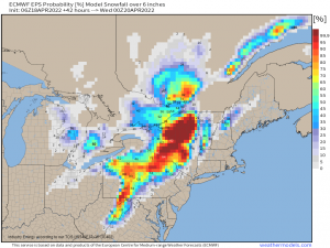
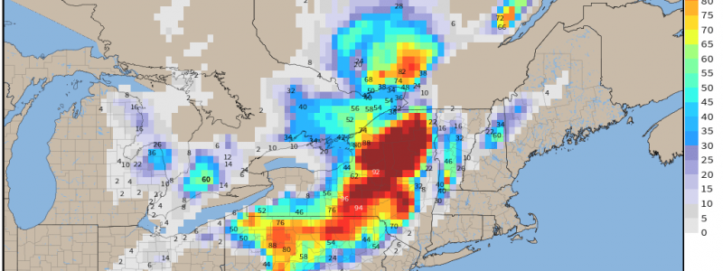
The elevations of central and upstate New York are the biggest winners as they will receive a boost to their totals by lake effect snow on the back side of the system in addition to the initial round of precipitation. Totals of over a foot are likely here.
Also notable is the potential accumulation of half a foot in the Alleghenies of central/south-central Pennsylvania and the Pocono Mountains of eastern Pennsylvania. Again, upslope flow and naturally colder conditions really help out here.
It’s worth noting that with temperatures so marginal, this will be a particularly wet, heavy snow. You know, one of those snows with the large, water-logged flakes. The accumulation of this heavy snow on powerlines and trees can bring them down, causing power outages. Prepare to stay warm should your power go out.
One good thing about April snowfall is that it doesn’t tend to stick around very long afterward.
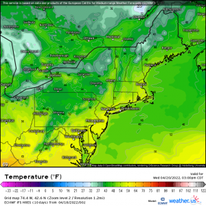
Though the valleys will be back above freezing by Tuesday afternoon, everyone, except maybe the very tops of the mountains, rises above freezing by Wednesday afternoon. Climbing temperatures plus that April sun will likely lead to a quick melt.
Some rivers in this area, particularly in Eastern New York, are near flood stage. It’s possible that a sudden melt could push a few locations into a low-end flood stage. At any rate, it’s something to be aware of if you live in a vulnerable area with a river near flood.
If you’re a snow-lover, enjoy your late-season snow! If not, well, just hold on. It’ll be summer soon.
