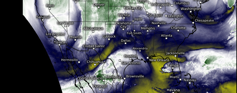
Snow and Ice and Severe Weather, Oh My!
In Friday’s blog, I promised to revisit the severe weather set up for this week. We’ll get to that today, but the system from which the threat originates is much more than simply severe weather.
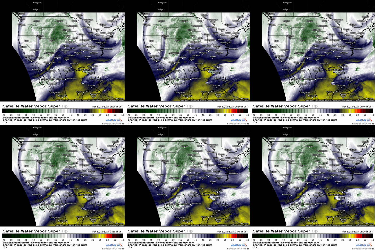
As evidenced on water vapor imagery, we have a large, amplified trough digging in over the Western US. The mid-latitude cyclone that is developing ahead of the trough will offer multiple hazards to a large portion of the country in coming days.
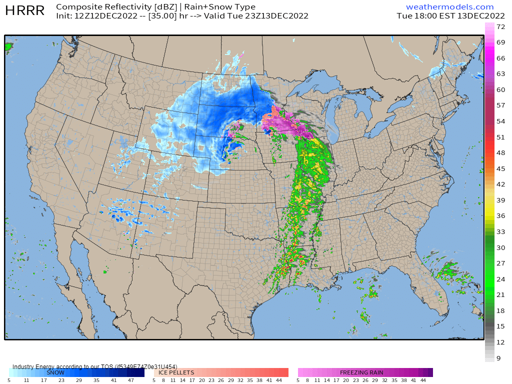
From an intense winter storm for the Northern Plains, to an icing event for the Upper Midwest, to heavy rain and severe storms in the warm sector – this system has it all.
Let’s cover the winter weather portion first, then we’ll look into the severe weather threat.
Snow
In the cold sector of this storm, where temperatures are already solidly below freezing and forecast to remain there, snow will fall.
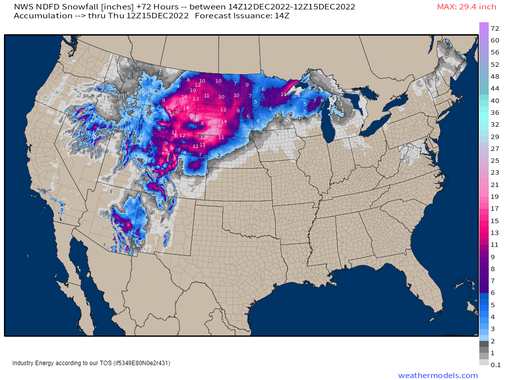
The Northern High Plains will bear the brunt of it with accumulations around a foot across the area.
To complicate matters, as this cyclone deepens and the pressure gradient tightens between the low pressure center and a strong high to the northeast over Canada, winds will increase.
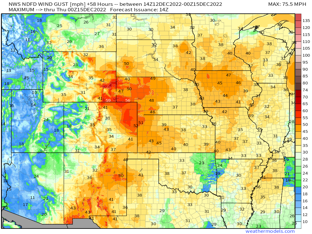
This adds the threat of blowing and drifting to the already-heavy snowfall. Whiteouts are possible as are blizzard conditions.
As a refresher: blizzard conditions occur when winds are sustained at or gust frequently to 35 mph or greater, falling/blowing snow reduces visibility to less than 1/4 mile, and these two prerequisites continue for at least 3 hours.
Travel will likely be dangerous to nearly impossible.
Ice
Along the line where the warm and cold sector meet, icy conditions are likely.
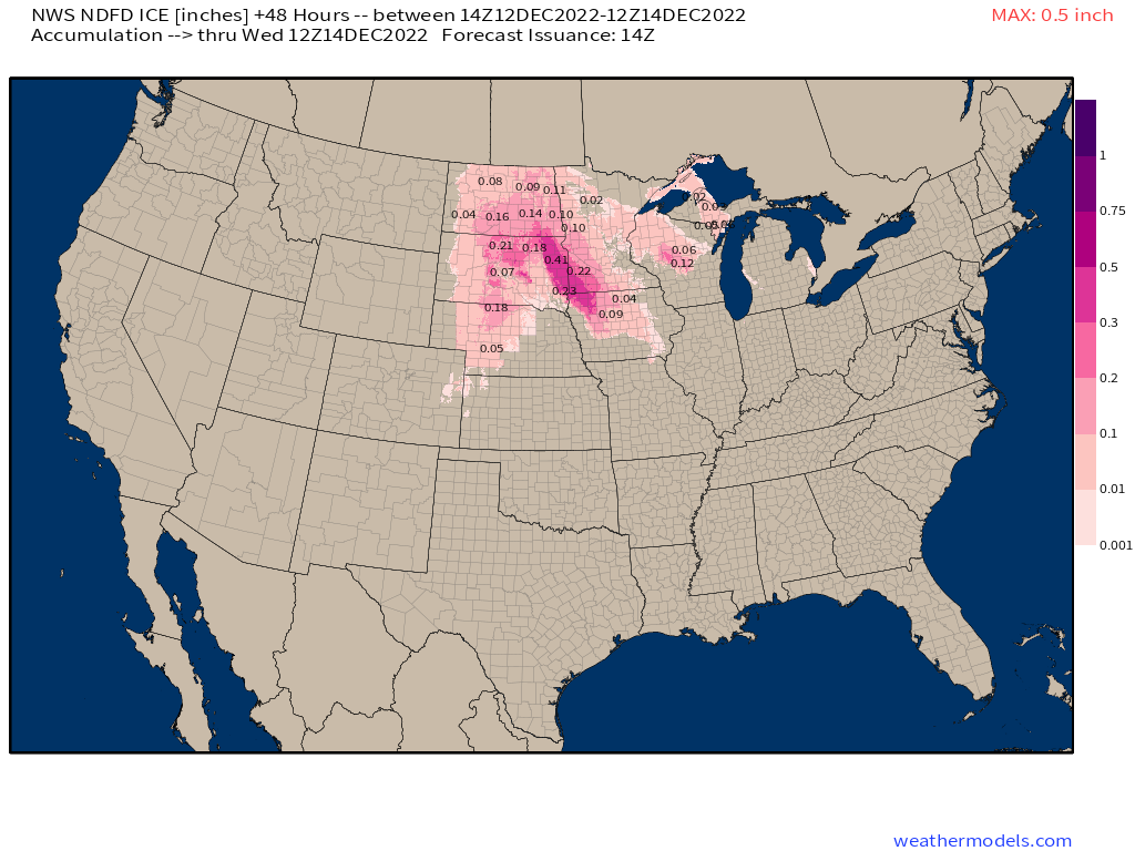
As our mid-latitude cyclone intensifies and the low-level jet ramps up, there will be considerable overrunning of warm air aloft. If you’ll recall from our winter precipitation lesson, a layer of warm air aloft can take what would otherwise be snow and change it to either freezing rain or sleet.
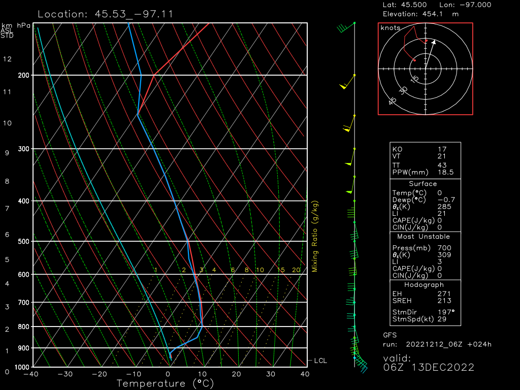
This sounding is from the GFS and is taken from the South Dakota/Minnesota border, valid near midnight tonight.
We can see a decent layer of warm air aloft along with a more shallow layer of below-freezing air at the surface.
Now, in order to determine how deep it is and the max warmth of the layer, you’d need to use a tool like Bufkit – which I did in my pre-blog analysis. According to the 12z NAM, the warm layer is roughly 3700 ft deep with a max temp of 3.5 degrees C. If we go back to our precip-type requirements, we’d see that a layer that warm and that deep would indicate a full melt. Therefore, freezing rain should be falling along the SD/MN border overnight.
That will change as colder air moves in and the warm layer shrinks, of course, but there is potential for some icing to complicate travel in this region overnight and then further east into the day Tuesday.
Severe Weather
In the warm sector, the low-level jet I mentioned above will be busy bringing warmth and moisture into the Mid/Deep South.
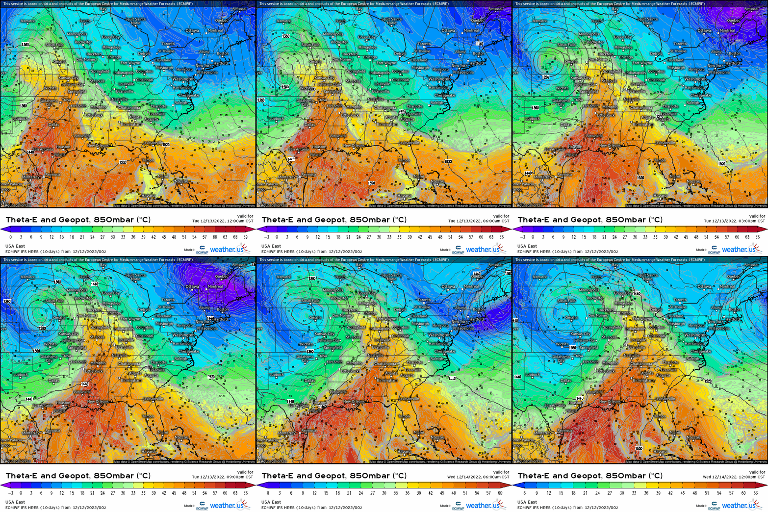
The 850 mb Theta-E transport is a great visual.
For those who don’t know, Theta-E is also known as equivalent potential temperature. It’s basically a measure of moisture and heat in an air mass. A higher Theta-E value equates to a warmer, more moist airmass. So, in this graphic, we are watching the warm, moist air being transported north at the 850 mb (~5,000 ft) level.
If we take this moisture and add in good deep layer shear, we have a recipe for trouble.
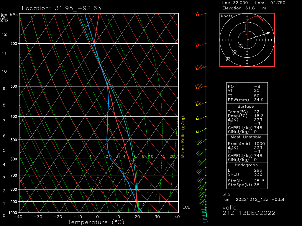
In a sounding from the GFS valid for roughly 5 PM Central in Northern Louisiana, we see a few things of note.
- Excellent low-level shear. Winds back from the SSE and turn solidly SW in the mid-levels. Low-level shear is very important in tornadogenesis.
- Overall shear is still good, despite a somewhat uni-directional look in the mid-levels. It’s still enough to organize storms.
- Lapse rates aren’t great. Could this be an inhibiting factor? Possibly. Storms could struggle to really strengthen quickly.
- Modest CAPE is adequate to fuel storms.
All hazards are on the table for this event (Tuesday). The areas with the highest probabilities of severe weather are Eastern Texas/Louisiana/far Southern Arkansas/Southwest Mississippi. You can see the SPC outlook for more specific locations, but remember that any area under any color on that map has some level of risk for severe storms, even if it is small.
The event will kick off tonight over the western parts of the Plains region.
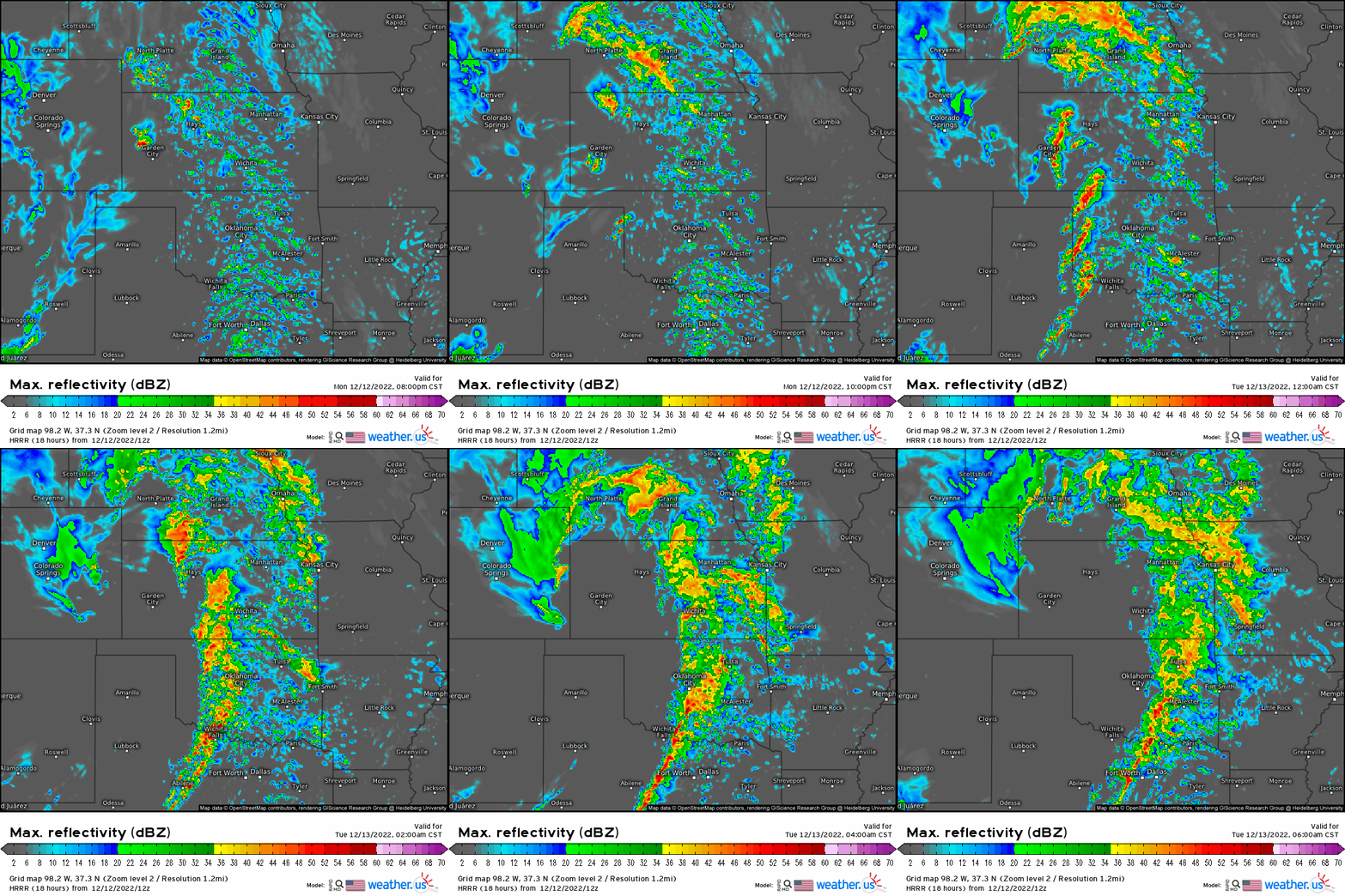
However, it is expected to be somewhat more limited than Tuesday’s event due to lack of moisture/instability. Still, as it is an overnight event and capable of large hail and perhaps a tornado or two, it would be wise to make sure you’re prepared ahead of time.
We’ve already discussed Tuesday’s outlook above. However, storms are expected to persist further east as Wednesday dawns.
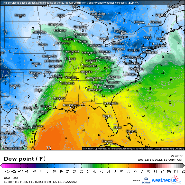
Due to influence from high pressure to the Northeast, moisture return will be severely limited on Wednesday. Therefore, the risk for severe weather will remain confined closer to the Gulf Coast in southern Louisiana/Mississippi/Alabama and the Florida panhandle.
This isn’t expected to be a non-event – in fact, potential exists for a few tornadoes to occur here in addition to a damaging wind threat on Wednesday. Be prepared to act if warnings are issued.
What You Need To Know:
- A large system will move eastward this week and brings multiple hazards spanning much of the US.
- In the cold sector, heavy snow is expected along with strong, gusty winds. Blizzard conditions are possible and travel will likely be impacted.
- On the border of the cold/warm sector, icy conditions are likely. Though it does not appear to be a devastating ice event, travel could be impacted some, especially near the morning commute hours on Tuesday.
- Severe weather will occur in the warm sector.
- It will kick off this evening in the western portion of the Plains. The overall risk is a bit more scattered, but large hail and perhaps a tornado or two are possible overnight. Have ways to receive warnings.
- Tuesday seems like the most potent in terms of severe weather risk. More moisture and increasing shear will lend to the possibility of tornadoes, a few of which could be strong. Damaging winds are also possible, especially as storms transition to a linear structure.
- Wednesday’s risk will be confined closer to the Gulf Coast but still has potential to be impactful as damaging winds and a tornado or two are possible.
- Additionally, heavy rain on top of already soggy ground due to a week’s worth of wet weather may cause flooding anywhere in this region. Use caution when traveling.
For those under the threat of severe weather, make sure you have multiple ways to receive warnings and are ready to shelter if the need arises.
For those facing colder weather, use caution traveling or simply stay home entirely, if possible.
Lastly, heavy rain over already saturated ground will bring a widespread risk of flooding to much of the Mid/Deep South and Southeast. Please don’t drive through floodwaters. Additionally, if your location floods easily, prepare as best you can for that possibility.


