Sluggish Pattern Brings Northeast Sun, Mississippi Rain
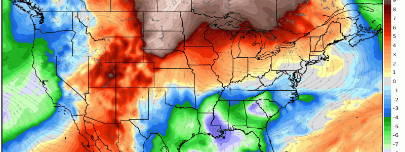
Happy Saturday! A lovely atmospheric set-up to write about, and an even lovelier one to experience, is bringing anomalous, springlike warmth to the Northeast this week, and crummy weather to parts of the central US. What a fitting way to kick off the best season of the year!
Considering the last two blogs I wrote were quite lengthy dives into significant tornado risks that overlapped with populated regions, it feels good to write today about warmth and general calm.
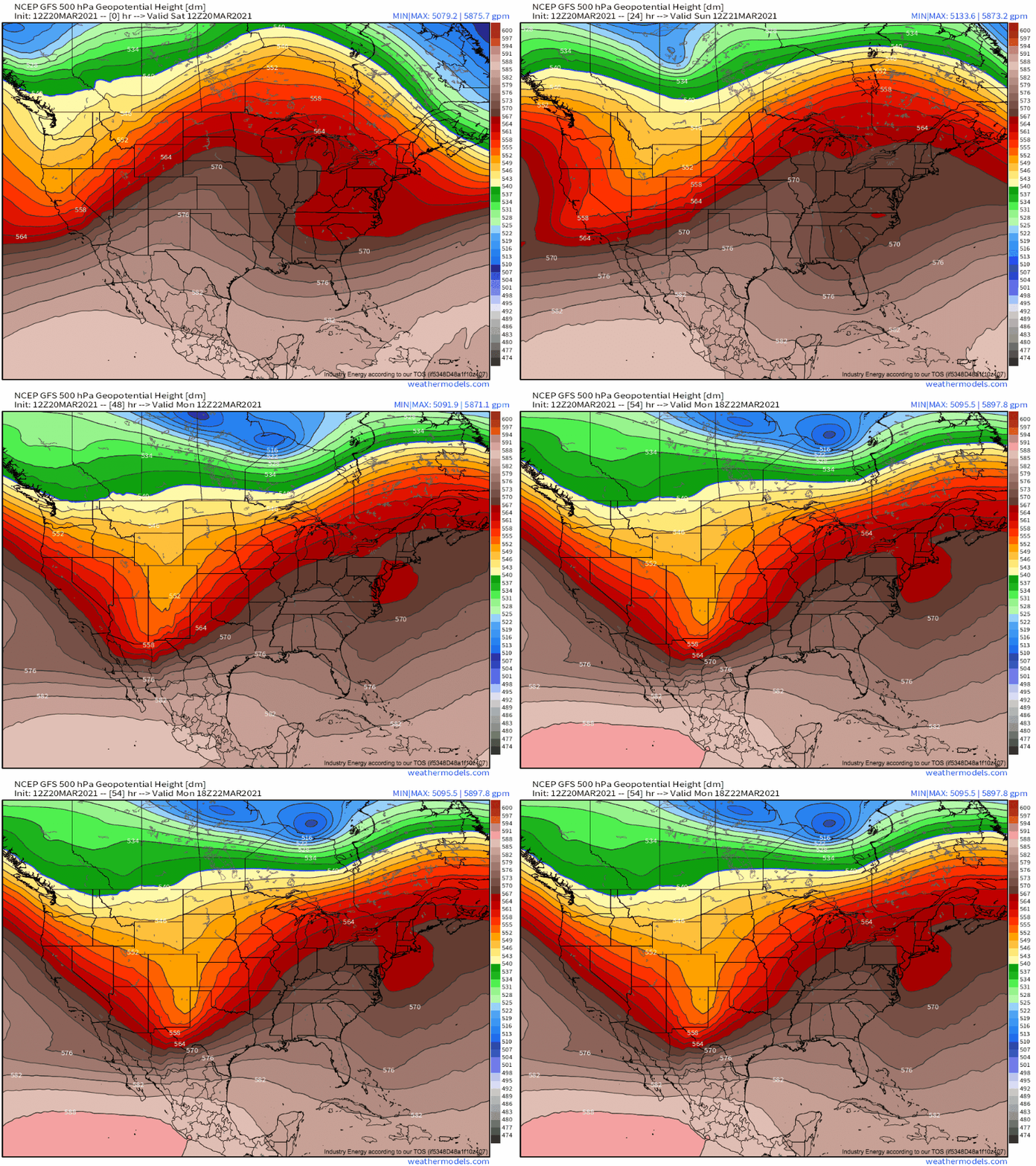
Aloft, two things will happen at once to kick the pattern off today. The first is an effective removal, at long last, of stubborn polar troughing that’s been pivoting across New England in an effective stall since earlier in the month. This comes as longwave ridging expands northeast, forcing downstream flotsam in the jet to break up into a relatively progressive flow regime. Simultaneously, a high-amplitude but relatively weakly forced longwave trough diving south towards the Baja peninsula will kick heights up over much of the United States.
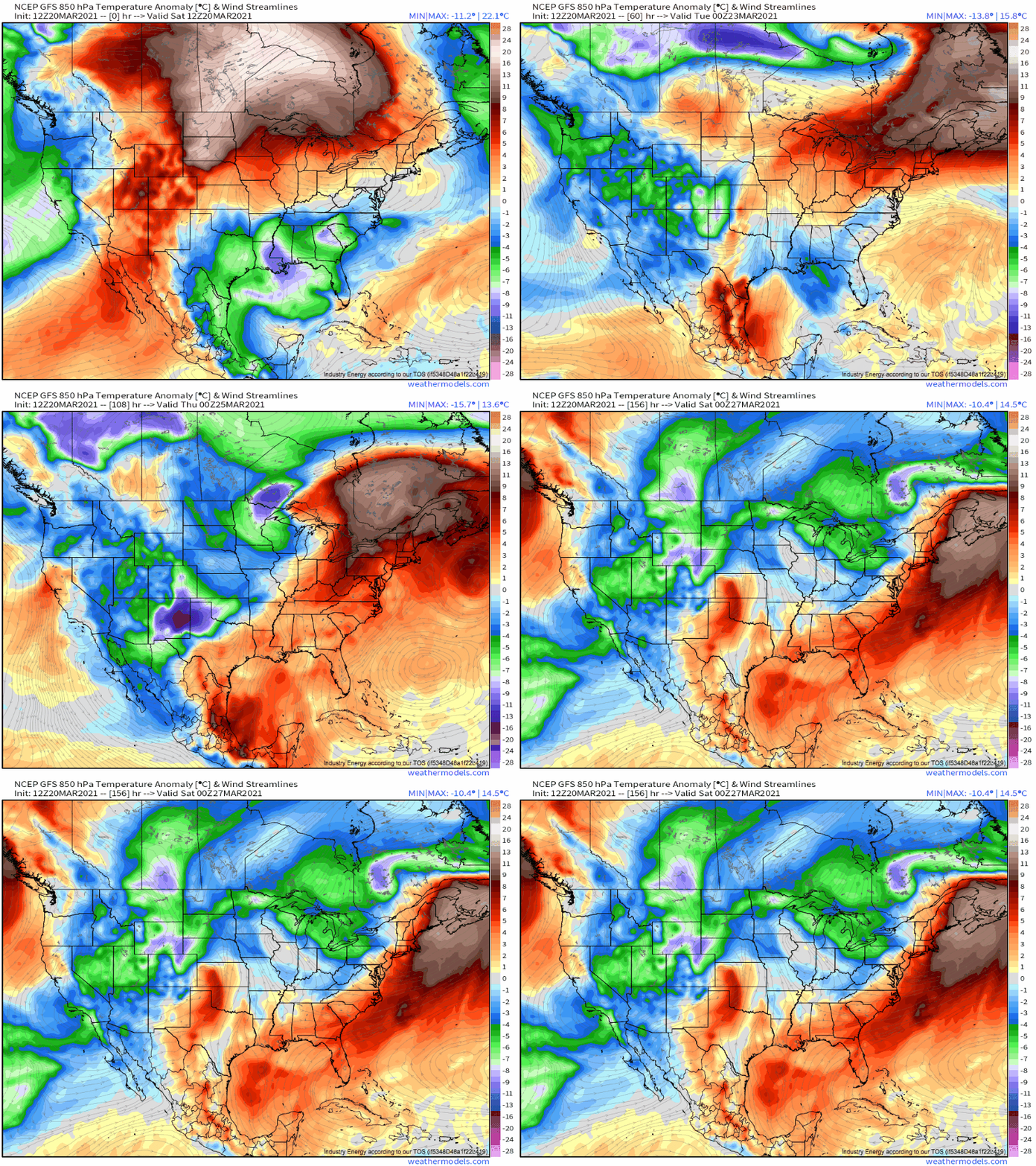
This combination will midlevel warm air advection to work with a preferred cyclone motion over the southern Hudson bay region to overspread much of the eastern US with incentive for unusual warmth. The result will be six hourly low level thermal anomalies swelling between +5ºC and +20ºC for the duration of the flow regime.
How persistent will this regime be, anyway? Well, weakly forced longwaves tend to stick around, closing off into blocking troughs that maintain downstream ridging. It looks like this sort of pattern will prevail over the CONUS for basically the entire work week, as the increasingly diffuse zone of low heights aloft is continuously reinforced by crashing shortwaves.
This will lead to a beautiful week for many in the east, as ridging keeps persistent high-angle sunshine cranking and impressively warm air flooding in. This isn’t necessarily a good thing- it’s normally the rainy season for much of the area, and even with the stratiform showers a could of days ago for some, widespread anomalous dryness has been the story this month. That looks unlikely to alleviate soon.
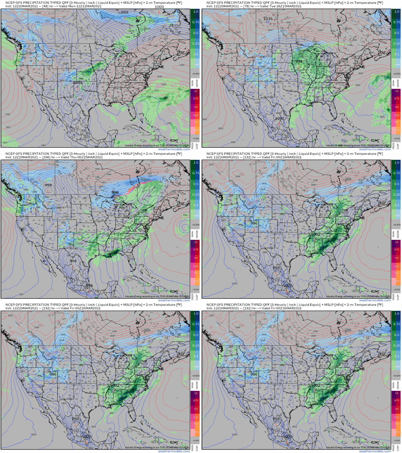
Funnily enough, this jet setup will also lead to a crummy pattern just west of the Mississippi, where persistent, albeit weak, forcing for ascent remains training for a multi-day fetch. A general lack of persistent destabilization or strong baroclinicity will keep *heavy* rain minimal, avoiding a flood threat, but it’ll be a gross week for sure for many, especially where persistent northerly flow keeps temperatures raw.


