Slow To Depart Snowstorm Will Impact New England
Following today’s winter storm, commuters and weather enthusiasts of the Northeast will only have a day to relax before another approaches the area, starting tomorrow evening and threatening an unusual long-duration accumulation event.
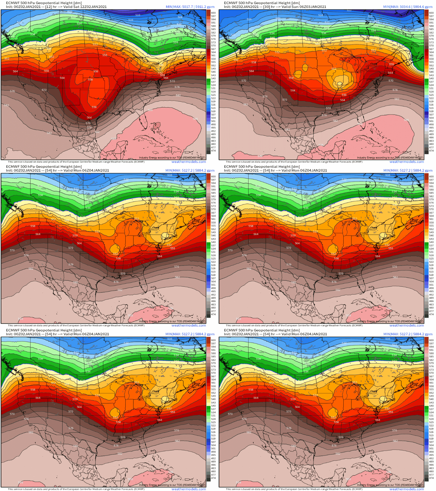
The first part of this storm will be a somewhat typical quick-hitting, moderate intensity nor’easter. An initially moisture-starved closed low currently over Texas will quickly pivot northeast while intensifying.
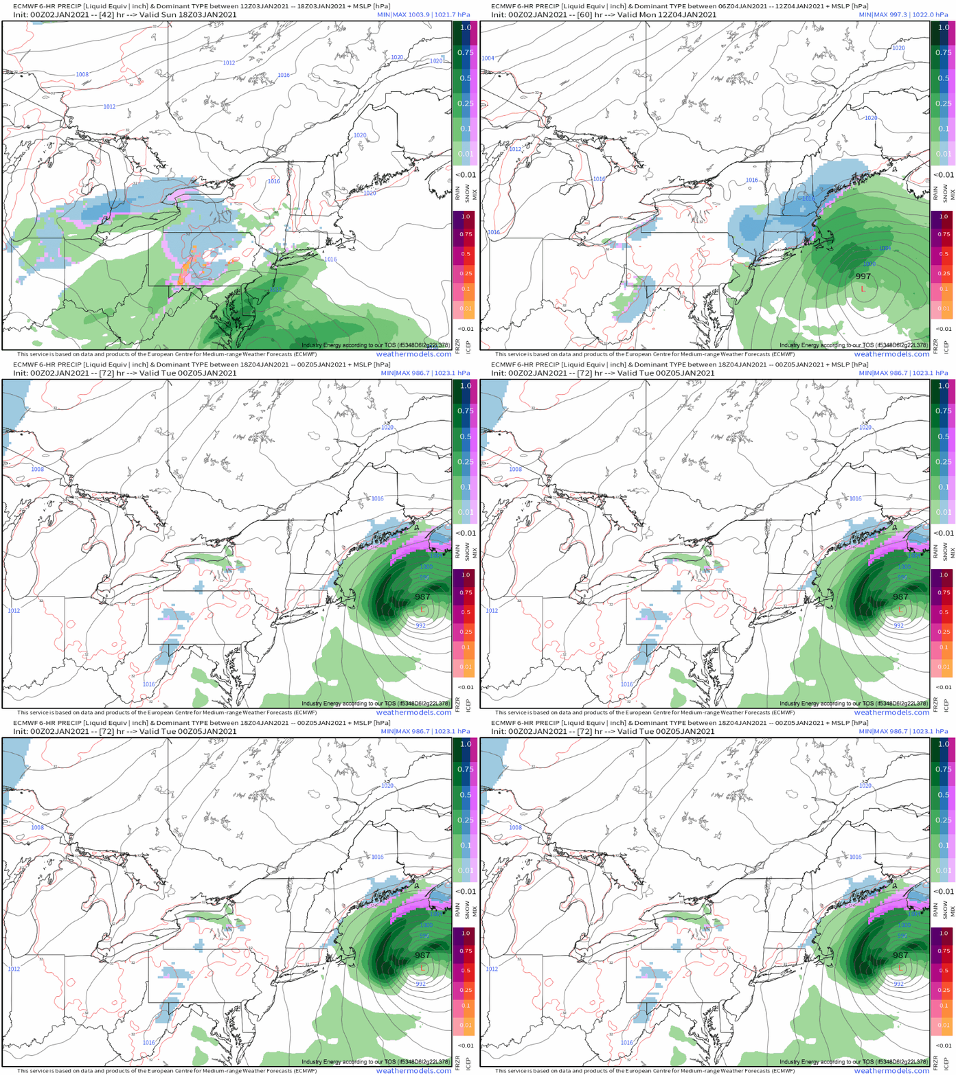
As it reaches the northeast, intense divergence immediately to the east will allow a maturing low-level cyclone to accelerate towards the 70/40 benchmark, where it will start to occlude late Sunday. It looks like much of the occlusion, and associated retrograde, intense banding, etc. will happen northeast of the benchmark, though. That will, in all likelihood, prevent this storm from becoming a two-footer for Boston, but a moderate slug of precipitation is still likely in southern New England tomorrow night.
Now, snow buffs will notice something else wrong with this setup- the antecedent airmass is southern stream ridging!! As I write this blog in central CT, it’s currently a gorgeous 50°, and any real cold air is locked north of zonal flow in northern Canada. Ouch. The storm will have time of day working for it thermally, but temperatures ranging from marginal to simply warm will probably keep rain locked into southeastern New England (Cape Cod, much of Rhode Island, New London, Long Island for example). Elsewhere, snow will be dense and pasty.
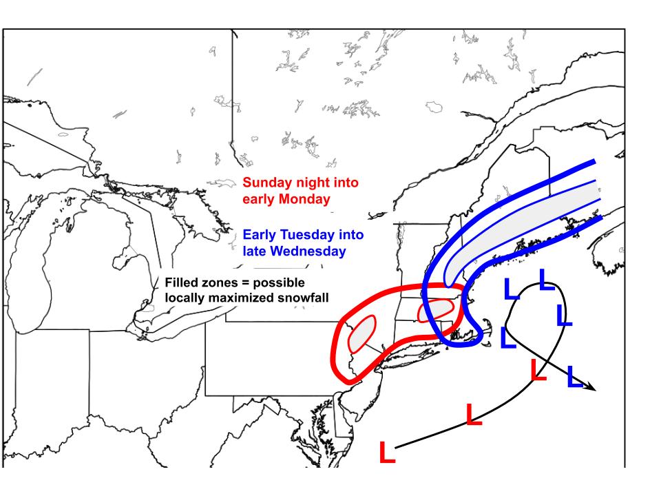
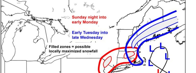
Without that much persistence or dynamic support leading to moderate precipitation at best, and lackluster thermals keeping snow ratios (and in some places, snow as a whole) minimal, this shouldn’t be more than a 2-4″ event for a swath of interior SE New England by Monday morning. Totals in places that could stay colder, like the Catskills and the hills of NE CT/central MA, could locally exceed 6″.
Of course, we could anticipate a northwest trend, which would bring the low closer to the benchmark and encourage banding over land, but without antecedent cold air, that would likely just produce a swath of dynamically forced rain in SE New England. Time for that sort of trend is also running out fast.
After Monday, this storm gets weird. Like, really weird.
Downstream blocking and zonal flow to the northwest means incentive will be minimal for the closed low to go anywhere fast. And so it looks to stick around. 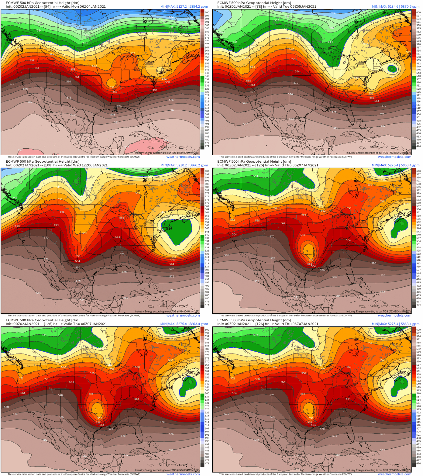
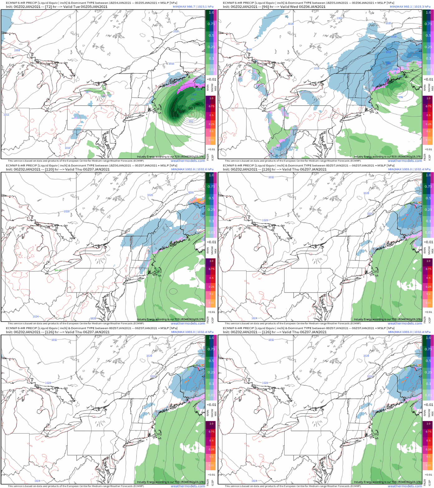
Where the closed low initially jumps to the southeast, corresponding with the full occlusion of the surface low, a band of very heavy, persistent precipitation is likely. Sadly for snow lovers, this will almost certainly happen so far SE that the heaviest dynamic forcing and corresponding precipitation will set up over the ocean, barring an unusually significant northwest shift. Normally this would be the end of the story. Not this week.
Tuesday, a diving trough threads the needle of reinforcing the trough without pushing it too hard in any direction. This is certainly helped by upstream zonal flow and downstream blocking, the former reducing the trough’s ‘oomph’ factor and the latter encouraging the closed low to stay as far west as possible. The energy injected by this trough will pull the surface low northeast, as the closed low it’s stacked beneath pivots around the broader trough base.
This will allow moderate precipitation banding to envelop the coast of northeastern New England, where the January sun should allow mostly snow despite above-average temperatures. Persistent light to moderate snow is expected, with meh dynamics but a broad precipitation field at the hands of an already-matured cyclone.
Eventually, circa Wednesday night, the closed low will consolidate, and the surface low will slink southeast as a weakening stacked cyclone, allowing snow to wrap up along eastern New England. This will end a four day run of this system pestering New England. While snow should never be falling very heavily, some parts of New England, probably Maine, could very well pick up more than a foot of snow given the longevity. If moderate banding can remain persistently localized, which we are simply too far out to say with any certainty, a couple feet could fall, probably in the higher elevations of internal Maine.
Enjoy (:
