Significant Winter Storm To Develop as Cold Intrusion Intensifies
This will be the busiest week for winter weather in the United States in many years.
A long-duration reversal of typical polar atmospheric flow has allowed the tropospheric (lower and middle atmosphere) polar jet to weaken, allowing lobes of frigid arctic air to spill south towards the more populous mid-latitudes. Last month, the loose bucket of polar air sloshed into Europe, allowing snow to fall in unusual cities such as Madrid and Paris while forcing much of the continent into periods of deep chill.
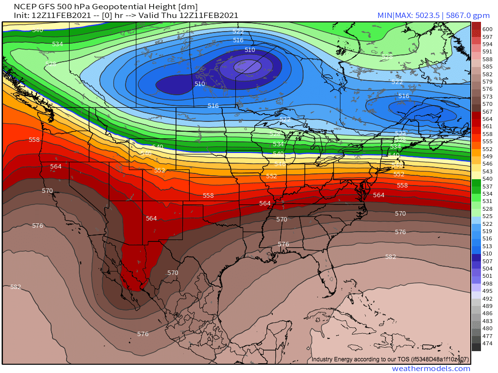
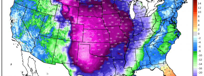
Earlier this month, a large slug of cold midlevel air descended towards the US/Canadian border. It has promoted low level temperature anomalies on the order of -30°C, but the orientation often kept the coldest air locked in the northern third of the US, regions somewhat used to extreme cold.
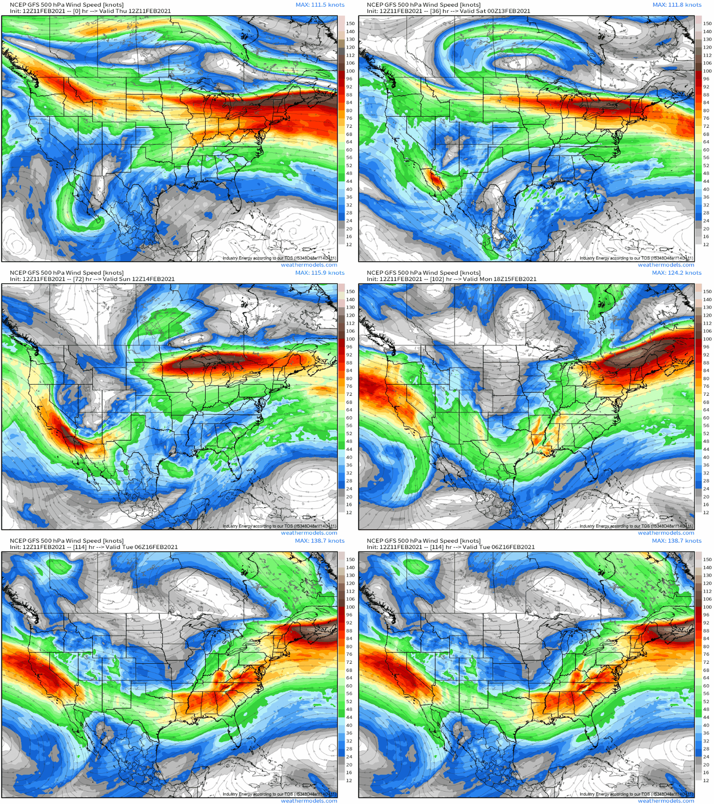
While some cold air is able to filter south, bringing low-level temperature anomalies of around -15°C to much of the southern plains, the truly frigid air remains stuck north of a strong midlevel jet over the north-central US. So, while records aren’t falling today, winter weather is impacting places that don’t often see it, like Dallas’s ice storm.
But this is set to change. As a secondary tropospheric arctic lobe swings down from Canada, a re-orientation of the midlevel cold air will allow the jet serving as the polar air boundary to redevelop south towards a trough diving towards. As a result, the arctic air will freely spill south behind this midlevel system.
Notice the belt of high wind separating much of the central US from Canada, and notice how it reforms south into a trough around Sunday.
The inevitable major impacts this will have over the central US will be discussed below. But the storm will actually lay down some significant snow in a city before it even crosses the rockies, delivering an unusual winter storm blow to Seattle.
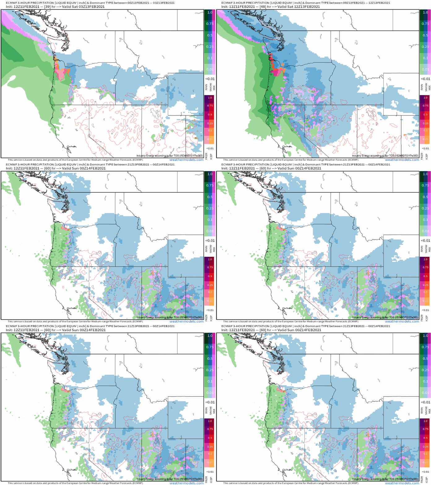
Unlike the mountains that surround it, Seattle rarely sees more than 6″ of snow in a single storm. Proximity to the moderate Pacific combines with mountains to the west to prevent really cold airmasses from taking hold of the city. But some airmasses are just cold enough to win out over unfavorable topography, and one such exception will be the rule tomorrow into Saturday.
With temperatures 10°-20°F below average, a plume of Pacific moisture will interact with synoptic scale lift and both atmospheric and topographical convergence to bring even the low-lying parts of Washington state, such as Seattle, heavy snow tomorrow into Saturday.
QPF likely won’t get above ~0.75″ with the fairly fast moving system, but snowfall ratios could actually end up fairly good with an elongated DGZ coinciding with maximized lift and saturation just above 700mb. The official forecast calls for 4-8″, but considering the tendency for these systems to dump precipitation, and the fact that this could very well be more of a fluff bomb than the area is used to, I could see amounts in the city hitting 10″ if lucky.
After the storm moves SE of Seattle, moderate to heavy snow will continue in the Great Basin and rockies, with frigid air filtering in in its wake. The quick motion of the storm here will combine with increasingly modified Pacific moisture and low population density to preclude major impacts.
Late Saturday night, snow will begin to spread into the central Plains as the system slinks down the Rockies. It won’t be overwhelmingly heavy at this point, but below zero temperatures as far south as central Kansas will combine with increasing northerly flow to insure impacts abound.
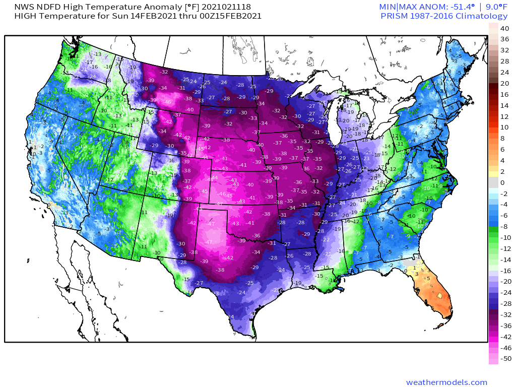
During the day Sunday, the low pressure system will rapidly jump towards central Mexico and then the far western Gulf as the divergence of the parent trough interacts with increasing baroclinicity with eastward extent. As it does, northerly flow will surge towards the Mexican border, and temperature anomalies approaching -50°F will overspread Kansas, Nebraska, Oklahoma and Texas.
By Sunday night, the consolidating western Gulf surface low will overrun this frigid airmass with moisture advection, and a potpourri of winter hazards will threaten a populous region that is not used to seeing significant snow, ice, or cold.
While it’s too early for specifics in what threatens to be a finicky situation, a lot could be on the table: a foot of snow in a swath from parts of Oklahoma and Texas through Arkansas and towards the northeast is shown by the GFS today, and it isn’t an unreasonable outcome given the set-up.
Stay tuned- this is sure to be a developing story.
