Significant Tornado Threat To Overspread Parts of Texas Panhandle Today
Numerous severe thunderstorms will likely develop across parts of the Texas panhandle today, with an attendant risk for large to significant hail, scattered damaging wind, and a number of tornadoes, some of which could be strong.
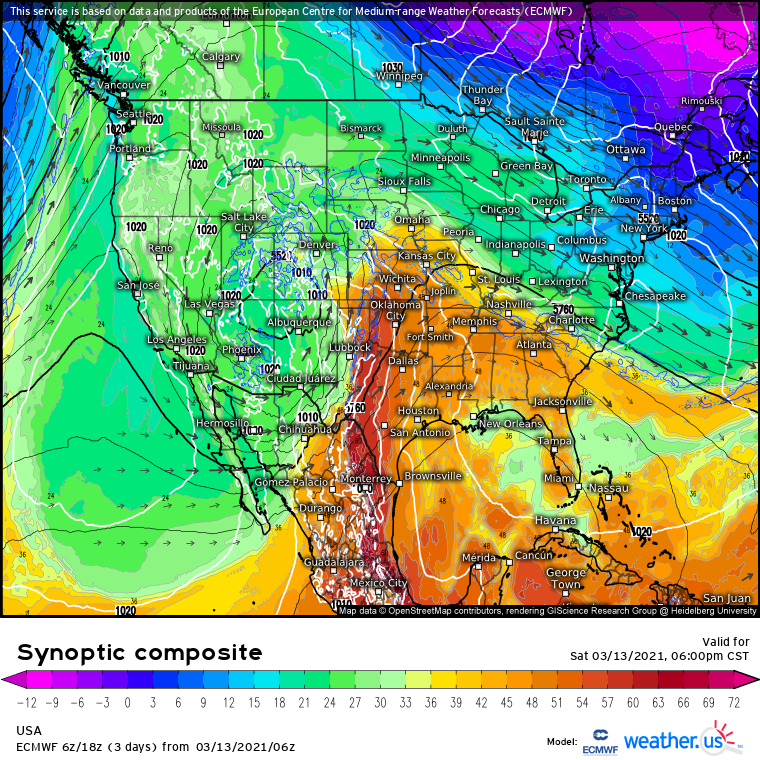
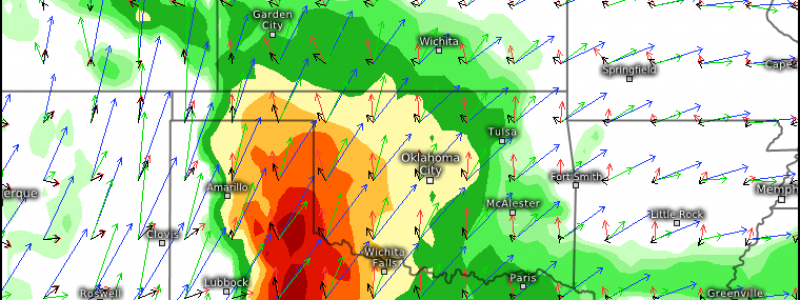
This morning sees a large and intense midlevel closed low bowling through the four corners region, with an impressive 100 knot jet streak ejecting eastward. In the exit region of this jet, 50-70 knot flow overspreads a zone of stout divergence, which itself will incentivize cyclogenesis to continue along the Texas/New Mexico border. A strengthening southwesterly low level jet of moderate magnitude will snake towards this zone of relative low pressure, continuing a multi-day fetch of moderate Gulf moisture return into the south-central Plains.
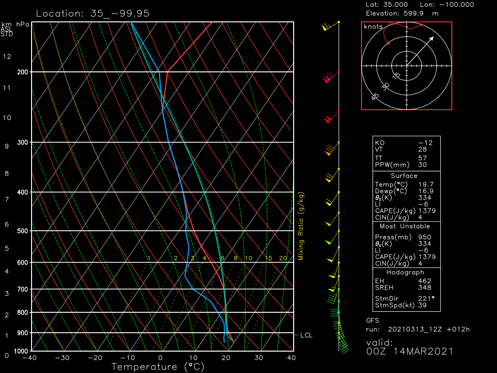
The result is a seasonally impressive warm sector of 55-65ºF dewpoints across portions of Texas and Oklahoma, which will be heated through broken cloud cover through the afternoon. Impressive flow throughout the atmosphere will help overspread this warm sector with a number of parameters typically favorable for severe storm formation. At the low levels, around 850mb, 30-50 knot southerly winds will promote large hodographs, favorable for rotation in any convection that can develop. Higher up in the atmosphere, southwesterly flow will transport a warm, dry elevated mixed layer that will serve to enhance the speed at which temperatures decrease with height. This will enhance instability where it overlaps with sufficient dewpoints for enthusiastic updraft development.
Caps around 700mb often occur with EMLs and prevent widespread open warm sector convective initiation, but today’s modeled hodographs differ from previous runs, and general rule of thumb forecasting, in showing any morning time inversion around 700mb to have been mixed out by peak heating.
Higher up still, the spreading of heights aloft overlapped with speedy exit region midlevel flow will promote a strongly sheared sector with favorable synoptic-scale incentive for ascent. This will help updrafts develop and organize, the slate upon which mesocyclone genesis can occur given favorable low-level kinematics.
Having all the parameters necessary for tornado development is one thing. They have to overlap, and they have to be taken advantage of by robust, discrete convection, for significant tornadoes to actually occur.
To figure out the conditional that is the former, and to consider where this overlap might occur if it does at all, it’s important to determine the limiting factor of the parameter space.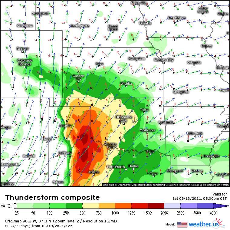
Booming kinematics overspreading basically the entire region mean thermodynamic factors will likely limit the areal extent of the severe threat, a hunch confirmed by CAPE profiling. CAPE is mainly a function of surface moisture return and lapse rates throughout the atmosphere. Both seem to have relative maxima across the Texas panhandle, where broken cloud cover and peak EML coverage with peak heating will promote quick atmospheric cooling relative to parcel temperature, and where topographical and atmospheric pooling will enhance dewpoints.
The result will be a zone quite favorable for the development of storms given forcing, which will likely develop a relatively substantial tornado risk given the kinematic and thermodynamic parameter space if they can remain discrete.
This forcing will come from a dry line/cold front and from localized divergent maxima imbedded in flow aloft. The latter is only possible thanks to the removal of EML capping mentioned, so this is an important parameter to watch. This is especially true considering an important caveat of today’s threat: the further west storms develop (ie, closer to the cold front), the more their motion will parallel the orientation of initiation. Such motion will lead to storms rapidly coalescing into linear, scything the tornado threat. This means storms that develop east of the front, over the open warm sector, will have the best chance to produce significant tornadoes. So, pay attention to the degree of capping in any soundings taken today away from the front.
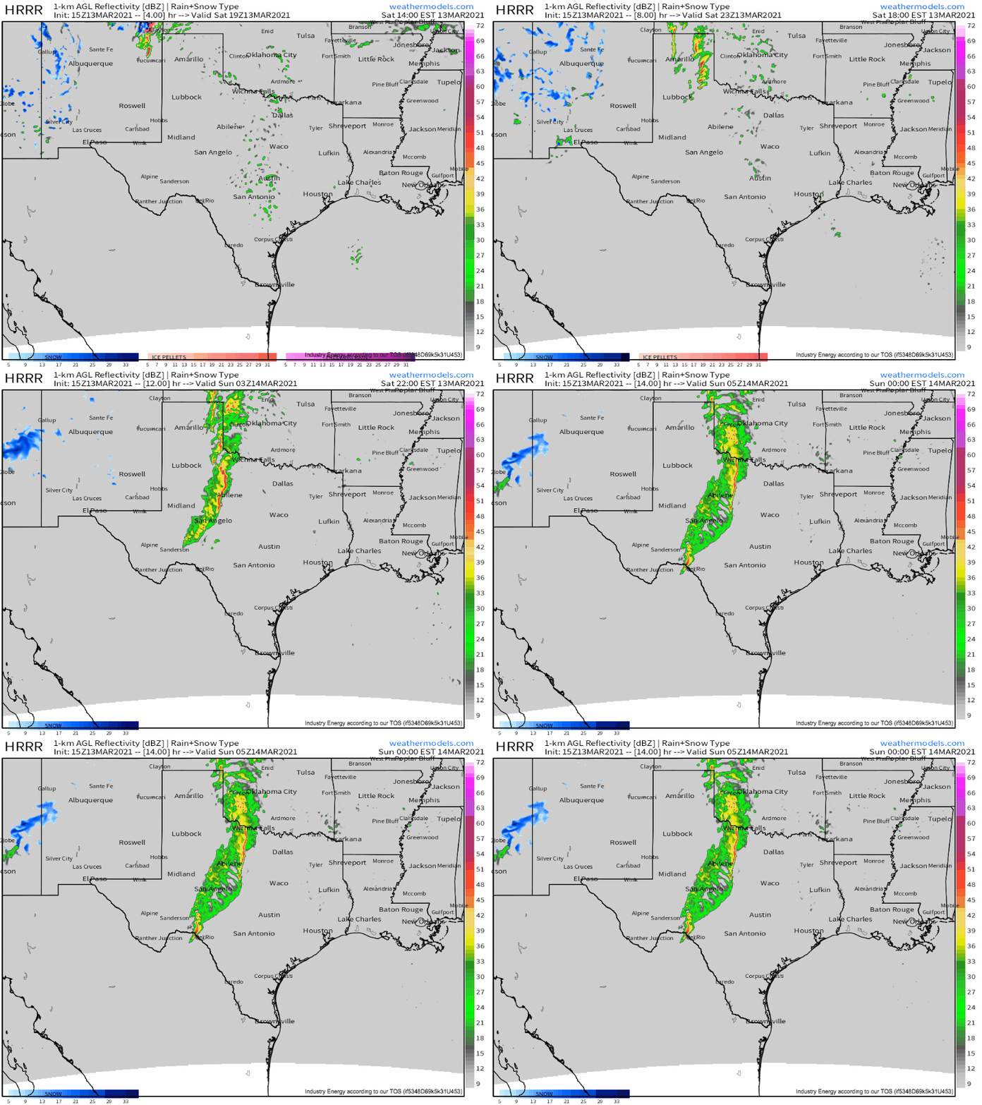
The most likely scenario, based on this parameter space and CAMs, is a round of storms initiating over the open warm sector in the mid-afternoon near and south of Amarillo in response to subtle forcing aloft. These storms will be very dangerous, likely posing a threat for tornadoes and very large hail. In this parameter space, significant (EF2+) tornadoes could occur.
To the west, storms will also form along the dryline/cold front, quickly becoming undercut by forcing and growing upscale into a line. In the first couple hours of these storms existing, into this evening across much of the Panhandle, large hail and a couple tornadoes are possible, before the threat becomes wind-dominated by sunset as storms grow upscale into a large linear cluster.
It seems the biggest uncertainty will be in regards to the first round of discrete, open warm sector convection development. Sufficient forcing for ascent and sufficiently weak capping are both conditions that must be met for this to occur, and while both seem more likely than not at the moment, either is far from assured.
Those in the areas impacted should be sure to have multiple ways to receive warnings today!!
Stay tuned to our twitter for updates.
