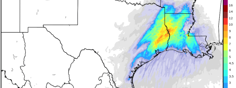
Significant Severe Weather Likely for 11/29
The easiest way to stir up active weather is to take a holiday break, it seems. Though our Thanksgiving break isn’t quite over just yet, I’m here a day early because we have a potentially dangerous severe weather set-up to discuss – and I’d like to give you as much of a heads up as possible.
Let’s jump right in.

On the synoptic level, a trough that is currently impacting the Pacific Northwest with rain and snow will dig into the Rockies region as we start the work week.
As the blossoming system descends the Rockies, it will undergo cyclogenesis and a surface low will form in the vicinity of the Central Plains states.
Additionally, the southern branch of the jet stream will attempt to partially phase with the northern branch of the jet stream. This leaves us with dual jet streaks over the Mid-South/Deep South by Tuesday as well as the potential for this event to pack a punch.
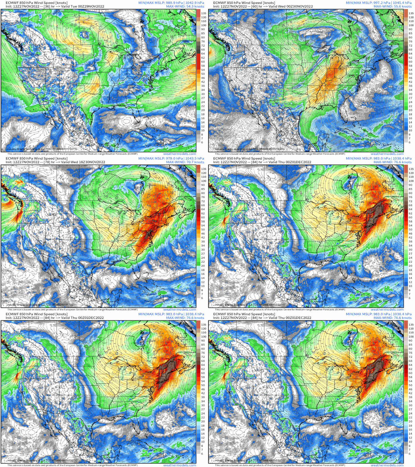
As the surface low forms and deepens some, the low-level jet will increase in earnest as early as Monday evening, priming the target area with moisture.
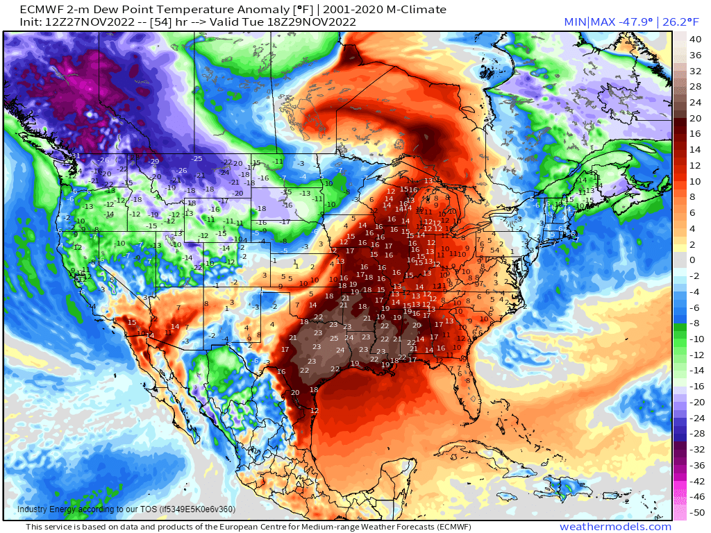
In fact, this moisture will be more than a bit anomalous. Dew points are forecast to soar into the mid 60’s and low 70’s, roughly 15 to 25 degrees above average for this time of year. Based on the synoptic support and moisture alone, the set up for this event should be sounding a few alarms in a seasoned forecaster’s mind.
Let’s take a look at a forecasted sounding to see what we’re working with vertically.
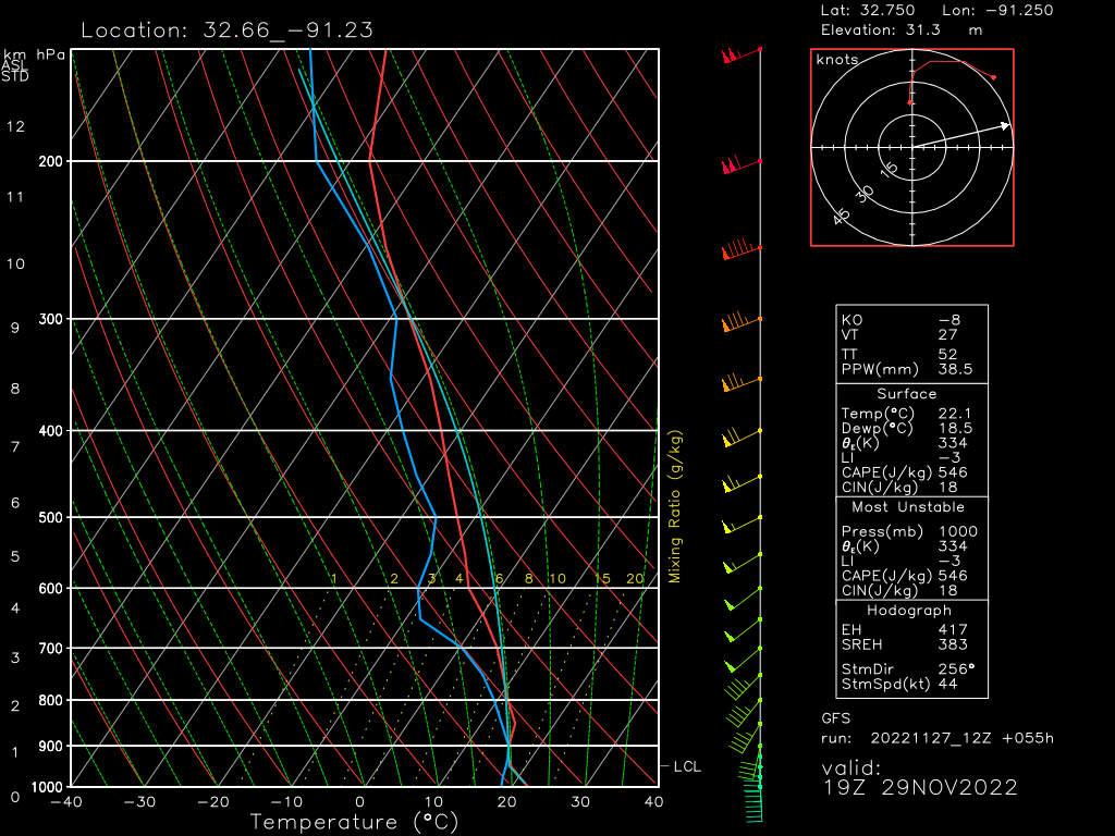
- Low LCLs. Inflow doesn’t have to travel far to be ingesting into the growing storms
- A very slight cap. Not enough to make storms impossible, but perhaps enough to focus that energy into more powerful storms vs junk convection.
- Dry air aloft. Can mix into updrafts resulting in strong winds at the surface as moisture evaporates in the air and it sinks.
- Surface winds backing from the SSE and turning SW in the mid-levels. This is excellent low- to mid-level directional shear and important for tornadogenesis.
- Speed shear is also good. Winds of 10 to 20 kts at the surface become 55 kts by the mid-levels. This gives us roughly 35 to 45 kts of shear, which is good for organizing supercells.
- With storm direction from the SW, this places the motion nearly perpendicular to the initiating boundary. This sort of alignment is favorable for producing supercells.
This is a sounding off of the GFS, which is a global model and therefore has a larger resolution. It’s easy for these models to miss the mesoscale details that may lend to stronger storms. Consequently, when a global model shows a favorable environment for strong storms, it’s time to pay attention.
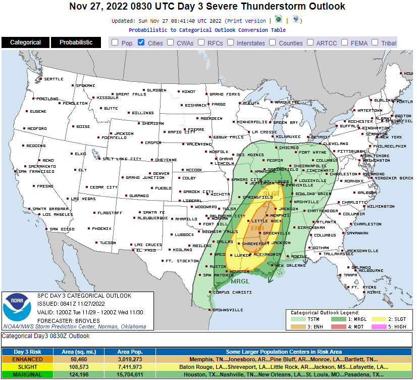
The above discussion boils down to this area above being under the gun for Tuesday. This is the forecast as of Sunday evening.
As we are still two days out, expect it to wiggle a bit here and there. Additionally, further risk level upgrades are possible as more mesoscale models come into range.
A word about scary colors before we move on: Don’t assume the worst weather will only occur in the scariest color. If your area is highlighted, you have a chance at severe weather. Your forecasted ingredients may not be as high of quality as, say, in the orange area, but you will still have a chance.
Prepare for severe weather in any of these outlined areas. Get your safe space ready to go, make sure you’re ready to receive watches and warnings as issued, and get ready to remain weather aware.
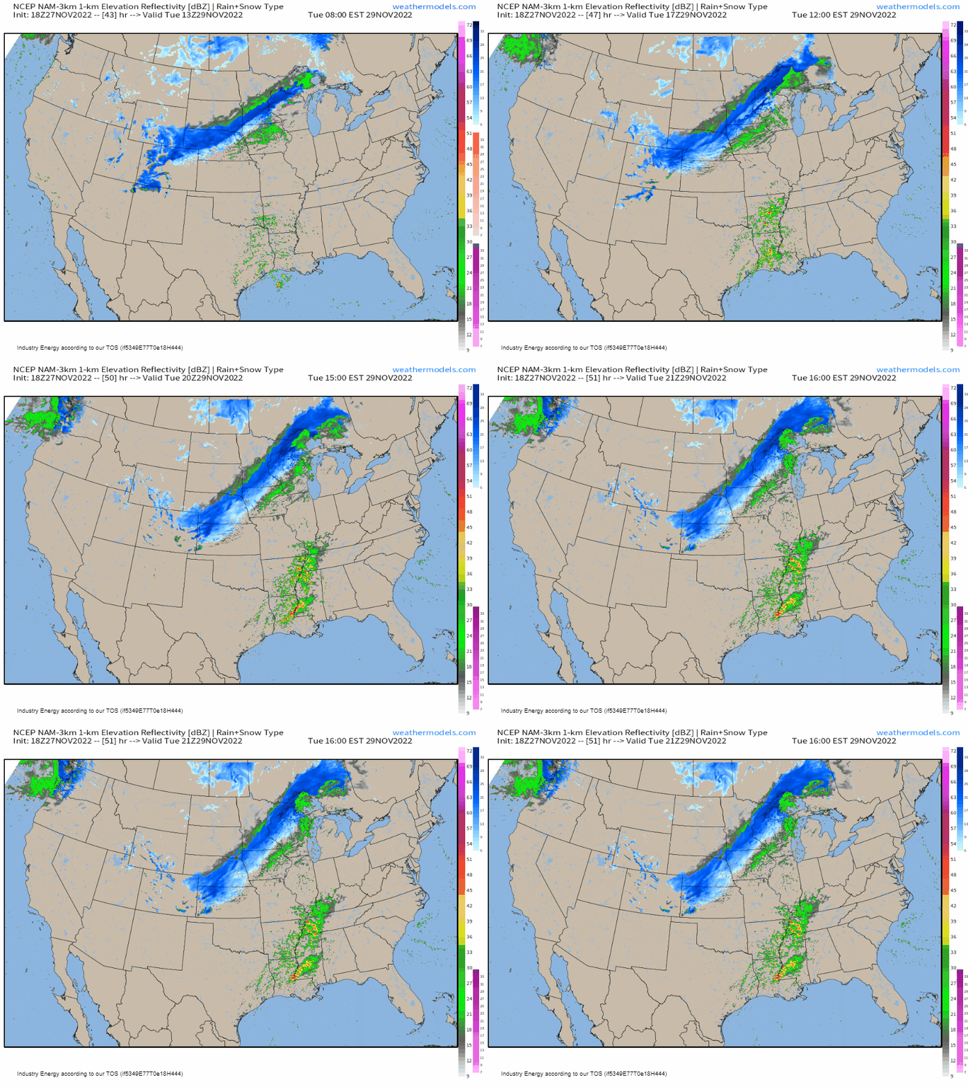
The timing isn’t quite exact yet, but it seems as if we could be looking at convective initiation sometime in the afternoon hours on Tuesday. Storms will then persist into the evening or even into the overnight hours, depending on available instability downstream.
All hazards are on the table, as mentioned above. Damaging winds will become the dominant threat later in the event, but at the beginning and if discrete cells can persist for a longer amount of time, tornadoes are likely. A few strong tornadoes may also occur.
What You Need To Know:
- A significant severe weather event seems likely for Tuesday in the Mid/Deep South.
- It is forecast to begin in the afternoon hours and persist into the evening or overnight hours.
- All hazards are possible, including several strong tornadoes.
- Start preparing now. Get your safe space ready and make sure you’re receiving warnings.
- Monitor the forecast for changes in the next day or so.
I’ll publish an update to this blog tomorrow evening with the latest forecast and outlooks as more mesoscale models come into range. Stay tuned!


I always appreciate how you simplify complicated events for geeks like me. Thank you