Significant Northeast Flash Flooding Likely Today
A memorable, widespread episode of flash flooding appears set to occur today across portions of the northern Mid-Atlantic and southern New England as soils and streams left waterlogged by a very active month meet a primed atmosphere.
A number of high-end flash flood events have impacted the region lately. In NYC, flash flooding on 7/8 filled the subway system with water, while in CT, Elsa’s swipe on 7/9 brought significant flash flooding to the streets of New Haven and Milford. When a storm slowed and back-built north of Philadelphia on the 12th, it triggered a flash flood emergency for parts of the metro, and several days of scattered flash flooding have occurred with intense, nearly daily storms near the PA/NY border.
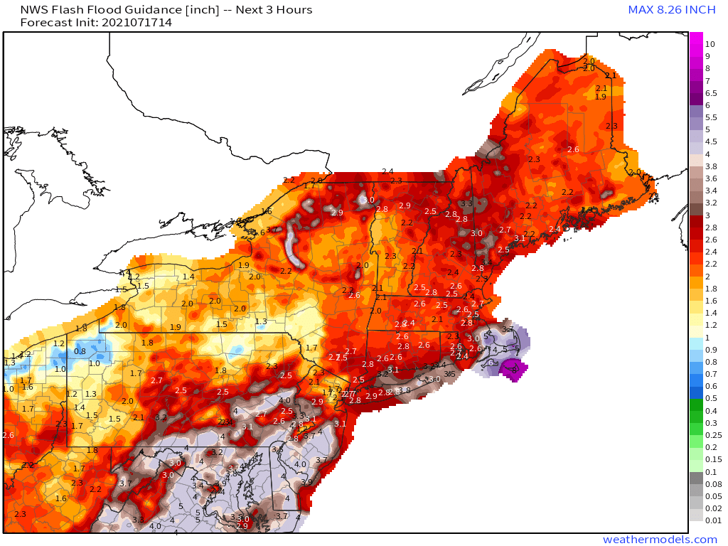
As I wrote about in my last blog on an almost identical subject, which was published the day of the Philly area floods, flash flooding tends to occur where it already has. Significant rainfall can saturate soils and swell streams, taking away natural defenses against flash flooding that include environmental runoff control and ground absorption. These factors can drag down a metric known as Flash Flood Guidance, or FFG, which is the amount of rain that must fall in a certain amount of time to trigger flash flooding.
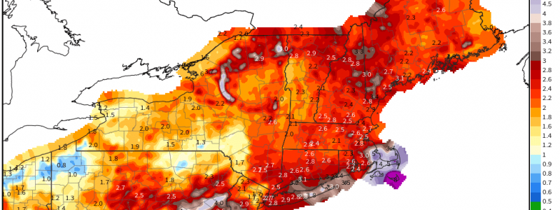
FFG values for the Northeast today show just how little rain it’ll take, due to the prolific deluges of the last month.
Vulnerability in much of the area between Syracuse, Scranton, NYC and Boston is high, and it’s downright extreme in the Binghamton area. If an atmosphere supportive of flash flooding can overlap this corridor, specifically near the central NY/PA border, serious flash flooding could commence.
That atmosphere looks in place today.
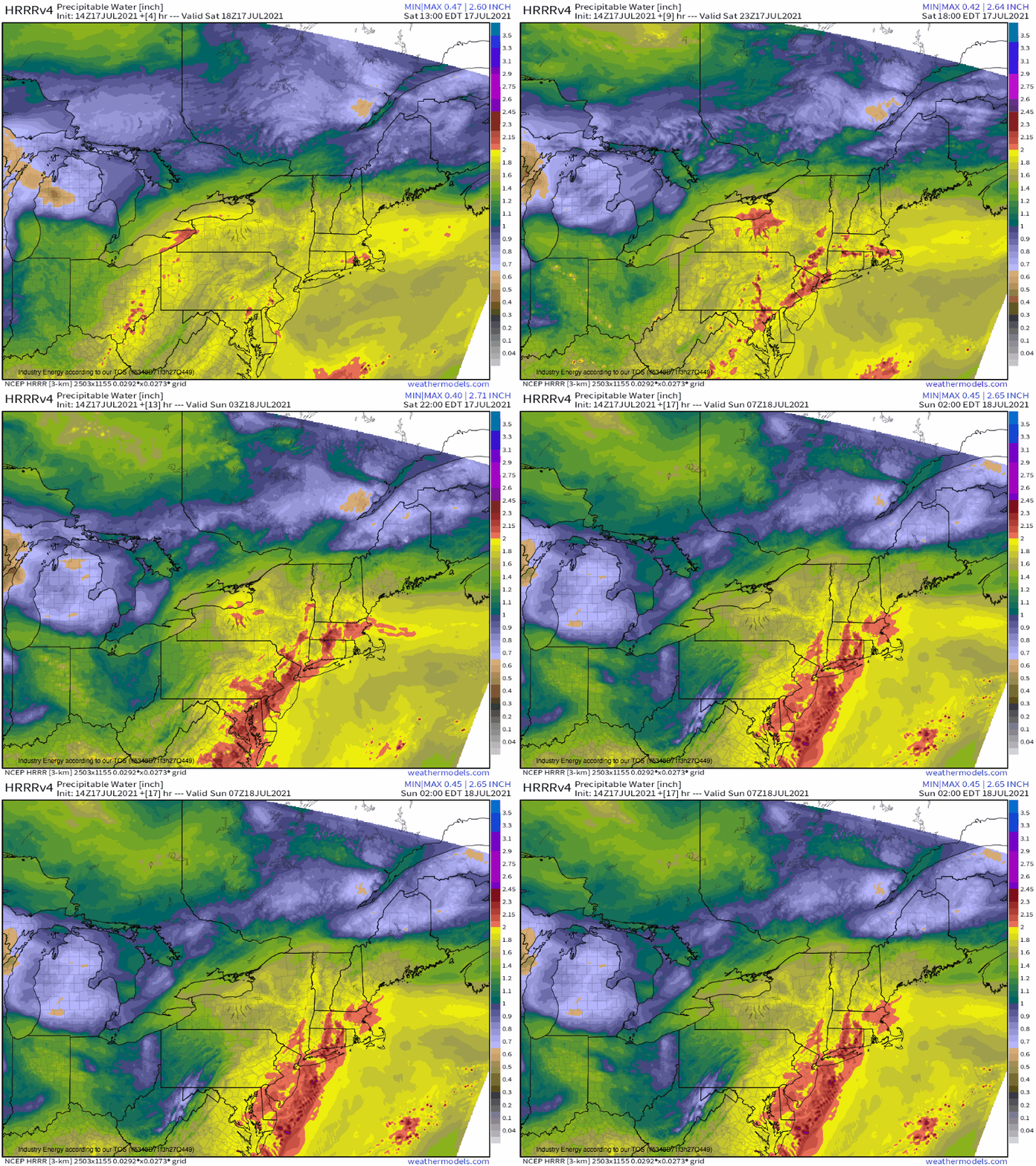
A strong Bermuda ridge is promoting a channel of low level flow that’s been able to advect a highly anomalous feed of moisture into the Northeast, straight from the Western Gulf. Precipitable water values are once again above 2″ for parts of the area, and even though that’s been happening regularly for the last month, it is really unusual!
This super-saturated atmosphere overlays dewpoints in the mid-70ºs F and CAPE exceeding 2000 j/kg, in places by a lot. Low level flow above 20 knots is also favorable, as it can help pull this moist, unstable air quickly into storm complexes.
Of course, the most favorable atmosphere in the world won’t lead to flash flooding if storms don’t develop to take advantage. But with convective temperatures in close grasp amidst wide, diffuse convergence today over several axes of an unconsolidated surface low, numerous storms look to develop across the Northeast. These boundaries should be perpendicular to flow, preventing training along them, but could be parallel to each other, which would allow storms to impact the same areas over and over again, albeit with a lesser degree of predictability on where, exactly, this will be. But widespread initiation should favor some ‘random’ path overlaps, which will lead to flash flooding where they occur. Be vigilant today.
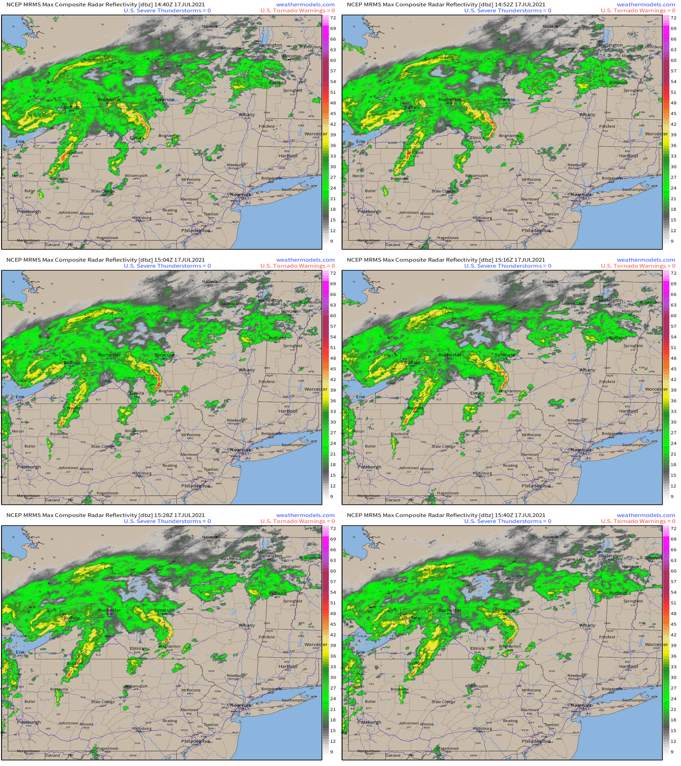
One final note on initiation is the semi-surface based storm complex that’s been moving through New York looks like it could be laying a pseudo-boundary there, as outflow backs winds locally and cloud cover keeps temperature contrasts high in its vicinity. Because the boundary is being laid by a storm, it’s inherently oriented parallel to shear, in the same way a lane line painted by a truck driving on the road will be oriented parallel to the road itself. This could allow storms to move parallel to initiation, should the boundary prove sufficient for it, then allowing geographically focused training in its vicinity. As this could end up near the super low FFG values in the Binghamton vicinity, I would certainly not be surprised if some serious flooding ends up in that area today.
Remember: when roads are flooded: turn around, don’t drown!


