Significant Ice Storm To Impact Parts of Ohio, Mississippi River Valleys
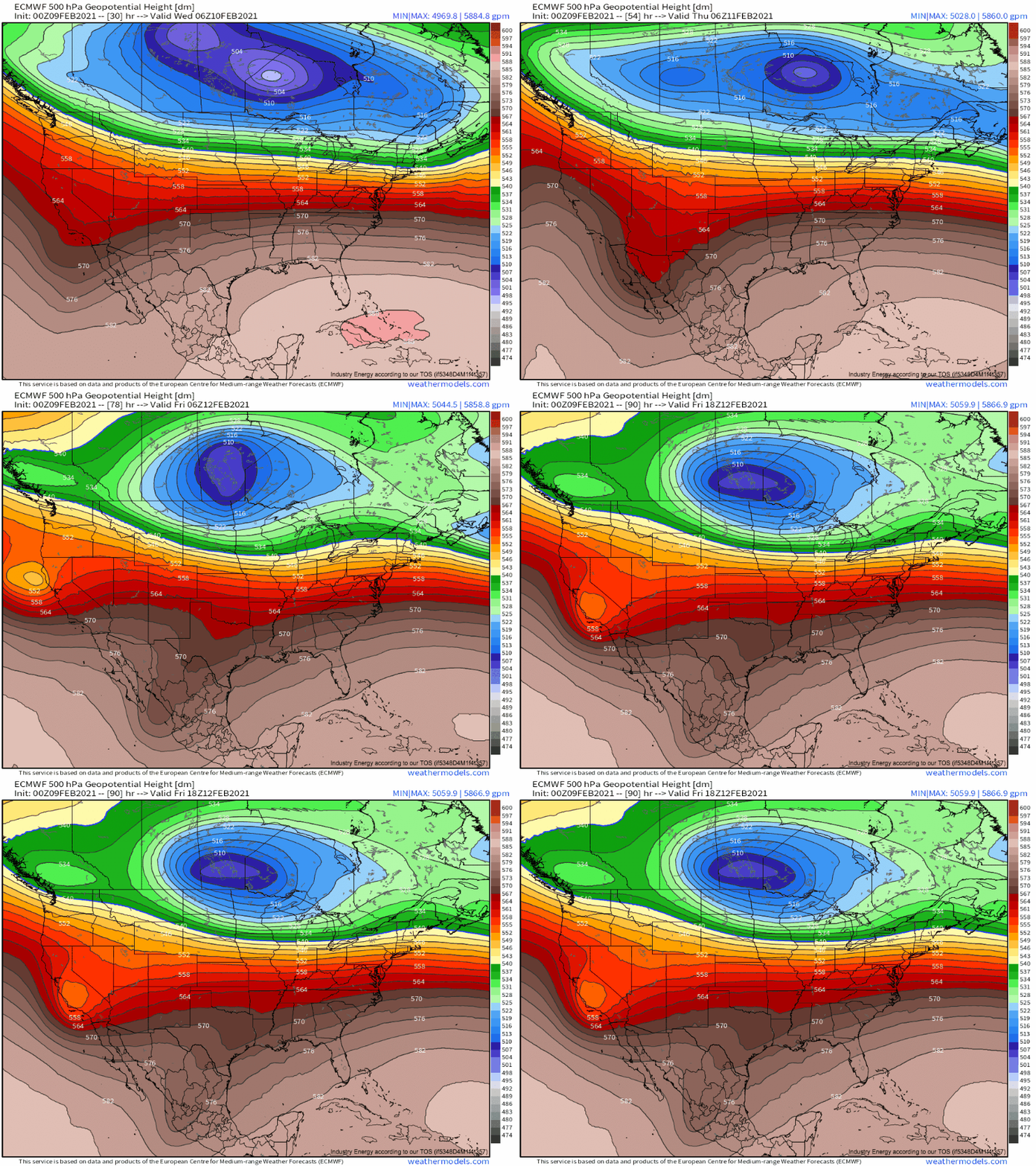
A massive, nearly stationary closed low north of the Canadian border will continue to send winter weather careening through the United States, with many feeling the impacts. For the mid-Atlantic and northeast, persistent storms will continue to boost the snowpack for many; for the north-central plains, intense cold air advection will bring frigid, dangerous wind chills. And for a swath of the country stretching across parts of the Mississippi and Ohio river valleys, long-duration light to moderate rain will fall on a freezing ground, with dangerous icing possible. This blog will focus on that threat.
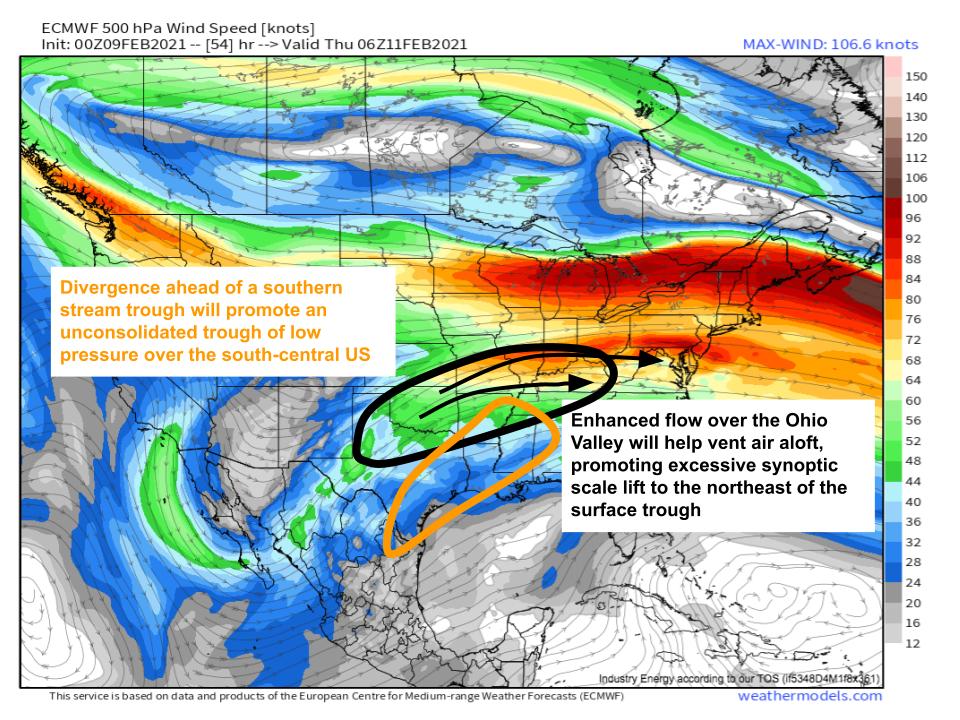
Split flow will return with a diffuse but high amplitude trough pivoting south through California today. As the trough swings slowly northeast, divergence ahead will allow a diffuse surface trough to develop, which will work with the entrance region of the jet stretched to the Canadian cyclone’s south to create a persistent zone of moderate lift.
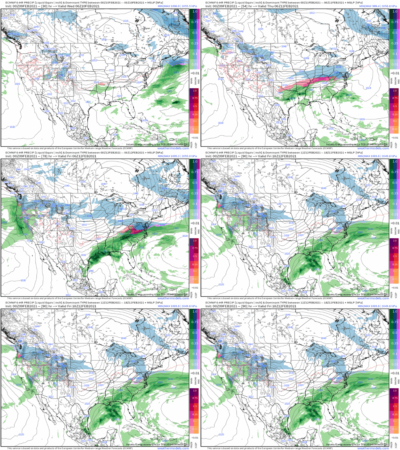
In this regime, light precipitation will begin over parts of the OK/AR/TX/LA region late tonight. As surface low pressure consolidation occurs in tandem with the approach of the southern-stream trough and an influx of deep Gulf moisture, precipitation will gradually increase in intensity and coverage during the day tomorrow. This is where the problems will begin.
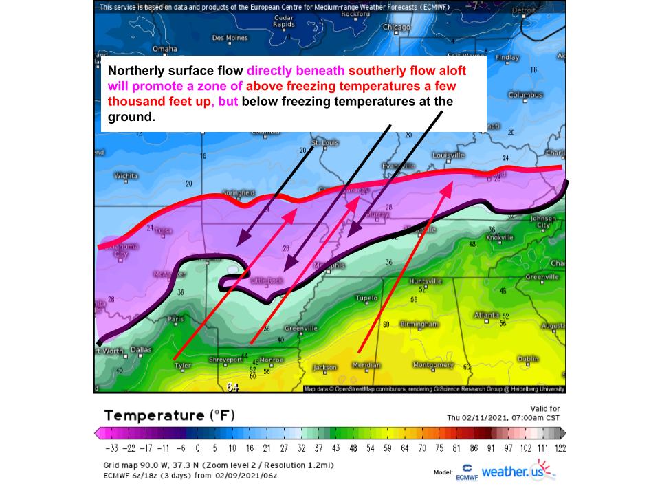
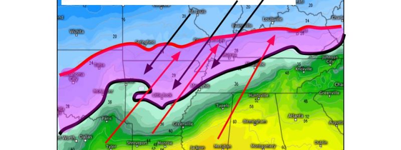
Typically for a section of the atmosphere within which a cyclone is consolidating, boundaries in the atmosphere will be tilted with height. Practically, this will mean a swath of the central US, to the north of the surface trough, will see northerly surface flow but southerly flow a few thousand feet up. This zone will be at risk of seeing freezing surface temperatures beneath plentiful above-freezing air aloft, coexisting with precipitation. This is the recipe for precipitation melting into rain before hitting the ground and re-freezing: the recipe for freezing rain. Uh oh!
The problem will be compounded by its longevity. Freezing rain is typically a short-duration event, as the thermodynamic conditions required to support it are finicky. But the somewhat atypical orientation of broader flow aloft, organized by the anomalous Canada cyclone, will assure the southern stream midlevel trough moves largely parallel to the orientation of the zone of divergence that exists ahead of it. This, in turn, will allow the surface and low level environment to remain largely unchanged for a fairly long amount of time, while the midlevel trough progresses west to east.
The result will be a freezing rain event that will be moderate in intensity and fairly long in duration, stretching across a swath of the central US.
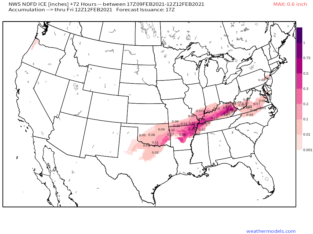
The following is the NWS forecast for ice accretion through Friday morning. Almost anywhere freezing rain falls could see severely degraded road conditions. The region from SW OK through E KY could see glazes exceeding 0.5″ in places, which could well cause some tree damage. There is also a chance for significant ice accretion in central VA and NC, although it’s beyond the forecast domain of the NDFD map below. Stay tuned!
