Severe Weather Update and How To Prepare
This blog will be a quick update to yesterday’s blog on the pending round of severe weather forecast for Tuesday.

We are still on track for a potentially serious severe weather event across the Mid/Deep South tomorrow afternoon into the overnight hours. In fact, confidence has increased in the event, hence the addition of the Moderate category.
Timing:

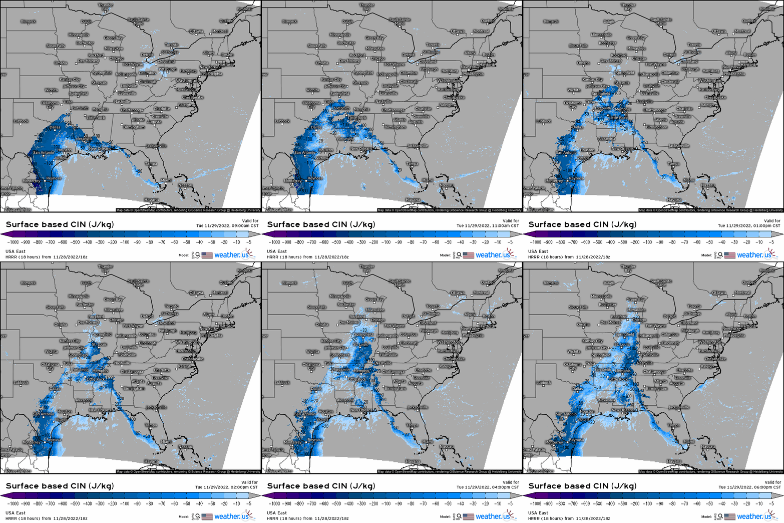
Initially, a cap is expected to be in place during the morning hours. This could result in some elevated convection in the early afternoon as it lingers. However, as the warm front lifts northward and incoming moisture/daytime heating work together to boost instability, it will erode by mid afternoon. At this time, we will likely see the development of surface-based storms – first further south and then moving northeastward with time.
By early evening, the event should be well underway and entering its peak as storms move into the most favorable environment. Additionally, the threat is expected to persist into the overnight hours as favorable conditions linger.
Areas Under Threat:

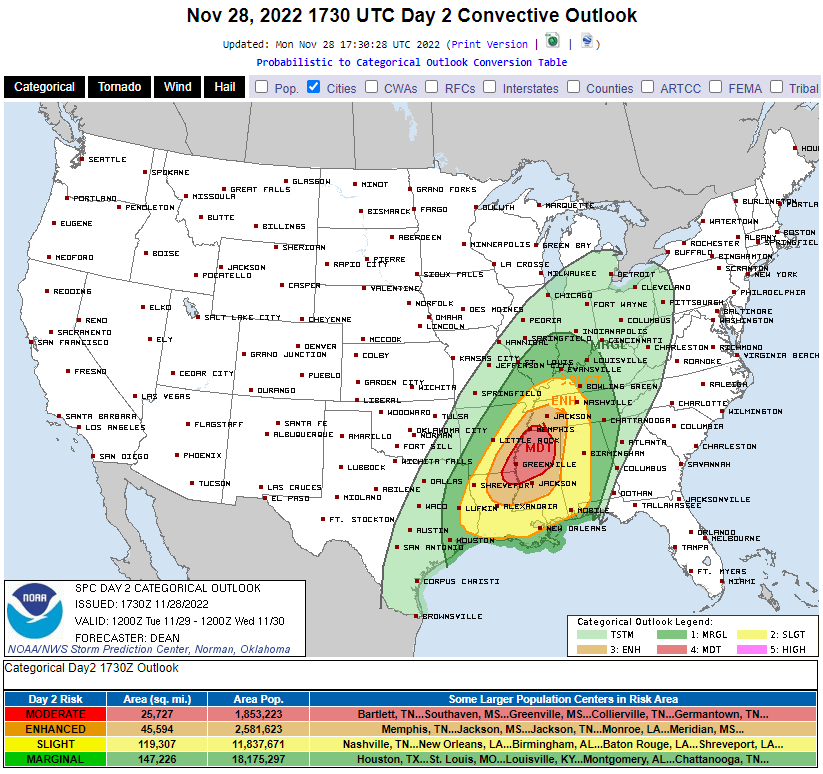
As seen in the SPC Day 2 Convective Outlook at the beginning of the blog, the area with the highest confidence in severe weather is the Mississippi Valley region where Louisiana, Arkansas, Mississippi, and Tennessee all meet.
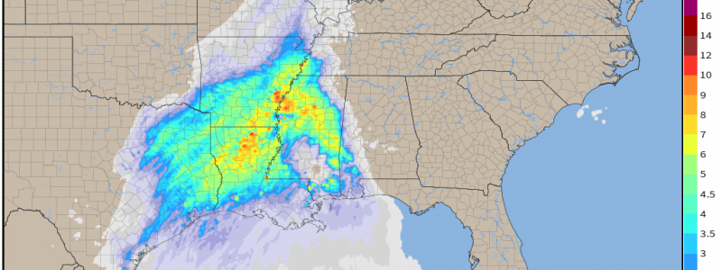
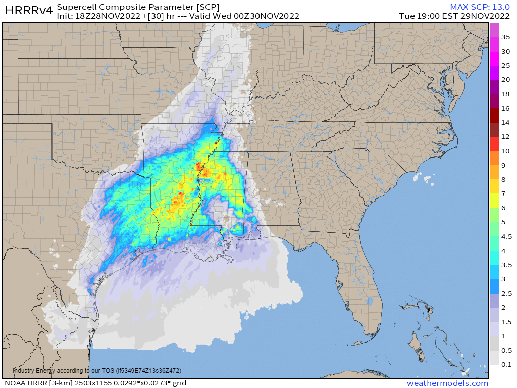
Here is where the highest quality ingredients will be co-located. Dew points in the upper 60s, deep layer shear on the order of 70 to 80 kts, favorable low-level shear and storm-relative helicity, potential for broken cloud cover in the morning hours to lend instability via heating, moderate amounts of CAPE, favorable placement of a jet streak, and upper-level divergence will all combine over this area to produce an environment capable of dangerous weather. The only question that lingers is that of mediocre lapse rates – and how it may affect tornado potential.
Another reminder on risk levels: if your area is highlighted in any color on the outlook posted above, you have some risk of severe weather tomorrow and should be preparing accordingly. Yes, the scarier colors display a higher confidence in that specific area receiving the full potential of this system, but the atmosphere doesn’t read maps. Sometimes meso- or even microscale features/boundaries/etc. can allow for enhancement of otherwise lackluster ingredients.
How to Prepare:
By now, everyone in the risk area should be preparing. This includes things like:
- Getting your safe space ready.
- Reviewing your plan to shelter with your family.
- Making sure friends and family in the risk areas know about the impending threat.
- Assuring you have multiple ways to receive warnings.
- Planning your day around your ability to shelter. If you must leave home, know where you will shelter if the need arises.
- Review a map. Know how to find your location quickly. Know the name of your counties and the surrounding counties so you can quickly judge if you need to act.
- Part of this event will be in the overnight hours. Make sure warnings will wake you if need be. Additionally, make plans to sleep in your safe space to cut down on time spent scrambling for shelter when everyone is still sleepy.
Tomorrow:
If you’re weather savvy, you can monitor conditions beginning tomorrow morning to get a sense of how things may unfold.
- Check the current temperature/dewpoint against the latest model initialization. If the models are already incorrect at the current hour, that will have downstream effects that cause the model to either overhype or underplay the coming threat depending on if they are too warm or too cold.
- Watch for breaks in the cloud cover. Seeing sun in advance of a severe weather threat isn’t a good thing. More heating leads to more instability for storms to work with later on.
- Be aware of mesoscale features like outflow boundaries, topography changes, thermal gradients, wind shifts, and confluence bands. These can provide a little something extra to an incoming storm or serve as a place for initiation to occur.
If you’re not weather savvy, there’s no need to worry. Follow your local NWS office and your local broadcast meteorologists. Their job is to know your area inside and out. They’ve got you covered during this event. Don’t panic, just prepare.
We’ll keep you updated through our Twitter feed as this event kicks off tomorrow. Stay safe!


