Severe Weather This Evening Into Tonight Across The Plains & Midwest
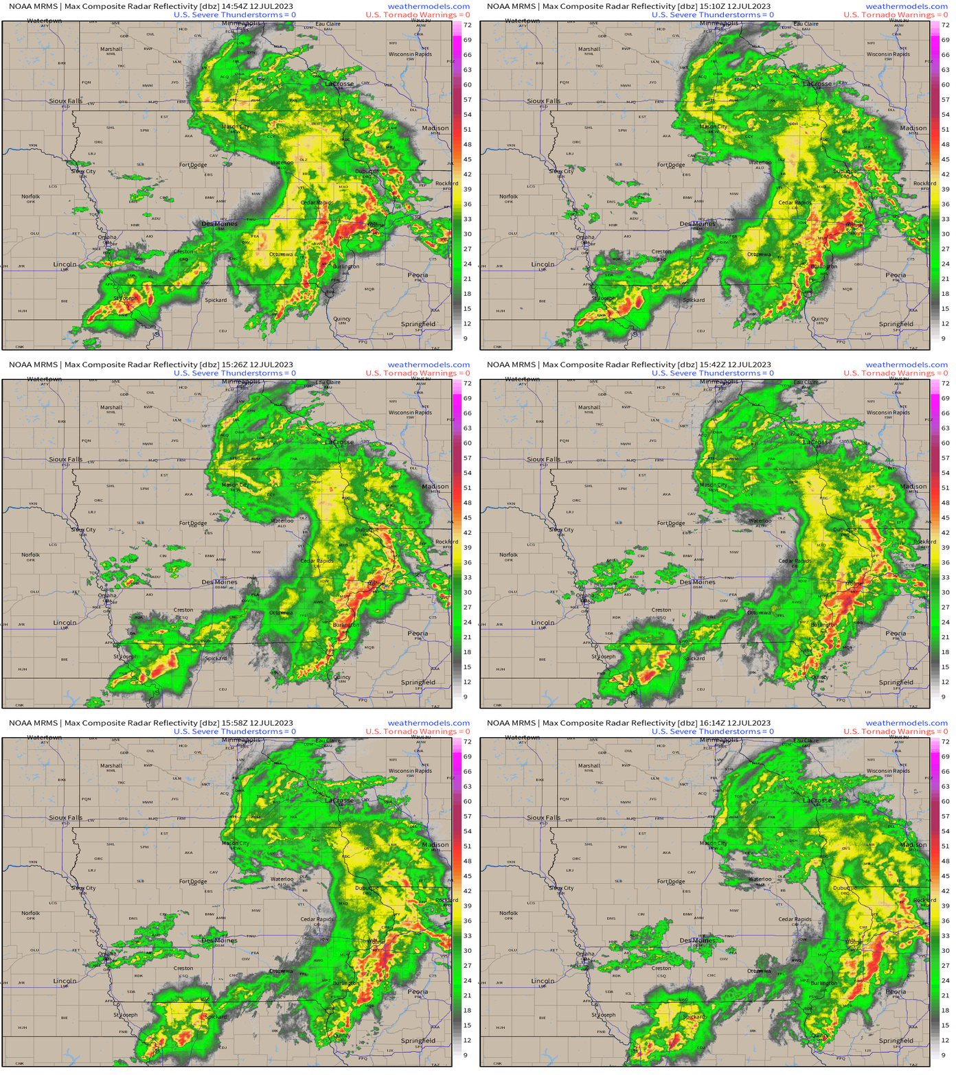
A fast-moving bow complex is currently pushing through IA, and into southern WI / northern IL along a stationary boundary draped across these states. Reports of wind damage with gusts between 55 – 75 mph have been reported across eastern NE and IA with property damage, along with large hail since overnight. This complex will continue to move eastward rendering severe gusts and large hail as it’ll be a long-lived MCS as it shifts into MI tonight. This is important because it’s this complex that’ll be responsible for severe weather today for MO, KS, and into OK by tonight. How you may ask? It’s because of a rain-cooled, induced boundary that’ll become the catalyst for storms later today and into tonight.
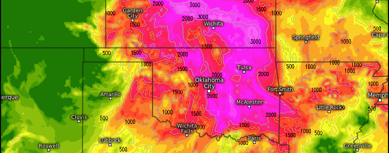
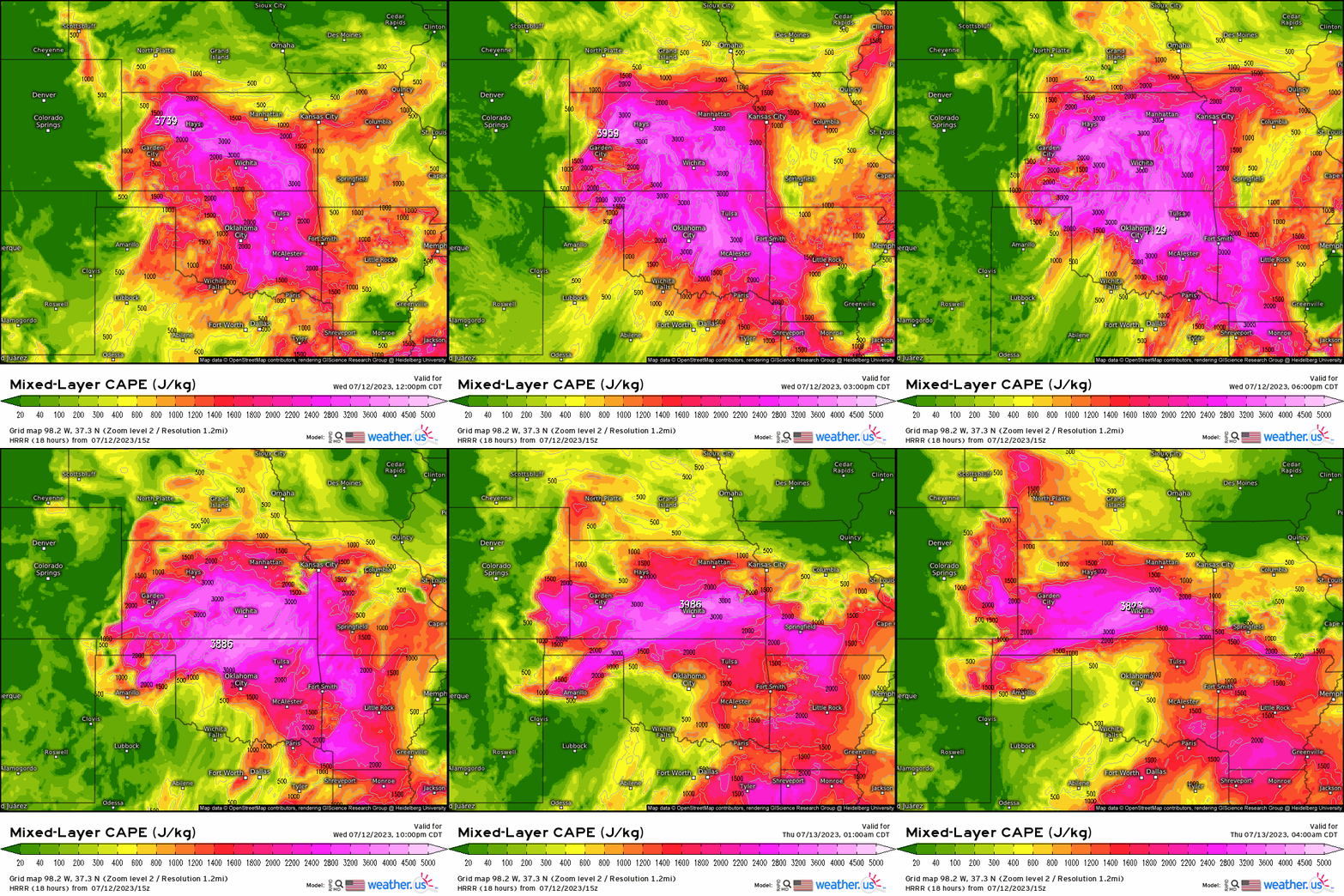
As we progress through the day today, with dewpoints into the 60’s and 70’s up through the entire Plains and Midwest, MLCAPE values in exceed of 2500 j/kg with the help of daytime afternoon heating, will occur. There will be no lack of instability given the combination of moisture and sufficient heating.
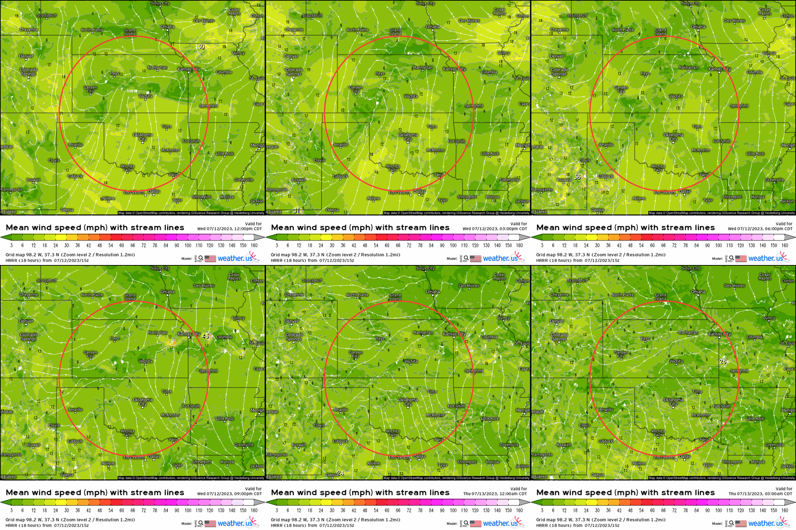
While we’ll have the favorable ingredients to get storms to quickly form, we do need the “trigger”. As already discussed, a boundary will manifest from that MCS. One can diagnose where that boundary may shift toward by analyzing streamlines. Doing so, we can see where surface convergence occurs as we know when we have low level convergence, this is all that is needed at times to allow convection to take place. Outlined below, we actually do see a boundary shift southward into NE through this afternoon and evening, and toward OK tonight.
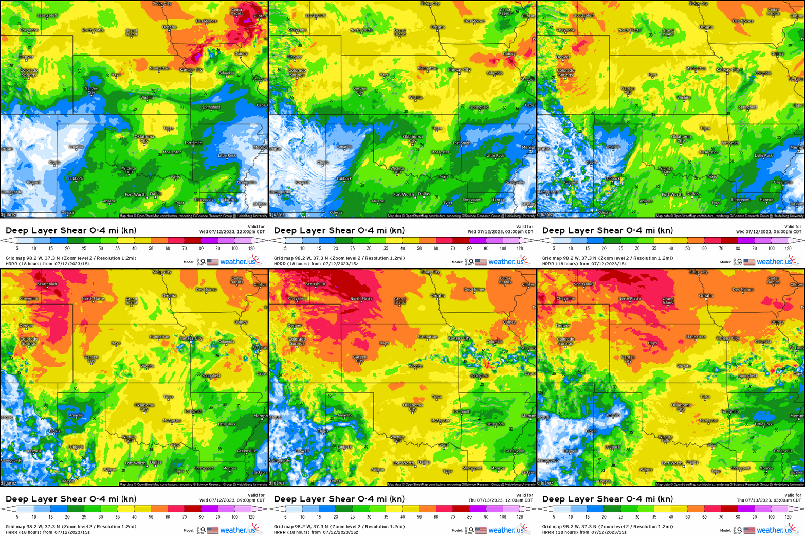
Checking to see how our shear is, we see that verbatim over 30 knots will expand across the Plains, so we can expect that any storms this afternoon that fire up will likely turn severe and have characteristics of supercells.
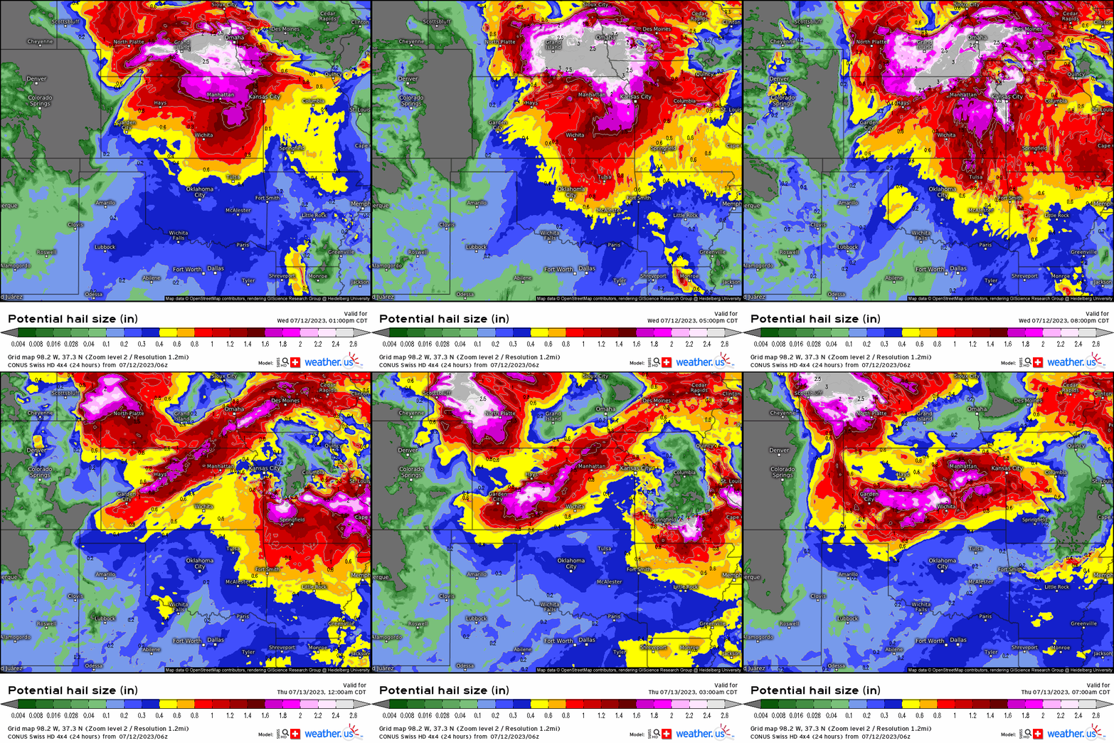
With the verbatim favorable shear, enough storm organization for billowing updrafts will allow for severe hail to primarily occur with these severe thunderstorms. We see here that hail over 2” will likely form across KS and MO. We also see gusts will exceed 55mph, which looks to take place mainly from eastern KS into central MO with this area being the prime spot to endure the bulk of this event. This doesn’t mean that nearby areas can’t still see potent gusts and hail.
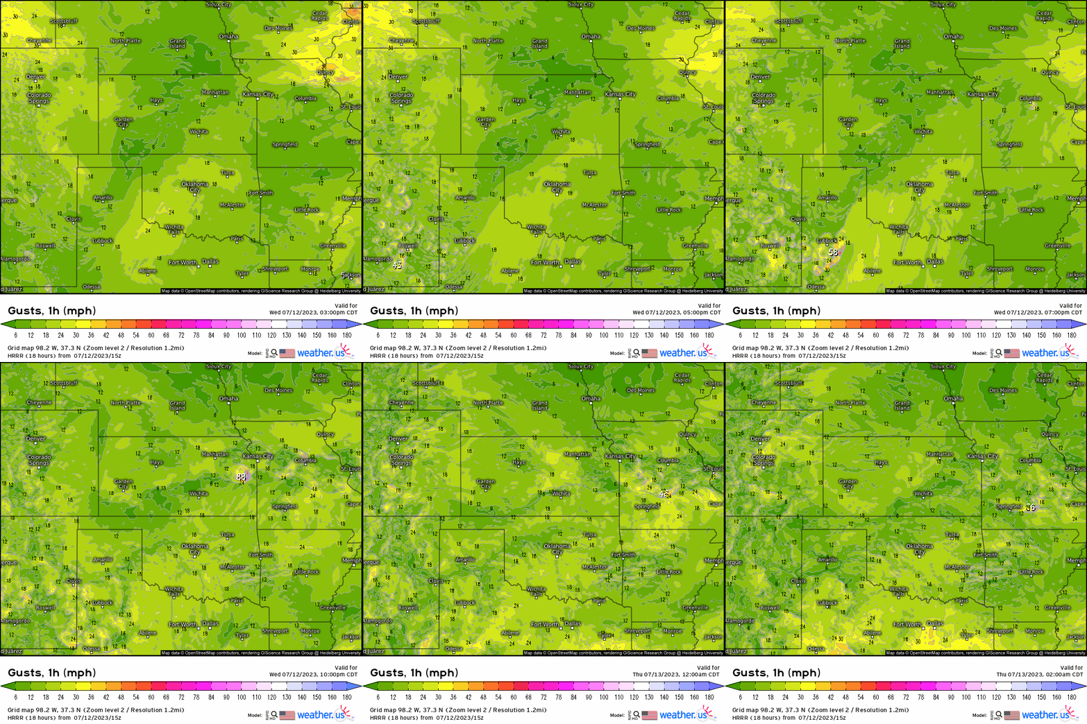
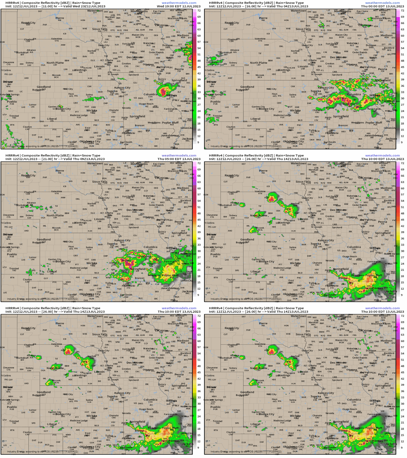
With the ingredients in place conducive for severe weather, storms will fire up between 5 – 7 p.m. CST initially across eastern KS and northern/central MO. These storms look to become semi-discrete before quickly growing upscale and congealing by tonight turning into a MCS overnight. The main hazards with this severe weather threat will undoubtedly be severe gusts over 58 mph, along with large hail unsurprisingly given the conducive atmospheric ingredients in place.
With severe weather once again a threat to populated areas, please have preparations and necessary precautions in place so you can stay on top of the watches and warnings that’ll begin later this afternoon and evening!


