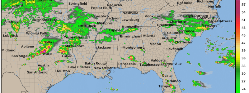
Severe Weather Targets Texas and Florida
It may be cooler than average for many east of the Rockies, but active weather is still in today’s forecast for some of the more southern reaches of the eastern half of the US.
The areas in question are the same as yesterday: Eastern Texas and the Florida Peninsula. They are separate events so I’ll address them separately below.
Florida

Visible satellite over Florida shows us plentiful sunshine, which results in ample surface heating.
As the loop wears on, we can see cumulus clouds begin to bubble up. Additionally, we can see the Sea/Gulf breeze boundaries becoming more and more defined. These boundaries will be the trigger for storms today.
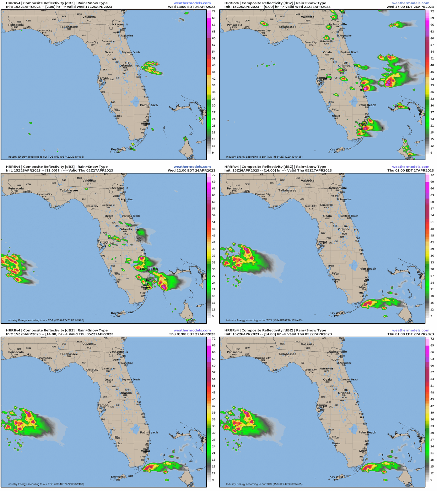
If you’ve lived in or even spent any prolonged amount of time in Florida, you know how the daily cycle goes.
Ample sunshine in the morning heats up the humid airmass. By the afternoon, the sea breezes are well-established and pushing inland. They provide a lifting mechanism and trigger the formation of a few storms. On a normal summer day, a few strong storms are possible but lacking better dynamics, they generally don’t become a widespread severe event.
Today we have the dynamics to allow for greater coverage of severe weather.
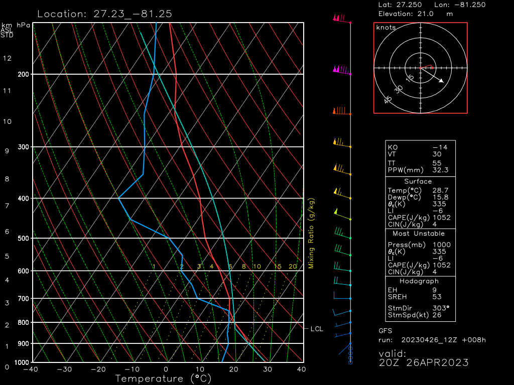
Steep lapse rates, dry air aloft, and a stronger flow aloft may allow for a few supercells to form. These storms will be capable of large hail and damaging winds. Due to the weak lower level winds and lack of directional shear, the tornado threat is rather low, but not completely zero.
As the primary hazard is large hail, take steps to protect your vehicle by parking it under shelter if that’s an option available to you.
Texas
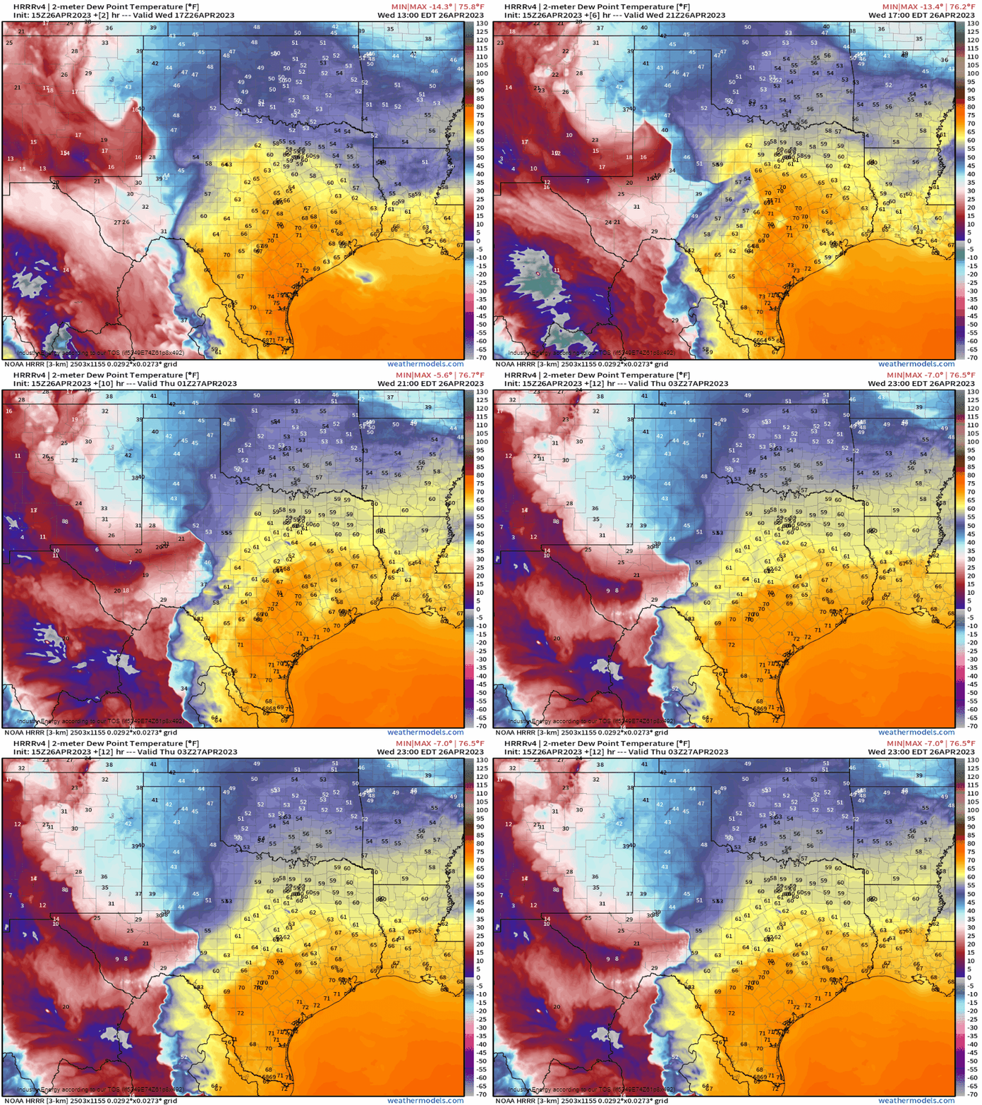
Morning convection is clearing out. As a trough pushes eastward, a dryline over the High Plains region will sharpen and migrate eastward as well, providing a focus for storms to fire off of.
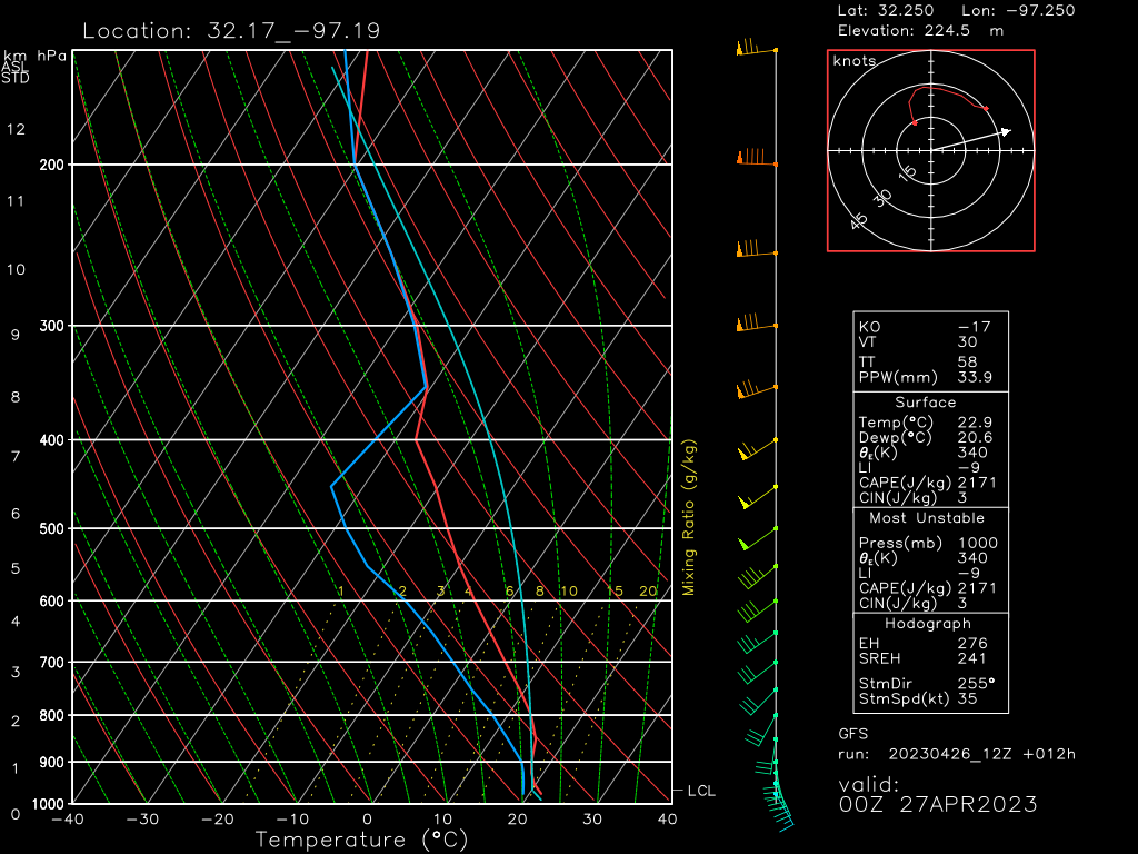
The dynamics in place offer a fairly volatile atmosphere for storms that are able to form to take advantage of.
- A slight cap is forecast. This is where the dryline comes in with added lift.
- Directional shear is in place, with surface winds backing from the SSE and veering with height. Additionally, speed shear is adequate to organize storms into supercells. A few tornadoes are possible, especially early in the event with more discrete cells.
- Ample CAPE and steep lapse rates indicate strong updrafts and the potential for very large hail.
- Dry air aloft may allow for a damaging wind threat, especially as storms congeal into a bowing line later in the event.
So, as we can see, this is an all-hazards-possible event.
Take Action:
- Have multiple ways to receive warnings, including at least one that will wake you.
- This event is expected to persist in a somewhat weakened state into the evening/overnight hours during which damaging winds of 75+ mph will be possible. Plan to shelter for a severe thunderstorm warning as you would for a tornado warning.
- A few strong tornadoes are possible in the early stages of this event. Be ready to shelter if a warning is issued for your area.
- Spread awareness. If you know anyone that lives in this region, warn them. Make sure they’re as prepared as possible. Let’s do our best to reduce the number of people caught off guard during these events!


