Severe Weather Risk Across The Plains Friday
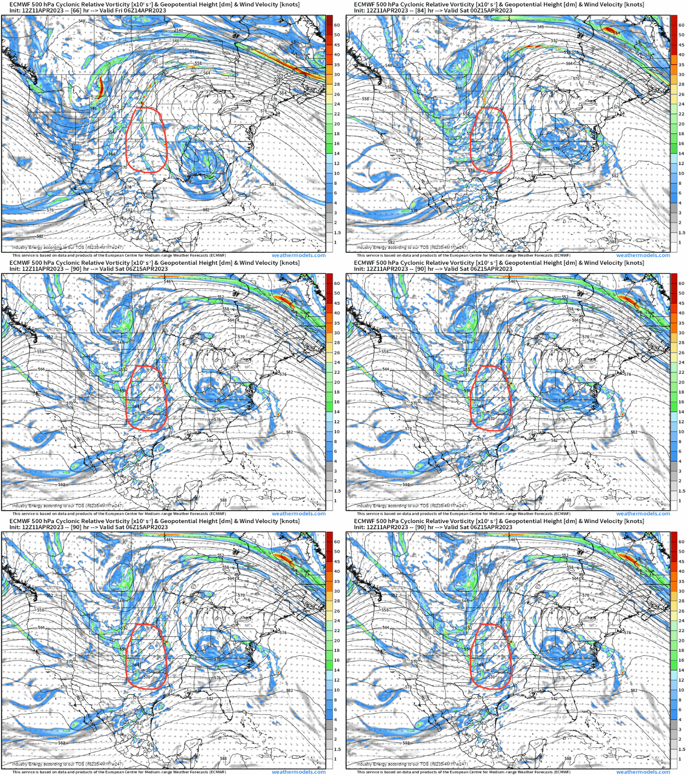
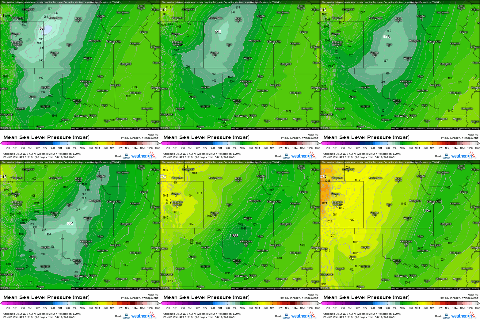
With a deep-longwave trough shifting into the northwest this week, several perturbations (shortwaves) in the flow will allow for forcing for ascent (eliciting divergence) in terms of severe weather this week across the Great Plains. We can see that downstream of this trough, we’ll also have warm air advection given the mean flow coming out of the south, so we know we’ll have certainly plenty of lift. At the surface, we’ll see a low pressure form out across the Front Range, and with it drag a dryline eastward, which it’s along and east of it that we’ll need to monitor! The question becomes, what about now the severe weather parameters and setup?
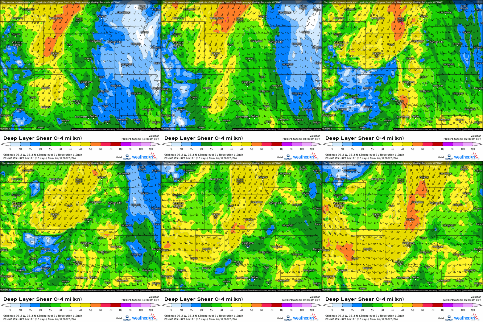
We’re looking at deep layer shear (0-4km) with 25-30+ knots, which shear determines storm type as it organizes convection, and can allow for rotating updrafts if we have sufficient CAPE.
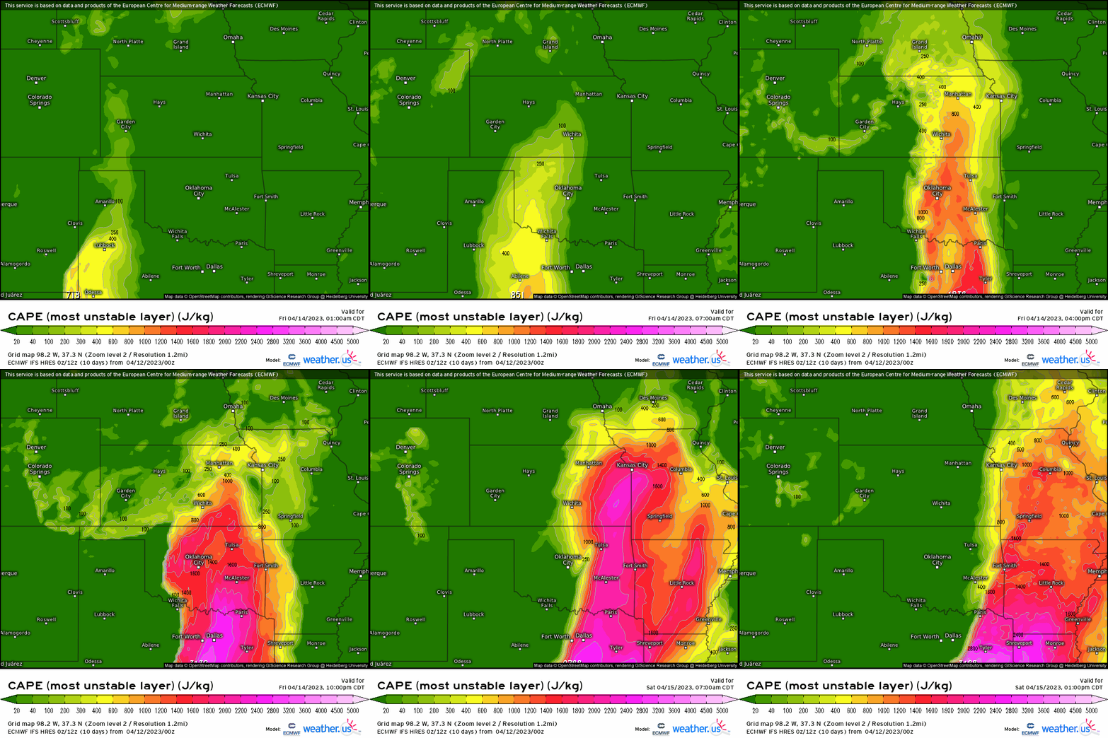
As we see verbatim, modeled CAPE will be more than sufficient with over 800 j/kg across the Plains, but more importantly over 1000 j/kg targeting KS through OK and into TX.
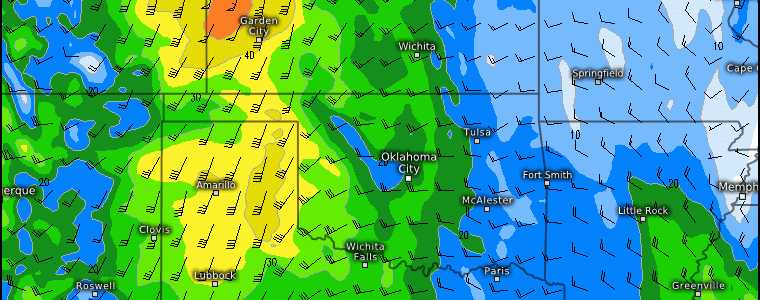
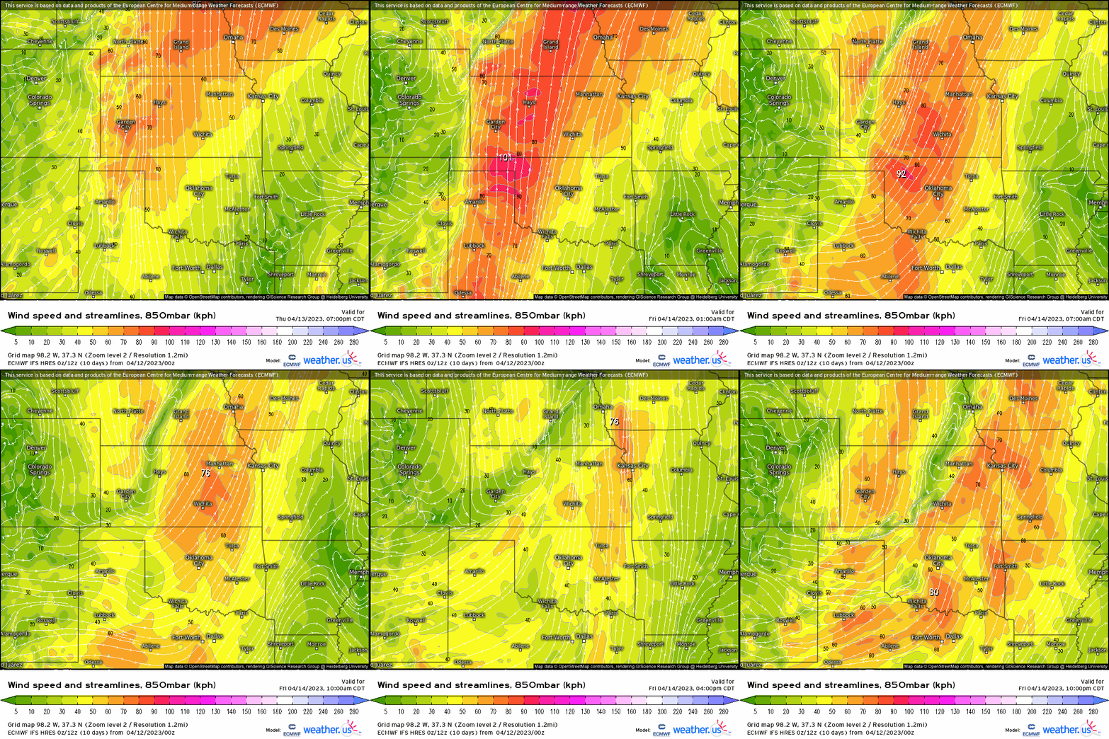
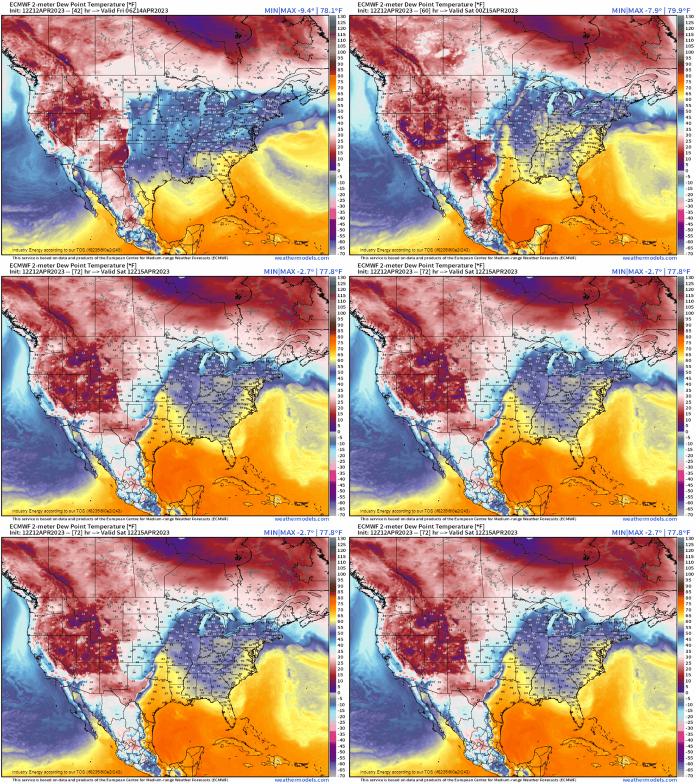
At 850mb, we see a low level jet respond in advance to the developing surface low pressure and downstream of the digging trough, which happens to coincide nicely with the CAPE parameter space above since moisture provides instability by providing steepening lapse rates (increasing the surface temperature), which will also play a role on Friday regarding severe weather. Regarding moisture, 2m dewpoints will surge into the 60’s up into southern NE, which is more than sufficient and notice the sharp delineation between the low and high dewpoints outlining the dryline from TX up into KS.
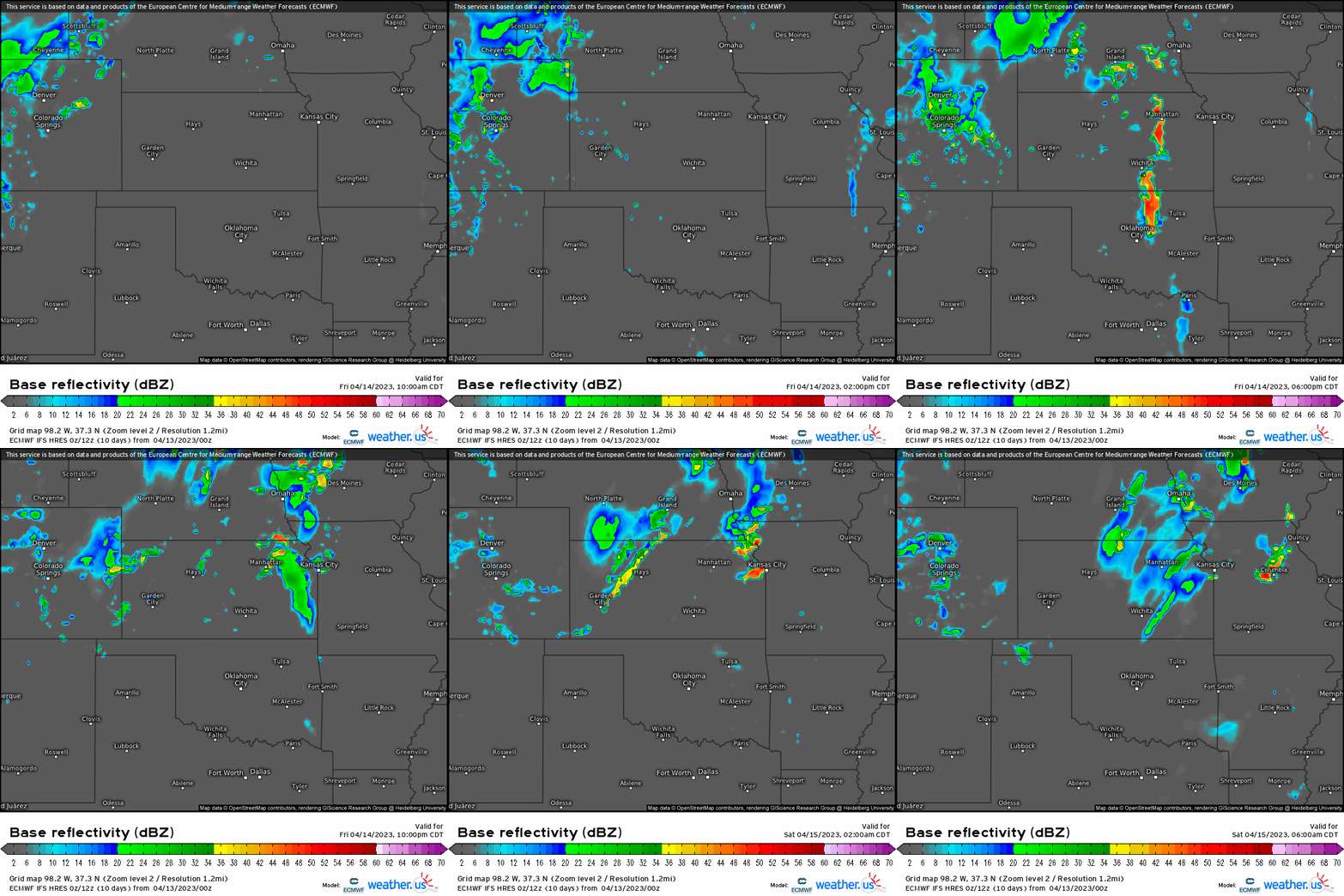
When we combine the ingredients together, we’re looking all severe hazards (lower tornado %), with large hail likely given the favorable atmospheric setup in general and we can see some discrete convection forming out ahead of the dryline tomorrow afternoon and evening across KS, eastern OK, and near/around Dallas on north. This also coincides nicely with the SPC outlook revealing where they believe to be the greatest risk for strong to severe thunderstorms as they have this area outlined in a “slight”.
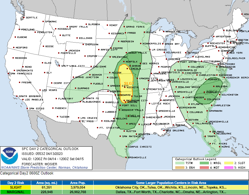
Most hazards likely given the setup will be large hail and damaging wind gusts, especially with anything that become discrete and overcome any capping during the afternoon. As of now, convection looks to begin out across KS and then into OK late afternoon. A little more uncertainty exists into northern TX given that it does appear to be more conditional on what the shortwave can do later in the afternoon/evening and along the dryline, but if anything can get going then we also could be looking at severe cells with large hail and microbursts can’t be ruled out. This threat rolls into tomorrow that shifts across the MS River Valley as Meghan will have a blog out regarding those details tomorrow. Stay tuned!
