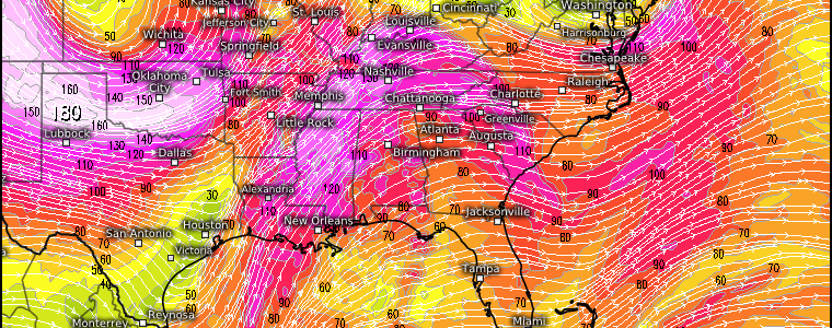
Severe Weather Returns To The MS River Valley
If we take a look at the current radar, we’ll see a few storms firing off a dryline located in the Plains states. A few then become severe as they move into more favorable atmospheric conditions.
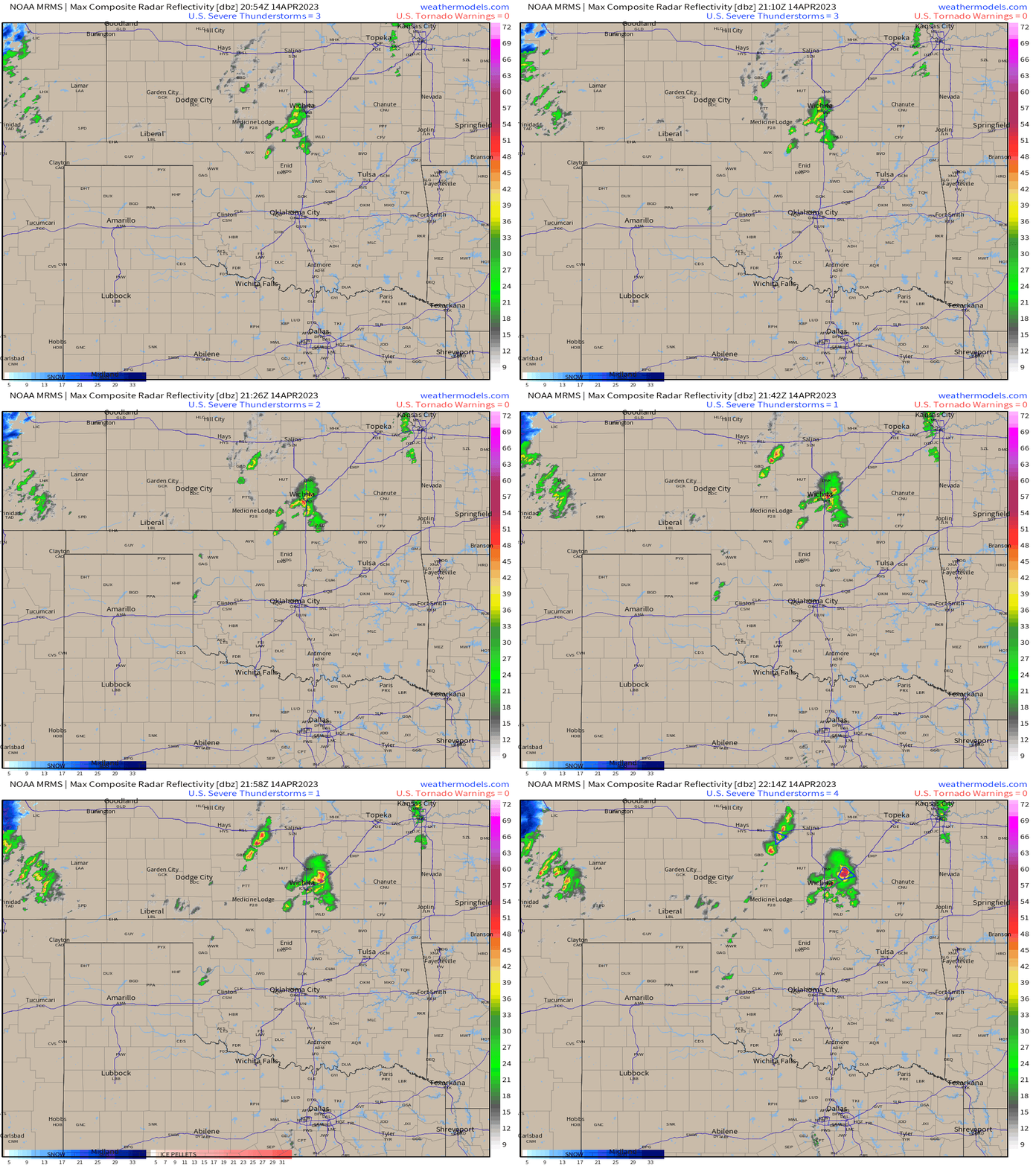
This is the severe threat that Armando wrote about in his blog yesterday. This remains mostly a large hail/damaging wind threat with shear less than favorable for tornadoes at the moment.
This system and associated surface low will continue lifting northeast tomorrow, bringing a renewed, somewhat more potent, threat to the Mississippi River Valley region.
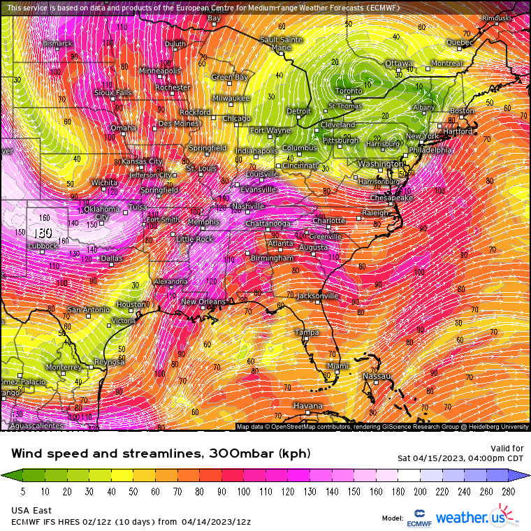
It may be a bit of a complicated set-up as we have “dueling” jet streams in place.
A shortwave moving through the southern jet stream may allow for some morning showers and cloud cover over the area of concern. This could throw a wrench in the expected daytime heating, or it could be a non-issue.
By the afternoon, the northern jet stream edges into the region in question. Upper-level diffluence as depicted in the map above will encourage rising air at the surface where moist air and plenty of CAPE will already be waiting. Storms should begin to develop by mid-afternoon.
What hazards can we expect?
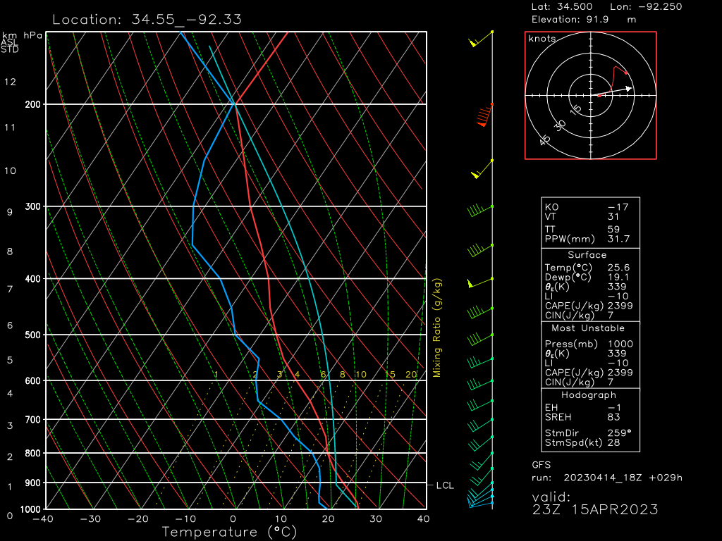
- The biggest thing that jumps out at me here is the amount of CAPE available. This will power strong updrafts that, when combined with steep lapse rates, will help facilitate the formation of VERY large hail.
- With dry air available to entrain into these updrafts, a damaging wind threat is also present.
- Directional shear doesn’t look too great, especially in the low levels – at least on this sounding. While a tornado or two may be possible, it won’t be the biggest threat posed tomorrow.
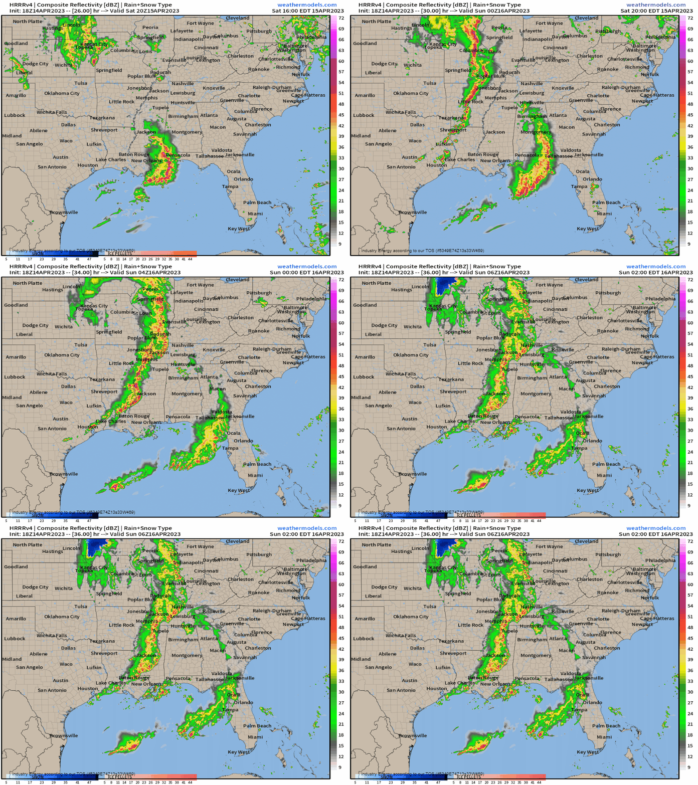
As far as timing goes: As mentioned, storms should begin to fire around mid-afternoon and will quickly organize into a convective line.
The southern line you see depicted here in the animation is the southern stream perturbation I mentioned earlier. This is not related to Saturday’s main severe threat and will mainly impact the Gulf Coast with heavy rain and perhaps some damaging wind.
Take Action:
- Severe storms are expected for a large part of the Mid/Lower Mississippi River Valley tomorrow.
- If you know anyone that lives in this region, make sure they are aware of the risk so they can be prepared. If you live in this region, make sure YOU are prepared.
- Have multiple ways to receive warnings with the primary one being a NOAA weather radio.
- Given the potential for large hail, consider parking your car in a garage or under a sturdy shelter.
- Widespread tornadoes aren’t expected tomorrow, however the threat is not zero. Be prepared to shelter if a warning is issued for your area.
- Monitor your local NWS and broadcast meteorologists’ forecasts for timing and threat changes for your specific area.


