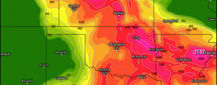
Severe Weather Potential Across The U.S.
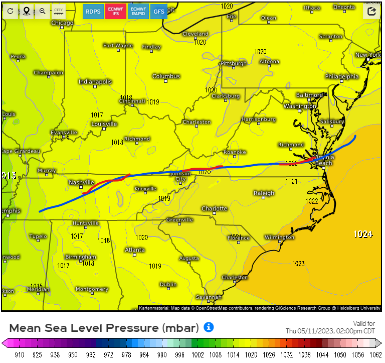
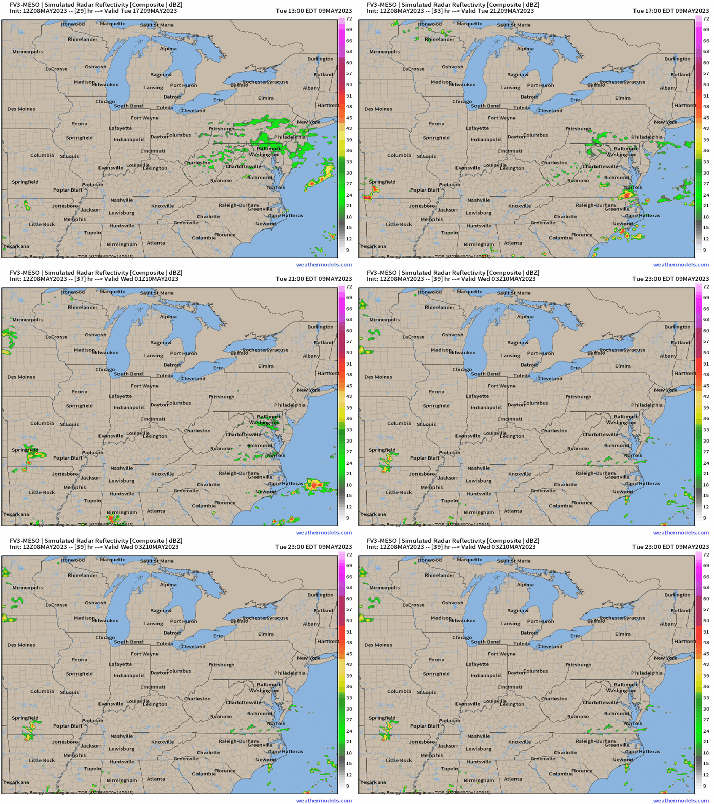
We start across the Mid-Atlantic, in particular eastern NC and possibly the far southeastern tip of VA where a diffuse stationary boundary will stall out providing the “trigger” to get thunderstorm development this afternoon to occur. We see valid this afternoon the boundary draped across the VA/NC border that extends west into TN.
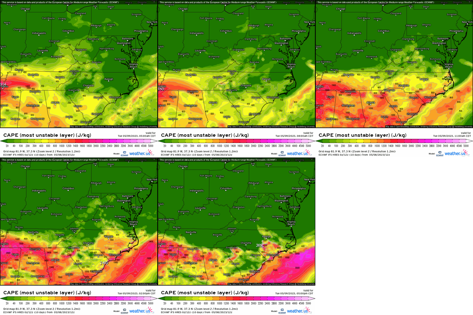
As we progress through the morning and into the afternoon, we’ll receive daytime heating via solar insolation and allowing for instability to build as we see MUCAPE billow rather quickly into the afternoon. You can see more of a focus east of Fayetteville and Raleigh, with over 800 j/kg (certainly enough) occurring with several hundred joules approaching VA beach.
To go along with the above, typically we like to see dewpoints reach and/or exceed ~60*F. Across this region, there won’t be any shortage of that with plenty of moisture which reemphasizes the buoyancy aspect.

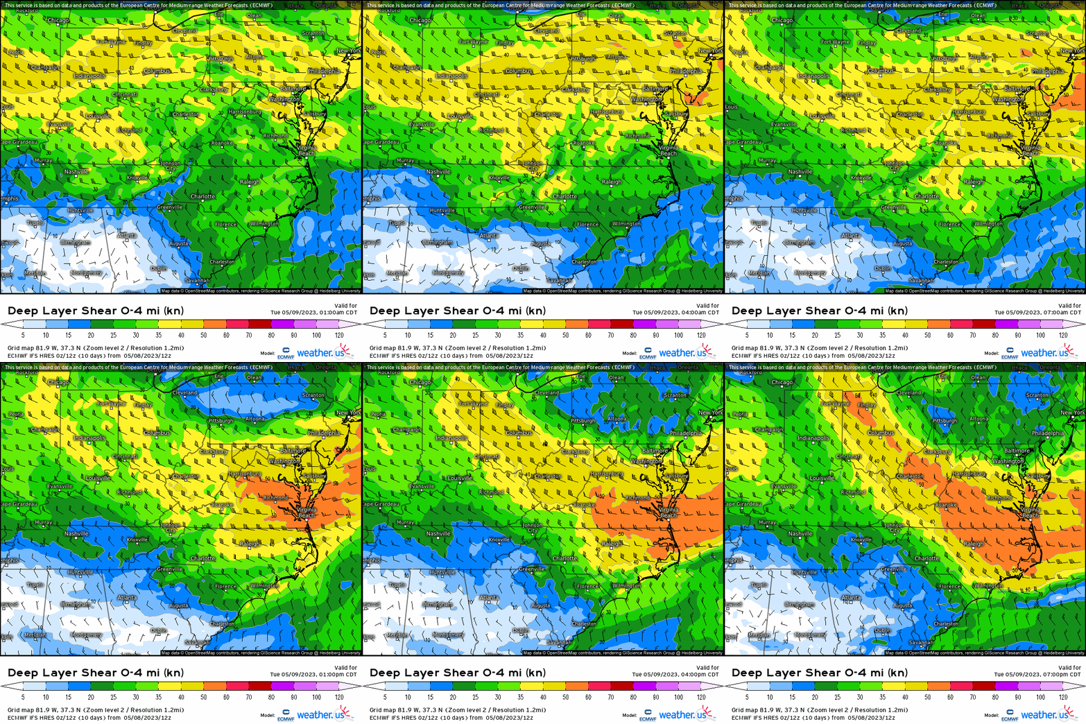
So we have forcing (albeit not entirely strong, but enough), a favorable thermodynamic profile, and now we see to look for the kinematic component, or shear. What we see below is 0-4 km shear of 30 – 35 knots is displaying support for updraft organization bringing about the potential for severe storms.
Putting it all together above reveals that we may see initially open sector discrete cells form, before cluster development later in the day with hazards including large hail given the elevated dry air aloft and decent instability through the hail growth zone, and damaging gusts with the “inverted V” profile within the soundings.
CENTRAL PLAINS
Similar to the setup above, a weak frontal boundary will lie parallel to the KS/NE border as a weak surface low develops tomorrow in response across OK panhandle through the morning and into the afternoon. It’s south of this boundary that moisture “pools” south of the front (within the warm sector), with dewpoints also getting into the 60’s and 70’s quite easily in response to the lowering of pressure and moisture advection from the Gulf.
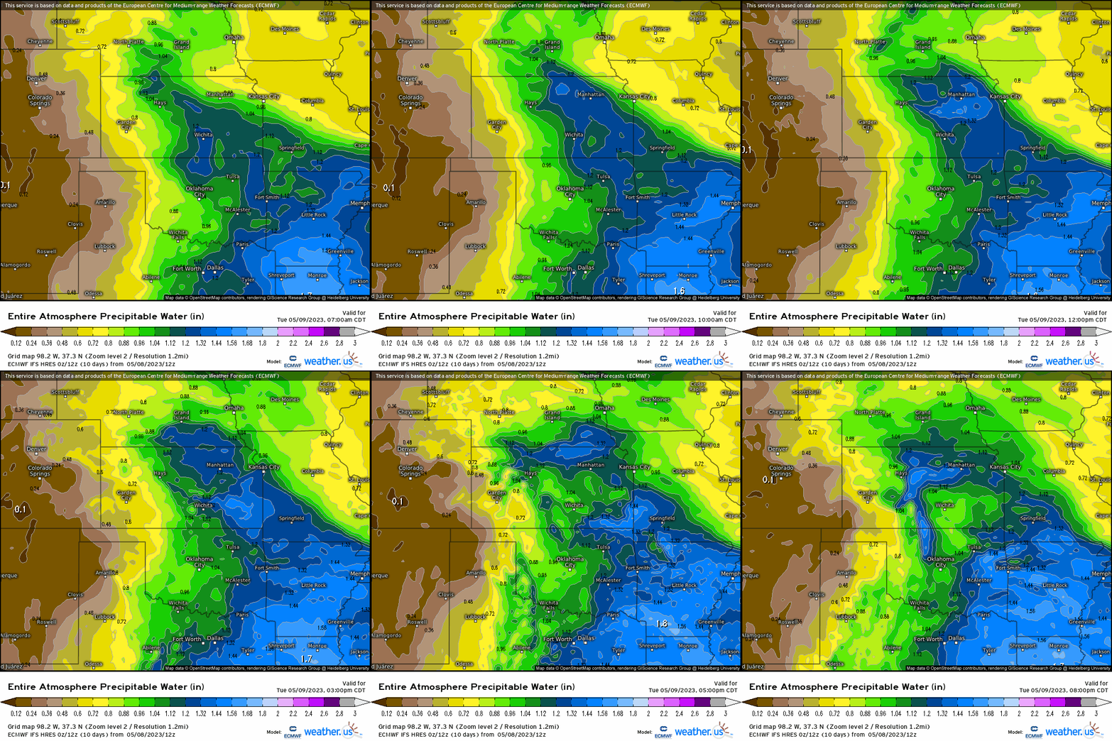

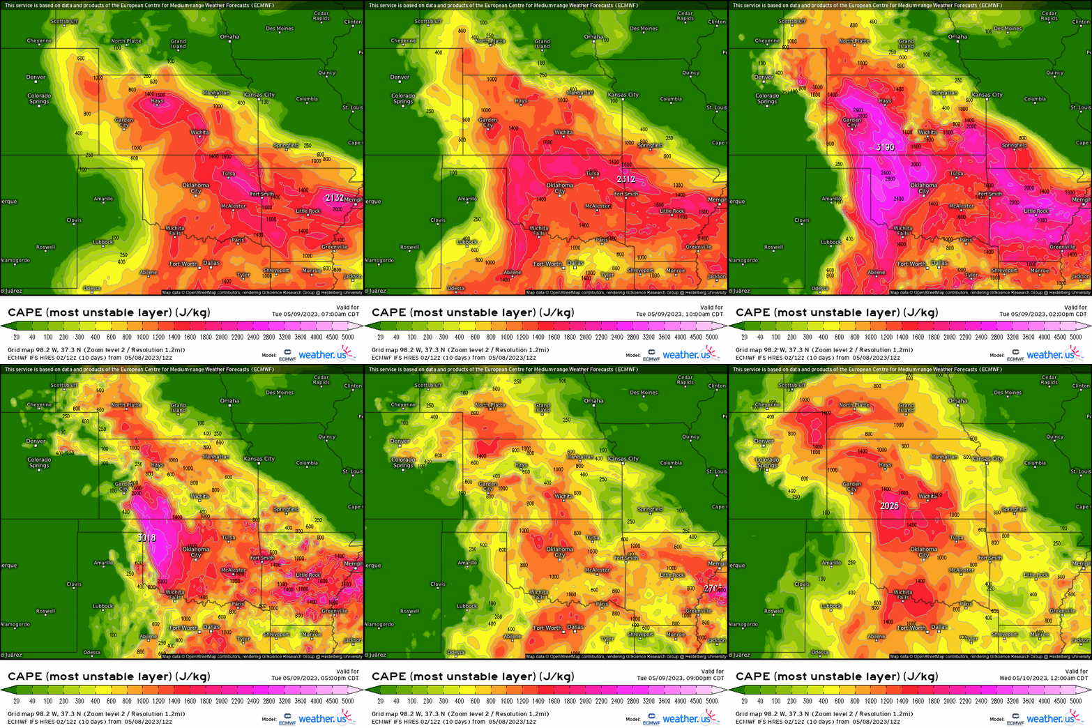
As we check in on our thermodynamic and kinematic profiles, we see absolutely no shortage of MUCAPE (most unstable CAPE — it’s found by lifting each layer in the lowest 300 mb of the troposphere and finding the CAPE for each. Then, the layer that registers the highest CAPE value is what generates “MUCAPE”. It’s also helpful in determining where there may be elevated CAPE above any inversions since CAPE can still exist aloft even if none is present in the boundary layer). Where you want to pay attention is now where the dryline (notice the distinct dry vs. moist differences in dewpoints across the OK/TX panhandle, nearly intersects the warm front draped across KS/OK border. In conjunction, we have an overlap of favorable CAPE and shear, supporting the potential for severe thunderstorm clusters to manifest and dive southeast.

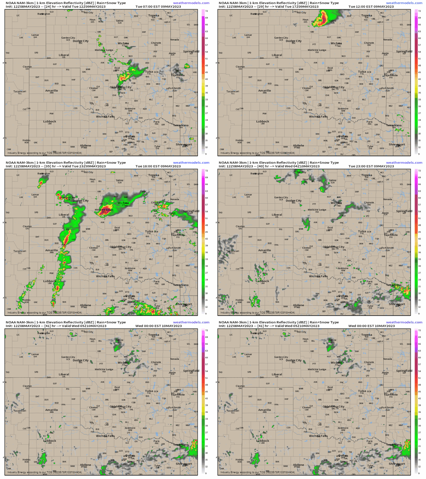
We see below the NAM show storms quickly growing and congealing, though the storm mode is a bit more uncertain given that the forcing is on the meager side. However, that’s not to say that any storm that produces or clusters that develop can’t produce severe weather, in which large hail and damaging gusts are supported by the environment for southern KS into northern OK. A few isolated tornadoes also are possible given the low level directional shear within the vicinity of the frontal boundary on the south side.
If you reside in these general areas, be sure to stay weather aware of course and refer to your local news stations and local NWS office for important updates / information.


