Severe Weather Possible for the Corn Belt Friday and Saturday
Two rounds of severe weather are expected for the Corn Belt region.
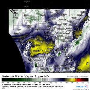
Current water vapor imagery shows an upper level trough currently over this region and another, stronger, short-wave trough approaching from the west. While severe weather will be possible both today and tomorrow, Saturday’s threat is expected to be somewhat more potent and even features a low, but non-zero, chance for tornadoes.
Before we dive into tomorrow’s set up, I briefly want to touch on the threat today, just to have it covered: Overnight convection has, for the most part, cleared out eastward and the sun is returning as the clouds thin. The day time heating in this region will lead to some destabilization throughout the day and possible redevelopment later this afternoon. The biggest threat with any storms that redevelop today will be strong winds.
The NWS has activated their new wireless emergency alerts for “destructive thunderstorms.” Storms with hail 2.75+ inches in diameter or winds exceeding 80 mph. Though it is unlikely to see widespread, if any, storms of this caliber today, simply be aware of the new warnings and be prepared to take shelter should one be issued for your area. More info about these new alerts here if you are unaware of the addition. Best to be informed now so you know what actions to take if/when you receive one.
Moving on to Saturday…
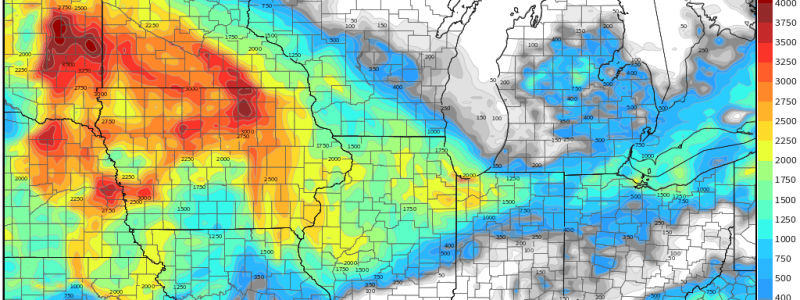
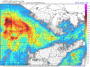
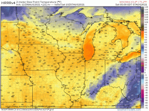
A developing low will move out of the northwest, across the northern Plains, and eventually encounter an atmosphere ripe for severe weather. Daytime heating and dew points in the upper 60s/low 70s, which is high for this region, will combine for some impressive CAPE values.
Though the average summer dew point has been increasing steadily here, dew points exceeding 70 degrees are still somewhat uncommon this far north. Being so far removed from any large, warm body of water, it’s difficult to find that amount of water vapor in air. So why now? Well, corn. Yep, you read that right. The thriving corn fields of the aptly named Corn Belt are transpiring as they grow, which is helping to increase the total amount of water vapor in the air. Warmer air can hold more water vapor. The summer temperatures have been pretty toasty recently which means the air’s capacity for water vapor has been raised. More water vapor via higher temps/plant transpiration = higher dew points.
The point to this is: plenty of energy will be available to storms that form tomorrow.
Storm mode remains a bit of a question. If discrete cells can form along/near the warm front, conditions may be conducive for a tornado or two. Upscale growth should limit the duration of the tornado threat, if any actually appears, and assist in making a transition into primarily a damaging wind threat with hail possible later in the day closer to the low, where lapse rates are steeper.
This is still an evolving forecast so we’ll monitor it’s evolution and update later and/or tomorrow with any new info. Jacob will likely have a blog tomorrow detailing what to expect.


