Severe Weather Moves Northwest
A massive trough is digging into the Western US, and the calendar reads May 20th. Unsurprisingly, severe thunderstorms are in the forecast.
But for a day packed with weather history ranging from fascinating (2019) to traumatic (2013, 1957), it’ll come as something of a relief that the orientation of said troughing will favor a setup more favorable for an odd type of squall line than for tornadoes. While potential impacts will probably be on the lower end, it’s a really interesting setup worth investigating further. Let’s!
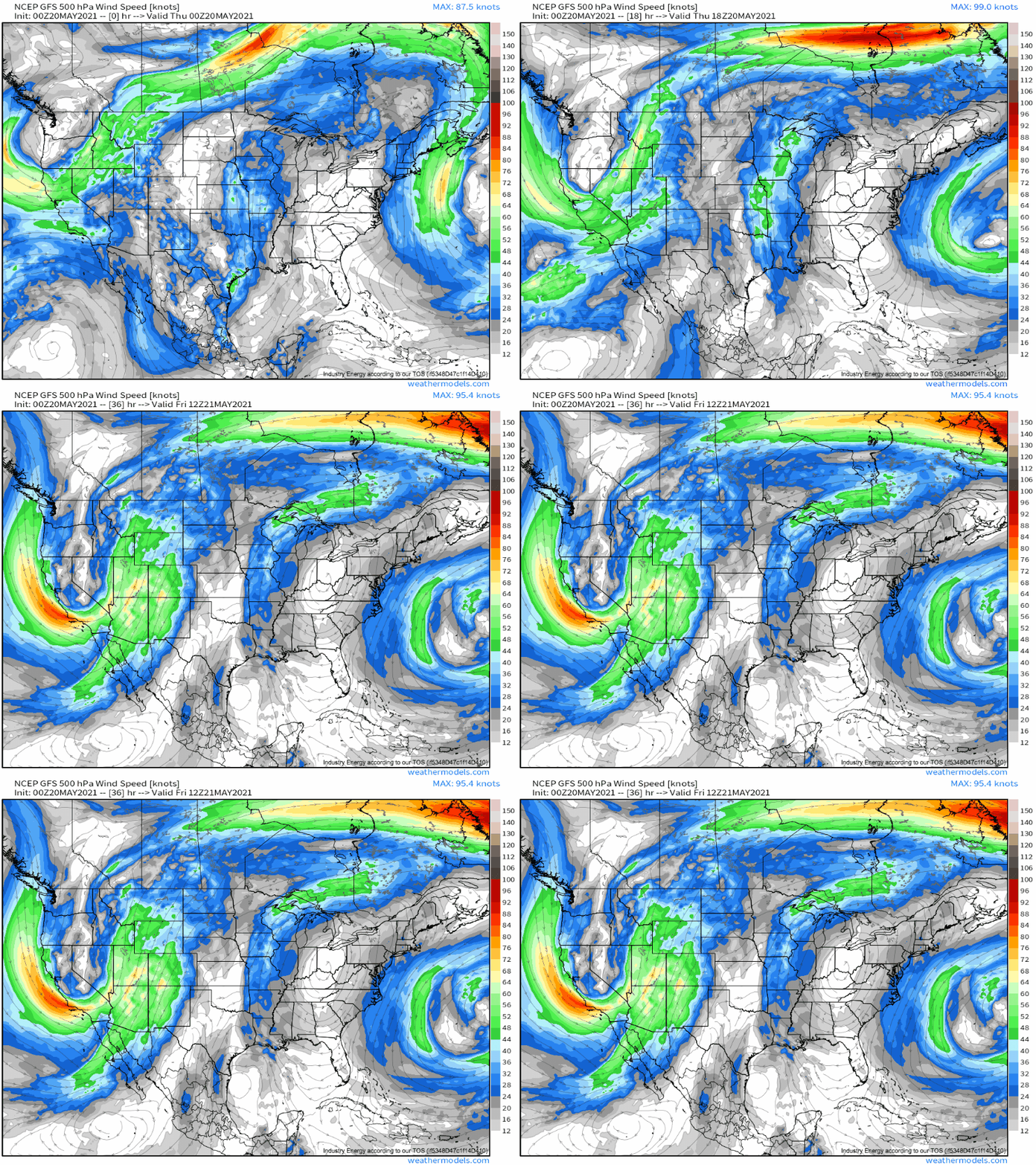
Our atmosphere starts to organize itself as a midlevel trough pivots southeast to a center near south-central Oregon by noon mountain time. Unusually high in amplitude due to the squeezing influences of central US ridging, a belt of increasingly strong and S-ly flow will overspread much of the transition zone east of the Rockies into the northern Great Plains by late evening.
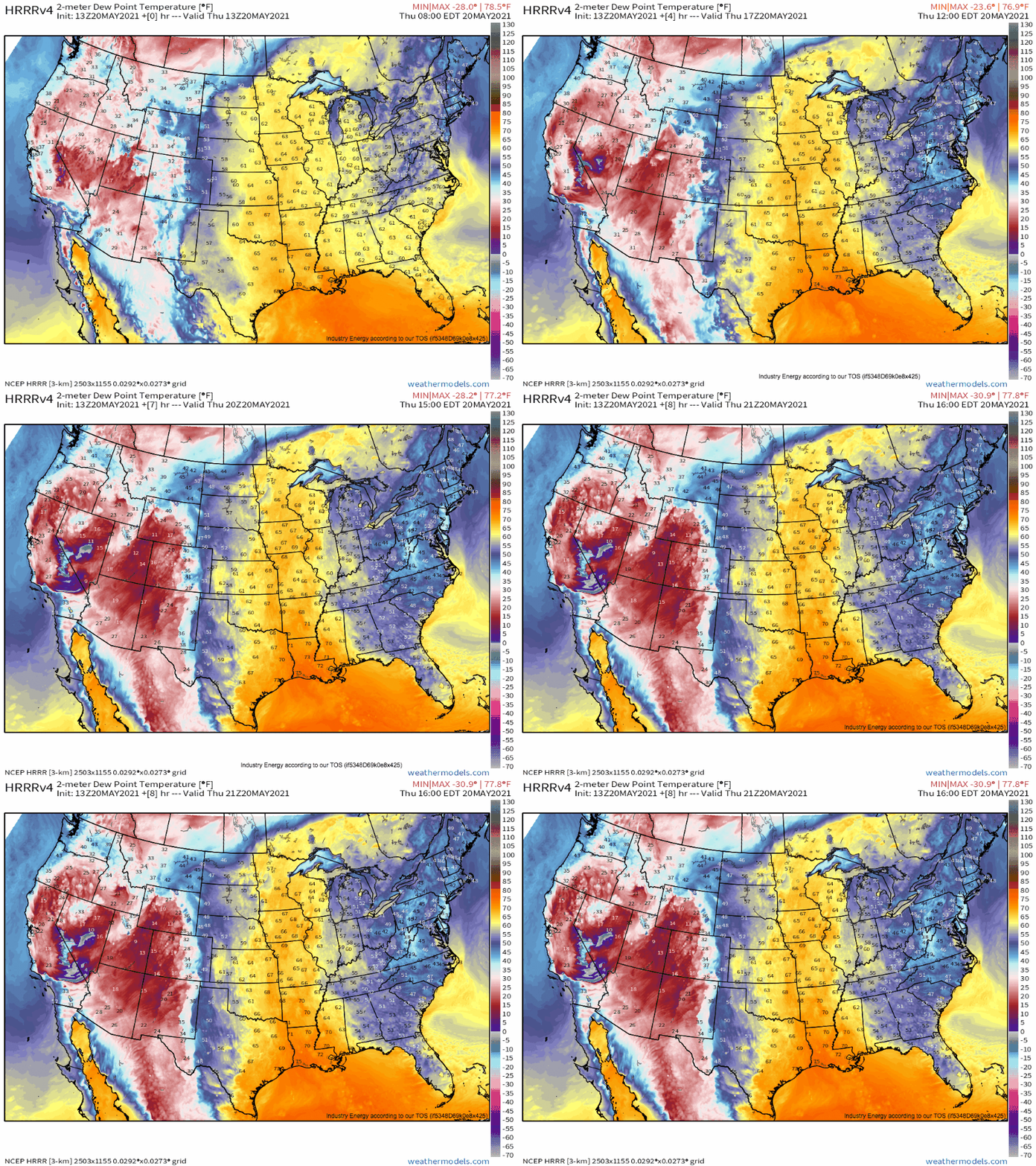
Diffluence ahead of this intense trough will unsurprisingly support mass removal. The result will be a developing cyclone over the central Rockies, centered from Nevada to Wyoming by the early afternoon, which will promote a belt of strong low level flow. This will help siphon moisture north from the Gulf towards the exit region of the bowling midlevel trough, which will lift dewpoints in a corridor from the Nebraska/Colorado border northwest to central Montana to near 50ºF.
Now, this is normally way too low for severe weather. But sometimes, you have to rip out the first few pages of the metaphorical poetry textbook, and the unusual interactions between topography and the atmosphere in this corridor could very well support a high-end severe wind threat. Bear with me.
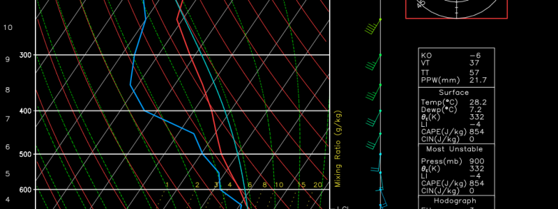
A swath of incredibly high-end lapse rates, in the low and mid levels, will advect east of the Rockies. It’ll mimic the kinds of EMLs that propagate into tornado alley from the Mexican plateau, and will result in an incredible thermodynamic property of the airmass- near-dry adiabatic lapse rates from the surface well into the midlevels. 
The result of these low dewpoints but incredibly high lapse rates will be an environment characterized by a hefty inverted V T/Td split below around 600mb, which will do two things: prevent updraft growth unless forcing for ascent is very strong, and allow the type of condensational cooling that can promote incredibly intense downdrafts in thunderstorms.
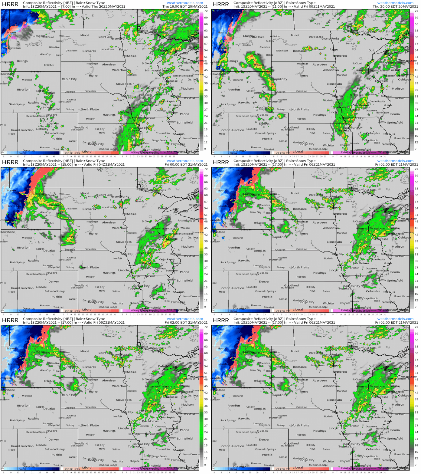
This lifting seems likely to occur amidst the intense differential heating associated with the Wyoming mountain ranges, which tower many thousands of feet. It’ll promote linear convective organization as modeled by CAMS, which will race north/northeast in something of a bow this evening.
While reflectivity associated should remain low, and tornadoes or heavy rain will be unlikely, an intense swath of damaging wind and hail will occur. Some of both could well be significant, and I wouldn’t be surprised to see a wind report in excess of 80mph from this line before it crosses into the Dakotas and dissipates tonight.


