Severe Weather In The Northeast Today
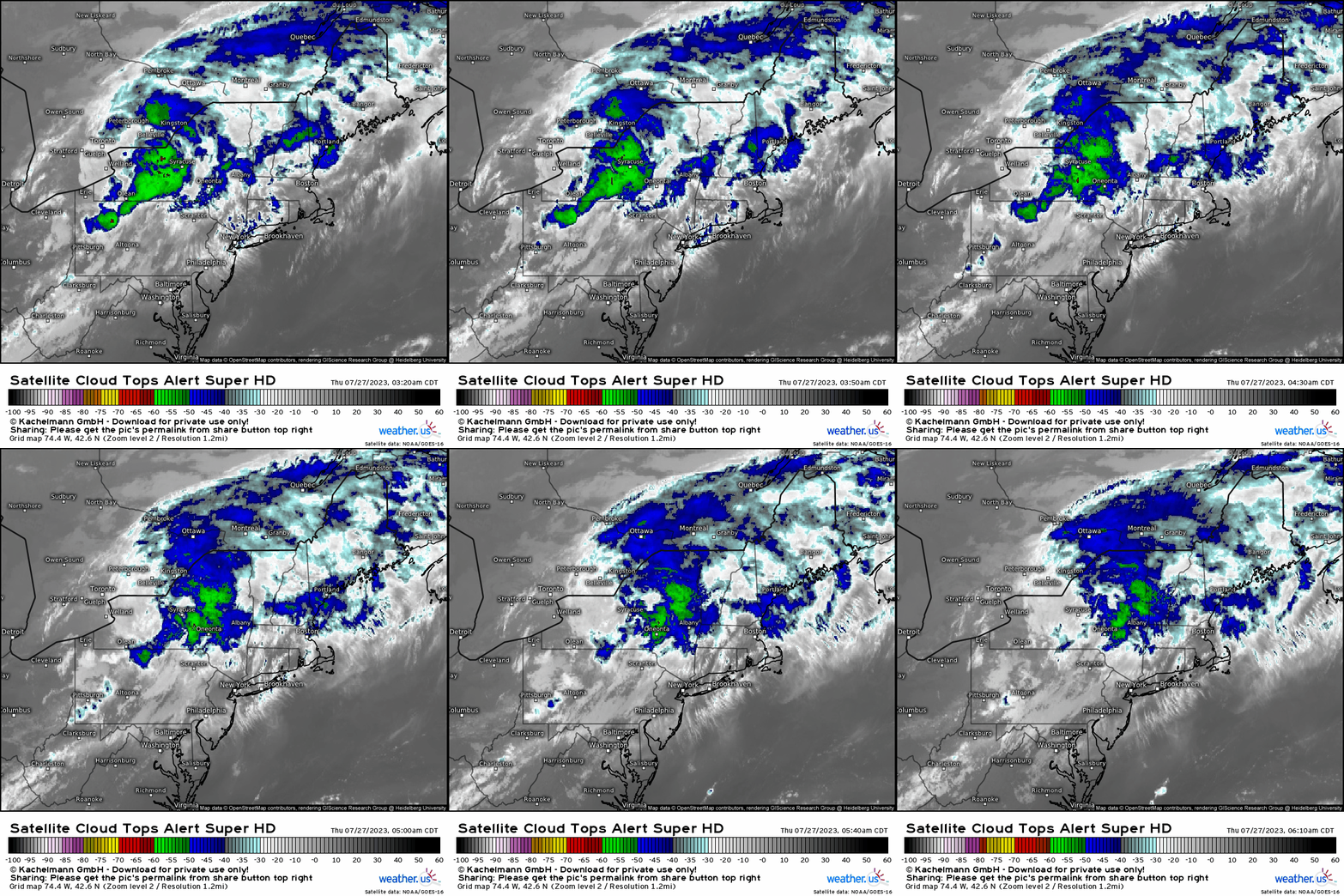
With ongoing convection upstream across the NY / Canadian border and into the interior Northeast this morning, it’ll temporarily stymie surface heating and favorable buoyancy until this afternoon. We can see this through the cooling of cloud tops across this region below.
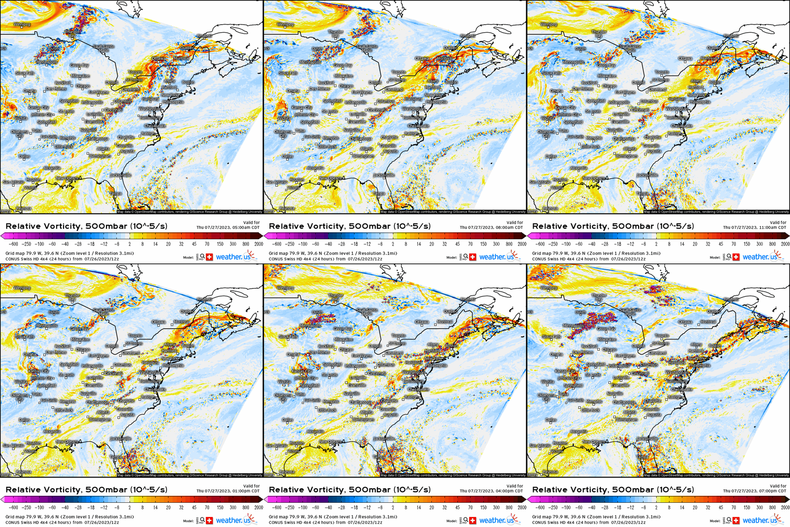
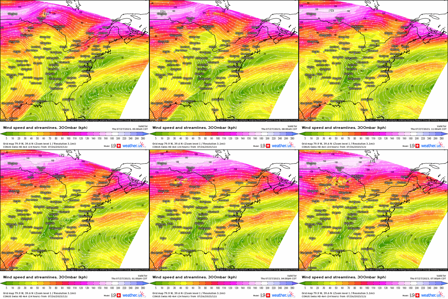
At 500mb, it’s quite obvious that a shortwave trough will lift toward the east / northeast across New England, providing forcing via positive vorticity advection. Furthermore, there’s also a jet streak that is juxtaposed to the trough and adjacent to New England, further enhancing divergence aloft.
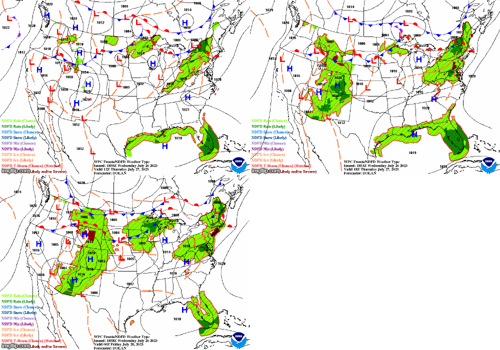
Thanks to the wonderful meteorologists at the Weather Prediction Center (WPC) with their surface analysis forecasts, we can see that now at the surface, a low pressure shifts into Maine. A warm front surges northward, rendering all areas within the warm sector. It’s near the triple point that low level shear is enhanced due to pressure falls, and this is where we can expect possibly tornadoes and rotating updrafts; thereby it puts areas across NY, VT, NH, and into ME at the greater tornado potential.
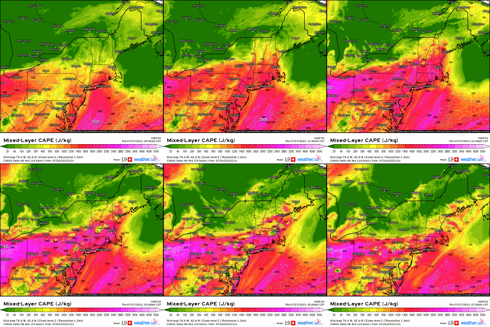
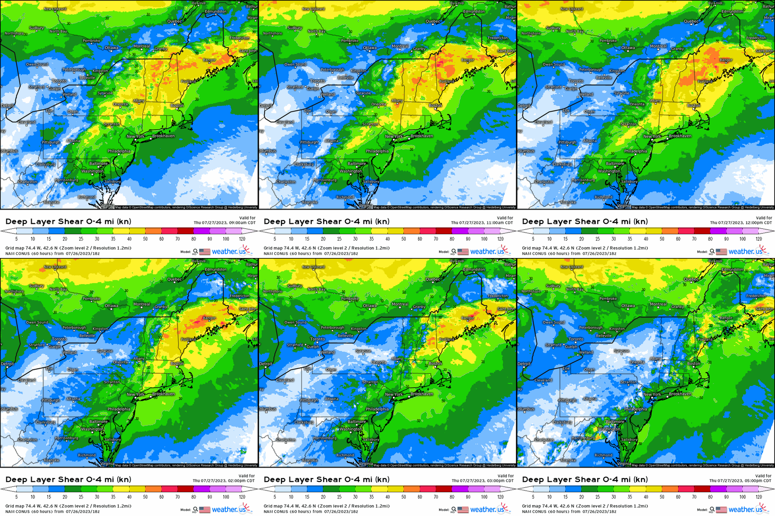
Once we see convective debris begin to clear and daytime heating becomes realized, this will quickly render favorable thermodynamics as instability builds. Denoted by 1000 – 1500 J/Kg of MLCAPE up to NH, VT, and ME (remember near the surface low as well), and shear magnitudes greater than 35 knots (especially further north across New England as opposed to further south into the Mid-Atlantic), we’ll be getting an environment supportive of supercells and multicells. Further south into the major metropolitan regions, the shear is slightly weaker and away from the “better” forcing, but with sufficient CAPE and wind shear, clusters and semi-discrete convective cells are still probable later this afternoon with the window for this area (i.e. NJ, PA, DE, MD) between 3 – 7 P.M. Further north, we’re looking at storms firing off around noon to 1 P.M. and continuing into the afternoon.
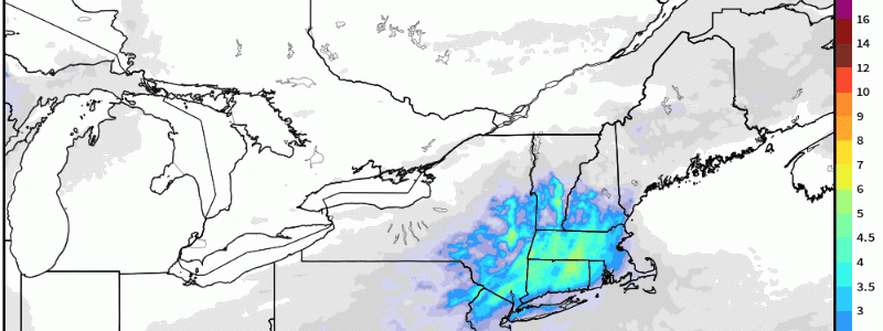
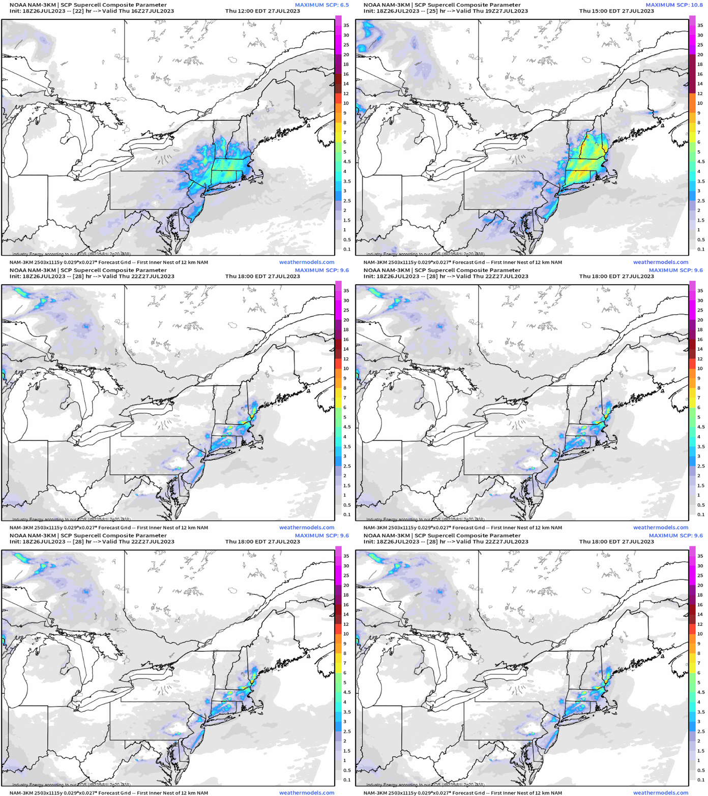
The HIRES NAM shows values exceeding 5 of the supercell composite parameter, which is indicative of a pretty solid chance of seeing supercell formation given a favorable environment further north into New England.
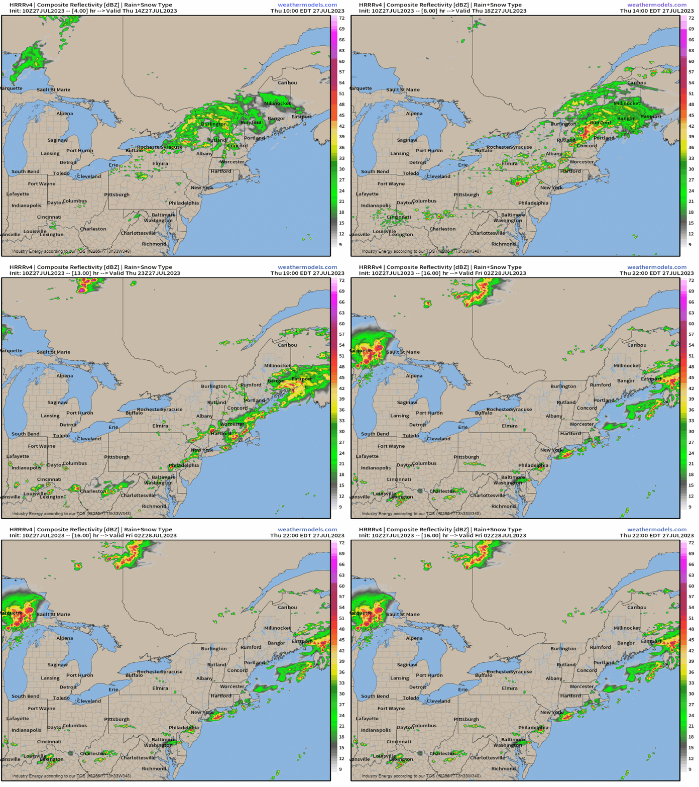
So putting this all together, we see our convective debris from upstream glide across the northern tier of the Northeast. Once this clears and the surface low shifts toward New England as the warm front surges as well, convection will begin to manifest further north by early this afternoon in conjunction with daytime heating (conditional on this as well). Expect discrete cells to fire off across upstate NY then proceed eastward as convection grows upscale. Further south, it’ll take some time, but multicell and discrete cells will occur likely across the higher terrain across the Appalachians before merging later this afternoon from PA down into VA. Hazards will mostly be large hail and damaging gusts, with the better chance for tornadoes as discussed further north across New England (CT, NH, VT, ME, and MA). It’s not to say an isolated tornado can’t occur further south, but as of now it’s more so the risk for wind and hail.
As always, be weather ready and prepared, especially with severe weather implications once again threatening.


