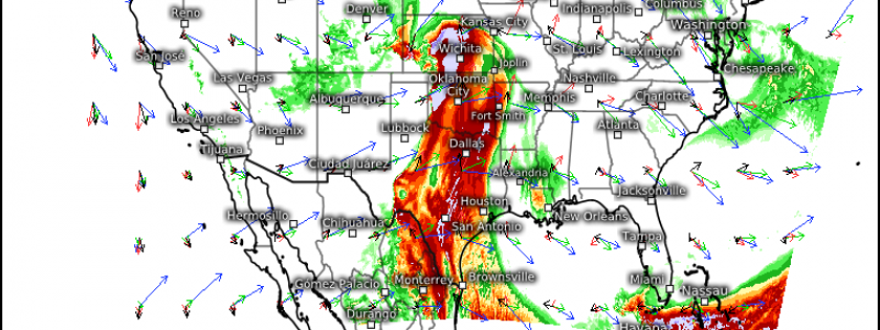
Severe Weather, Flash Flooding Possible This Mother’s Day Weekend
Well, it’s Friday night and the weekend is here. However, if you’re looking for a weekend full of fantastic weather in which to get outside and enjoy your free time, you’re not going to like what I’m about to write. Though it won’t be bad weather for everyone all weekend, a large portion of the country stands to see some adverse weather for at least part of the weekend.
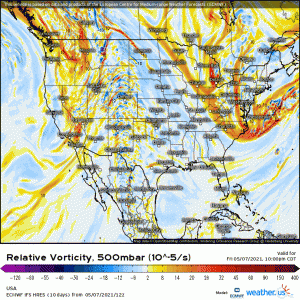
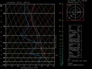
A shortwave trough will traverse the Rockies and incite surface cyclogenesis as it descends the eastern slopes. This deepening low will then begin to draw moisture from the Gulf. Steep lapse rates facilitated by very cold air aloft, courtesy of the shortwave, and adequate shear will set the stage for the possibility of severe weather ahead of the approaching cold front later tomorrow afternoon. Storms will kick off near the dry line boundary and advance eastward.
The extent of the possible severe weather is a bit uncertain as the atmosphere looks to remain capped.
The weak forcing associated with the shortwave and marginal moisture may not be enough to break this cap. The possible exception is near the triple point in western Kansas. For now, the most likely hazards are damaging winds and large hail, especially considering the cold air aloft and steep lapse rates. A few tornadoes are possible, also likely closer to the triple point and nearer to the approaching front, where low level shear is somewhat enhanced. We’ll have to see how things evolve in the morning so look for an update on the severe potential from Jacob sometime tomorrow.
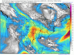
One thing I’d like to mention, aside from the severe weather, is the amount of moisture this deepening low is going to draw in.
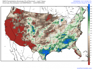
Looking at the Vapor Transport and the Precipitable Water, the moisture content looks to maximize over the deep south. As a reminder, this is the area that saw devastating flash flooding just a few days ago. Though this event doesn’t look to be as slow moving or widespread as the last one, with the ground already oversaturated, it won’t take much more than a potent storm to push some of these areas back into flash flooding. In fact, a decent portion of the east coast has seen above average rainfall lately.
In fact, in the last 7 days alone, the south has seen anywhere from 125% to 500% of normal rainfall.
Both the GFS and the Euro suggest a corridor of 2+ inches of rain by Tuesday morning stretching from Louisiana to western Alabama. While that does not include central Alabama, which was the hardest hit this week in terms of rainfall, parts of both LA and MS received in excess of 2 inches of rain from the event earlier in the week and also don’t really need more rain right now.
Basically what I’m saying is, yes, be aware of the severe weather, but don’t count out a flash flooding threat. Many locations are oversaturated already and can’t handle a sudden influx of heavy rain.
Enjoy your weekend, but remain weather aware!
