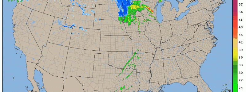
Severe Weather Continues Today
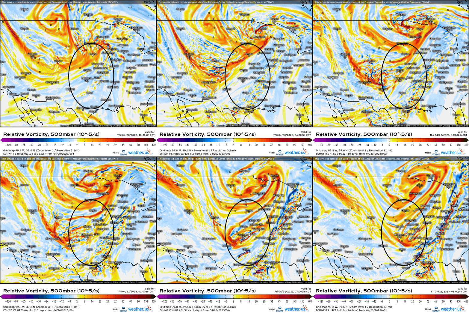
With a broad long-wave trough carving out west, we’re going to see vorticity advection out ahead of this trough allowing for sufficient forcing for ascent downstream.
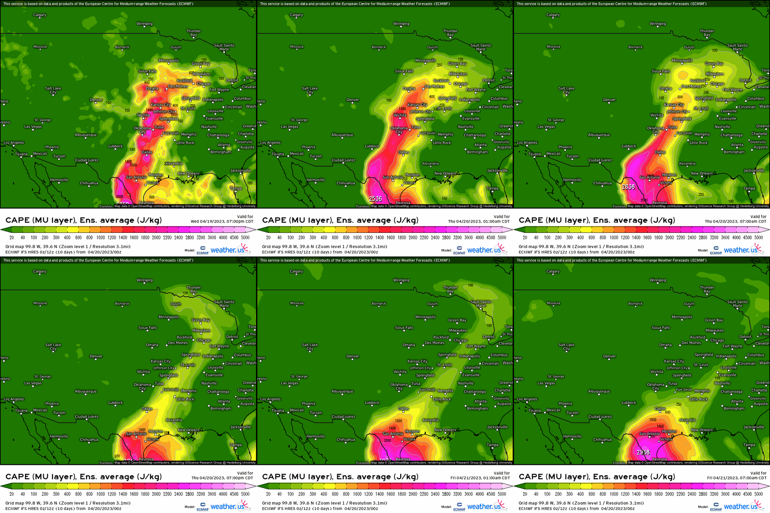
Turning to our instability, you can begin to make out the main area of concern where a relatively narrow strip of CAPE (Most unstable CAPE – takes the lowest 300mb of the troposphere and assesses the instability) extend from TX up into IL with a pretty robust 1400-2000 j/kg of MUCAPE (average in this case). The southern half of this area is where we’re likely going to see more potent convection given the combination of severe weather parameters and lack of overall convective inhibition.
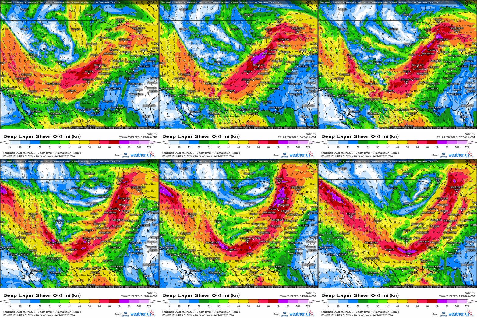
Next, do we have convection that can be sustained? We know shear organizes storms (keeps updrafts and downdrafts seperated), so as we take a look at the deep-layer shear, we can see a swath of over 40-50 knots extend from TX up into IL, demarcating the outline of the trough so no lack of it across the Plains and into the Midwest today.
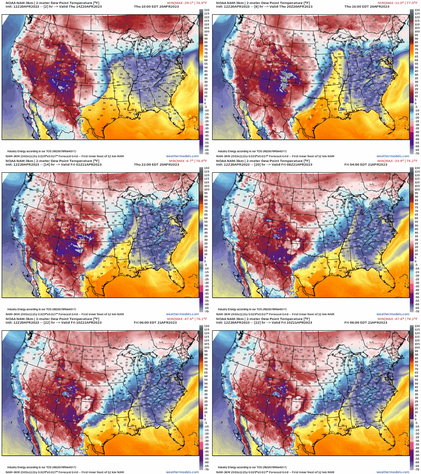
Now, we know we have sufficient divergence aloft to help evacuate mass, but what about the surface to help focus convection? As we analyze the dew points, we can not only see sufficient moisture present, but a surging cold front southeastward across the Plains and Midwest. This cold front will help spark thunderstorms, and allow for a mixture of discrete supercells and clusters to form this afternoon and into tonight.
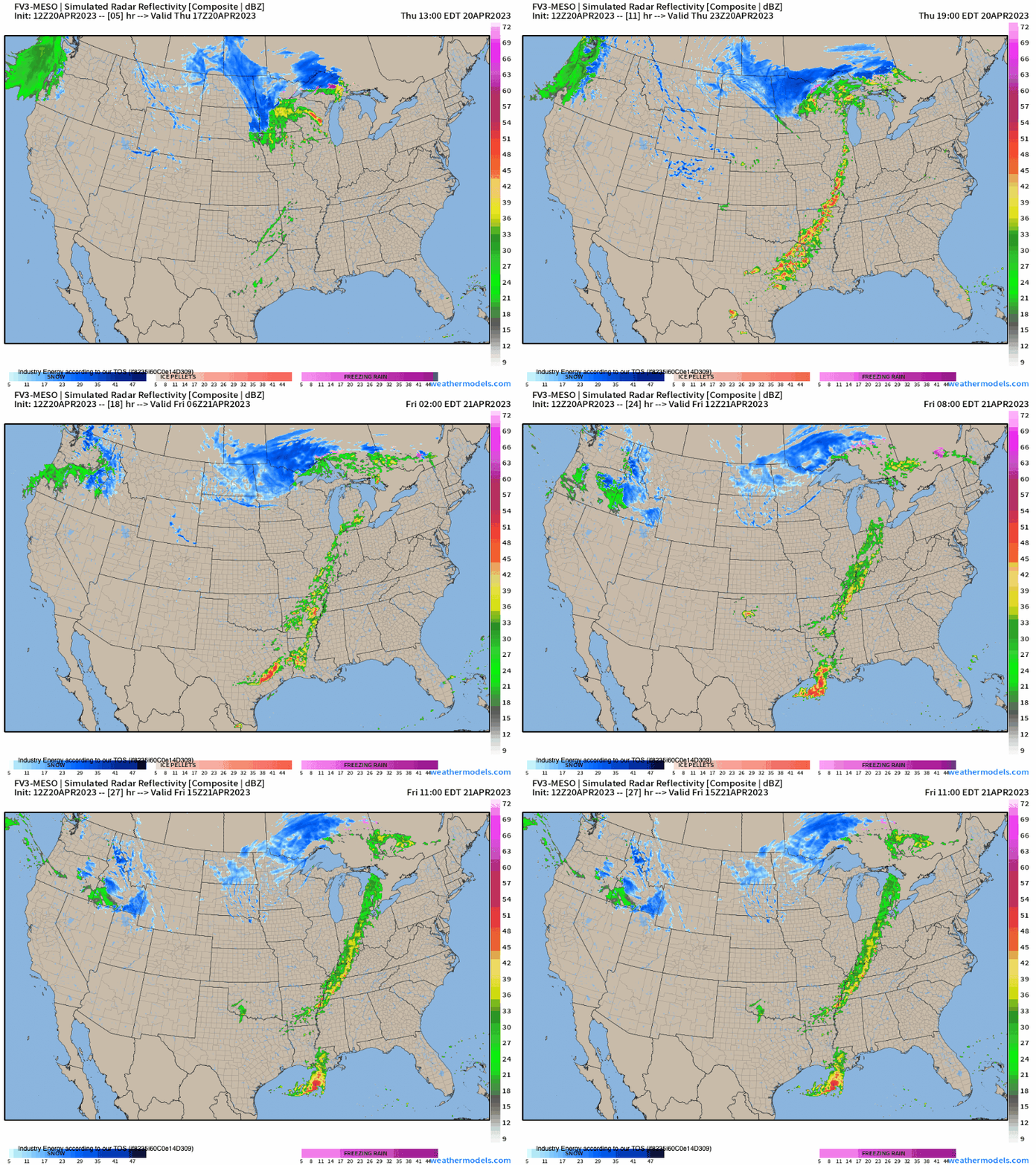
So putting it all together, we take a look at the FV3-meso CAM (convective allowing model) simulated radar today into tonight. Across the southern Plains and ArkLaTex, initial storms look to fire up this afternoon and progress into a cluster by this evening allowing for damaging winds, large hail, and isolated tornadoes. Further north across MO into IL, while the severe threat is a bit lower given the ongoing convection from this morning, though destabilization is expected through the day. With a cold front to still help allow for forcing for ascent and diurnal heating, storms can still become severe that are capable of also damaging gusts, hail, and an isolated tornado can’t be ruled out either.
As we continue to trek deeper into the severe weather season, please always be aware and have precautions in place! Please refer to your local NWS office and/or local TV station to further you’re heightened awareness for your local area so that you can be safe and feel secured, or know what to do and when!


