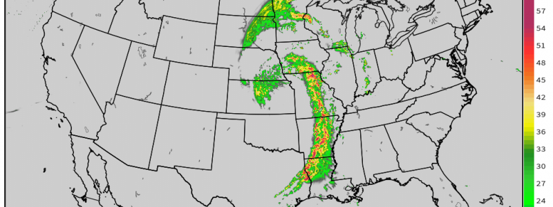
Severe Weather Concerns for the Mid and Deep South Today
Another spring day, another severe threat. ‘Tis the season, after all. But the good news is: this isn’t expected to be an outbreak like the events we saw on March 17 and 25. While the chance for tornadoes exists, it is more scattered than widespread. Also in the good news department: Alabama gets a much needed break this time. They aren’t the focus of the greatest threat and any storms are expected to weaken before reaching them overnight.
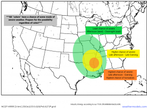
So today, while a large area of the mid-south and deep south has a chance at severe weather, we focus a bit on Arkansas, Louisiana, and Mississippi for the highest probabilities.
If you’re a regular reader of my blogs, you’ll know what’s coming next:
Don’t focus much on the colors. Know that if your area is highlighted in a color, you have a chance for severe weather and you should prepare accordingly. The “less scary” colors have a lower chance, of course, but it isn’t zero. Damaging weather often occurs outside of the higher risk areas. Better to be prepared than caught off guard.
That said, let’s look at what we’re expecting.
(gif) Link
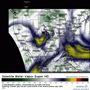
An area of low pressure is bowling eastward this morning. As it moves throughout the day, the low level jet will really begin to crank up this afternoon, advecting warmth and moisture with dewpoints reaching into the 60s as far inland as central Missouri, perhaps even into pockets of western Illinois.
Most of this area is currently covered in clouds with a bit of stratiform rain falling from Arkansas south. Heavier storms are occurring closer to the low and will do much to mitigate the northern extent of the severe threat later today as the atmosphere won’t have time to recover adequately before the front passes through.
In the southern extent of our severe threat, however, breaks in the cloud cover are likely and diurnal heating will do much to add to the destabilization of the atmosphere. Temperatures are expected to soar into the low 80s from the low 60s this morning and dew points could approach 70. All of this leads to a concentrated area of CAPE ranging from 1000 – 1500 J/kg in the general vicinity of N LA/SE AR/NW MS.
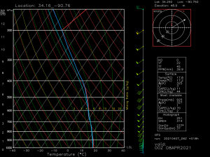
This forecasted sounding is taken near the SE AR/NW MS border for 7 pm CST. Lapse rates are okay, but not impressive, and shear is merely adequate around 40 kts. However, notice the wind barb at the surface. If we can get winds backing a bit to the SE, that could really assist with the tornado potential, giving a bit of extra directional shear to boost rotation.
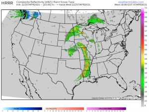
We are expecting storms to begin firing this afternoon in E TX and E OK and quickly organize into a pre-frontal convective line. These storms will strengthen and possibly go severe as they move into more favorable kinematics to the east. Though a largely linear mode is expected, any cells that are able to form ahead of the line may be able to strengthen quickly and pose a greater severe threat.
Unfortunately, this event will likely peak near/after sunset so please have multiple ways to receive warnings including at least one that will wake you if need be.
As we move into the overnight hours, the threat will diminish with loss of daytime heating and the addition of less favorable conditions further east. Storms are expected to weaken quite a bit as they pass out of Arkansas/Mississippi and into Alabama/middle Tennessee.
Remember: regardless of level of risk- prepare for severe weather today to avoid being caught off guard. No matter the “color,” your risk is not zero. Have ways to receive warnings and monitor development throughout the day.
