Severe Thunderstorms, Flooding Likely Again in Central US
Good morning!
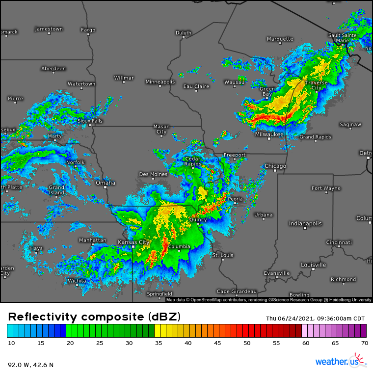
The fairly significant quasi-linear convective system (QLCS) that tore across a swath of Nebraska yesterday, leaving behind a swath of 60-85mph wind gusts, has weakened considerably but evolved into a distinct mesoscale convective vortex (MCV) over Iowa and Missouri. This acronym soup really just means that the intense pressure perturbations associated with a strong thunderstorm complex actually allowed the complex to take on several features of a small low pressure system, which can be seen on radar.
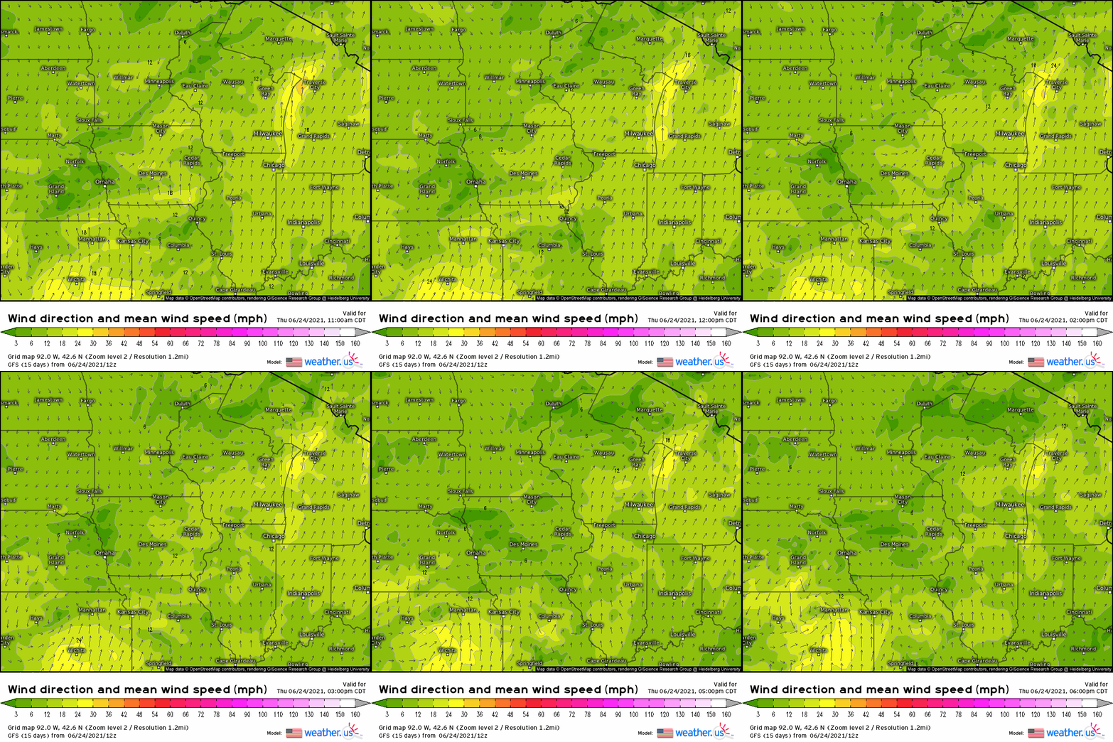
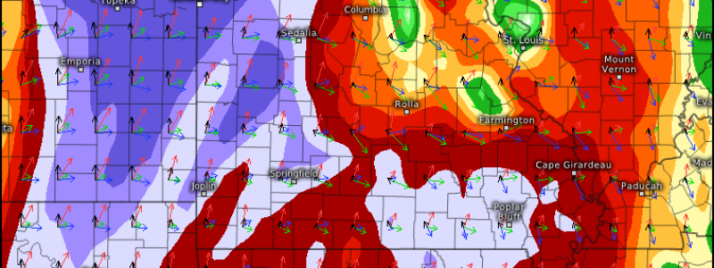
Notice the eye-like feature south of Cedar Rapids? It’s an unusually visible indicator of the fact that a relative low pressure center exists over eastern Iowa, associated with the mass of convection. To the south and east, a wind shift that resembles something halfway between an outflow boundary and a cold front slinks southward, slowing as the MCV weakens. It’ll continue to do that, as modeled by the GFS, through the evening, when it’ll stall from northeast Kansas through northern Missouri. Look for where wind subtly changes both speed and direction in the modeled surface field through then.
While this wind shift crawls south, moisture advected from the Gulf will continue edging north. Characterized by dewpoints to 75ºF, the airmass will see heating from the late-June sun amidst broken clouds, and will be overspread by very high lapse rates advected from the southwest, known as an EML. This will mean surface air over the central US will be energetic to the point that minimal lift can lead to explosive vertical motion, as expressed by CAPE exceeding 5000j/kg in places by the early evening.
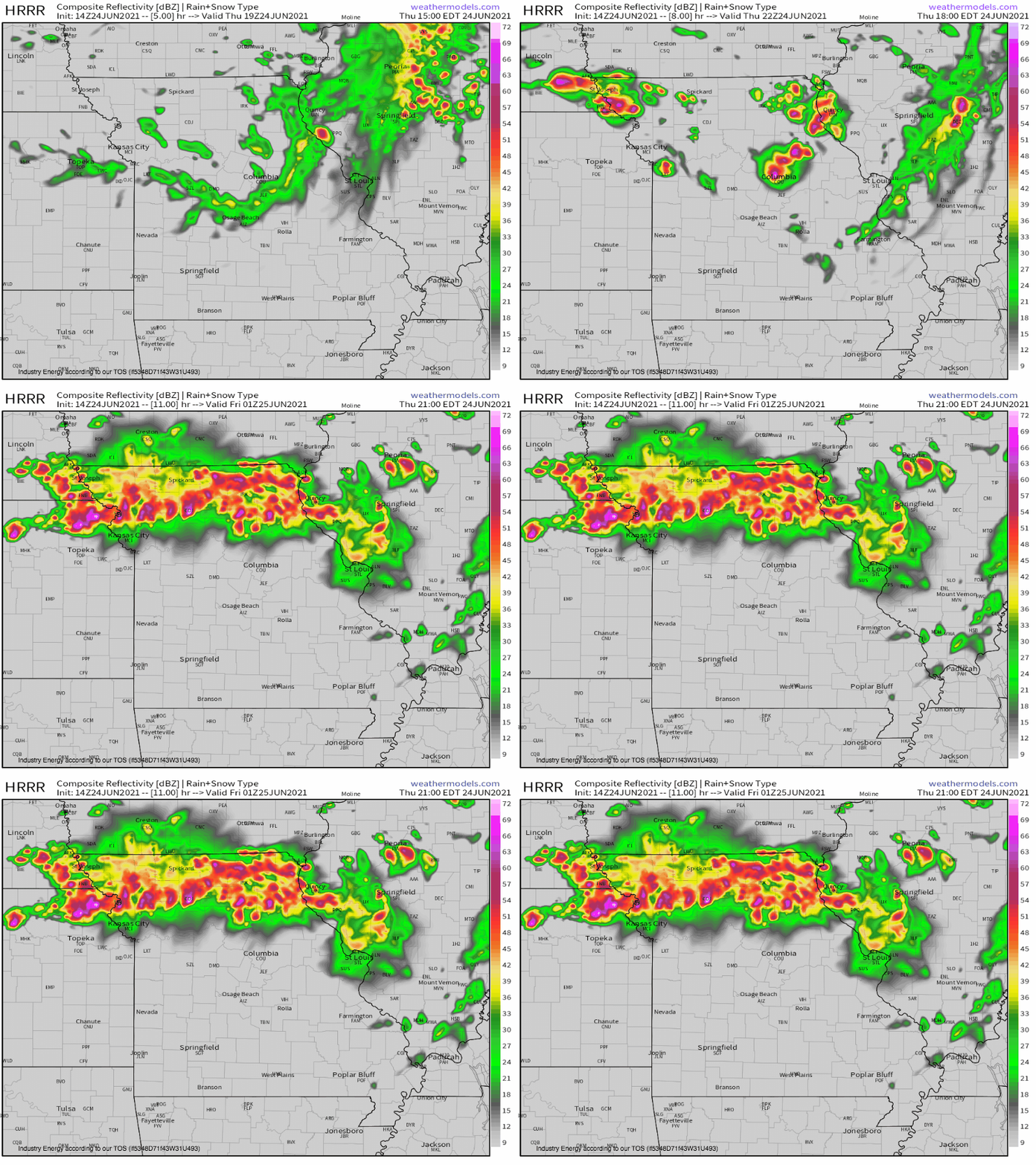
That lift will likely come in the form of the aforementioned wind shift, which will meet the high-CAPE airmass somewhere over northern Missouri and northeast Kansas. And then, boom…
…as an explosive line of updrafts roars to life.
Of course, there’s more to thunderstorms than just potential updraft energy. To determine the ability of these storms to cause damage, it’s advisable to check out the wind profiles of the atmosphere. What we find is fairly ominous.
With a seasonably moderate midlevel jet streak pushing southeast towards Kansas and Missouri by evening, co-located with a low level jet kicking up and the explosive instability and wind shift mentioned before, these storms could produce fairly significant severe weather.
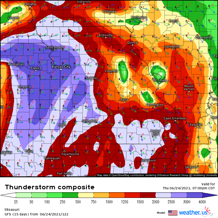
The weather.us thunderstorm composite, run for the GFS, shows how a wind profile with moderate flow that turns with height will develop over the northern tier of the explosive instability.
In this environment, supercells are likely at first, but the rapid storm development that’ll occur parallel to motion will limit the amount of time cells can be discrete. Tornadoes will be possible at first across northern Missouri, but the threat will quickly transition to significantly large hail over northern Missouri and northeast Kansas. Later on, storms will continue to consolidate into yet another racing MCS, bringing a significant damaging wind threat downstream. Tornadoes will also be conditionally possible in northeast Kansas, upstream of the rest of the severe weather threat. It’ll be a conditional risk, but a significant tornado *could* occur here if storms actually find a way to discretely develop amidst limited lift.
