Severe Thunderstorm Threat Targets Central US
A tightly coiled midlevel cyclone will bowl towards the Mississippi over the next couple of days, inciting a threat for severe thunderstorms and even a few tornadoes from parts of the central US into the Ozarks.
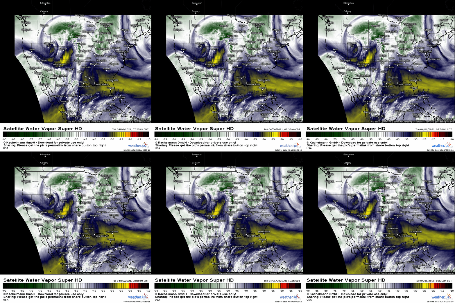
Right now, the lobe of low midlevel heights is positioned near Salt Lake city, and can be seen well on water vapor imagery as synoptic lift downstream incites (indirectly) an arcing band of clouds and convection from Texas to Montana.
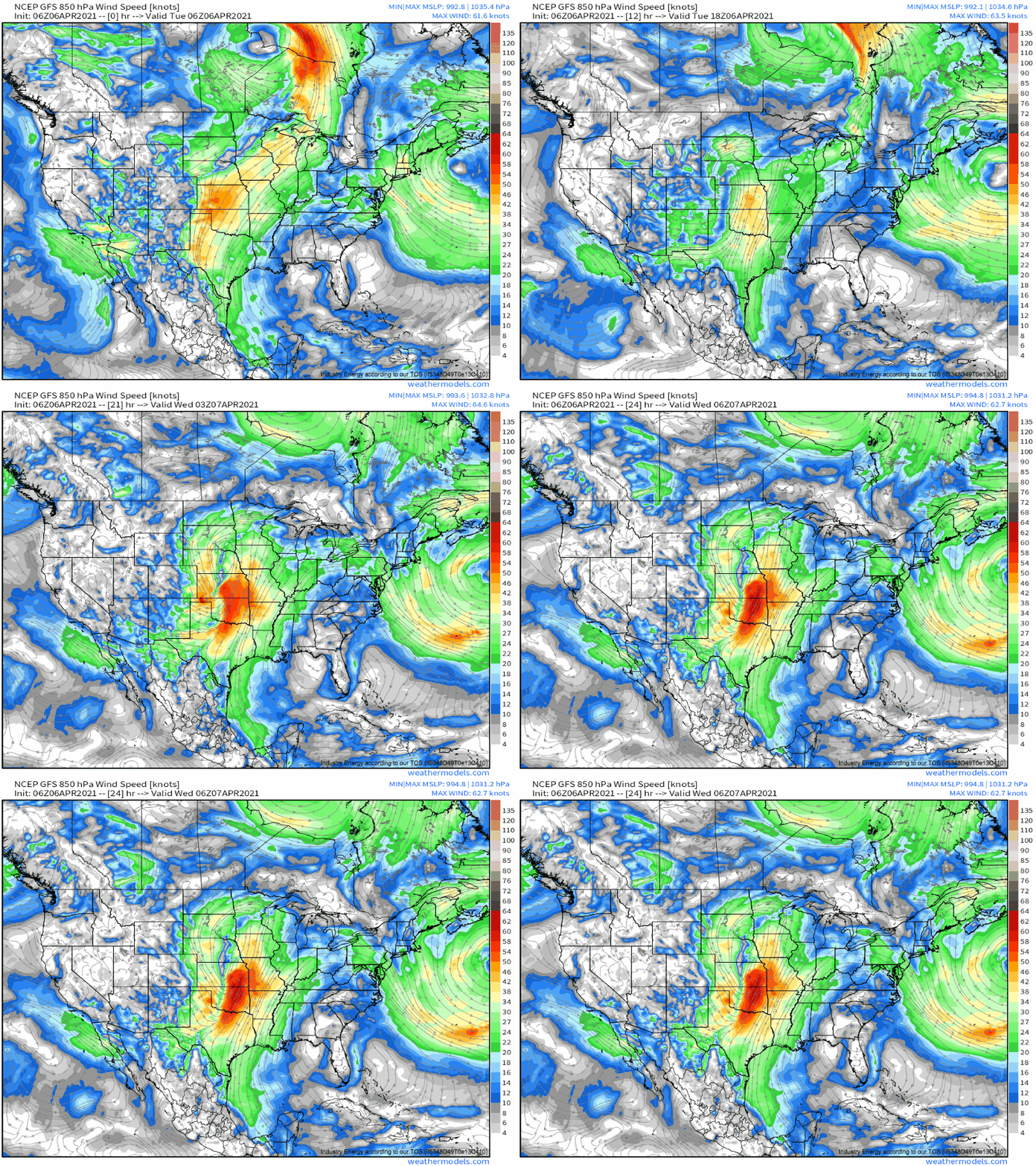
As the cyclone pivots southeast today into tonight, it’ll incite increased cyclogenesis at the lower levels of the atmosphere over the Great Plains. The result will be a steady intensification of a low level jet already hosing much of the central US down with southerly flow.
The result will be a near-surface environment characterized by increasingly high dewpoints by evening, and overspread with speedy flow that will likely induce fairly large, looped low level hodographs. With some degree of midlevel shear downstream of the ejecting trough, an environment conducive to the development of severe convection is apparent today in parts of the central Plains. But, surely, that doesn’t mean storms will actually form.
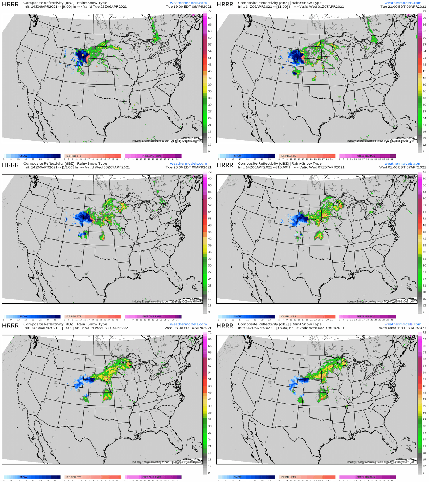
The first hump to overcome will be the co-occurence of storm initiation ahead of a dryline with a relative lull in both MLJ intensity and low level helicity, which will mean storms probably evolve past discrete mode before the best kinematics overspread the Plains. This will luckily probably keep many cells sub-tornadic, with diffuse mesocyclones and messy modes that serve well for plentiful hail production, but probably no tornadoes, and almost certainly none of significance. Should a nighttime QLCS develop, increased tornado chances could coincide, but with limited moisture and forcing, such robust convective coalescence seems unlikely.
Come tomorrow, severe chances will continue into the Ozarks, but with some familiar limitations keeping a medium lid on potential.
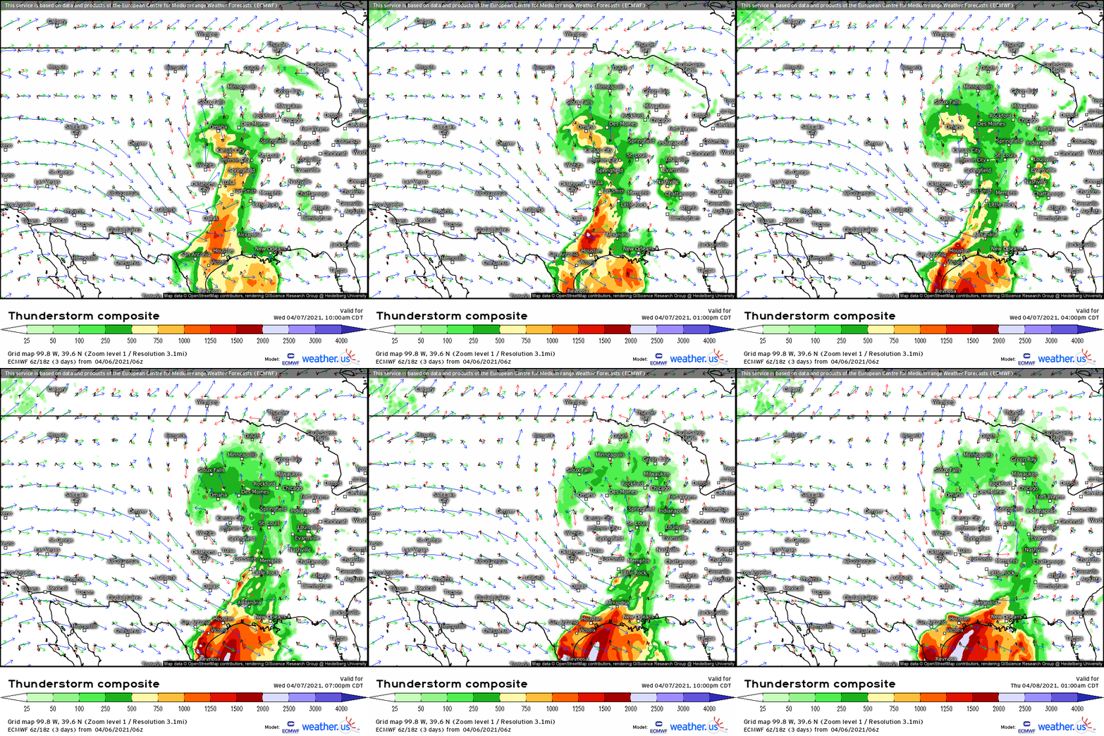
Potential will exist along a fairly wide swath, an arcing region stretching from Iowa south to Arkansas, Louisiana and Mississippi. Throughout, fairly limited midlevel flow and instability that’s largely on the low end of supportive will prevent convection from really taking off, although two zones do look like they could be relatively favorable for supercells, possibly including the risk for tornadoes.
They will occur where kinematics and instability, respectively, are maximized: near the occluding low, over Iowa, and in parts of the Ozarks into ArkaLaTex and adjacent portions of the S. MS Valley. The differences in synoptic setup will mean different limiting factors require watching, though.
In Iowa and Missouri, watch for locally enhanced instability, either along pooled dewpoints, stronger-than-expected EML/lapse rates, or cloud breaks that can lead to solar heating. These could increase the severe threat there. Correspondingly, weaker than expected lapse rates or dewpoints, or morning time showers/cloud cover of a higher than anticipated magnitude, could both well lead to a lower-than-expected risk.
In the ArkaLaTex, look for stronger midlevel flow than anticipated, as well as topographically backed flow from the SE instead of SW. These factors could help storms organize and tighten mesocyclones.


