Severe Threat Continues Into Carolinas Today
Ok, we can take a deep breath. The atmosphere certainly produced yesterday in the way the parameter space suggested it might, with dozens of tornado warned supercells erupting over hours and hours across the Southeast yesterday. But a combination of luck- none of the strongest rotation signatures impacted population centers- and overzealous instability-killing stratiform rain over Mississippi, the worst case scenarios were avoided. But the threat today, while somewhat muted compared to yesterday, will continue to require us to stay on our toes as another round of supercells and QLCS storms threaten to impact parts of the east coast with tornadoes, which could be strong, and widespread damaging wind gusts.
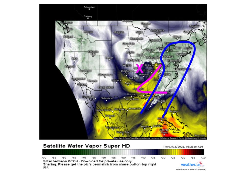
The system bowling east remains a potent source of divergence, which will be focused in the midlevel jet’s exit region (pink) from the mid-Atlantic south into Florida. Here, incentive is high, and will increase with time, for the type of mass removal that supports both a roaring southerly low level jet (blue) and precipitation. This low level jet will write the story of our sensible weather, as often occurs in springtime.
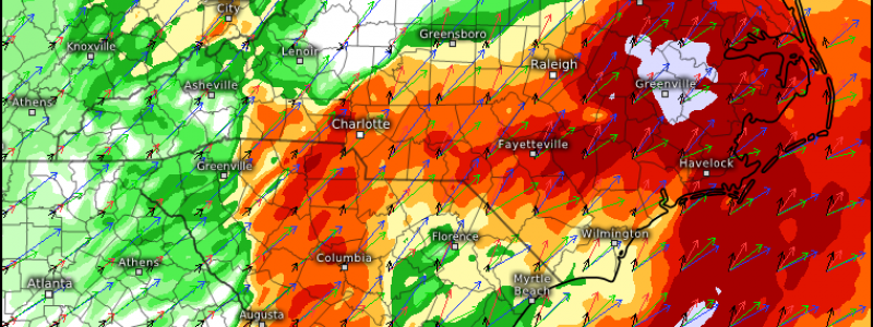
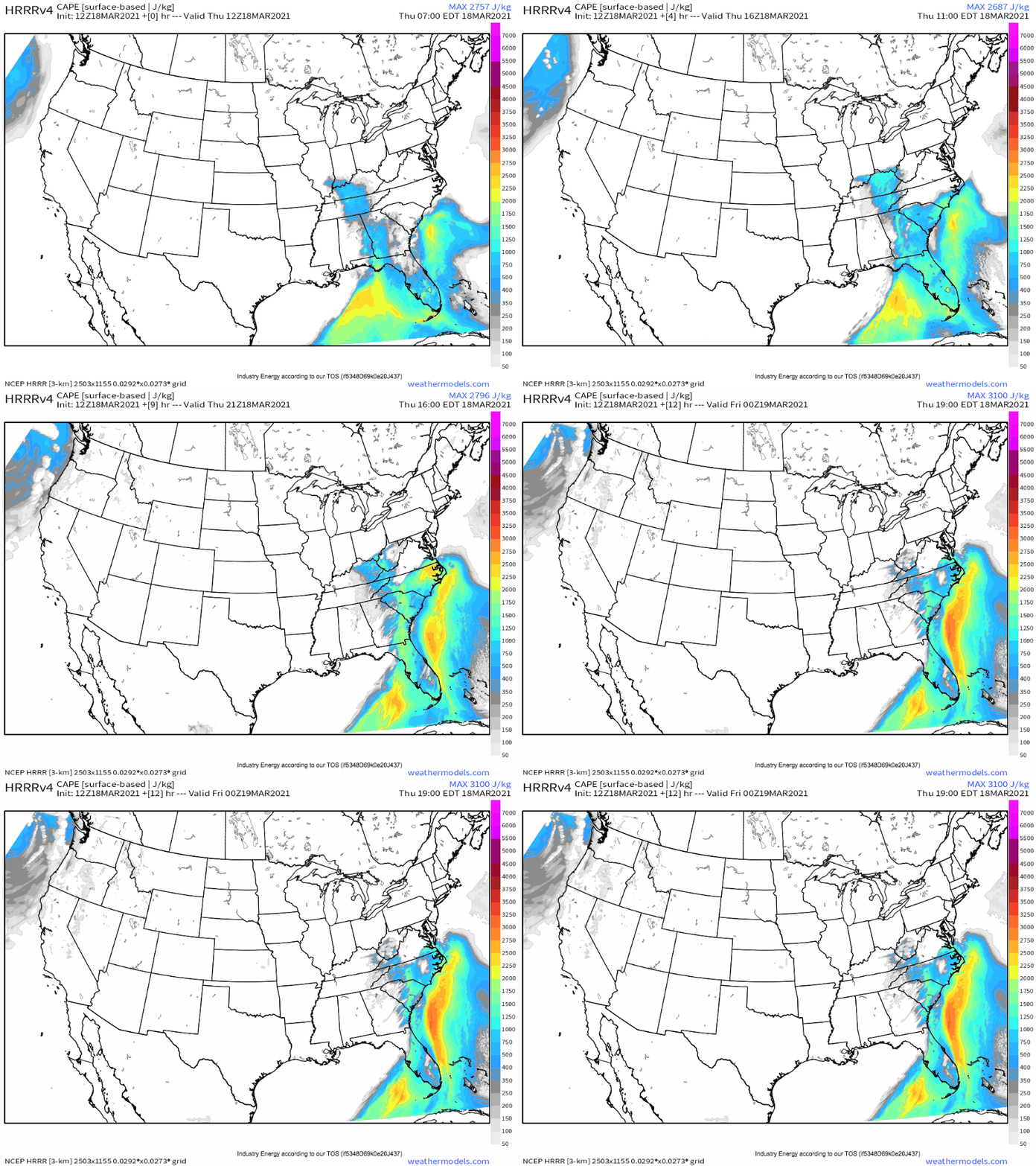
It will do this by setting the stage for round two of our severe weather event, advecting a deeply moist, moderately unstable Gulf airmass well into the southern mid-Atlantic. The EML has by now been completely shredded, and overcast cloud cover is complete, but high-end moistening will still allow CAPE to build locally in excess of 1000 j/kg. For some in eastern NC, CAPE could even approach 2500 j/kg.
This is amidst the aforementioned high-end southerly low level jet, and beneath impressive midlevel flow. The result will be a moderately unstable, strongly sheared environment with the speed support for high-end helicity.
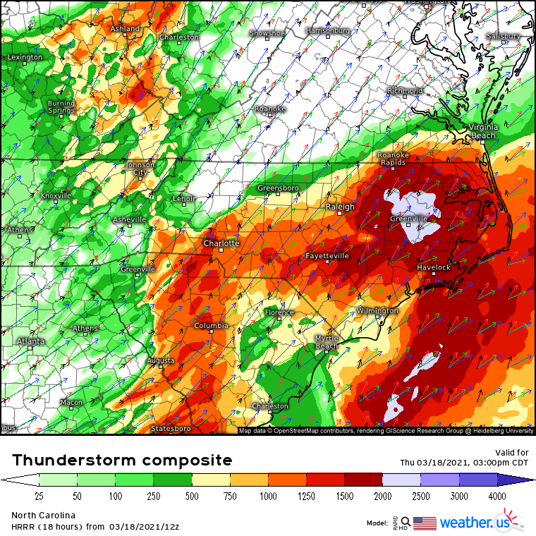
This is a great environment for severe storms, on paper. In isolation, the parameter space approaches or even locally exceed yesterday’s! This means that any discrete storm capable of persisting can reasonably drop a significant, damaging tornado.
But there are a couple issues with this happening. Instability could well never make it to the values forecasted by the HRRR on account of widespread forcing for ascent resulting in lots of messy stratiform rain and convective showers in the warm sector. Betting on these to destroy instability potential is no sure thing by any means, but it historically has led to the bust of many mid-Atlantic tornado events. Additionally, there’s always the chance that storms quickly coalesce to linear given impressive forcing along a cold front. Were this to happen, QLCS tornadoes could still cause damage, as could wind gusts. Regardless of whether storms in parts of the warm sector remain discrete, some of the warm sector will almost certainly see linear storms with these aforementioned threats. This is most likely to occur in Georgia and South Carolina.
Ok, so let’s say the warm sector remains sufficiently un-cluttered such that instability remains AOA ~1500 j/kg in parts of North Carolina, and that storms are firing ahead of the cold front. This could actually end up quite the dangerous situation given this fairly reasonable conditional, with fast moving high-precipitation supercells capable of dropping rain wrapped tornadoes, which could well end up strong given the parameter space discussed above.
Watch instability and storm mode evolve today- they will more than likely be the limiting factors that could ‘decide’ whether or not a robust tornado event occurs.
Those in the Carolinas are implored to remain weather aware, especially in eastern North Carolina and adjacent South Carolina, potentially southwest into coastal Georgia.


