Severe Threat: 03/06 – 03/07
If you were tracking yesterday’s severe event, we saw what a High Shear, Low CAPE event is truly capable of. I mentioned in a blog earlier this week, sometimes they don’t produce anything. Sometimes they produce more than expected. Yesterday was definitely in the “more than expected” category. Instability was overwhelmingly low, but shear took it to another level.
That said, we have another such event on tap for today, though it will have a bit more instability to work with by the time storms begin firing.
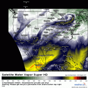
Water vapor imagery shows a shortwave digging in near the Four Corners region. Ahead of it, convection is firing in the Oklahoma and Texas Panhandles and moving east.
Not much is expected from these storms until this evening, as the upper support lifts northeastward.
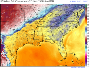
A stationary front is draped from the Mid-south to the Midwest, creating a clear division between cool, stable air, and warm, moist air prime for severe thunderstorm development. As the upper level support lifts along that boundary this evening, robust convection is expected as lifting encounters unstable air.
A decent amount of instability is already in place over Arkansas and is expected to filter northward some as the warm front continues to lift into southern Missouri. Morning observed soundings from the area in question showed decent shear already in place. This will only increase as the low level jet cranks up later this afternoon.
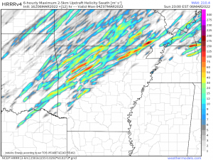
So, with ample shear and more available instability/better thermodynamics than yesterday’s event, it makes sense that this event carries the possibility of a few strong tornadoes – a risk mainly centered on northern Arkansas and southeastern Missouri. This area is expected to have the best ingredients – near the triple point, best shear, surface winds backing from the southeast for extra directional shear, and best instability.
Also of note, the topography of the Ozarks may aid in enhancing either shear or lift. They’re a little bit of elevation in an otherwise flat landscape. We’ve seen many cases where little elevation changes assist in intensifying a cell.
Discrete supercells or multicellular clusters are expected in the early stages as a very weak cap breaks. The chance for strong tornadoes will be greatest during this phase, before upscale growth into more of a QLCS. Embedded supercells will remain possible, however, along with QLCS tornadoes into the evening/early overnight hours.
Damaging winds become the main threat as the storms transition to a linear mode. Large hail is also possible, but mainly in the early stages while discrete/multicellular mode is ongoing.
Your Sunday take-away: Severe storms are expected this evening/overnight from Arkansas into the Ohio Valley. Strong tornadoes will be possible early on, with damaging winds becoming the main threat overnight/with northeastward extent. Have multiple ways to receive warnings including at least one that will wake you if need be. Be prepared to shelter if a warning is issued.
This threat will continue eastward into the overnight hours and return renewed by Monday afternoon, mainly for those near and west of the Appalachians.
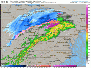
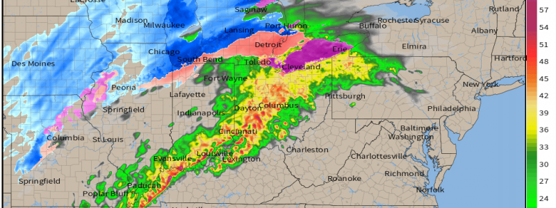
A weakened line of storms is expected to be somewhere in the vicinity of Memphis/Louisville/Columbus by dawn.
As it moves eastward throughout the day, it is expected to encounter modestly unstable air closer to the Appalachians. Instability is forecast to remain on the lower side, but may be enough to allow the line to strengthen again.
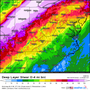
Ample shear is expected to be in place, along with a strong low-level flow. Should this line be able to re-strengthen to severe status, a few QLCS tornadoes are possible. The primary threat will be damaging winds, however, if winds aloft are able to mix to the surface in stronger parts of the line.
Your Monday Take-away: A line of storms will be ongoing from the previous night. They are expected to re-strengthen during the afternoon hours. Damaging winds are the main threat but a few brief tornadoes could be possible with any “kinks” in the line. The line is forecast to weaken significantly once it crosses the Appalachians. Tornado chance is low, but not zero, so have ways to receive warnings if needed.
Stay safe and weather aware!
