Severe Threat 03/05/22
A negatively-tilted, strengthening surface cyclone ejecting northeastward is expected to incite anomalous moisture return which will, in turn, fuel a severe threat over Iowa and parts of the surrounding states this afternoon.
In other words: a system is pulling Gulf moisture much further north than is typical for this time of year. Extra moisture/instability combined with the lift, cold air aloft, and shear from approaching system is likely to initiate severe weather.
Need a visual?
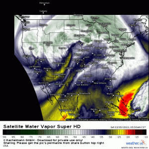
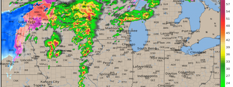
Note the trough, which has taken on a negative tilt, the moisture streaming north ahead of the trough, and even some pre main event convection taking place over northeastern Kansas and eastern Iowa.
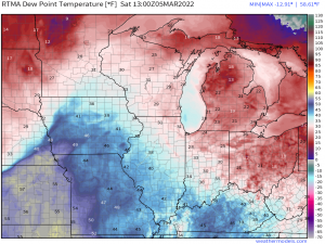
Moisture levels aren’t great just yet, but we can already see dewpoints in the mid 50s creeping into the area in question. Moisture advection will increase through the afternoon as the low level jet becomes stronger ahead of the surface cyclone.
By afternoon, dewpoints in the upper 50s and low 60s are expected over the region. While these values may be “above average” at this location for this time of year, they’re still rather marginal for severe weather. As discussed in Thursday’s blog, we’re going to be relying a good deal on shear and lifting to get things rolling.
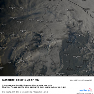
One factor that can make a big difference today is broken cloud cover behind the initial round of rain and storms.
Which is exactly what we see on visible satellite right now. If these areas of patchy clearing can persist, daytime heating will add some extra instability to the atmosphere for storms to tap into later. The more instability we have, the less reliant we are on shear and lifting. Don’t get me wrong, we’re still going to need both, but a little extra instability can change a conditional threat to an actual threat.
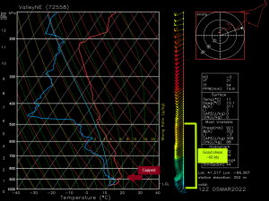
An observed sounding from the Nebraska/Iowa line shows a decently capped atmosphere. In order to erode that cap, we’ll need to advect in enough moisture to break it or make use of the lifting mechanism (the front) to force air above it.
So, if you’re monitoring the situation today, you’re going to want to be comparing observations to what the models have forecasted. Are the actual dewpoints/temperatures higher or lower than the models predicted at the same hours? Is there more or less clearing than expected? How long does the morning convection linger?
Most of the CAMs (convective allowing models – like the HRRR, RAP, NAM) indicated that the atmosphere would indeed become unstable enough for all modes of severe weather. If observations are less than what was forecast, that may not be true. Conversely, if they’re ahead of what was forecast, stronger development may be possible.
Even now, short-term models seem to be split on potential
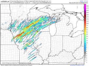
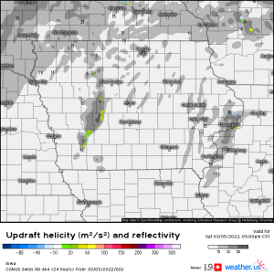
Here’s two examples.
The HRRR brings greater moisture further north and subsequently the threat increases. Updraft helicity swaths show great potential for rotating updrafts indicating supercells, some capable of producing tornadoes.
The Swiss HD, on the other hand, does not bring quality moisture far enough north. The best moisture does not overlap with the best lift and the potential for supercells capable of tornadoes is rather diminished.
So, we can see how much quality moisture overlapping the best lift is rather important today. The shear will be in place regardless, we just need the other factors to also be in place… in the same location… at the same time.
Your take-away from this discussion should be that the potential for strong/severe storms capable of damaging winds/hail/a few tornadoes is absolutely there. And you should prepare for that possibility. Monitor the changing conditions and be prepared to take shelter if warnings are issued.
We have a separate severe threat to talk about for later Sunday/Monday – expect a blog discussing that one sometime tomorrow morning.
