Severe Storms, Snow, and Record Lows, Oh My!
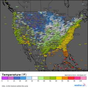
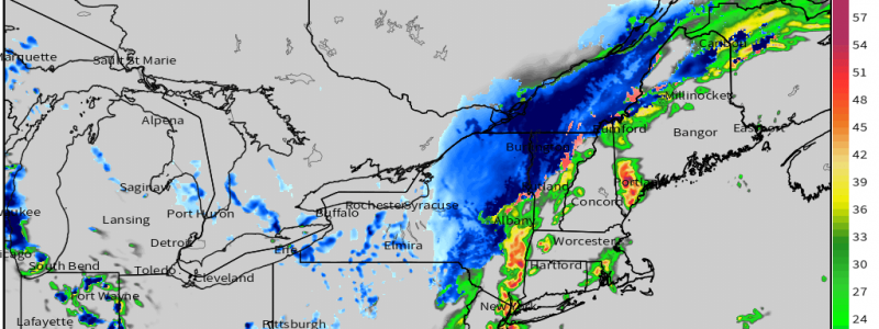
A powerful front is plowing eastward this morning while chilly arctic air slowly settles in behind it. It’s not hard to find the front on a map, especially with such a drastic contrast in temperatures. These temperature differences and the forcing from the front itself will fuel a day of wild weather swings in the northeast. It’s very possible that northeastern Meteorologists will be tracking severe weather and accumulating snowfall simultaneously this afternoon.
If you’ll turn your attention back to observed temperatures map for a moment, you’ll notice the warmth surging up the east coast and into roughly Massachusetts. A speedy LLJ and broken cloud cover facilitating daytime heating will help the northeast rise into the low 70s in places by early this afternoon.
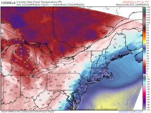
Despite the heat, dew points will remain quite low, in terms of what’s favorable for severe development.
Currently, dew points in the coastal states are in the 30s and 40s and won’t rise much beyond that through the morning ahead of the front. The exception would be along the immediate coast where a brief rise to dews in the mid-50s could be possible. For this reason, we will see the greatest risk of severe weather generally right along the coast/a few miles inland from about the Delmarva to western MA.
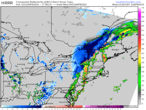
The lower dew points means that buoyancy will be limited, so we will be relying heavily on the forcing along the cold front to jump start any storms. A pre-frontal line will likely begin to organize shortly as the cold front approaches a more favorable thermal environment. Expect a low-topped line to sweep through ahead of the front this afternoon as Lapse rates possibly exceeding 8 degrees C per km due to very cold air aloft will help to facilitate development even with sub-optimal instability.
As far as hazards go, the main threat will be damaging winds that could mix down from aloft inside some of the stronger storms. However, further south – say, around the Delmarva and south/central New Jersey – where the kinematics are a bit stronger, we could see a more broken line of storms/individual storms that could lead to a couple of supercells.
Some marginally severe hail or even a spin up tornado is not out of the question with these, if supercells can in fact form. Either way, remain weather aware through the afternoon and have multiple ways to receive warnings.
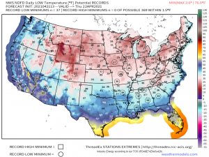
Behind the front, temperatures will drop sharply. Accumulating snow in the interior northeast is already occurring and the Lake Effect Snow Machine will crank up one more time once we switch over to a northwest flow behind the front. By tomorrow morning, many record lows will likely be broken as this arctic air mass settles in.
If there is any good news that comes with the latest chill, it’s that it won’t last long. The warmth returns by the weekend along with a threat for severe weather in the Plains and then the south late this week. And looks to crank up once again next week as well. We’ll be keeping an eye on these potential events.
