Severe Storms Possible Across Northeast
As summer turns to fall, the descent of the midlevel jet creates something of a secondary severe season across the northern third of the US. This climatology will likely be realized today, as a setup of robust kinematics (if lackluster thermodynamics) overspreads the Northeast.
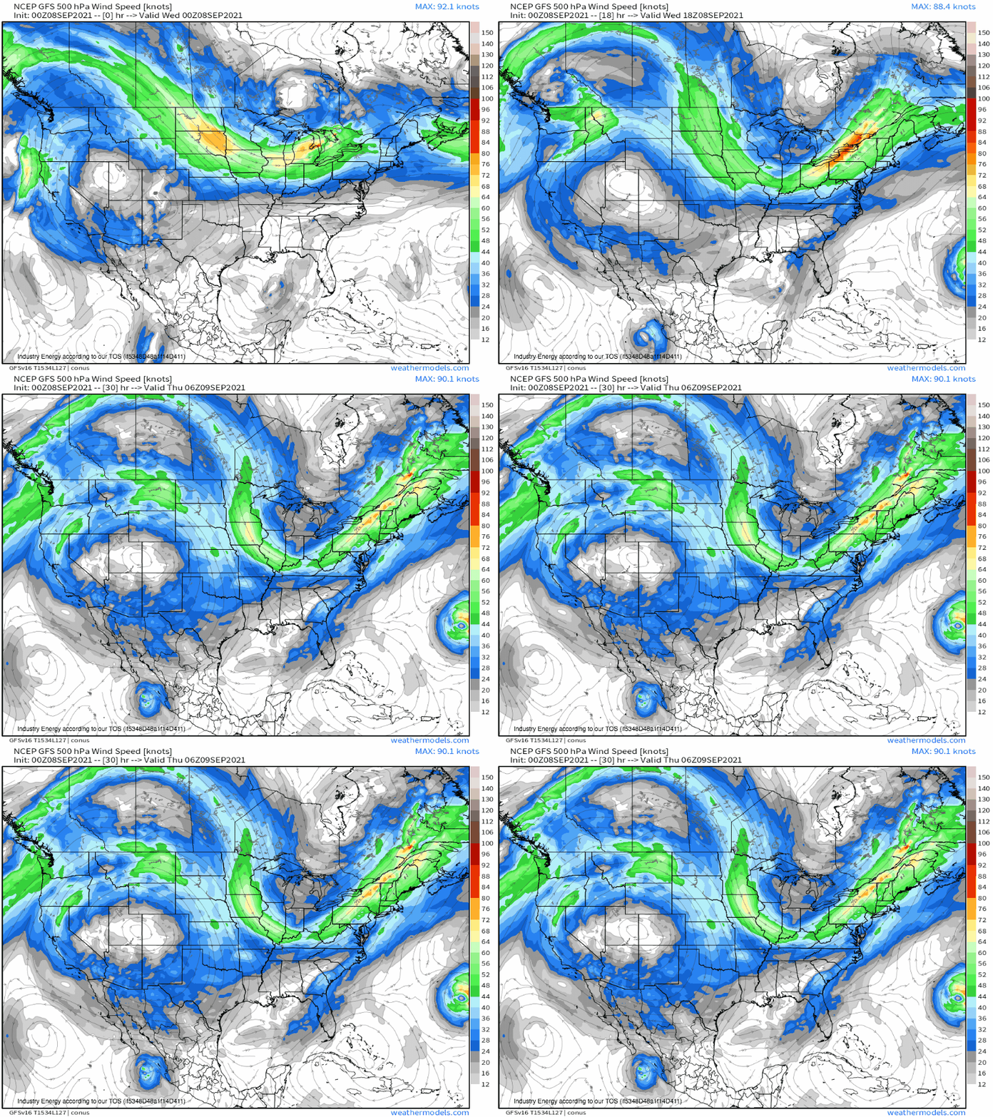
A robust mid-altitude trough will slink an amplified jet through the Northeast, overspreading the region with moderate wind shear and synoptic-scale incentive for ascent.
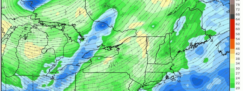
Mass removal aloft will promote the development of a brisk low-level jet, which will help maximize the amount of low level ‘spin’ held by the atmosphere while simultaneously pulling source air from the south.
This is a fairly strong low level jet for the Northeast, an anomalous intensity driven primarily by the robust Autumn kinematics at play.
If the strong low and mid level jets overlapped sufficient instability, a severe thunderstorm outbreak would be effectively guaranteed. However, a wrench in the gears of thermodynamic support will probably prevent such an outcome.
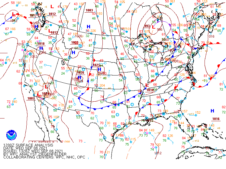
Such thermodynamic support for severe weather typically comes from the warm, humid Gulf-originating air, which carries a ton of energy that thunderstorms can use to grow. However, as if to say “oh, you want southerly advection of Gulf air? Good luck with that!”, a stationary front has managed to wedge itself between the warm body of water and our severe template. See the frontal analysis from the NOAA WPC for more:
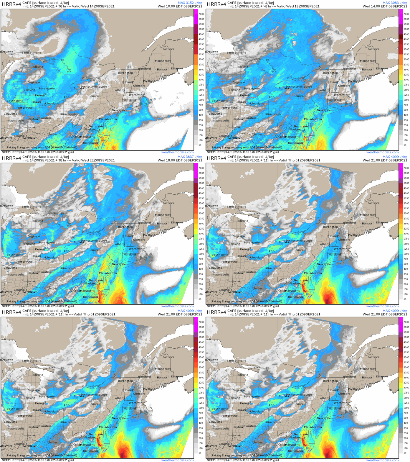
Now, it is possible to build a thermodynamic profile sufficient for thunderstorm activity without a direct Gulf pipeline, especially in September, but the ceiling is certainly lowered. This is largely thanks to the dewpoints at play, which will be low, especially for this time of year. The result will be a CAPE profile sufficient for thunderstorms, especially given the incredible kinematics at play, but not supportive– it won’t be easy at all to get very vigorous updrafts going with this sort of energy.
This is especially true where kinematics are stronger (west, north). However, another moisture source- the Atlantic- will help CAPE grow more favorable east and south, albeit amidst lesser flow aloft.
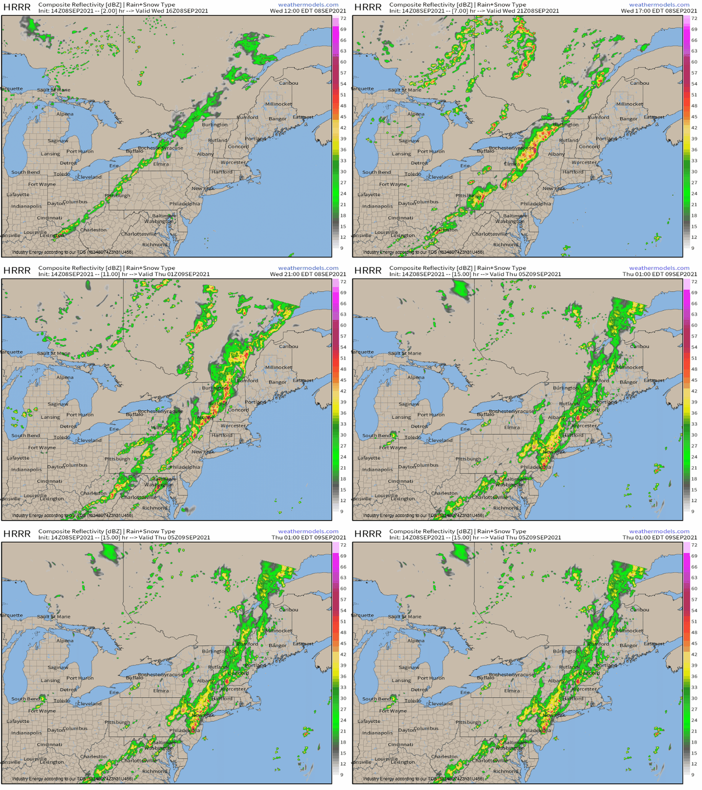
The result will be sort of a bifurcated threat today- one dominated by instability south and east, and one dominated by kinematics north and west. Expect a more low-topped, linear convective threat in the latter, with more of a multicellular hazard space in the former.
Where storms are linear and low topped, expect damaging wind to be the main threat. While this will still be the biggest hazard east and south, the higher instability will support an increasing proportional risk of tornadoes and hail. These threats will probably be maximized near the Hudson Valley south towards Philadelphia, where the best parameter overlap exists.
