Severe Activity To Pick Up Towards Heart of Season
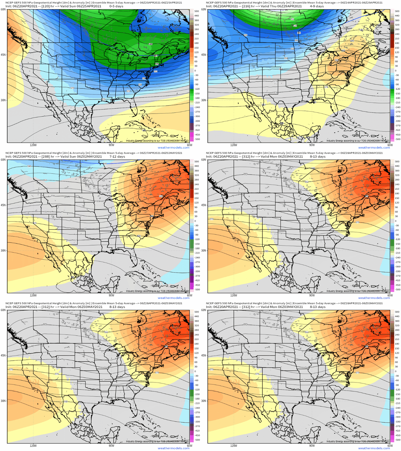
A theme we’ve been discussing a lot lately has been the tendency for east coast troughing and west coast ridging to run the atmospheric scene. Generally, under a pattern like this, low pressure system development off the east coast precludes substantial inland moisture return, making for a pretty boring stretch. This has allowed the year to deviate to below normal levels for tornado activity, despite our very active March.
The set-up also shows itself in allowing for persistent ejections of seasonally frigid air into the eastern half of the country, while the western half roasts. This, too, has been a recurring theme this month. Heck, it’s gonna snow where I live in western NY tomorrow, April 21st!
But change is coming, and that fact has implications for severe weather in and beyond the medium range.
As troughing breaks down over the east, an opportunity will present itself for height falls to envelop the west and central US in a more progressive, less blocked/amplified pattern. The first such progressive trough of the shifting regime will move eastward through the south-central and south-eastern US from early Friday through early Sunday.
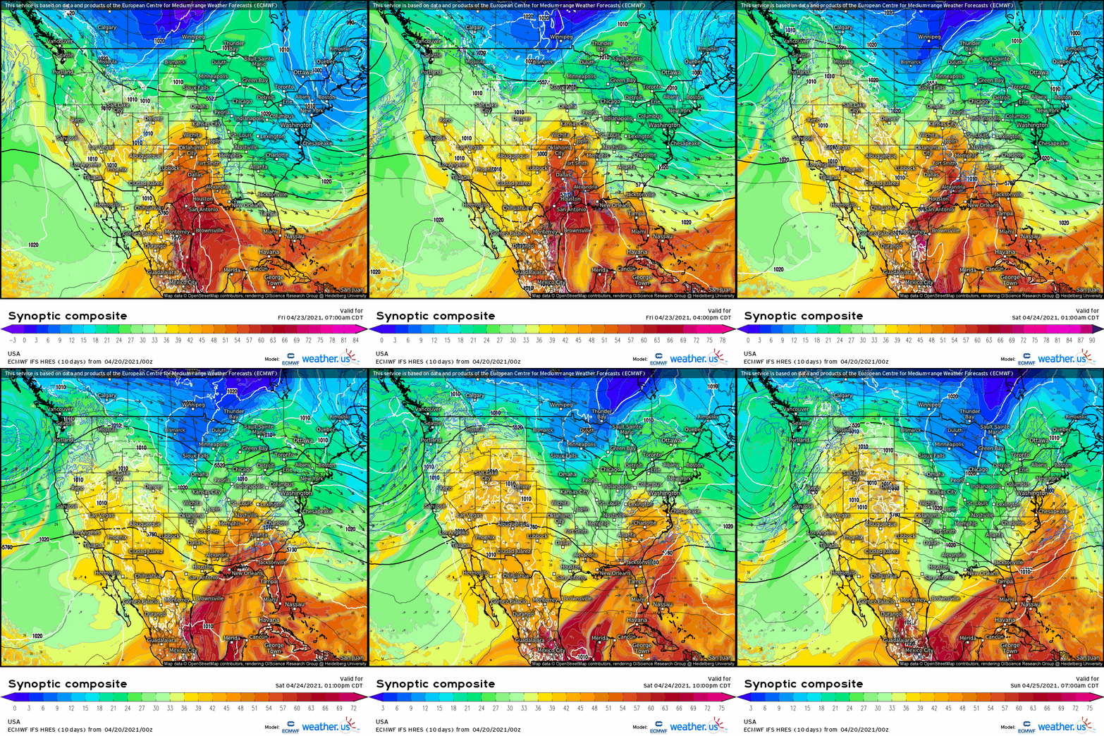
While the midlevel trough won’t win any awards for whatever it is troughs can win awards for, it’ll prove sufficient in generating enough synoptic-scale support for ascent for a reasonably compact, intense low-level cyclone to contort itself into existence over or near Texas on Friday. The result will be regional southerly flow, which will include some fairly substantial theta-e advection.
Come nightfall, the progressive trough will, well, progress. Increasingly intense low-level flow will assist the warm front in moving inland of the Gulf as far east as the Panhandle and parts of Georgia by Saturday morning, and a muggy, warm, unstable airmass will follow shortly.
Now, this sort of pattern in late April naturally leads into a discussion on severe thunderstorm potential.
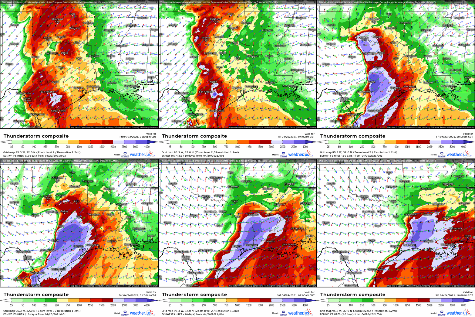
In conjunction with the trough, moderate flow aloft will overspread the progressive warm sector with deep layer shear more than sufficient to encourage storm organization. On Friday, this midlevel jet will overspread a warm sector characterized by moderate dewpoints and a stout EML, supportive of destabilization that’s sufficient for intense updrafts to develop. Beneath the EML, a largely capped environment will support discrete storms initially, however a relatively weakened low level jet by evening will be an inhibitor of mesocyclone development with initiation.
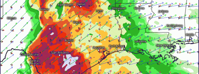
The most likely scenario looks to be several strong thunderstorm cells initiating rapidly along the northern sections of the dryline, over Oklahoma, during the late evening, as the cap erodes and moistening reaches a critical mass. These cells will feature a fairly high threat for large hail, and a tornado or two will be possible, although a relatively weak LLJ will largely preclude a threat for strong tornadoes.
Further south, over Texas, more robust low-level jet intensification south of what appears to be modeled convection amplification of the height field aloft will overlap with maximized instability to conditionally yield a higher-end risk for tornadoes. Convection here will also produce large hail and, as it coalesces into the overnight, a damaging wind threat with continued tornadic risk.
Day two of the outbreak could also feature a great environment for tornadoes over Louisiana, Mississippi, and Alabama. However, this threat depends largely on the fact that overnight convection could clear the warm sector during the mid-morning or early afternoon, which would preclude much of a substantial risk for severe storms. But, if recovery can occur, there’s a chance a parameter space favorable for significant tornadoes could occur over the southeast. Given this uncertainty, it seems wise to wait a couple more days before going in depth into that threat.
For now, stay tuned!


THank you Jacob! I really enjoyed your blog. I know a lot about hurricanes but not much about severe weather in the plains and I am learning. I am trying to get a grasp on sounding charts and hodographs.