Seventies to Snow
What a weird couple of days for the Northeast.
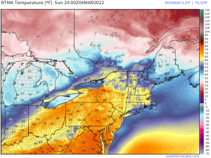
Sunday brought anomalous warmth reminiscent of late May rather than early March and, consequently, record highs.
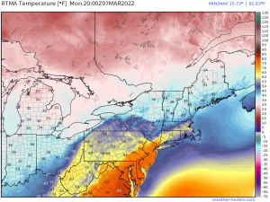
Warmth stuck around (to a somewhat lesser degree) through the day Monday.
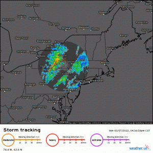
And finally, a potent squall line moved through in the late afternoon hours, spawning wind-driven Severe Thunderstorm Warnings from western New York/western Pennsylvania to the coast.
All of that (very brief) spring-like excitement just to revert back to chilly, gloomy winter temperatures and the possibility of snow looming on the horizon. Well, that’s Spring, folks!
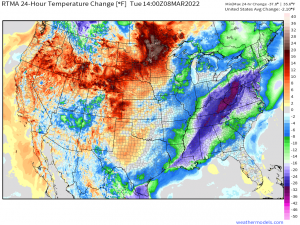
Temperatures at this hour are now significantly lower than this time yesterday – not just in the northeast, but for much of the Eastern US.
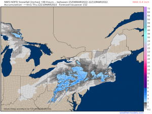
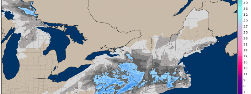
A second, quick-moving system is forecast to slide up the coast overnight/during the day tomorrow. As temperatures won’t have the opportunity to recover much beforehand, this system brings the threat of accumulating snow to the northeast. From 70s to snow – talk about a shock to the system.
A broad area of low pressure originating in the Gulf will begin to slide northward through the southeast today. Once it makes it into the Mid-Atlantic by tomorrow morning, the broad low will transfer its energy to another area of low pressure just off the East Coast.
Guidance is in fairly good agreement that this low will remain just offshore. This translates to an all-snow event for those in the interior Northeast as they remain on the cold side. The coastal locations, however, may have a bit of a mixing issue. While they will be on the cold side initially, as the center of the low approaches, it is possible that some overrunning could occur.
No strong Arctic high is forecast to be nearby, pumping in cold air. Without that fresh infusion of frigid air, temperatures will be marginal at best in the interior, and a bit warmer at the coast due to the moderating effect “warmer” water has on coastal locations.
Marginal temperatures, location of the low, and the speed of the system point to this event being not too thrilling. Impacts aren’t expected to be especially huge as far as accumulations go…
…however, the timing is less than ideal as this event is forecast to be ongoing during morning rush hour. Give yourself a little extra time if you plan to commute to work or school tomorrow.
The “big winners” as far as snowfall goes will be the elevations. Upslope flow and colder temperatures will really assist in facilitating bigger accumulations. The Allegheny Mts, Poconos, and Catskills are likely to be where we see our maximum accumulations.
Beyond the short-term, a much more impactful event looms on the horizon – as early as this weekend.
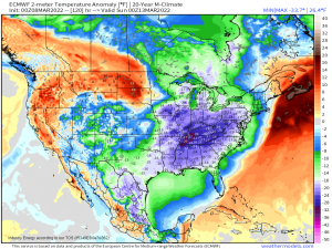
A very brief warm-up is expected after tomorrow’s snowfall. On its heels, another system moves through. This system brings not only another chance for snow, but a significant cooldown.
We’ll talk about this forecast in the next few days. Stay tuned!
