Searching For Storms
Last week we talked about an upcoming pattern flip, or the PNA going negative, that would result in the discontinuation of endless ridging across the Northwest and the beginning of cooler, wetter weather.
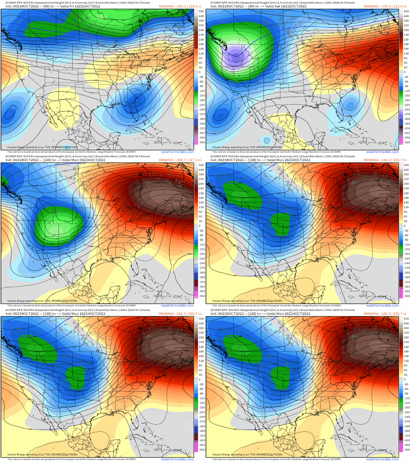
This is still the case, however, we’re going to talk about the downstream effects this incoming pattern can have. A set up like this can often carry the potential to produce severe weather – and our next chance could come later this weekend.
What we see above is ridging building into the East while the troughing digs into the West.
Eventually, this trough and/or the shortwaves associated with it will need to lift out. It can’t go directly east as the ridge is blocking its progress as long as it remains in place. So instead, it will lift northeastward over the Plains/Midwest around the Sunday timeframe.
Now, before you go fire up your chasing vehicle, this forecast isn’t even close to a slam dunk. In fact, there is great uncertainty at the moment. Other than model differences in regard to timing and placement of the trough, one of our main roadblocks may be the return of quality moisture.
In case you’ve forgotten, the area east of the Rockies is effectively in the freezer right now. Okay, maybe that was a bit dramatic – but it is abnormally cold.
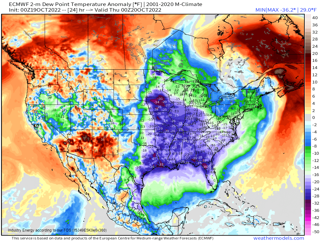
And with colder air comes lower dewpoints. So the question is: can we see a sufficient return of moisture to fuel a potential severe weather threat?
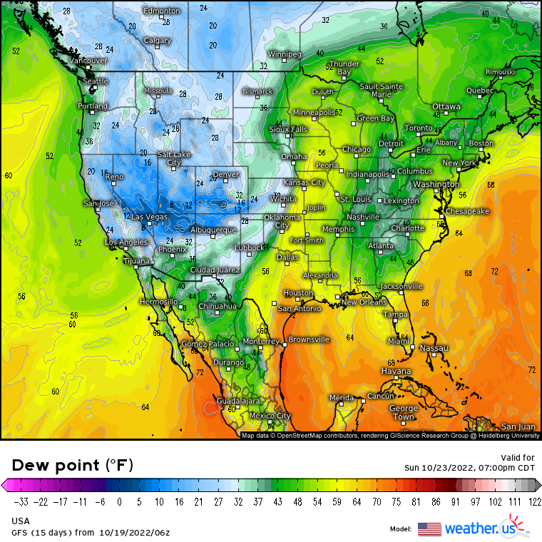
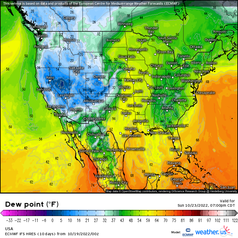
Maybe? Global models aren’t too enthused about moisture return just yet. Dewpoints around 60 won’t provide much instability. It is, however, only Wednesday and things can change.
Additionally, lower instability isn’t always a roadblock. We’ve all seen HSLC (high shear, low CAPE) set ups that have produced significant (localized) severe weather.
The bottom line is: the potential is there for a severe weather threat. If it materializes, how potent it will be, the exact timing, and the areas affected are still up for debate. We’ll get a better idea in the next couple of days as to whether or not this will evolve to a legitimate threat.
For now, just be aware of the potential. Remember that mid to late fall is climatologically favored for severe weather. Don’t let it catch you by surprise.


Great weather analysis. Keep up the great work!