Searching For Big City Snow
It’s no big secret that this winter (so far) has been a rather strange one.
From a record-breaking early cold snap, multiple potent rounds of severe weather, relentless atmospheric river events in California, the Northeast snow drought that Armando mentioned in yesterday’s blog, and the consistently warm temperatures east of the Rockies, things have just felt…. off.
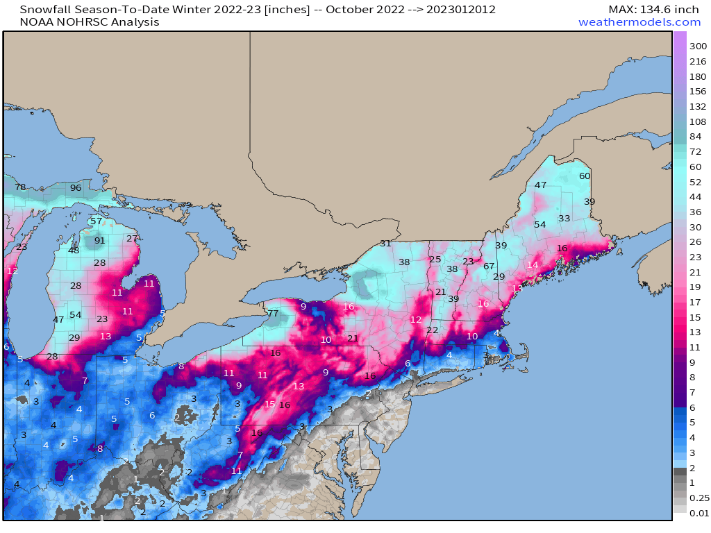
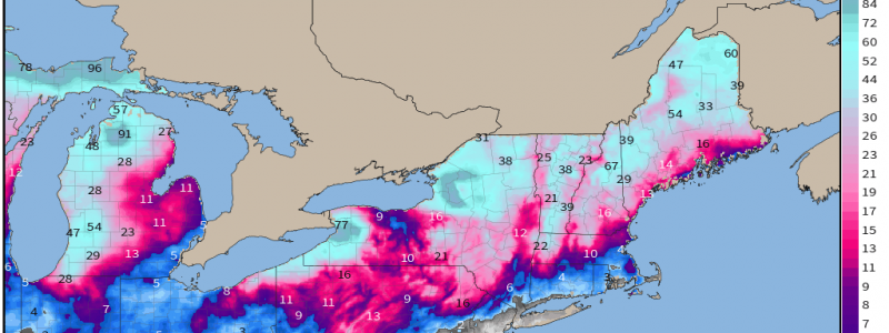
Looking at the snowfall analysis for this season so far, the lack of snow in the major I-95 metro areas – New York, DC, Baltimore, and Philadelphia – sticks out like a sore thumb. In fact, these cities are approaching record territory in regard to length of time without measurable snow.
January so far has offered no help.
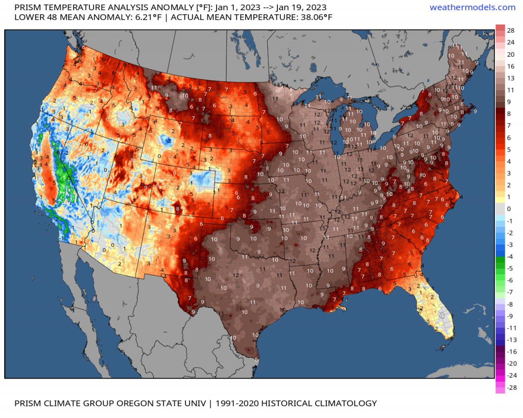
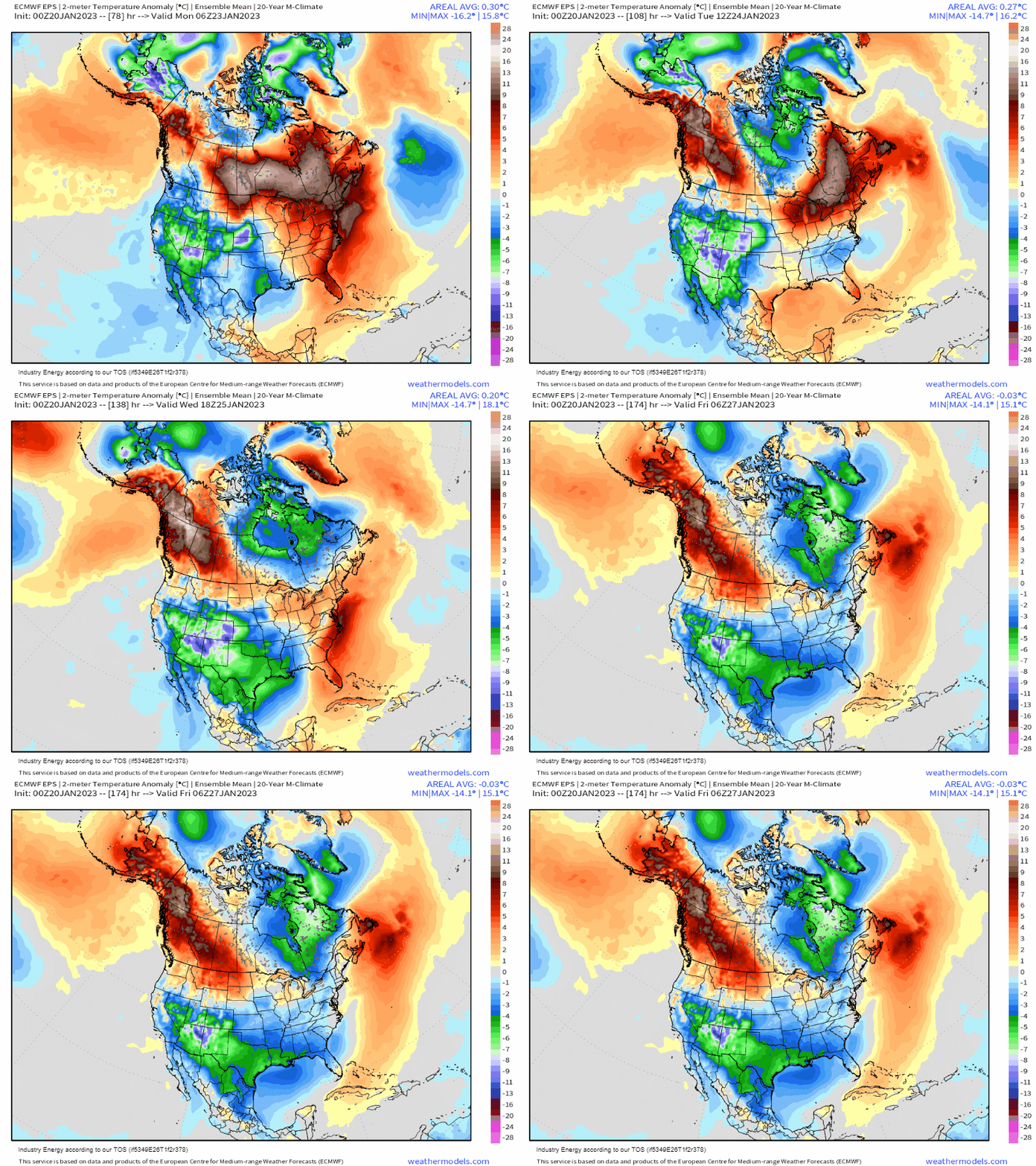
The month-to-date has been astonishingly warmer than average with the aforementioned cities seeing average temperature anomalies near10 degrees above normal.
Though we’ve had cold snaps, the cold air never seems to stick around long enough or line up just right with an incoming system to produce a decent snowfall for near-coast Northeast.

Additionally, much-warmer-than-average sea surface temperatures just off the coast are of no help.
Any system moving up the coast will tap these warmer waters. While that may be useful in terms of the system strengthening, when that low-level jet cranks across the water onto land, it’s carrying these warmer temps with it. This results in a lot of warm air overrunning any colder air at the surface, which causes mixing issues. A stronger system will have a stronger low-level jet, and thus mixing issues abound further north.
All this aside, winter weather lovers are no doubt wondering if there’s any chance for a turn around coming up?
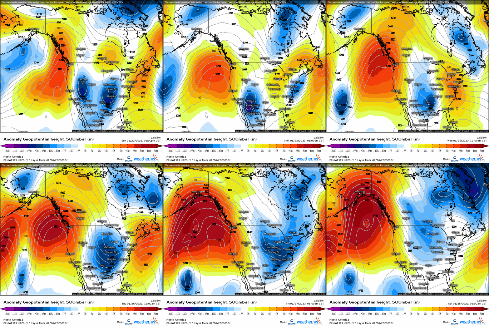
Toward the middle of next week, the EPO is expected to shift into the negative phase. This is visualized above as a strong ridge amplifying over the Gulf of Alaska. The more amplified the ridge becomes, the more likely it is to encourage cross-polar flow.
Additionally, the PNA is forecast to remain near neutral for this time frame. On the map above, that’s represented as some positive/some negative heights over the Western US. A neutral PNA would allow for some troughing over the Eastern US. However, without the ridge axis solidly on shore over the west, the troughing and coldest air provided by the -EPO stays in the west-central portion of the US.
Further, the fact that AO is forecast to be neutral to weakly positive during this time frame means that no truly frigid Arctic air will be released southward.
And, one more blow to snow-lovers’ hopes: without a –NAO (a blocking high near Greenland), any exiting system is free to quickly escape northeast.
An additional blow to snow hopes: no strong Arctic high will be correctly positioned to pump cold air into the Northeast ahead of/during the advance of the moisture.
So, although colder air will filter in as a (potentially potent) system moves through mid-week, it seems that once again the coldest air and moisture will not be in the same place at the same time. The result: more cold rain for the big cities of the I-95 corridor and squashed hopes for at least another week.
Can this change? Yes, we are just under a week out and nothing is set in stone.
However, as the forecast stands now, it seems unlikely. With warmer water temperatures influencing the big cities and urban heat islands causing their own problems, sufficiently cold air must be in place or moving in extremely quickly to avoid missing the best moisture and produce a solid snowfall.
Temperatures will revert to seasonable or even slightly below average later next week, though probably not for long. Measurable snow in the near-coast Northeast seems determined to remain rather difficult to find for a bit longer.
As always, we’ll keep an eye on the forecast and update as time progresses.


