Say It Ain’t Snow: Winter Eyes Northeast Return
Almost every year, the Northeast is visited by some degree of a “false spring”, in which temperatures make a prolonged leap into the 60ºFs in March or April and trick people into thinking the cold and snow of winter is fully in the rear view mirror. If the warmth is prolonged and intense enough, even plants can be tricked, with buds developing and flowers opening through the soil. Surely, many of us residents of the great Northeastern states fein ignorance to the fact that what feels like hard-won spring is almost always temporary at first, but the atmosphere doesn’t care how much we wish the frost would cease for good.
This brings me to the blog I’m writing now, about how a week and a half of almost ceaseless sun amidst temperatures approaching 70ºF are about to abruptly transition into a meteorologically impressive snow storm for parts of the region on Thursday, with significant accumulations likely for some.
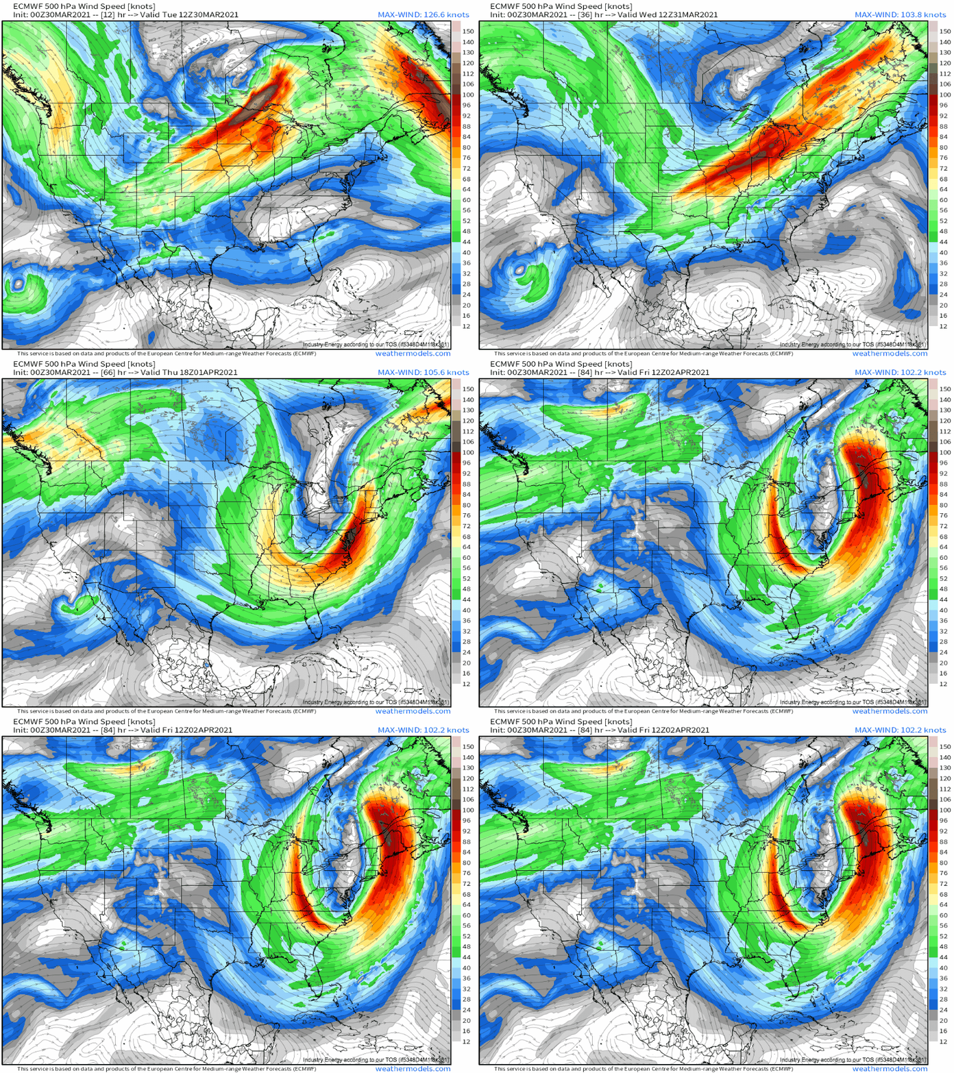
The snow threat to eventually arise traces its roots to a positively tilted longwave currently crossing the central US. The positive tilt is due to the fact that the longwave is being driven by two somewhat distinct impulses, a closed low near the northeastern periphery and a shortwave to the southeast. If the two jet structures were swapped, we might be talking about another major tornado outbreak, but luckily the atmosphere has had enough of that show.
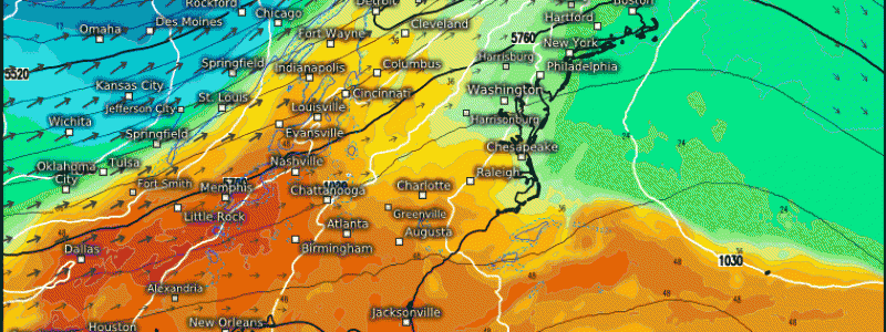
The northern impulse, an intense closed low, incited impressive cyclogenesis yesterday over the northern Plains, deepening a substantial southerly low level jet that overspread much of the central US with gusty winds and a critical risk for fire weather. This segment of the longwave will accelerate northeast today, elongating the western periphery of troughing and stretching a cold front from the south-central US north to near the Hudson Bay. East of this front, still-ripping southerly flow will make for another beautiful east coast day today.
Come Wednesday, two things will happen at once. A lobe of northern stream energy will swing south and phase with the southern impulse, and the northern impulse will lose its steam and proximity to the southern one. As a result, the southern half of the longwave will take on a pronounced neutral to slightly negative tilt and intensify. This will dramatically increase the incentive for mass removal high in the atmosphere, promoting pressure falls along the front over the Carolinas. They will be slow at first, but the northeast moving surface low will quickly intensify in association with the increasingly favorable orientation of the longwave.
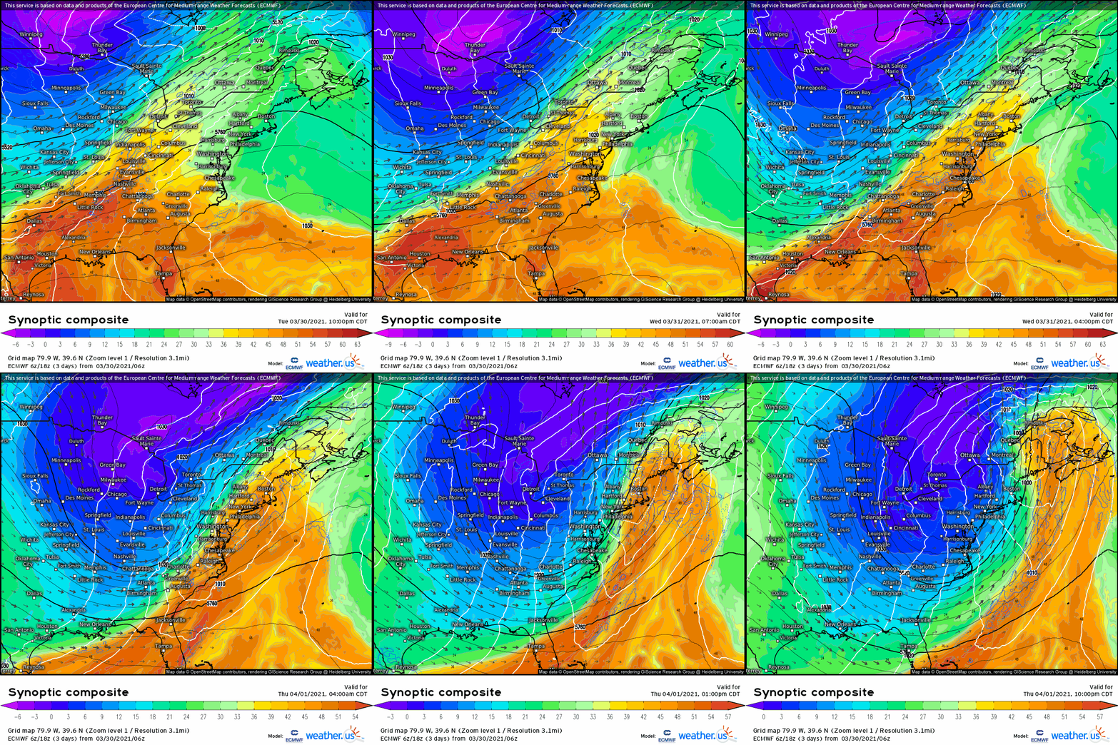
Following the passage of the front Wednesday, temperatures will drop from the 50s and 60s ºF into the 30s and 40sºF, chilly but probably not yet cold enough for snow. This means that, when the front slows down to a stall under the mixed influences of the surface low that spawned it and the new one over the Carolinas, and steady precipitation overspreads the Northeast, it’ll at first fall as cold rain. But, as the surface low continues intensifying and sliding northeast Wednesday afternoon, increased northerly flow in its proximity will change rain to snow over Ohio and Pennsylvania by sunset. As the surface low intensifies further into Wednesday night, sliding through the middle of New England, increasingly intense midlevel ascent will overspread an airmass cooled by the loss of solar heating and, simultaneously, by increasingly fierce northerly advection. The result will be a band of heavy snow, prolonged by the surface low’s motion parallel to forcing.
The euro and the gfs handle this slightly differently for New York and Vermont, with the former hosting more of an occlusion of the low over New England. This would help snow stick around for longer, boosting totals over the latter’s solution. But regardless, many will almost certainly see 6″ out of this, with somebody seeing a foot.


