Rumors Of Big Snows
I had intended to wait until Monday to publish a blog addressing the “winter storm” threat, but I see by the sheer amount of misinformation floating around social media that I’m going to have to at least touch on it today.
First: Is there a reason to believe that we’ll be facing a winter storm in the Eastern US near Christmas?
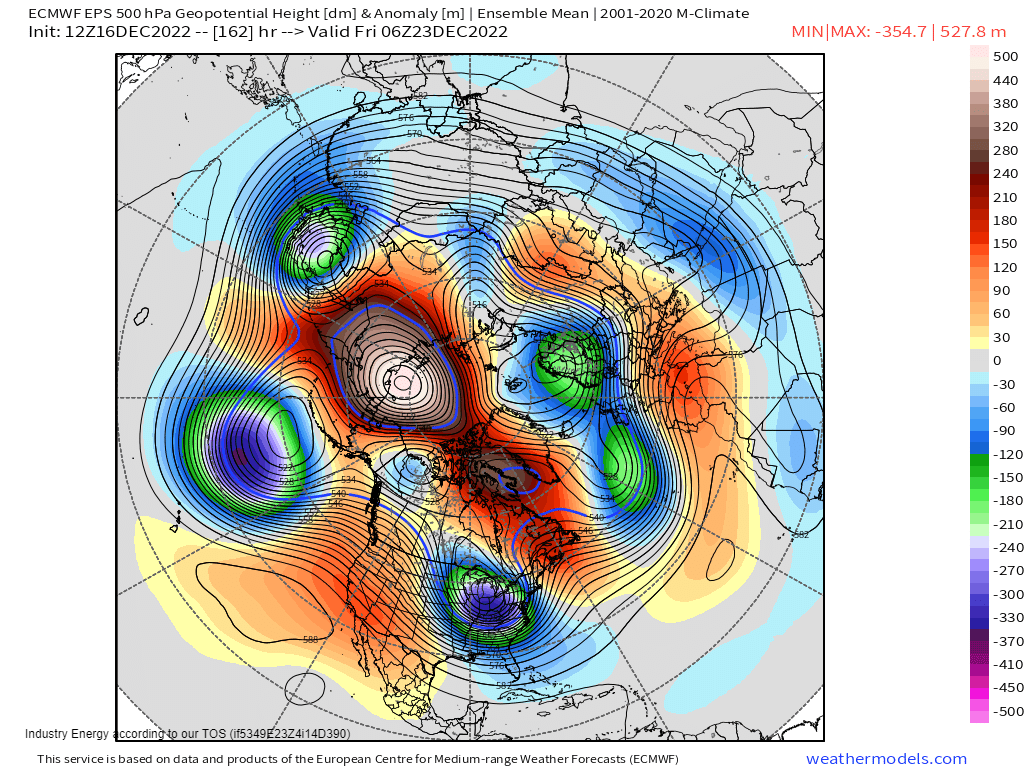
As I’ve mentioned in past blogs, whenever we have a -AO, -NAO, -EPO, and +PNA, it is a favorable pattern for a big winter storm.
Does it always produce? No, definitely not. However, models have been fairly insistent on developing some sort of storm around the Dec 22/23/24 time frame.
So far, we have a solid signal.
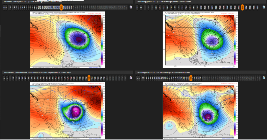
Beyond a solid signal for some sort of storm, however, we do not have much agreement.
While the ensembles have similar solutions, they are not the same and would likely have different impacts. The deterministic runs are and have been all over the place – and they should be since we’re still a week out.
As I mentioned in Wednesday’s blog: this is a highly anomalous pattern. Models, especially deterministic, will be all over the place for a bit yet. Don’t expect any kind of clarity on this storm until maybe Monday.
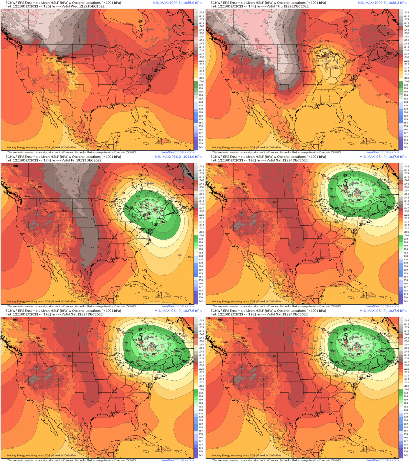
Taking a look at the ensemble low locations is a really good way to get a feel for how much uncertainty there is. As you can see, there is really no significant clustering on the EPS. Therefore, there is still much uncertainty.
Some of the solutions the EPS gives us also highlight a potential problem. Notice the ridge of high pressure hanging out over the north part of the Northeast. If the block associated with the -NAO scoots slightly east instead of remaining west-based, ridging could force the eventual low to remain inland or a coast-hugger. That would lend to a rain event for the coast and snow inland rather than all snow.
But that’s just one of many potential problems. Oh, and just for reference, the GEFS has a completely different set of solutions.
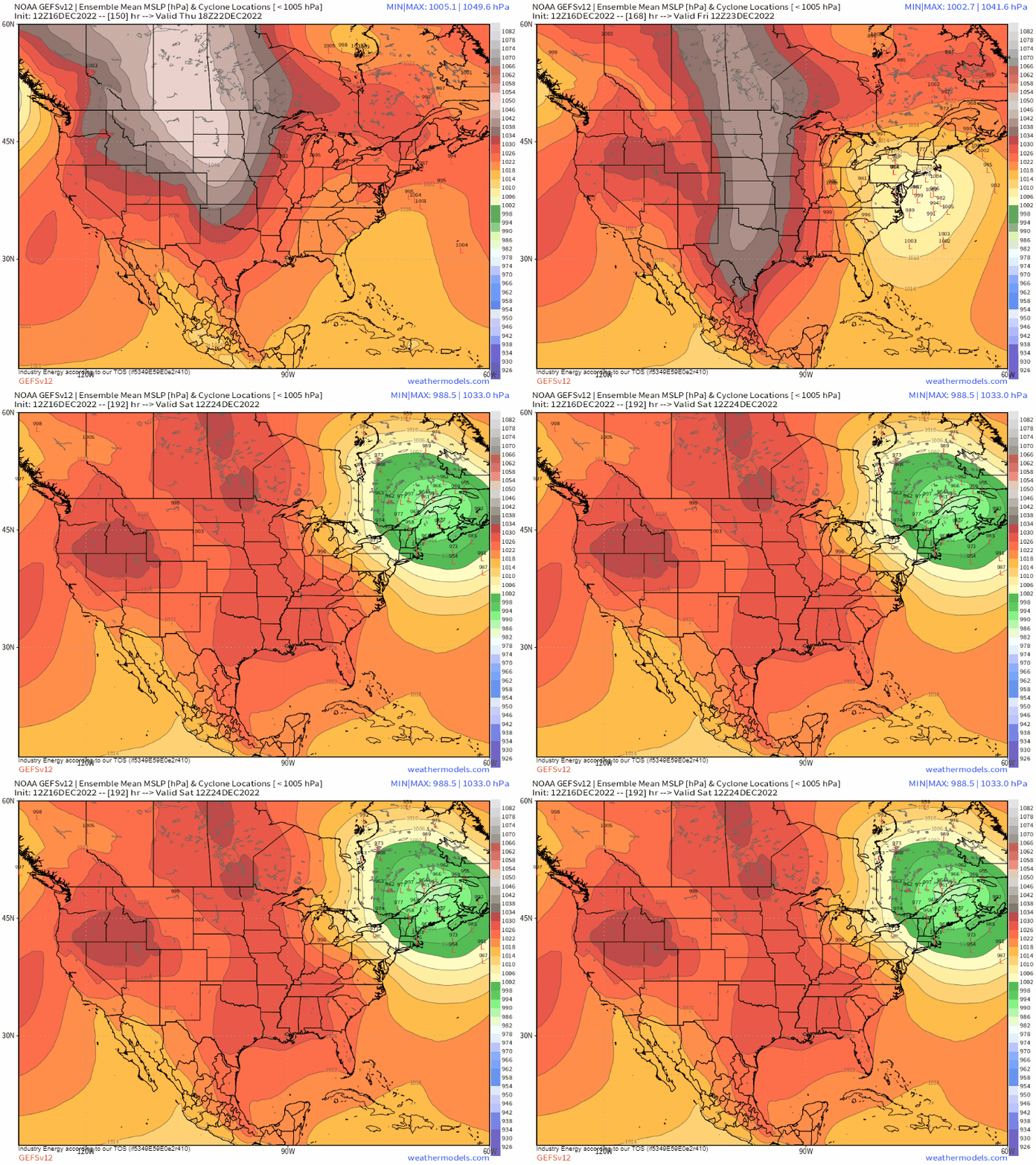
It (for the most part) develops a low just offshore of the Carolinas which then tracks northward while remaining offshore. This would change the outcome entirely.
Simply put: there is far too much uncertainty to make any sort of forecast right now.
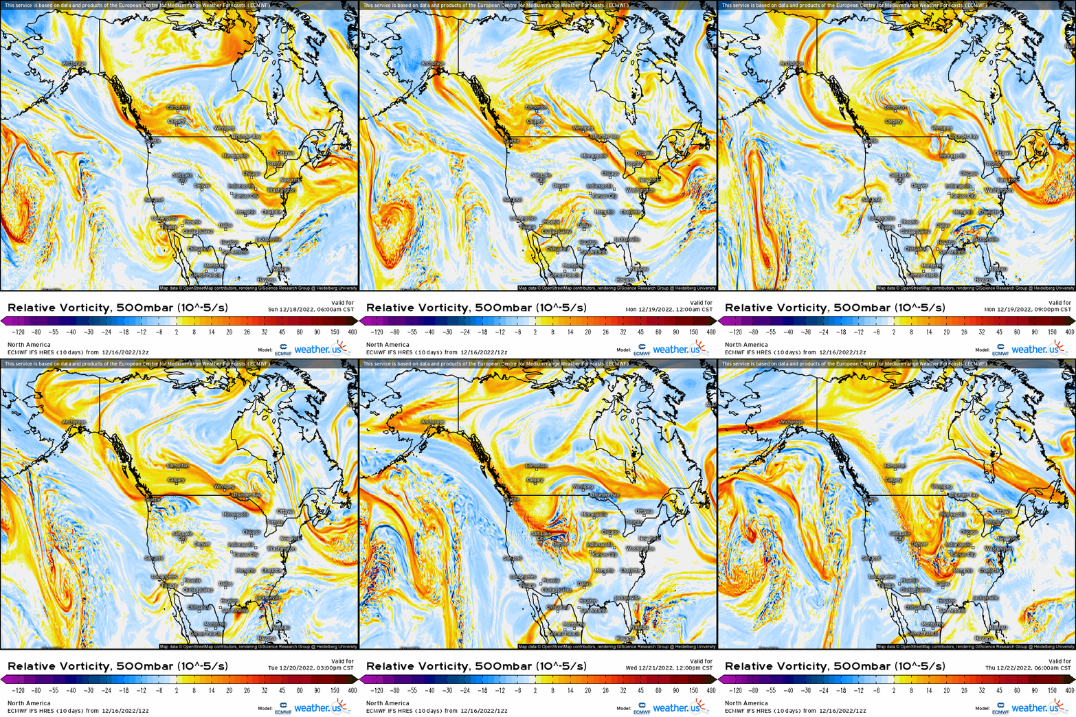
Something else to keep in mind: the “energy” that will power this potential storm literally hasn’t even reached the continent yet.
Sometime on Sunday it should cross the pole. After that, it will slowly move through western Canada/just offshore before arriving in the Pacific Northwest in the Tues/Wed timeframe. It might be hard to follow on that map, but I tried to slow the loop down to make it a bit easier.
Why is it significant that this “energy” isn’t on the continent yet? Without actual observations (soundings, etc.), we are making assumptions about the environment – and that modeling may be incorrect. Once we sample the actual environment and that data gets fed into our models, the forecast will start to come together.
To sum up what I’ve written above: There is a signal for some sort of storm. Pattern recognition would tell us that it has potential to be a significant winter weather event for the Eastern US, but potential is all it has right now.
Now is not the time for snow maps or exact forecasts. The only thing we should be doing at this point is watch the trends. We’ll see what models are resolving the near-term conditions the best, which models are staying the most consistent, and how the timing of the Arctic blast progresses. That last one is important – without cold air in place or filtering in quickly, the Southeast gets plain old rain.
Expect wide swings in deterministic model solutions in the next few days as they struggle to get a handle on it. Additionally, expect some smaller changes in ensembles.
I’ll revisit this potential storm in Monday’s blog and we’ll discuss how our forecast has evolved over the weekend.


