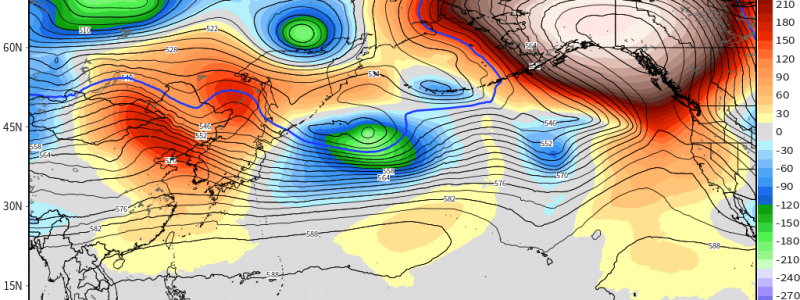
Robust Alaskan Ridge Incoming!
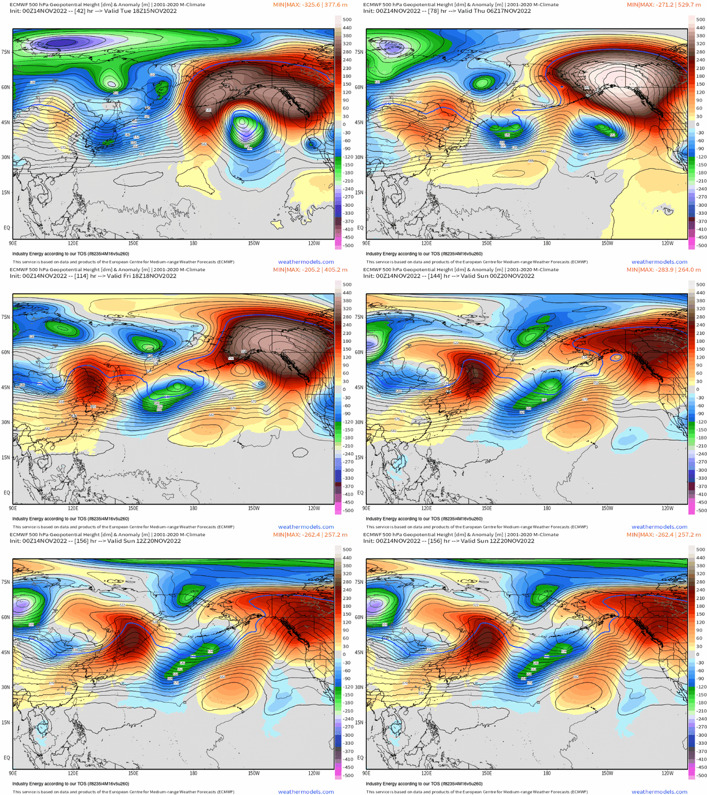
A large-scale ridge, what we’d call an “omega” blocking configuration, will build this week. It’ll be over 4 standard deviations above climatology, an impressive high latitude blocking signature for November!
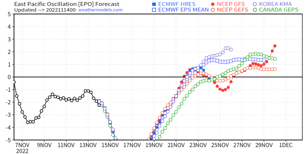
This is reflected as a very strong -EPO, as shown below. In fact, there’s a consensus that on a standardized scale, it’s literally off the charts!
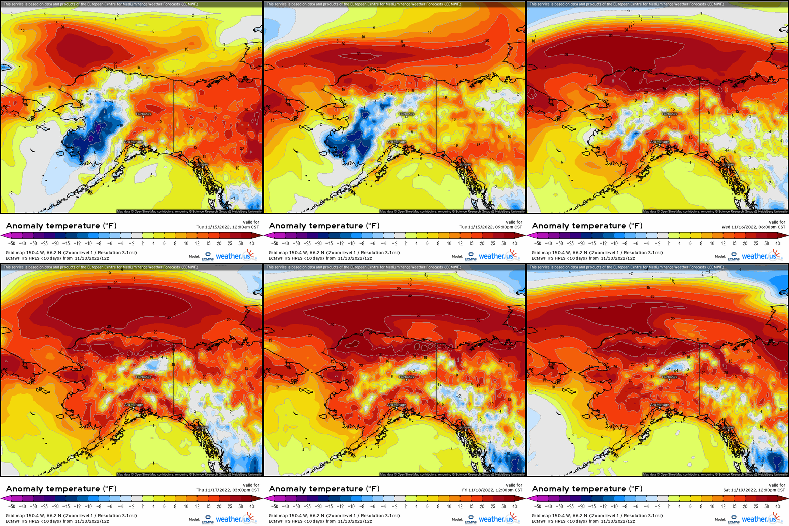
There are several implications from this high-latitude blocking pattern that’ll manifest this week;
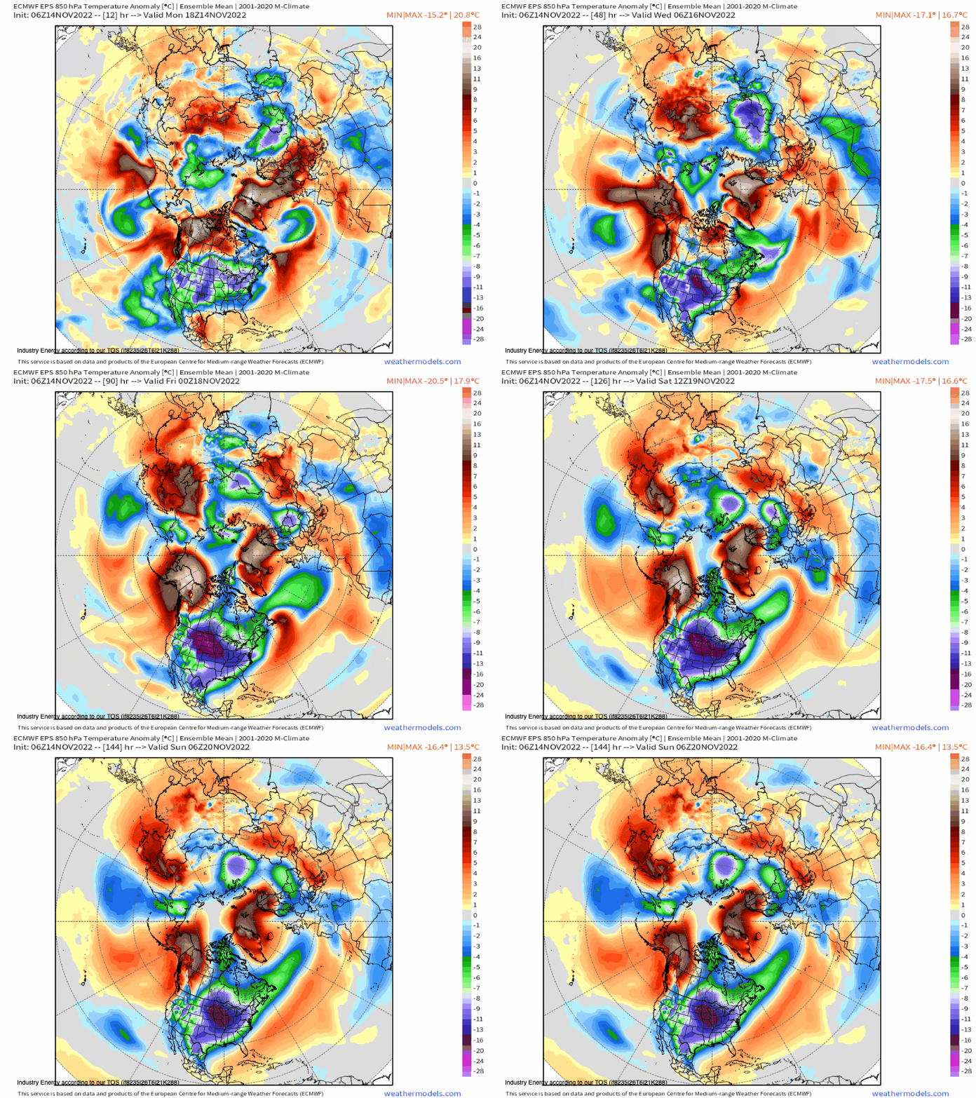
- Above average temperatures of up to over 20 degrees above normal will center across Alaska and into the Arctic Sea.
- Downstream across the lower 48, widespread below average temperatures will spread causing wintry precipitation opportunities given the expansive nature of the polar air masses as the upstream (e.g. blocking ridge) forces the polar jet stream to extend southward. This feature is usually essential in delievering significant winter storms across the CONUS, given its catalyst for laying the foundation for snow to occur!
Lets view this from a Northern Hemispheric perspective to appreciate the harmony and sequence between the Alaskan ridge and what it renders downstream at 850mb. Watch as the big anticyclonic wave break (looks like a legitimate “wave” breaking into Alaska) forces a polar air mass into the Intermountain West before it shifts into the Central U.S. and allocates eastward.
It’s going to surely feel like a true winter pattern this week across the country! Time to break out those winter coats!


