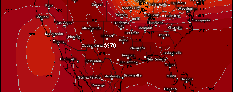
Rinse and Repeat: A Look At Next Week
If you’re here hoping to read that there will be a change in the pattern ahead, I’m sorry to say you’re going to be rather disappointed.
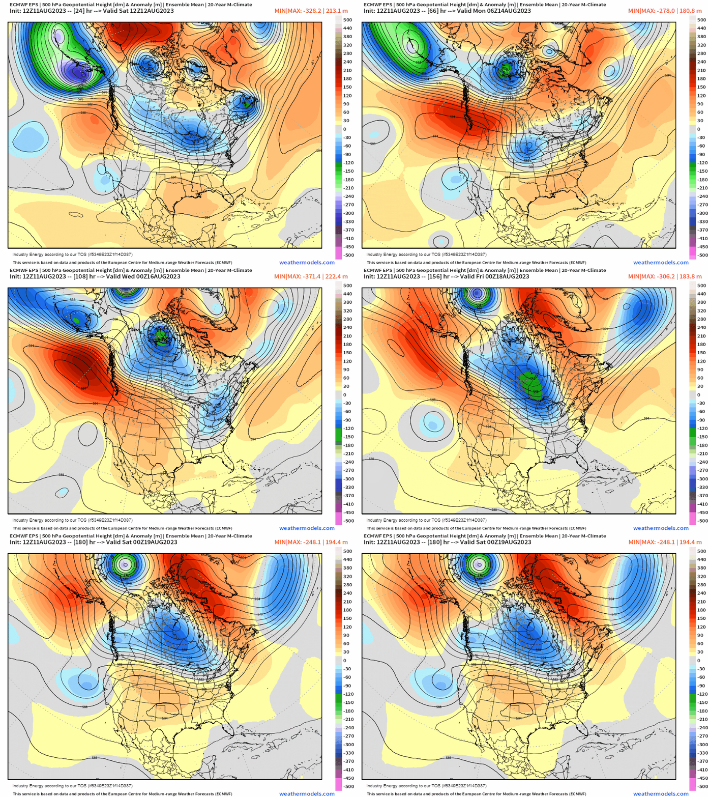
With only a few minor changes, the pattern we’ve been stuck in (a ridge over the south, stormy on the periphery) looks to endure another week.
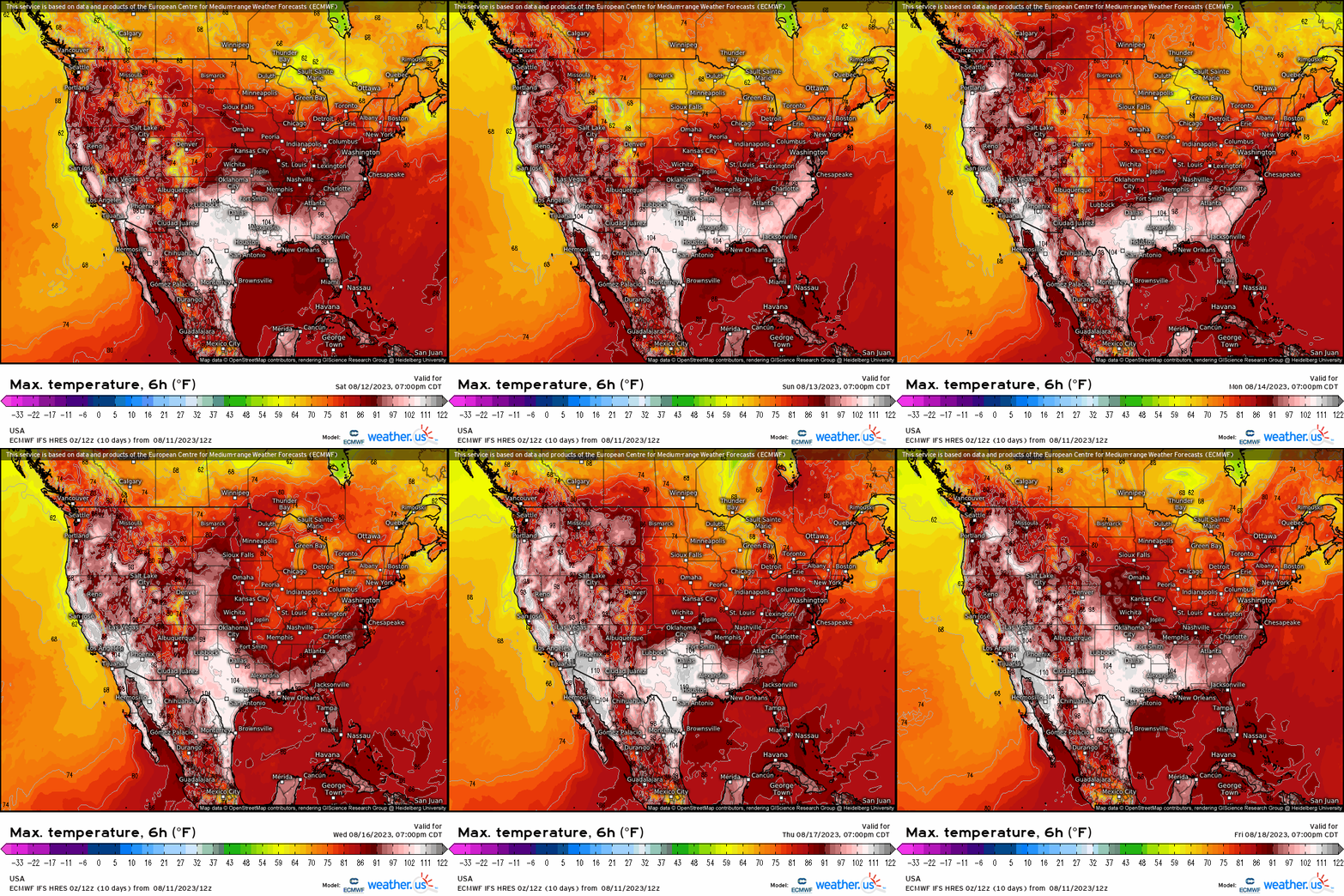
For the South-Central US into the Southeastern US, this means continued record-breaking heat. The Southwest/West Coast will also turn the heat back up early next week in what will likely be another record-breaking heat wave.
Unfortunately for the expanding drought conditions due to excessive heat and little rainfall in the aforementioned regions, it will be another week with slim-to-none rain chances.
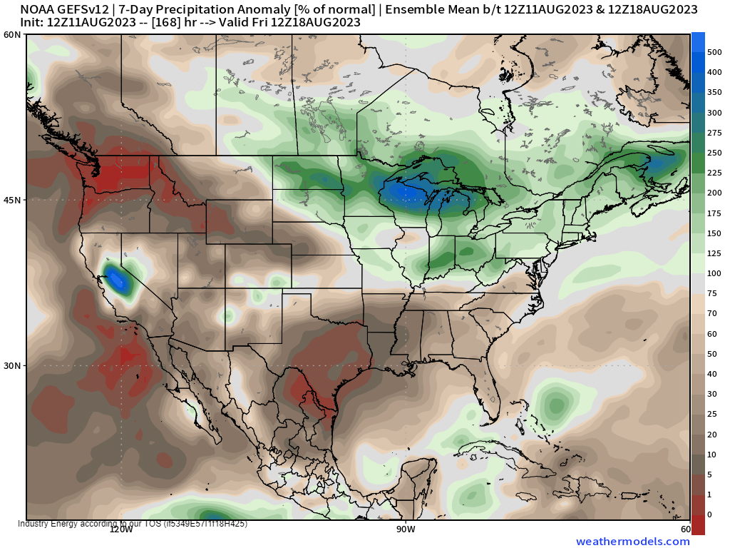
The exceptions, of course, are the lucky parts of the Southwest receiving rainfall from the monsoonal pattern.
We’ve seen drought expand this summer over much of the Southern Tier as relentless heat digs its claws further into the region. Drought has also crept back in over the Northwest which, as mentioned, will likely see record heat next week as well.
But, the storms continue elsewhere. As you can see in the precipitation anomaly map above, disturbances will continue to move around the ridge. This will keep the Plains/Midwest/Northeast unsettled in the week ahead and allow for more chances of severe weather.
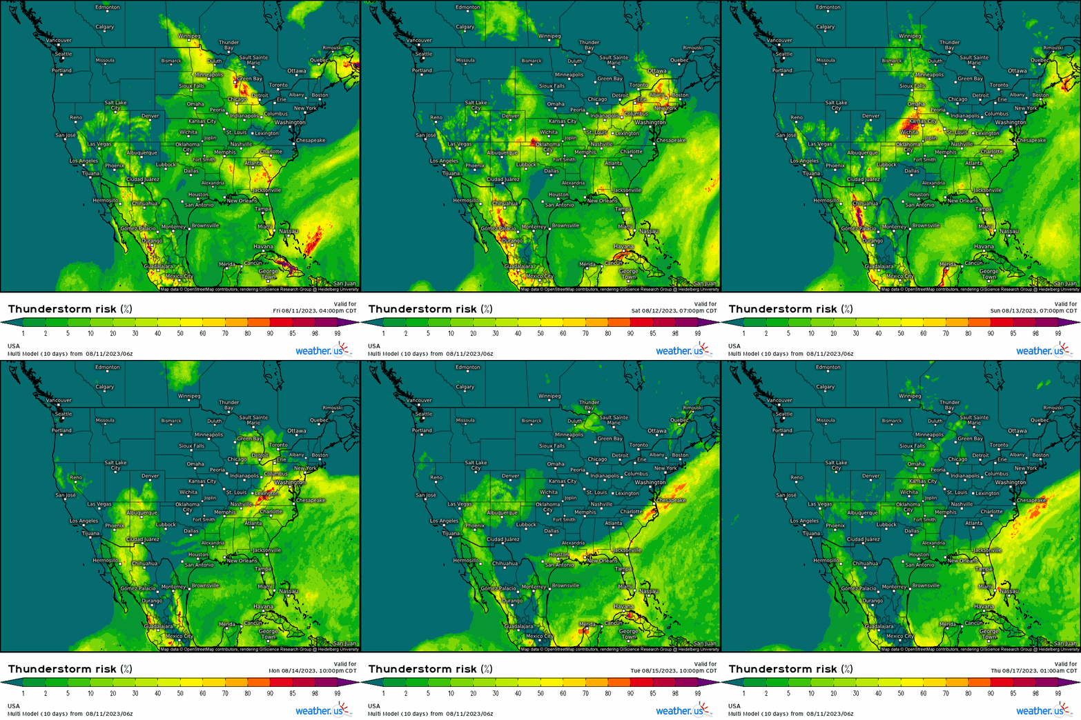
The Thunderstorm Risk parameter from the Multi Model does a good job of showing not only where those waves might trek, but also the expected daily activity from the Southwest Monsoon.
The set-up for each day will be different and carry various hazards, but more wide-spread, organized severe weather remains a possibility through at least Tuesday as the forecast stands now. I’ll address these on a as-needed basis in the days ahead.
And how about hurricane season? What’s the Atlantic Basin up to?
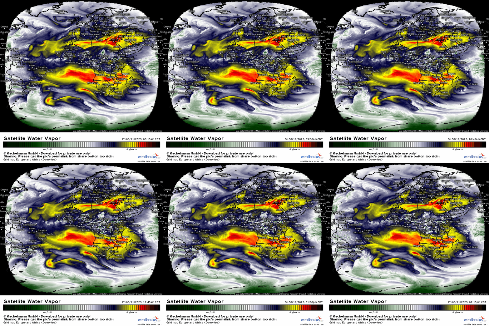
Despite a steady flow of disturbances off the coast of Africa, shear and dry air reign supreme. They are succeeding in suppressing any development for the time being.
Some models try to ramp up the activity after the middle of the month, but it remains to be seen if the background state will support that. I will, of course, keep you updated as we go along.
So to sum up: more heat in places that don’t need it, more chances for severe weather outside of the heat dome, and a quiet Atlantic – for now. Enjoy the weekend!


