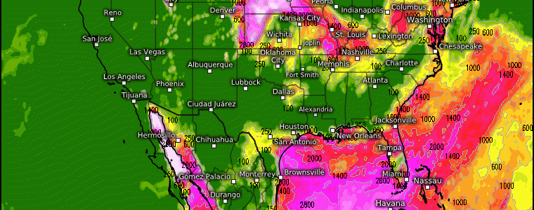
“Ring Of Fire” Pattern This Week
Whenever you see the reference, “The Ring of Fire” pattern, this essentially translates to a stagnant weather pattern that features a large-scale anticyclone like the large heat dome we’ve been dealing with for weeks now across the south and southwestern regions. As this ridge cuts off from the atmospheric flow, the jet stream to the north as winds flow from west to east carry troughs and disturbances downstream. A combination of shortwaves, moisture, vertical wind shear, and temperature advection complete the necessary ingredients for severe weather, convective complexes, storms, and showers across a generally wide range. Meghan wonderfully discussed the heat implications that this ridge will render east of the Rockies this week in her latest blog , but this is also two-fold because of the activeness it incurs.
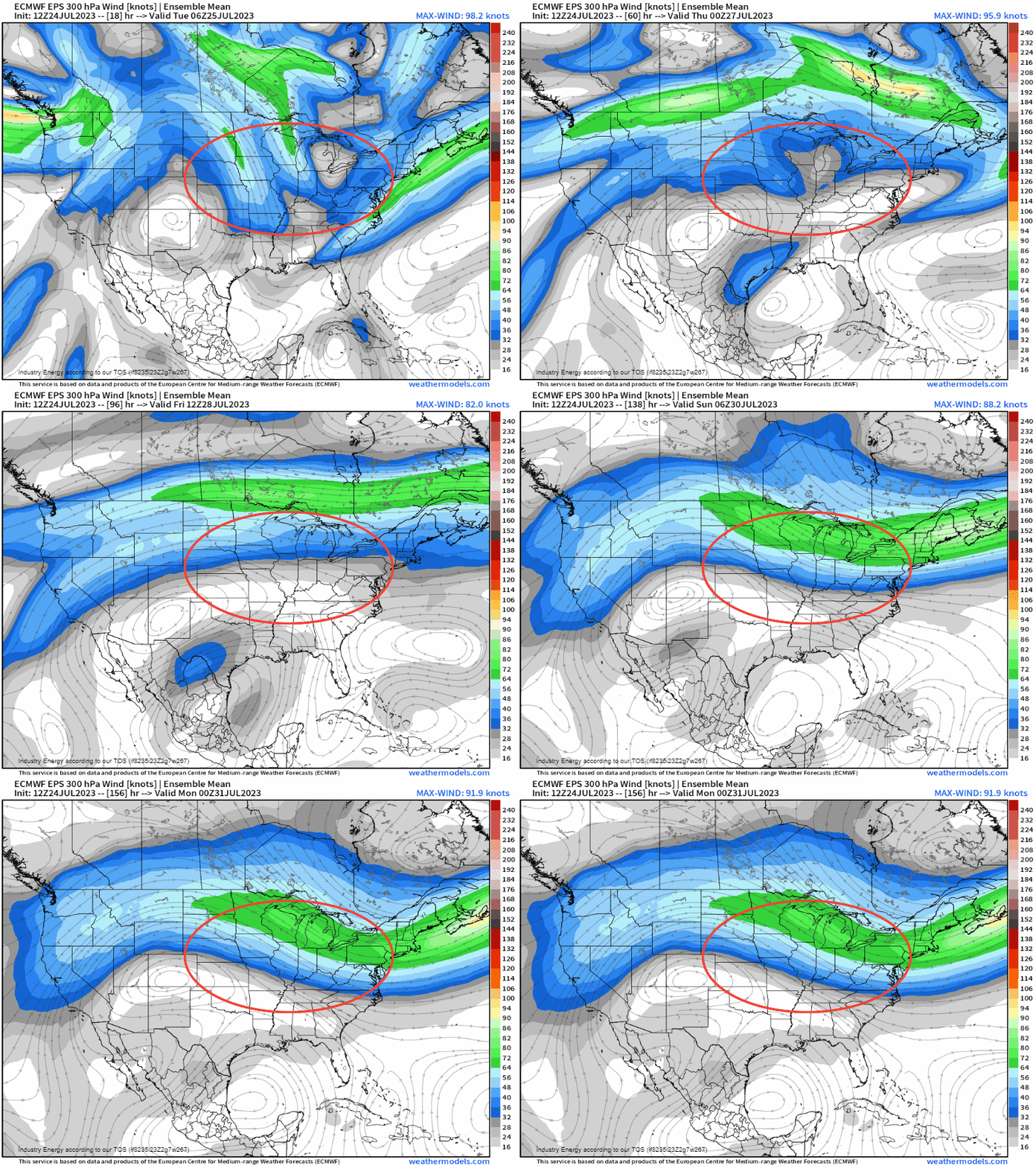
Below, this shows 300mb (or 30,000 ft) that denotes our jet stream. We see the large clockwise circulation oscillate around the desert Southwest. As the jet stream flows carrying moisture and energy from the Pacific, it continues to propagate across the CONUS from NW to SE. Outlined in red is where we’re going to have several key ingredients that’ll favor convective systems and thunderstorms downstream of the ridge that’ll impact areas from the northern Plains to the Mid-Atlantic / Northeast.
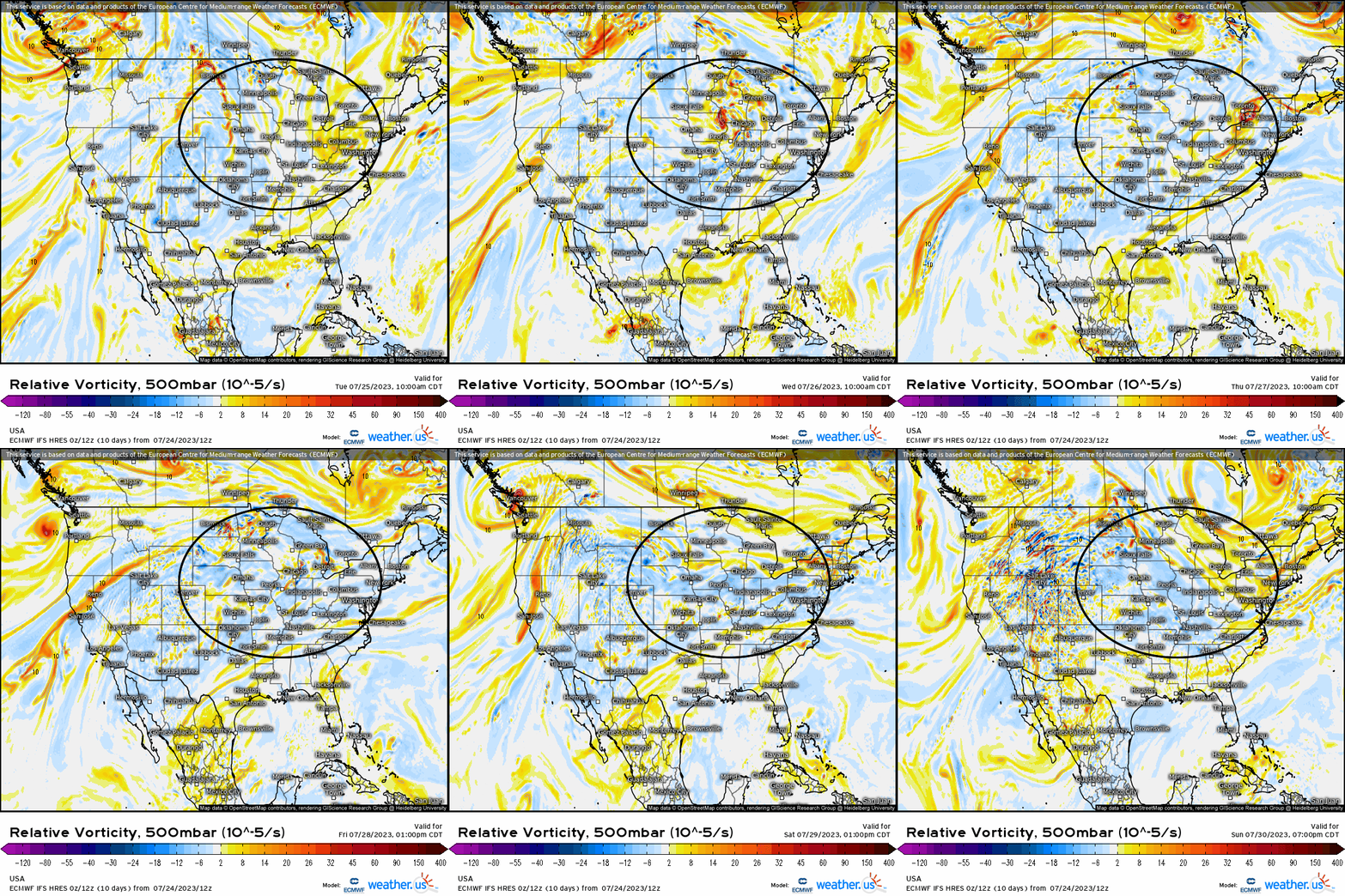
Below we see at 500mb, several shortwave troughs swinging through repeatedly demarcated by areas of positive vorticity (yellows and oranges). By now, we know that these troughs are our catalysts or “trigger” for precipitation and essentially convection.
What do we look for to forecast an area that will experience inclement weather, or any type of active convective phenomenon?
- Lift
- Instability
- Moisture
We can check off (1.), and that is shown by utilizing 500mb for areas of divergence in the form of troughs that induce vertical motion, and lets also not forget that the jet streaks aloft help augment divergence at the surface.
We certainly will have plenty of instability (2.). Our heat ridge that zonally expands across the Southwest and before it shifts eastward, what you also have is the Bermuda ridge in the western Atlantic. With its clockwise flow, it advects moisture and latent heat from the Atlantic and Gulf northward.
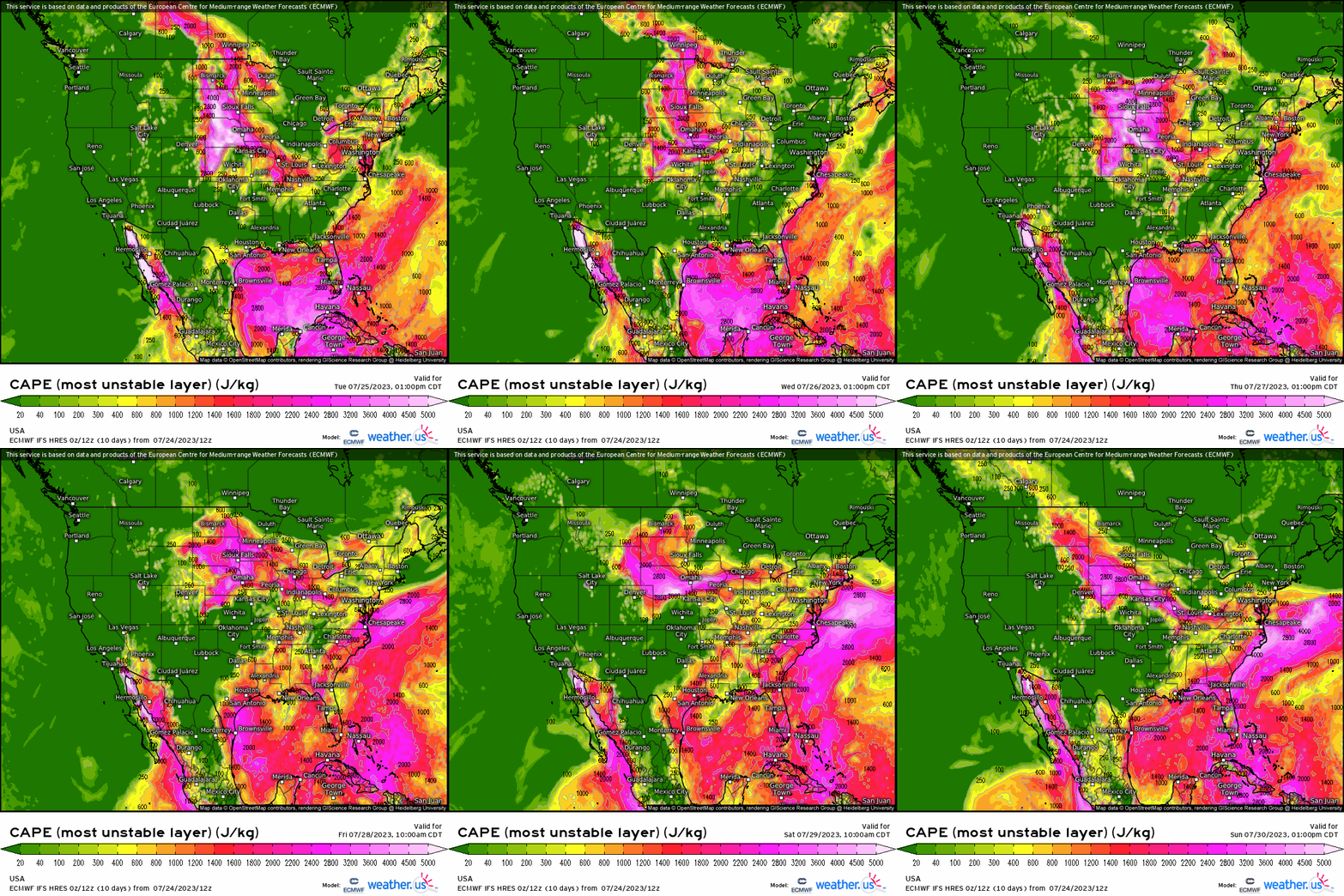
So we have our moisture (3.), and no shortage of it. Notice how nicely it aligns with the high values of CAPE? We a large swath of 60+F dewpoints from the Dakotas down to Texas, and on east. That is our instability thanks to the moisture supplied by the advection of moisture, in conjunction with of course diurnal heating.
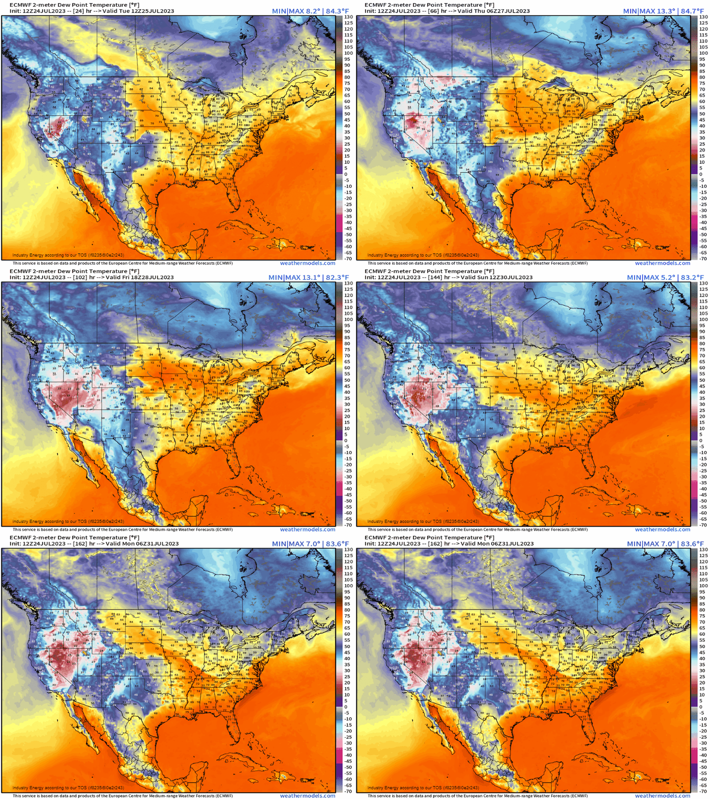
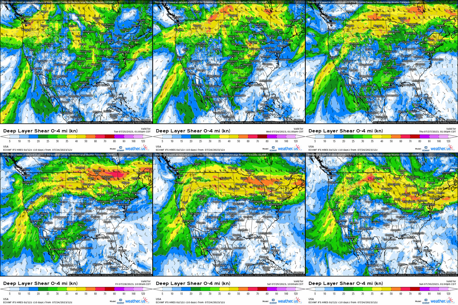
Lastly, lets not forget wind shear. With the jet stream displaced poleward of the heat and moisture, this helps to provide wind shear as well with a predominant west/northwest flow aloft, and also helps to “carry” dry air aloft which is also a key ingredient in yielding severe weather as it exacerbates the atmospheric environment. Notice narrow swaths of over 35-40 knots from the northern Plains to the Northeast, which is more than sufficient in helping updraft maintenance, and ultimately dictating storm type (I.e. supercells, clusters, etc.).
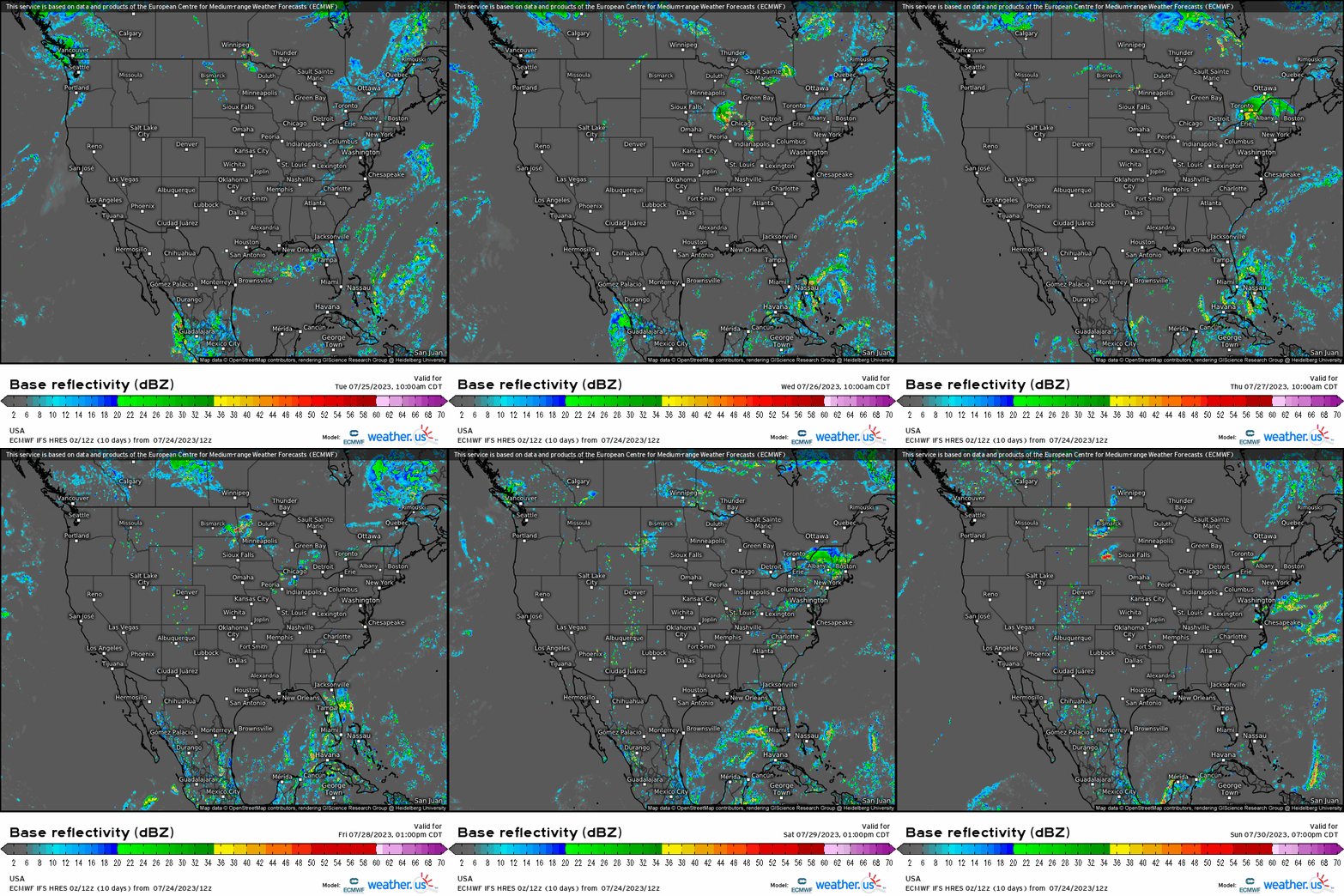
This type of pattern also is notorious for derecho’s and long-lived MCS’s, due to the fact that these convective complexes can maintain their mesoscale circulations due to all of the factors discussed. When we put it together, notice several MCS’s and thunderstorm systems on a daily basis today through the end of the week. Today across the Dakotas and into Nebraska, thunderstorm development will occur this afternoon with hazards likely from supercells (isolated) and clusters rendering damaging gusts and large hail. Then by tomorrow, our severe threat shifts into the Great Lakes region from Iowa to Ohio as a MCS may be propagating into this region, continuing to maintain given the favorable wind shear and instability present. Large hail and severe gusts also look to occur with this complex, and continue on into Thursday possibly and we see this by observing the ECMWF output. We then see activity shift into the Northeast toward the end of the week and Mid-Atlantic as well, and bleeding into the Southeast.
This pattern primarily occurs every summer as we always see the sub-tropical ridge (Sonoran Ridge – its name deriving from the desert SW) cut off from the mean flow, and stagnates across the lower 48 sending impulses around its northern periphery bringing about severe weather and precipitation.


