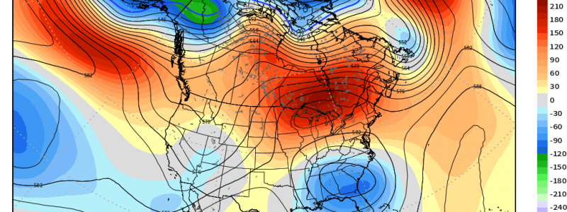
Rex Block Woes
If you reside in the Midwest and feel like perhaps it’s been much drier than average lately, you might be on to something.
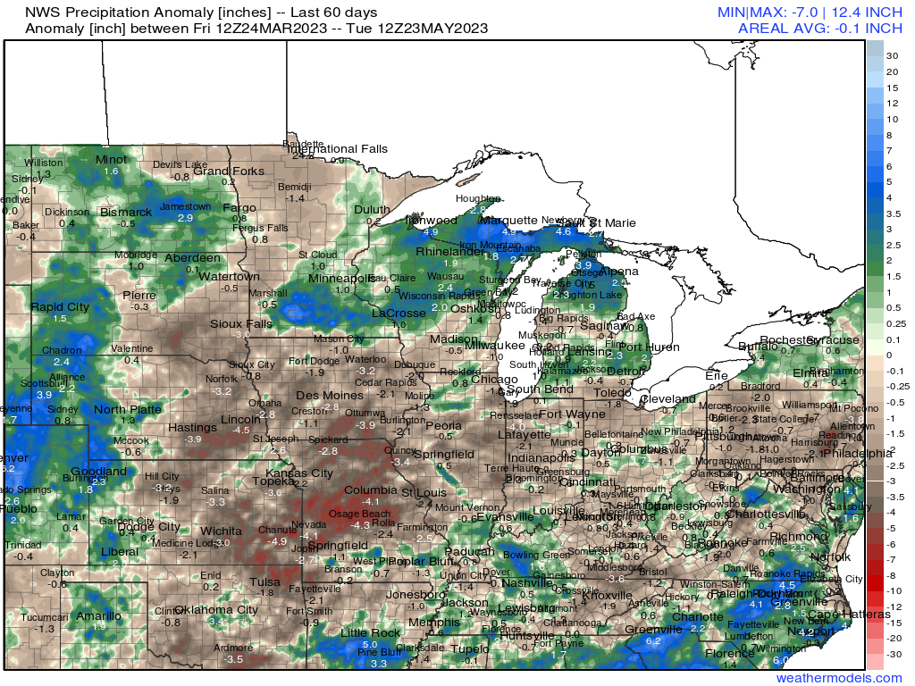
Precipitation analysis shows that over the last 60 days, some pretty serious deficits have developed – especially in the heart of the “corn belt” region. It’s no surprise that drought conditions have begun to develop in Missouri and Iowa. Even parts of Illinois are abnormally dry.
An unfavorable pattern has left the early growing season without much rain to nourish emerging crops. Unfortunately, the upper air pattern looks to remain unfavorable into the next week as blocking develops and persists.
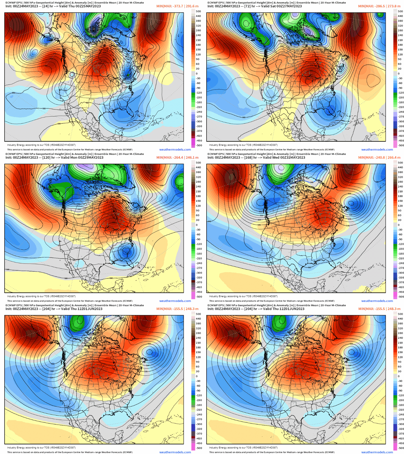
The current pattern, which resembles an Omega Block, will evolve into what’s known as a Rex Block as ridging shifts eastward by the weekend.
What is a Rex Block? This type of blocking occurs when high pressure is located directly northward of an area of low pressure. In fact, they will appear to be stacked on top of each other. These blocks can be slow to clear. They will generally linger until one of the pressure centers decreases in intensity, allowing the flow to begin moving once again.
The moisture-starved Corn Belt region will unfortunately remain under the influence of the high pressure portion of the Rex Block.
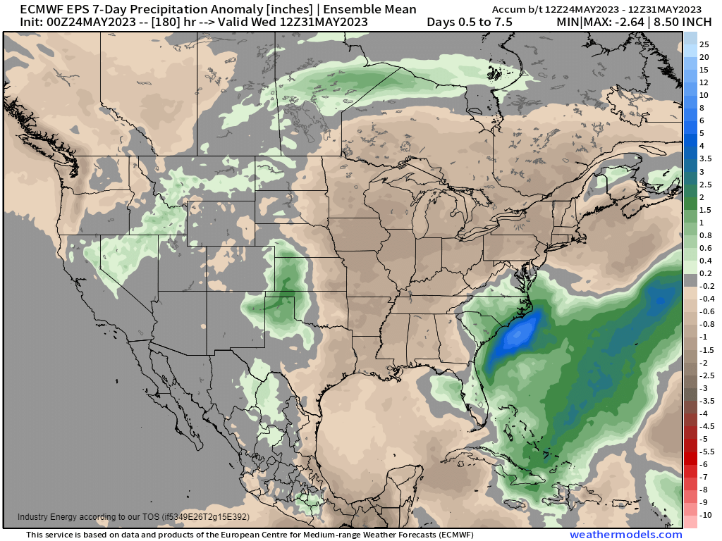
As high pressure generally equates to subsidence and clear, sunny days, this region is looking at yet another week (at least) of below-average precipitation. Not great news for farmers trying to keep their crops healthy.
Conversely, the Southeast, over which the low pressure center will be located, will remain soggy and somewhat cooler than average as this block persists.
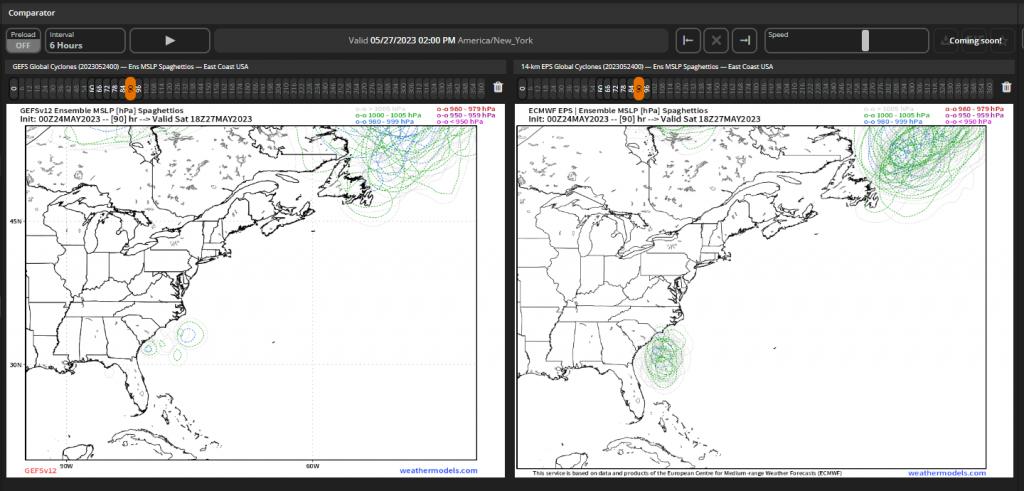
The location of the eventual low and how far west it nudges will determine who sees a soggy holiday weekend.
Further, as we nudge ever closer to the official start of hurricane season, there’s always the chance that these coastal lows can attempt to spin up some tropical or sub-tropical mischief as they ride along the Gulf Stream.
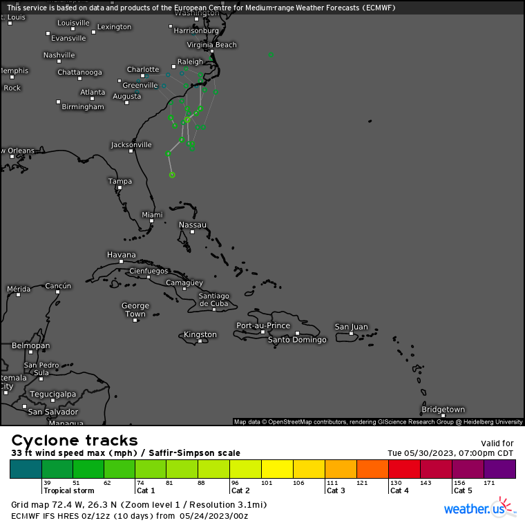
While there is no official “spot to watch” issued by the NHC yet, it’s something to keep in mind over the next few days. Tropical/sub-tropical development or not, the effects will be the same: rain, some wind, and the potential for some coastal flooding with a persistent on-shore flow.
We’ll look at this – and the holiday weekend forecast – in more depth in the next couple of days.


