Resilient Henri Eyes Storm-Weary Northeast
The Northeast is forced to jump from hurricane threat to hurricane threat at a pace unusual for the region this weekend.
Fred’s remnants, and the associated PRE, have just finished bringing prolific rainfall to the interior mid-Atlantic and parts of southern New England, with considerable flash and river flooding still ongoing.
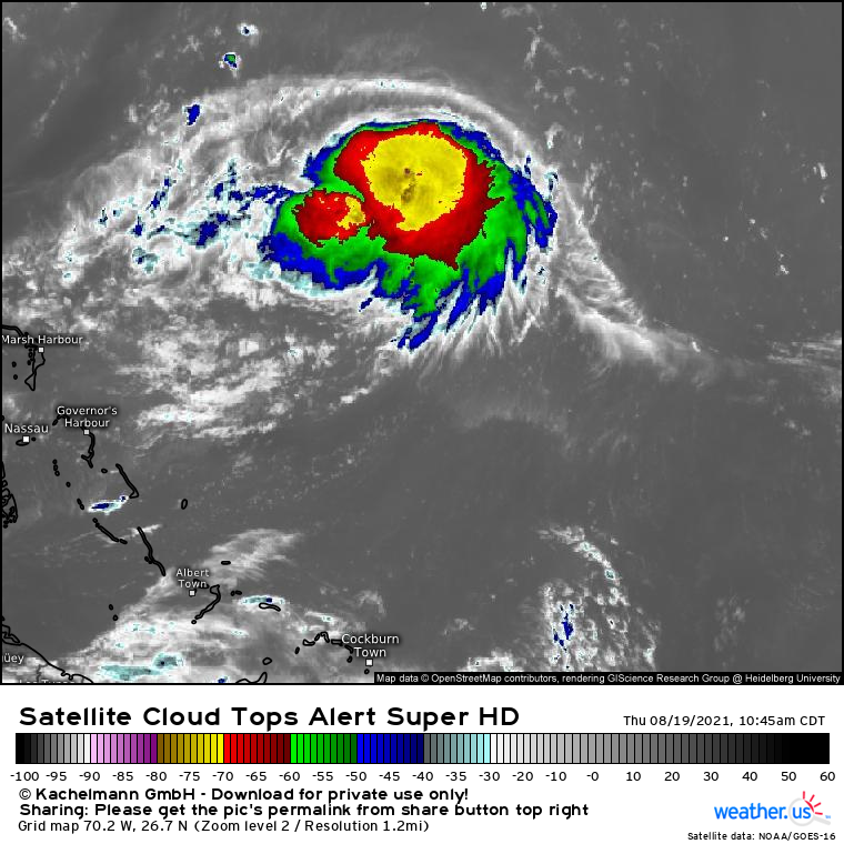
But attention now turns to Henri, a tropical storm sputtering over the open western tropics between Bermuda and Florida.
The storm is over a sea surface rendered quite warm by late summer sun and proximity to the Gulf Stream, and has developed a moderately organized convective structure in spite of 20+ knots of northerly shear.
While healthy outflow and bubbling convection indicate a storm still efficiently converting oceanic heat into kinetic energy, the northerly shear is likely keeping Henri’s vertical low pressure column tilted with height. We aren’t sure at the moment whether the low-level center has become completely separated from the upper level center due to shear, but an observational flight soon will help answer that question.
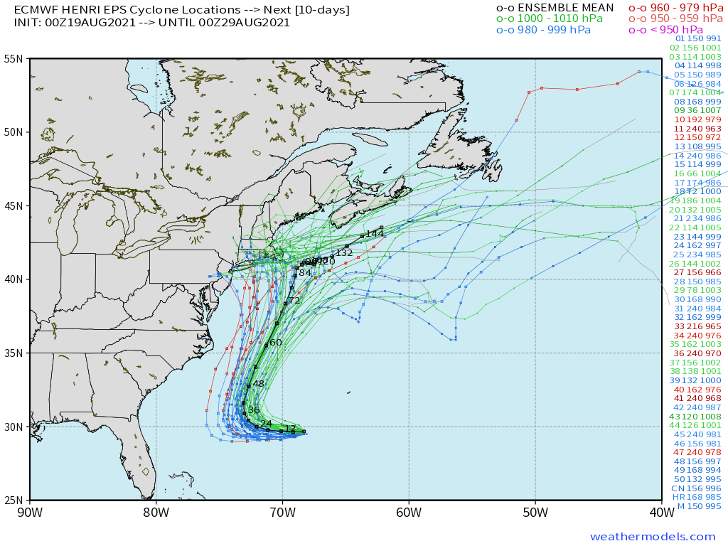
It’s a question that, along with a few others, will prove vital in determining whether Henri passes offshore Cape Cod or hooks east into New England.
Henri is a typical storm in an atypical place. It formed as a trough of vorticity along a cold front became ‘caught’ amidst mid-Atlantic ridging near Bermuda, a fairly regular late summer occurrence. As it developed steadily at the beginning of the week, it was ignored by many in favor of Fred and Grace: storms that form near Bermuda almost never impact the US. But an unusual synoptic pattern threatens to capture Henri and upend climatology.
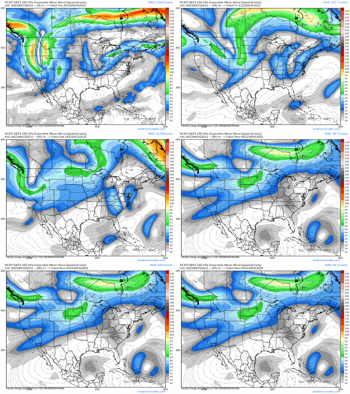
A fairly progressive, deep midlevel trough largely cutoff from at-large westerlies will take on an increasingly pronounced negative tilt over the weekend in response to a combination of downstream ridging, upstream jet acceleration, and Henri’s venting of heat (from condensation) into the upper atmosphere.
This trough will work with a central Atlantic ridge to incentivize Henri to turn north tomorrow, where it will begin to parallel the eastern seaboard. By the end of the weekend, the increasingly negative tilt to the upper level trough will back flow aloft to southeasterly, with a possibility of pulling the storm into the coast somewhere from New Jersey to Cape Cod. This would, of course, be a big deal- the area is quite vulnerable to even tropical storms, and hasn’t seen a hurricane since Bob, 30 years ago today.
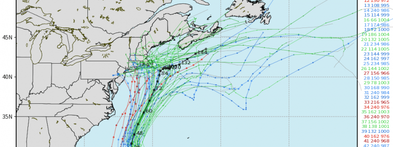
This sort of extremely impactful track is far from assured. Many tropical cyclones see steering currents that change depending on intensity, but few experience this effect to the degree of Henri. The eventual track depends greatly on the storm’s strength over the next 24 hours, with different flow regimes at various heights in the atmosphere.
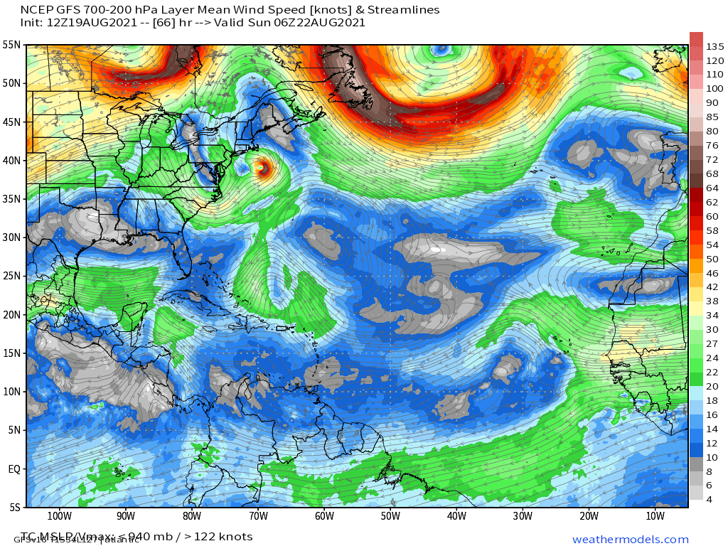
As Henri flirts with New England by the weekend, it’ll be under the influence of Atlantic ridging centered low in the atmosphere, and the aforementioned trough centered high. This means a stronger hurricane will have much more incentive to travel west with the trough, while a weaker storm will have incentive to travel east atop the ridge.
In fact, this sort of pattern is seen temporally upstream, too: ensemble members of global and hurricane models that depict Henri stronger over the next 24 hours almost universally have it stronger in 48 hours, further west through the weekend, and substantially more likely to make landfall in the northeast.
Clearly, intensity matters a great deal, starting… now. Remember our discussion before about the influence of shear on Henri? The degree to which the vortex tilts with height, and even decouples, over the next 24 hours will prove extremely influentional on the track of the potentially dangerous storm.
If you should be watching anything today, it isn’t the global models. It should be the deviation of the storm south of 30N, and it should be the ability of Henri to hold together in spite of northerly shear.
If it stays far south, if it intensifies into the 990-1000mb range, Henri’s threat to New England becomes a whole lot more real.
For now, though, stay calm. There are bad or misinformed actors out there who will attempt to fear monger with a storm like this, and the best way to ward off anxiety is to be prepared. Do you have a hurricane action plan? If you live in one of the areas that could be impacted by Henri, you already should have one prepared. If not, now is a great time.
If Henri does ward off shear, and intensity by this evening is in the 990-1000mb range, it may be time to start thinking about hurricane action items.
Stay tuned, folks, and stay safe and prepared out there.

