Repeated Rounds Of Heavy Rain And Storms
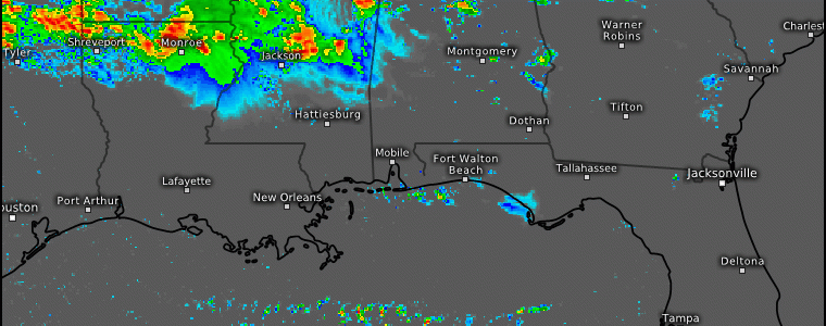
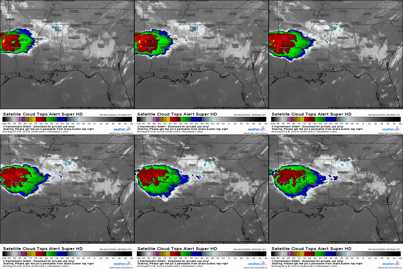
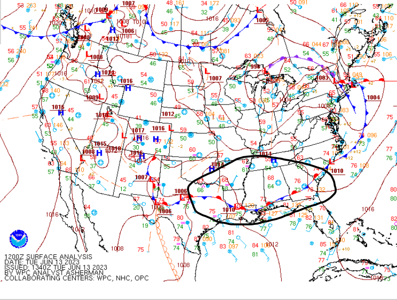
We begin the day with infrared satellite imagery that helps to reveal how strong thunderstorms are across the Deep South today by measuring the cloud top height through temperatures. We see a thunderstorm complex currently across the Ark-La-Tex region. What is happening currently is that this is being forced by a long, draped stationary boundary that we see analyzed via the Weather Prediction Center, and outlined in black below. It’s this boundary that’ll be the catalyst for repeated rounds of convection in the form of training storms today and into tomorrow by providing low level convergence. When comparing the current observations with satellite, we can visually see why and how we have convection going on right now.
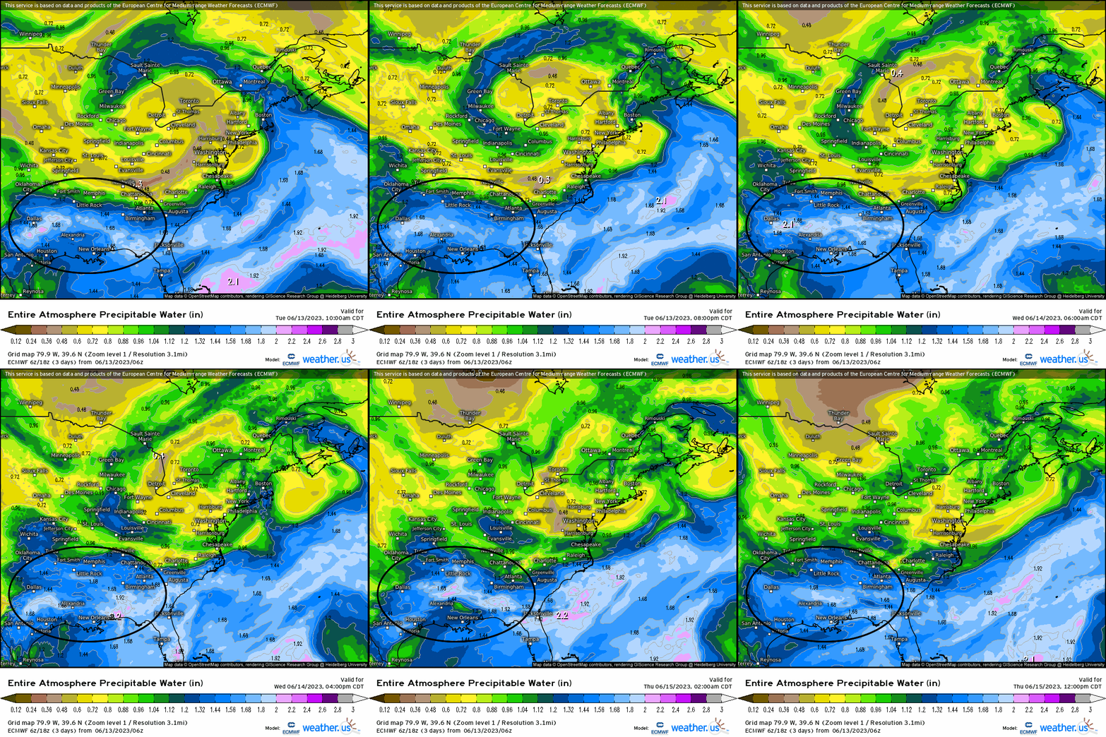
Lets analyze why we’ll have very favorable ingredients in place for heavy rainfall and a strong thunderstorm threat across the South. First, outlined is the forecasted animation via HIRES European model showing PWAT values above 1.5” into Thursday. This denotes an environment capable of producing heavy rainfall given how much moisture availability there is, and again notice how this streams along the stationary boundary from above.
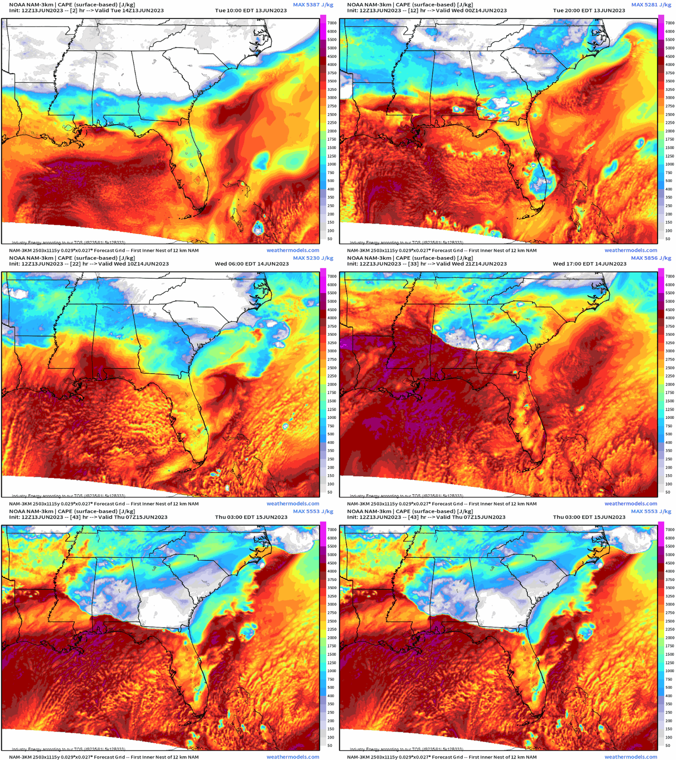
Next, we see that instability because of the pooling moisture along the boundary is nothing short of formidable. Water “holds” latent heat, and there is plenty of it from the Gulf! So we combine a humid low-level atmosphere with instability, and we have the “trigger” (forcing for vertical motion) from the boundary to culminate an ideal environment capable of producing downpours, flash flooding, and severe storms.
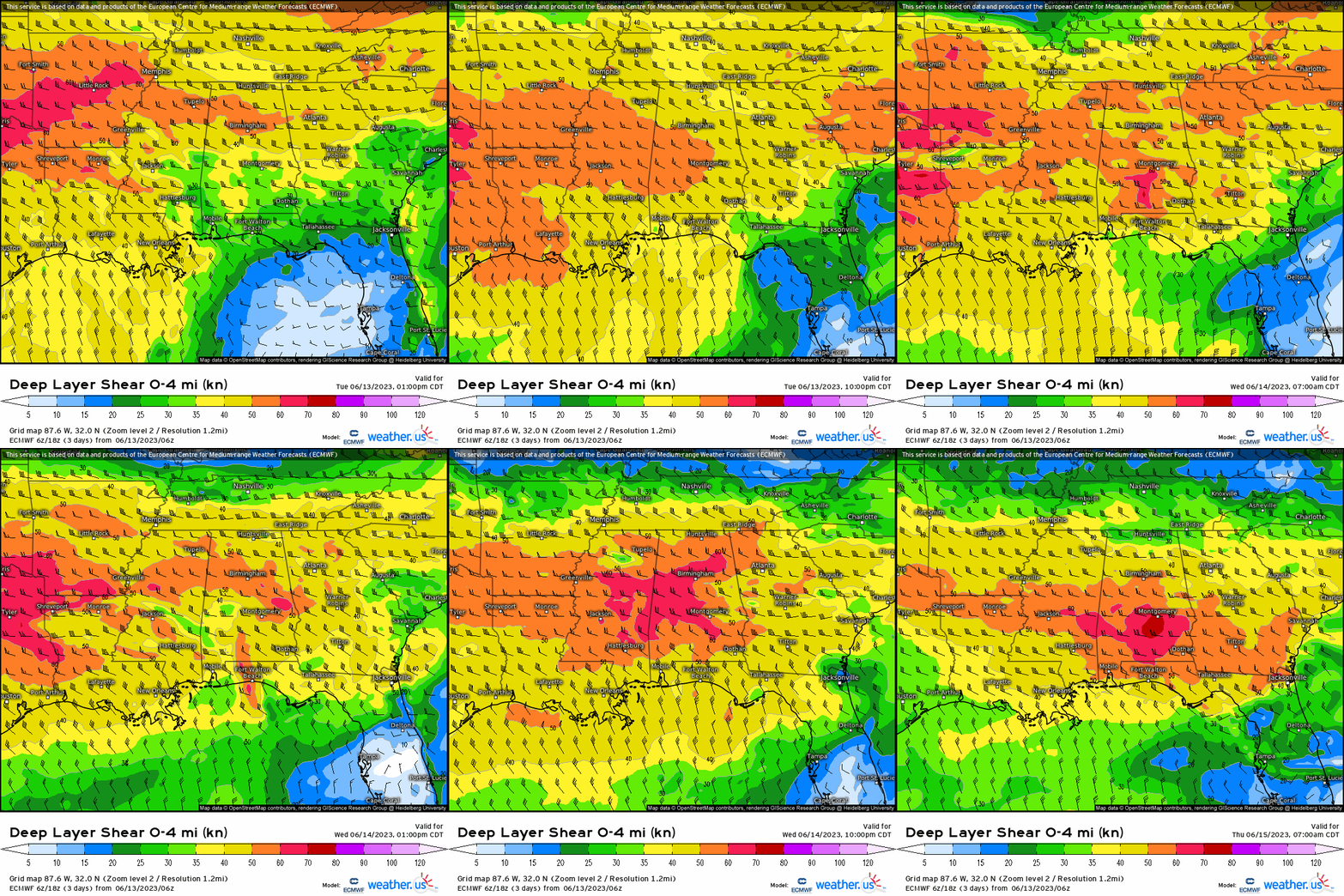
Next, lets look at both what the storm motion may be and shear of course because severe weather needs vertical wind shear as it determines storm type, while instability determines updraft strength. We see that our 0-4 km (surface to ~ 13,000 ft) mean vector is oriented west to east. Our boundary is also draped in the same direction. When this is aligned in such a way, we get a net slower storm motion because both want to try to cancel out (cloud motion and shear). We also verbatim have wind shear that is over 40 knots as this will also help to organize convection leading to strong thunderstorms this afternoon and once again further east into the Gulf Coast states from MS to GA.
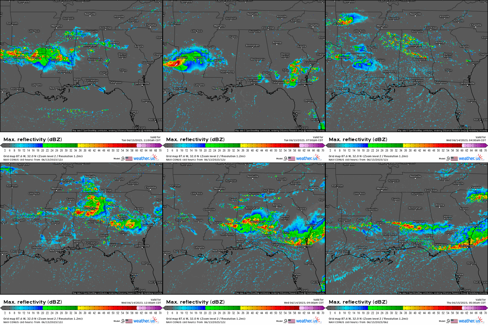
When we see how this plays out through the rest of today and into tomorrow, we see initially our convective complex move through the southeast with new storms firing off from eastern TX tonight and merging. New storms, with possibly discrete cells tomorrow occur late morning and into the afternoon with training convection emerging during the day tomorrow before growing upscale and once again merging. We’ll likely see some supercells along with embedded thunderstorms that are capable producing large hail and damaging gusts.
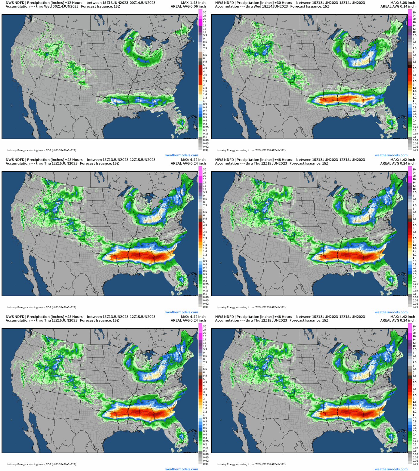
In terms of accumulated rainfall, we’re looking at totals largely in the 2-5” rain, with locally higher amounts from the Ark-La-TeX region to southern GA especially with areas that see training storms continuously fire along the stalled frontal boundary. This will likely also lead to localized flash flooding with excessive rainfall, and areas that already have saturated soils. Unfortunately, given the pattern heading into next week, we’ll see renewed threats for this region for heavy rain and storms so be prepared if you reside in this general area!
