Remnants of Fred Bring Flooding, Tornado Threat North
Whoever proclaimed “Fred is Dead” this past weekend when Fred degraded to an open wave has apparently angered the storm. Fred seems to have taken that proclamation personally and is continuing to cause headaches since landfall two days ago.
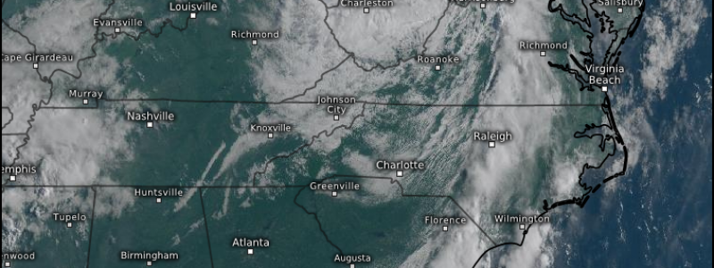
In addition to the coastal effects, Fred continued into the southeast/Mid-Atlantic and, through a combination of instability and enhanced low level flow on the eastern side of the storm, spawned quite a few tornado warnings in GA/NC/SC which lead to a few confirmed tornadoes. Heavy, topographically enhanced rainfall was also seen across this area.
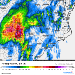
The mountains of Western North Carolina picked up as much as 6 inches in 6 hours yesterday which, combined with a PRE, lead to many creeks, streams, and even rivers entering into major flood stage.
These waters may be receding now, but Fred, or what’s left of him, isn’t quite done yet. His remnants move into the upper mid-Atlantic and the Northeast today where, once again, a PRE has primed the region for flash flooding concerns.
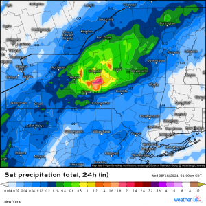
Especially in central New York, roughly in the vicinity of Ithaca, Binghamton, and Syracuse, and even into Western PA – all of which have received decent rainfall in the past 24 hours.
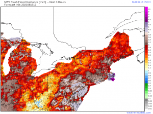
FFG values in both aforementioned regions are low which means it won’t take much beyond a few hours of steady, heavy-at-times rainfall for flash flooding to manifest somewhere in these areas.
Western PA is experiencing heavy rainfall now while New York will experience their peak later on. Orographic lift will assist in enhancing rainfall totals throughout the NY/PA region which makes me fairly confident that we will see at least a few flooding issues at some point today, especially in central NY.
On top of water woes, we also need to discuss a fairly significant (at least for this region) tornado threat for the upper mid-Atlantic – namely Maryland and Pennsylvania.
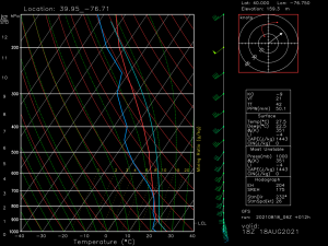
This is a forecasted sounding for York, PA for this afternoon. The threat is expected to be most potent in this general area. Strong low level flow and winds backing from the southeast will provide adequate shear. The satellite loop shows breaks in the clouds which will allow for daytime heating to further destabilize the air – with dew points already in the low to mid 70s at this hour.
Yesterday, we saw the remnants of Fred overachieve a bit in the tornado threat category. Similar conditions lead to tornado warnings persisting from the pre-dawn hours until after sunset. While today’s threat may not be quite the same, conditions look ideal for at least a few tornadoes this afternoon and evening. More breaks in the clouds will lead to more destabilization and a more certain threat.
So, for today – sun = not good. If you’re in this region and the sun is out for any extended amount of time, prepare yourself for the possibility of having to seek shelter later. Get those weather radios out and ready, make sure you can receive warnings on your phone, and have a plan to shelter that you can execute quickly. Time is of the essence when sheltering for tornado warnings associated with a tropical system. Lead time on a tornado warnings in these situations is often reduced.
When discussing tornadoes accompanying TCs, you may hear the term “spin-up.” Tropical systems generally have low-topped convection. Rotation can be shallow, confined to the lower levels, and hard to catch on radar. Occasionally, warnings aren’t issued until the funnel is descending. In addition, sometimes it dissipates just as quickly as it formed. My point = be prepared.
Summary: Heavy rain is expected today with the heaviest totals seen where the terrain enhances the rainfall. Flash flooding is a possibility, especially for those who received decent totals yesterday. Tornadoes are a possibility, particularly in southern PA/MD, and are more likely with more sunshine leading to further destabilization.
Stay safe – don’t drive through floodwaters and make sure you can receive warnings/take action if one is issued.
