Remaining Dry and Heating Up
It’s no secret that the heat has been relentless this summer for the south-central US.
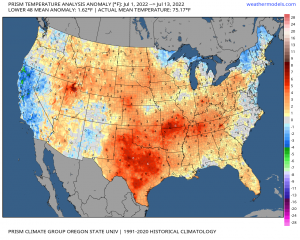
July may be only half over, but the half that has passed has been well above average for places like Texas, Arkansas, Oklahoma, and southern Missouri. In fact, it’s been above average in this region every month this year from March forward. You can take a look at the analysis yourself by following the link above.
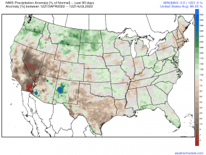
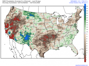
In addition to the heat, it has been incredibly dry.
Link
While Texas has been drier than average for much longer, places like Oklahoma, Arkansas, and Missouri are just recently coming out much drier.
The most recent update of the drought monitor places most of each of these states in some level of drought. Of course, it varies from one part of each state to the other, but it is rather clear now that it is abnormally dry.
So why am I talking about this?
Well, I’m prefacing today’s blog with the lack of rain for a reason – more heat is on the way for this region. Continuing dry conditions may allow heat levels to rise to impressive levels next week. How hot, you ask? Let’s look at model output.
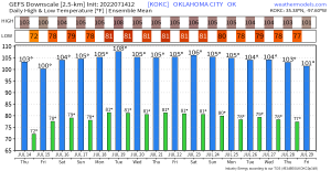
I’ve pulled the city charts for Oklahoma City, OK from the ensembles as it is kind of a center point for the upcoming period of heat.
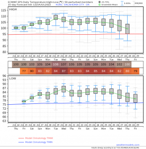
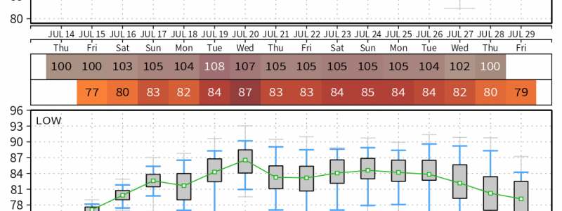
This is the GEFS Ensemble (left) and EPS Ensemble (right). Ensembles tend to be more reasonable than deterministic models, especially in the longer range. To see ~12 days above 100 degrees on an ensemble run is pretty impressive. Or perhaps the word I’m looking for is frightening.
For perspective, the forecast high temp of 108 on Tuesday the 19th is one degree under the record high of 109 set in 1936. Similar records exist for this week, some which were set over half a century ago.
Take a look at the predicted lows, as well. Overnight temps in the 80s (or near 90?) will offer zero relief from the day’s heat, making heat exhaustion/heat stroke more likely for those who don’t have a reliable way to remain cool.
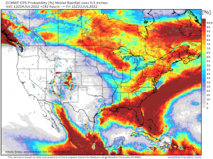
And, offering no help at all is the chance for beneficial rain, which are very minimal for this region over the next 7 days. This means the region will likely become drier leading up to the onset of these temperatures. Could this lead to higher highs? Perhaps.
We’ll need to monitor how this forecast evolves over the weekend. But consider this blog an early heads-up to what could potentially be rather significant heat for the Central US moving into the new week.
