Rain, Wintry Mix, and Some Snow: Mid-Atlantic, Ohio River Valley, & Northeast
Now that we’ve reached Thursday, I figured an update would suffice on what we’re looking at and what has changed.
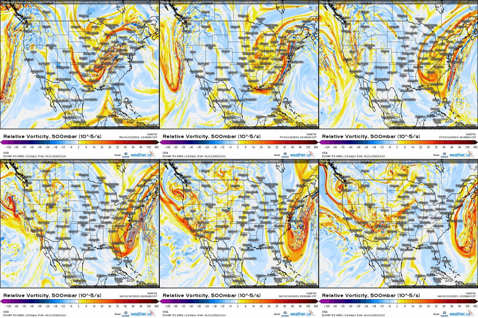
Since several model runs ago, we’ve seen a more progressive trend with the overall trough axis. Despite seeing an interaction between the northern and southern streams, what has changed is the cutting off of the mid-upper level trough. Instead, we’re now looking at that transpire offshore, therefore making for a more progressive surface reflection. Below, we again do see that polar piece “dive” into the base of the trough and then rotates offshore. It’s this dynamic process that allows for a secondary low to form (which forms along a front), but stays well offshore.

There’s a solid consensus on the overall storm track – a low will ride in from MO into IN and then cut into OH before shifting into upstate NY before then crossing northern ME. At the surface, this will cause several types of weather to occur:
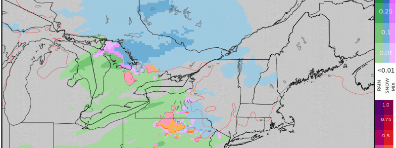
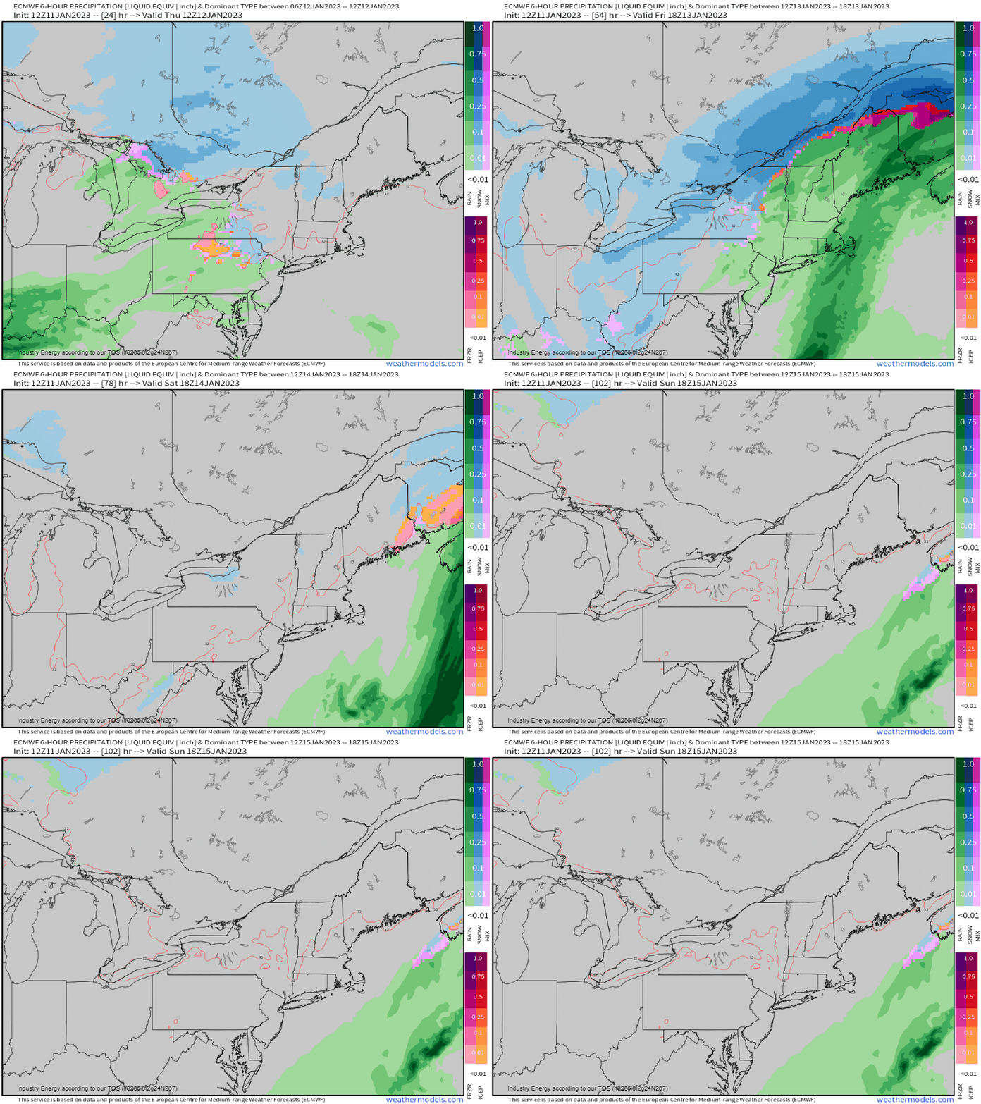
1.An area of some snow out ahead may develop across NE PA, lower Hudson Valley, and into Southern New England, which will become a bit steadier heading into midday today, especially north of the MA turnpike. This will changeover from south to north with Maine seeing cold hang on the longest into tomorrow while everywhere changes over. It’s also during this change we see brief mixing with sleet and freezing rain, though ice will not be much of an issue since warm air wins out.
2. Rain overspreads from southwest to northeast during the early afternoon, becoming heavier into the overnight across the majority of the Mid-Atlantic and into the Northeast. Out across the Ohio Valley, steadier rain will shift in by midday before exiting by the evening/night. On the backside, we may see some snow showers and some patchy freezing drizzle into tomorrow morning.
3. Some rumbles of thunder are “in the cards” for places like Baltimore and down into places like Richmond, where a line of convection may occur along the front with just enough instability present (especially for January standards) overnight tonight.

In terms of rainfall, we’re looking at a general widespread 0.30”- 0.5”+, with many areas seeing 1-2” locally with embedded periods of rain, especially further north.

As for snowfall, generally anywhere from a scattered coating to an inch will be more commonly observed across the Ohio Valley, into PA, and into the Northeast. Once again, major metros miss out from Baltimore to Boston, though Boston could see some flakes fly prior to rain. More snow will be observed as you head further into the foothills of Maine and the White mountains in New Hampshire. On the backside of the departing low, we’ll again see some lake-effect snow bands and showers before clearing commences by Saturday morning.

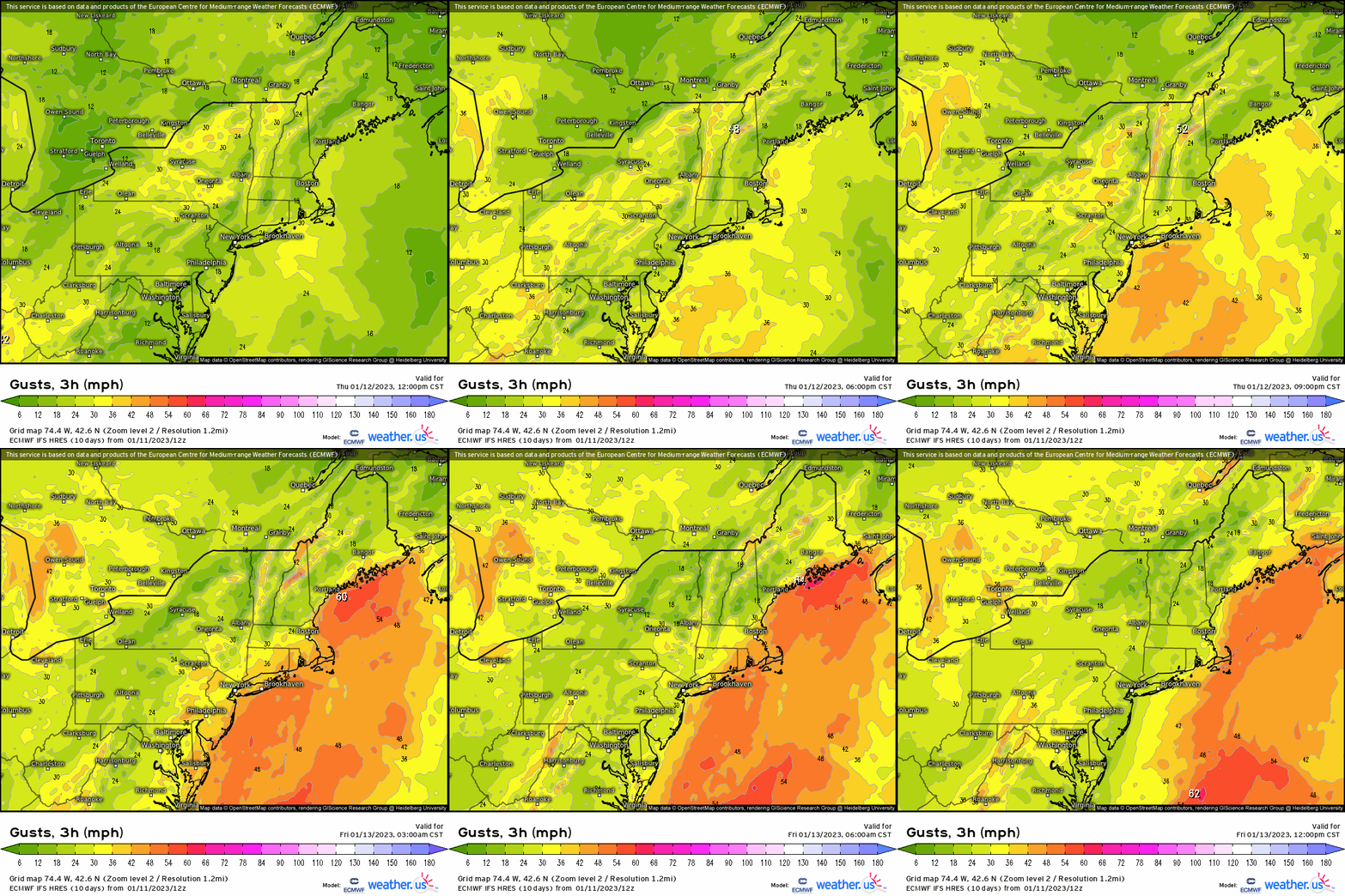
The one notable occurrence will be gusty winds, as a developing low level jet within the warm sector ramps up and some of the stronger winds mix down to the surface depending on the strength of an inversion that develops as a result of warm air advection between 700-850mb. As of now, the thinking is that the stronger wind gusts (i.e. 30 – 45 mph) stay offshore and along the coast of New England.

The good news is, at least the secondary low that was a bit of a concern earlier this week, now will remain offshore thanks to the overall progressive nature of the trough axis. Yet again, snow evades the Northeast region primarily as the below average streak continues.


Well written story, as usual, despite its somewhat disappointing content. Like the Northeast, here in the upper Midwest in the Milwaukee/Chicago region there’s a severe lack of snow and an overabundance of mild (well above avg) temperatures.
Our average Max Temp should be around 27°F but we’ve had 7 days already with temps in the 40’s (January). In addition MKE Airport recorded a daily High Temp of 46° in each of the past 3 days!
These “unusual” weather quirks are not nice for the true winter fanatics but highly interesting from the neutral science perspective. Let’s wait and see what this winter can still bring us (and surprise us?)