Quite A Bit Of Ridging
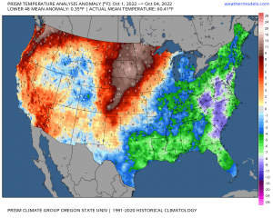
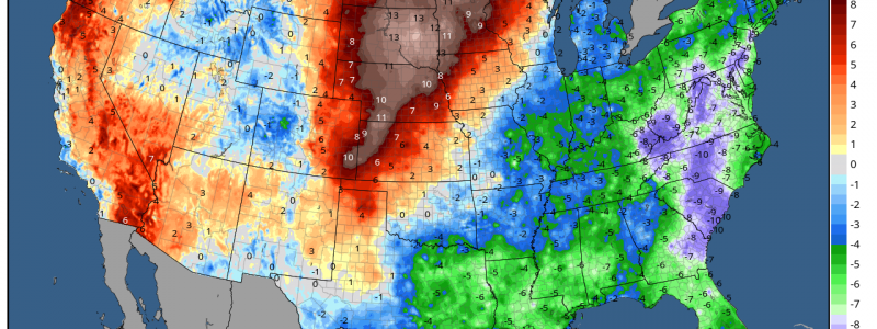
Despite a couple shots of cooler weather, average monthly temperatures in the Northwest have remained higher than normal for July, August, and September. Not much has changed in the first few days of October, either.
Yes, I know it’s only 5 days into the month. Still, we’re off to a roaring start with temperatures significantly above average in the Pacific Northwest as well as the Northern Plains/Central Plains who, by the way, has also seen a long stretch of monthly averages warmer than normal.
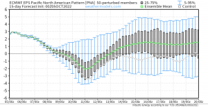
Though there have been dips here and there, the Pacific-North American Pattern has favored the positive phase recently. That translates to ridging lingering over the Western US.
Warm and sunny days may be welcome for awhile in a region known for its rainy, dreary weather, but too many of them start to cause a problem.
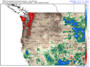
The last 90 days of mostly warmer, drier weather has left its mark by way of a deficit in rainfall. Shockingly little has fallen in the last 90 days. In fact, more has fallen in parts of Northern California than in the Pacific Northwest in the same amount of time. If you don’t believe me, check out the data for yourself!
While parts of this region were already in a long-standing drought, the parts that weren’t are now creeping back into the “abnormally dry” category. With more warm, sunny days in the forecast as ridging continues, some may be starting to wonder: is there relief in sight?
Well, kind of? Maybe a very brief bout of relief, at any rate.
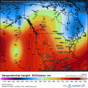
Looking at the EPS forecast for the PNA, we see a brief dip into the negative phase toward the beginning of next week. This correlates well with the region being clipped by a trough-to-cut-off-low forecast on both the ECMWF and GFS deterministic models.
Once that passes though, a ridge amplifying as it is squeezed between two troughs builds right back in – at least over part of the Northwest. Ridging will be centered more over western Canada, but will still impact a portion of the Northwest. Some of the interior west will remain below average as a cut-off low sits over the region.
The return of the ridge correlates with the PNA forecast to move back into the positive phase. It’s worth mentioning, however, that based on current data, the temperature anomalies once the ridge builds back in don’t seem quite as potent as they are currently. Instead of 10 to 20 degrees above average, it’s more on the order of 5 to (an isolated) 15 degrees above average – at least as the forecast stands now. There’s still time for that to change one way or the other.
Anyway, this region needs rain. Will they see it from this passing trough?
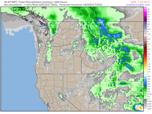
The data currently suggests very little in the way of rainfall, with the higher elevations squeezing out the “biggest” totals.
Unfortunately, chances at a decent rainfall for this region seem slim through at least next weekend, if not longer. This can, of course, change. But for now, no real signal exists for a widespread, heavy rain in the medium range.
