PTC One: A Lot of Water
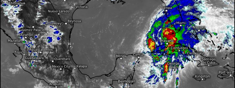
Our disturbance’s name may have changed from Invest 91L to PTC One over the last two days, but it honestly hasn’t changed very much otherwise. In Wednesday’s blog, I discussed the future of Invest 91L and mentioned that it would likely be a sheared, lopsided rainmaker.
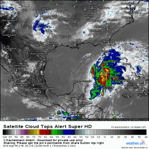
And, that’s exactly what we’re looking at right now. The low level center has managed to stay just barely hidden by bursts of convection, but still, most of said convection has been blown east.
In addition, the convection that currently accompanies PTC One is looking a little less than impressive. Yes, we are at the diurnal minimum (least convectively active time of day over water), but we really lack any signs of stronger convection attempting to organize at the moment.
Can that change? Sure! There’s still plenty of warm water to work with as it chugs on toward the southern Florida peninsula. The overnight hours could bring a burst of stronger convection and an attempt to organize. But, the storm will remain highly sheared and eastern-weighted.
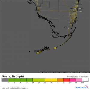
Though gusts greater than 40 mph have been observed in the Keys, the Hurricane Hunters have not yet been able to find sustained winds over 40 mph in the core.
They have noted, however, that the circulation has improved a bit. Perhaps an increase in convection as we enter the diurnal max overnight will assist in further strengthening the circulation and helping it to achieve TS status. In fact, the NHC still forecasts that PTC One will attain TS status sometime overnight/early tomorrow morning.
Regardless, impacts to southern Florida will remain just about the same.
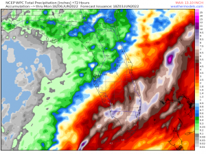
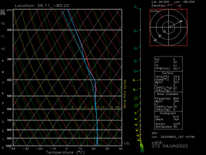
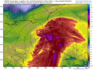
Very heavy rain is a certainty, resulting in flash flooding and urban flooding concerns.
Of greatest concern will be the highly developed areas that consist more of concrete than of grass or swampland. When heavy rain falls on concrete, it has nowhere to go as concrete can’t absorb it like soil can. It tends to just sit there and pile up, leading to flooded roadways or neighborhoods.
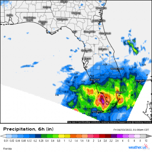
A decent amount of rain has already fallen over some of south Florida over the past 6 hours. If you reside here and are already seeing signs of flooding issues, keep in mind it will most likely get worse before it gets better as there is still a good amount of rain yet to come ashore.
In addition to rain/flooding, south Florida is currently under a slight risk for severe weather, including a few spin-up tornadoes.
As the center approaches land, winds will increase and back from the SSE, providing ample shear in the lower levels.
Tornadoes from landfalling tropical systems are notoriously hard to warn. Their circulations generally form at lower levels and form/dissipate quickly. There can be nothing one scan, a signature next scan, and then nothing the next. It’s important to be ready to act at moment’s notice if a warning is issued for your area, regardless of the time of day.
While many of tornadoes associated with tropical systems remain relatively weak, not all do. Take shelter for any warning issued.
All in all, this won’t be a particularly dangerous storm wind-wise. The danger will come from the deep tropical moisture and the resulting flooding.
Stay aware and stay off the roads if possible. If you must drive, don’t drive through floodwaters!
Check our Twitter feed for updates as PTC One nears landfall in the next 24 hours or so!
