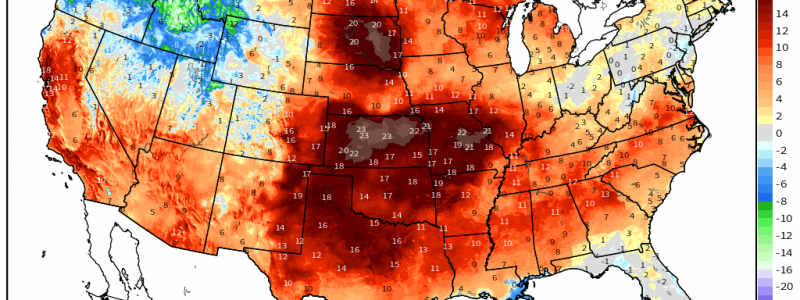
Progressive Pattern Brings CONUS Warmth
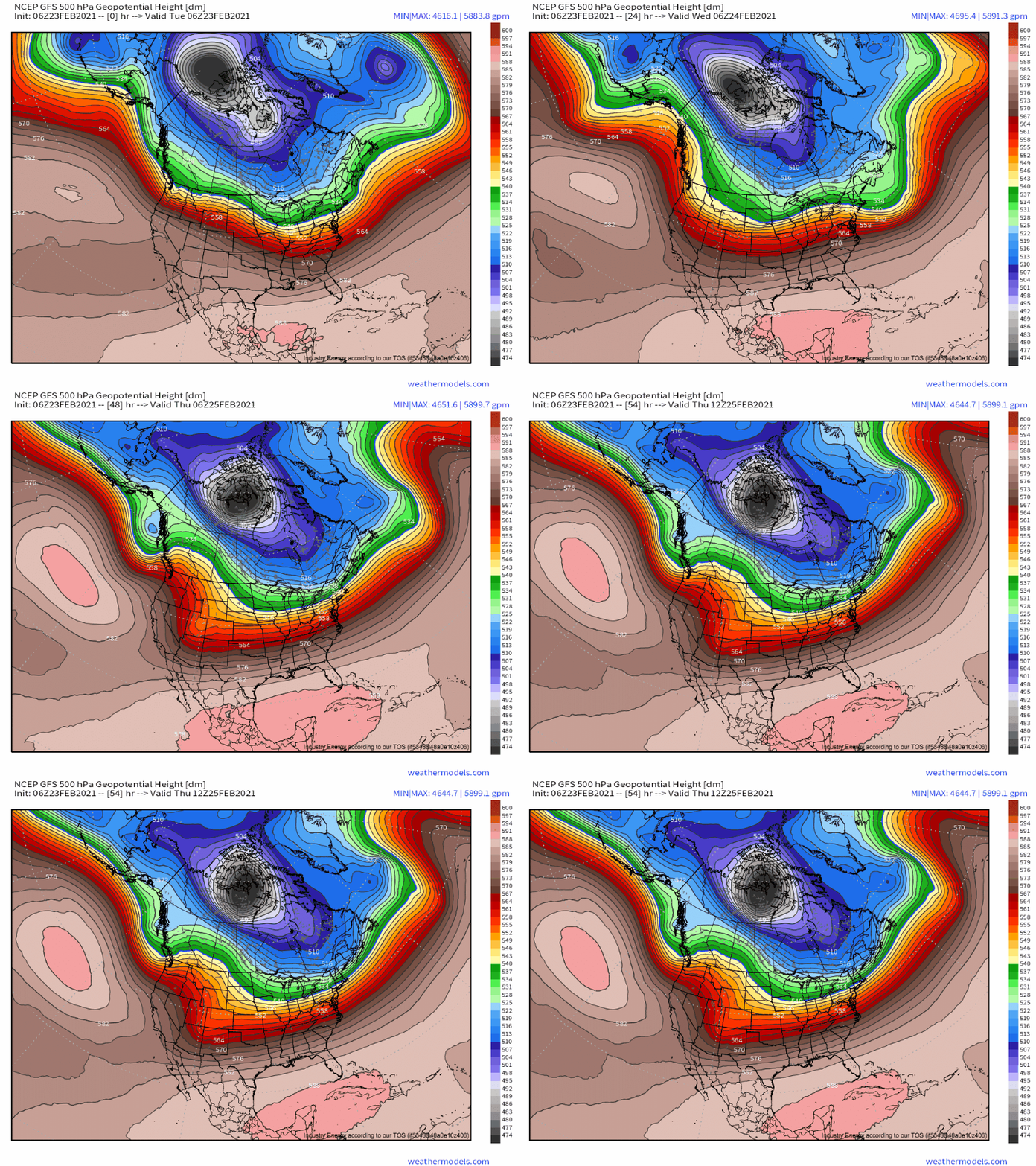
In a dramatic reversal from last week’s pattern, the tropospheric polar vortex has dramatically re-consolidated over the Arctic, where it belongs, with an intense polar jet keeping truly frigid air locked well to the north of the US/Canadian border. Phew.
Meanwhile, Pacific ridging has built north and west into the United States, pushing the subtropical jet rather far north into the Pacific Northwest. As the jet orients itself over the next couple of days, it will set up a regime of zonal flow and broad ridging favorable for Pacific air to infiltrate into the CONUS, and unfavorable for meaningful northerly advection.
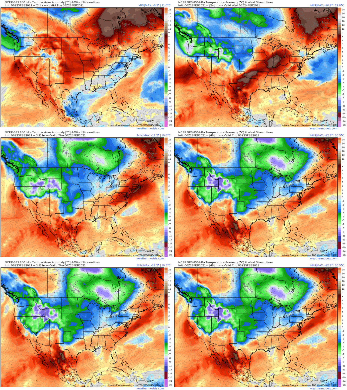
The axis of this ridging amidst zonal flow will sit over the central US today, shifting into the eastern US tomorrow. But even outside of this main zone, with a few localized exceptions, the only advection regime of note aloft in the CONUS will be southwesterly, sourced from the Pacific.
The sensible weather impacts of this temporary but welcome pattern are notably, in a word, pleasant: the Pacific is a wonderful place to import an airmass from, and the Arctic is not. The ocean is often significantly more temperature-moderate than air due to the sluggish speed at which water heats up and cools off, which means that air originating from a mid-latitude ocean is often mild, if damp. Largely, the mountainous west will serve to wring out this moisture, with topography forcing rain. Heavy rain and snow have been occurring there, as they often do amidst synoptic scale ascent and onshore flow when parcels of air are lifted to condensation at the hands of upsloping.
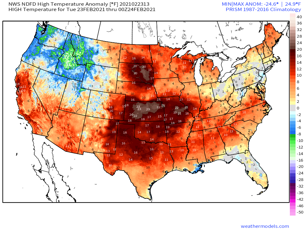
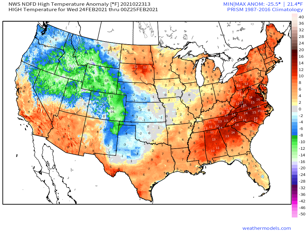
What comes up must come down, and adiabatic warming as air descends east of the mountains assures both anomalous warmth and unusual dryness of the air. Basically, where Pacific zonal flow sets up, sunny warmth follows.
This most wonderful winter airmass plagued the country for much of January, but is a wonderful respite from the deadly cold that had a grip on the south-central US as of late.
Enjoy!
