Powerhouse Trough to Bring Severe Storms, Winter Weather to US This Week
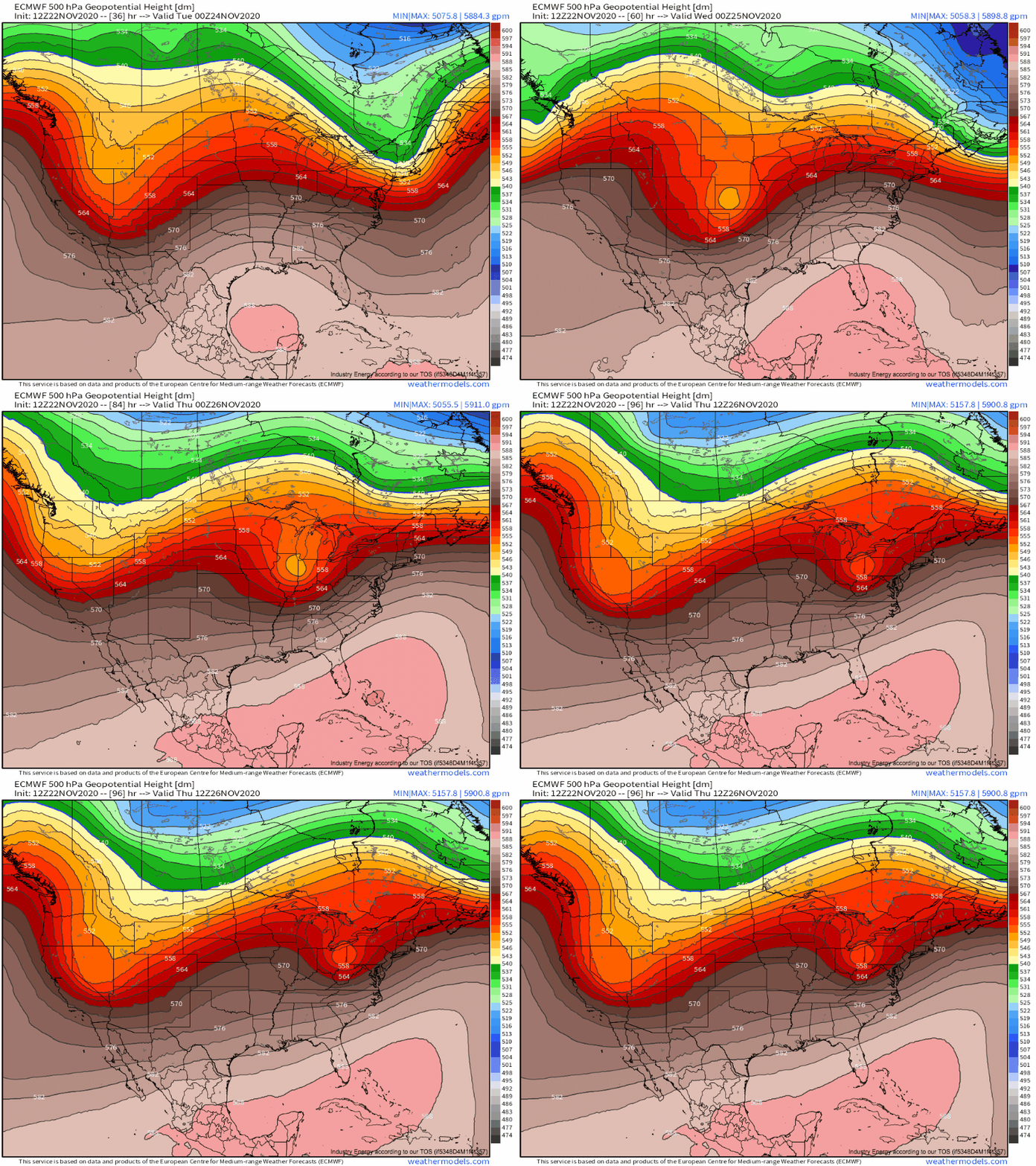
In a sharp pattern change from last week, the foreseeable future will likely feature a series of high-amplitude troughs making their way across the United States. The first such trough will bring much of the United States appreciable weather, with the potential for significant impacts in the form of severe thunderstorms, snow, and potentially even some ice this week.
As early as tonight, the midlevel energy entering the west coast will be responsible for moderate rain and snow in the Pacific northwest.
By the middle of tomorrow, increasing divergence ahead of the eastward moving trough will allow low pressure to begin organizing at the surface just east of the Rockies. As this surface low consolidates through Tuesday, a winter storm seems likely in the mountains of Colorado. Nothing unusually intense for the area is expected, but the slow-to-depart low and a persistent inflow of Pacific moisture could drop reasonably widespread snow totals exceeding 6″ by late Tuesday, with significantly more in favored peaks. 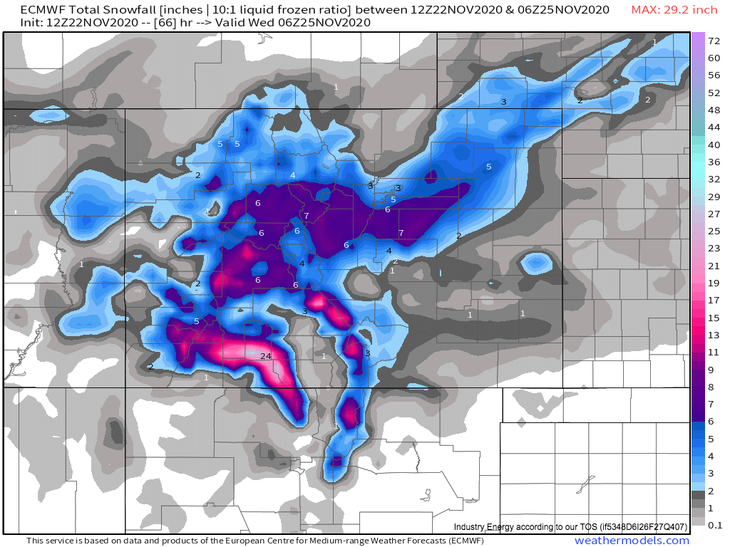
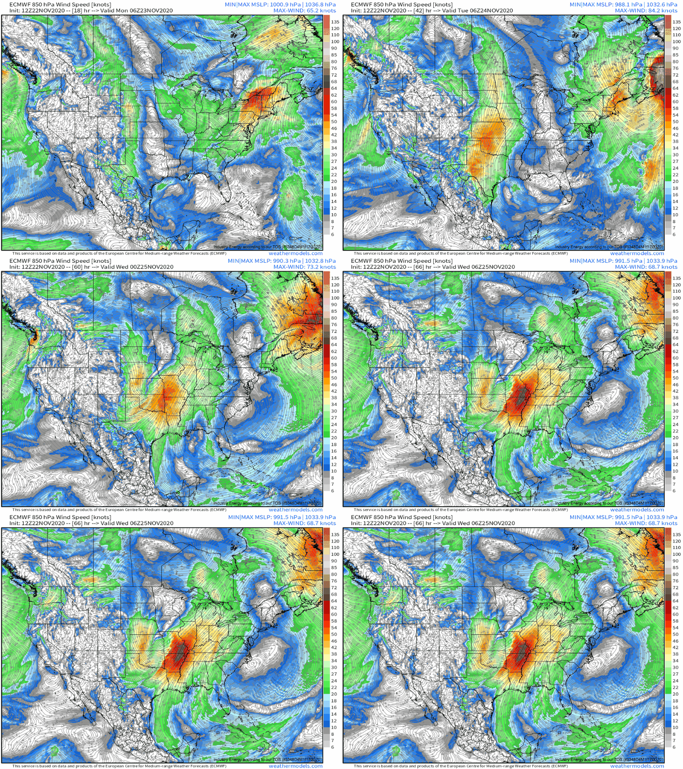
As the surface low is consolidating just east of the great weather machine that is the Rockies on Tuesday, another, very different atmospheric threat will evolve across the southern Plains and potentially parts of the Southeast and Midwest. A strong high pressure system developing under convergence in the wake of today’s Great Lakes trough will be sliding east Tuesday, and the pressure gradient between this feature and the strengthening cyclone will allow a very strong Plains low-level jet to develop, with southerly flow to 50 knots.
This type of roaring low-level jet is a very important ingredient when it comes to….cold season severe thunderstorms! 850mb flow is a good indicator of whether advection will be able to overcome unfavorable time of year and bring warm, humid gulf air north (it should be). It’s also a good indicator of whether low-level shear will be supportive of rotation or momentum transfer, which can lead to tornadoes and damaging wind gusts in convection, respectively.
So, we know that the type of low-level flow typically necessary for severe convection is likely to be in place over the Plains Tuesday. We also know from our synoptic overview before that 500mb flow will be more than sufficient to produce the kind of deep-layer shear that storms need to organize, and that the deep, compact trough digging into the Rockies will provide synoptic scale lift. This zone of favorable conditions will overlap with marginal to moderate instability at the hands of our Gulf moisture return, too.
Let’s look at a vertical slice of the warm-sector atmosphere next, to see how these features could overlap to either allow or suppress severe convection. This sounding is taken from Oklahoma, in the northern half of the warm sector:
A few things jump out: first of all, as expected, strong winds at all levels of the atmosphere with warm air advection will lead to a wide, curving hodograph, supportive of rotation in any stronger, more discrete/QLCS-y convection. At the same time, though, CAPE is pretty skinny, and largely absent from the low levels. This should put a significant damper on more significant severe weather. In the southern half of the warm sector, less impressive hodographs and stronger instability are the story, but nowhere are the hodographs particularly unimpressive or the instability particularly strong. So, this is going to be a pretty classic high shear low CAPE setup, huh!
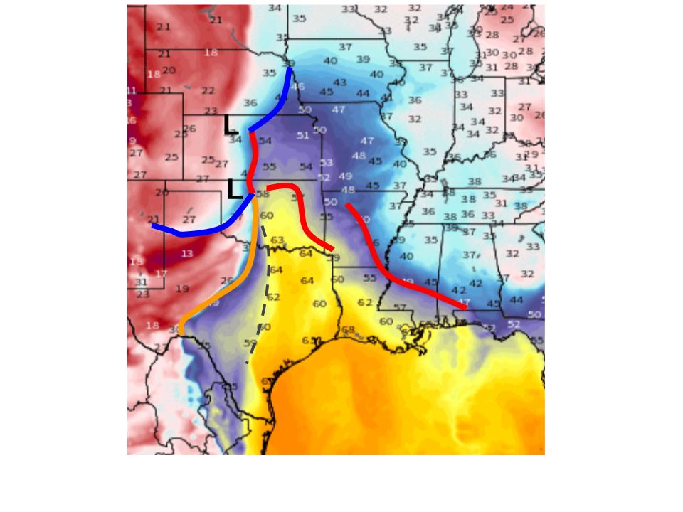
To continue our analysis, it becomes imperative to look at where storms may initiate Tuesday. Let’s look at the surface.
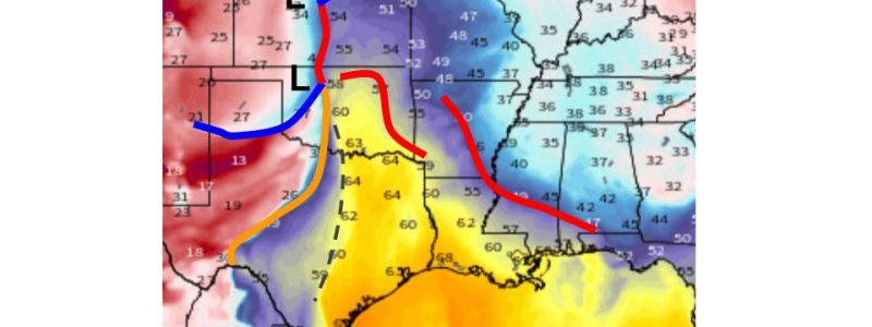
I’ve annotated up our dewpoint map with a few important surface features I see, and frankly, I’m impressed. If it were May, this could be a real tornado outbreak! But it’s November. Anyway, evidence of a pseudo-dryline feature ahead of the actual dryline/cold front mess could provide an opportunity for discrete convection to fire up with strong, but not overwhelmingly linear, forcing. The actual dryline/cold front itself will then swoop in and initiate convection everywhere, probably in a line late Tuesday evening. Both of these convective regimes will threaten severe weather, with any discrete cells potentially posing a tornado/wind risk, and the eventual line potentially posing a damaging wind risk, especially with the roaring low-level jet.
Some severe potential will likely continue Wednesday, probably in an even higher-shear, lower-CAPE regime, and will likely be mostly damaging wind along a strongly forced cold front.
Back to the low itself!
There will almost certainly be a snow threat to the storm’s west, as the precipitation shield associated with the low moves over Nebraska and into the Dakotas Tuesday afternoon. Nothing likely serious here, but could prove disruptive to Thanksgiving travel. Another, possibly more significant wave of snow will develop with the system late Tuesday into Wednesday, as the northern precipitation shield moves into the Great Lakes and SE Canada. This could drop a low-end plowable snowfall, maybe 4-7″ in places.
A final threat worth watching is what happens when eager low level southerly advection hits cold air daming over north-central New England late Wednesday and early Thursday. This could end up producing sleet or even ice accretion, both of which can prove quite hazardous to travel. Significant, damaging ice accretion seems unlikely with this system. Of course, mixed precipitation types are hard to predict, especially 5 days out, so we’ll leave that threat for further analysis in later blogs.
A powerful trough will slide into the central US this week, with a developing surface cyclone creating widespread, if typically low-end, impacts. On Monday, heavy snow is possible in Colorado, before Tuesday brings a severe thunderstorm threat to the Southern Plains and some snow to the Northern Plains and Midwest. Snow and a severe weather threat continues in the midwest and southeast Wednesday, respectively, and a mixed precipitation event is possible into Thursday over New England. We will keep you posted with updates via blog and tweet, of course! Safe travels!
