Potent Severe Threat Targets Plains States Sunday
Typically, when someone mentions “severe season,” our minds go straight to Spring. Spring is well known for exciting (or terrifying, if you have storm anxiety) Day 1/2/3 outlooks. These begin in the south in March and move into the Plains states by late Spring. But the lesser-known “second season” that occurs in the Fall can be just as potent. Once the jet stream migrates south and those big, synoptic systems start rolling across the country again, the thermal contrast and powerful lifting can fuel severe weather that is just as memorable as anything the Spring has to offer.
The latter half of this weekend will offer such an event.
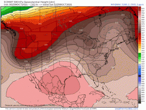
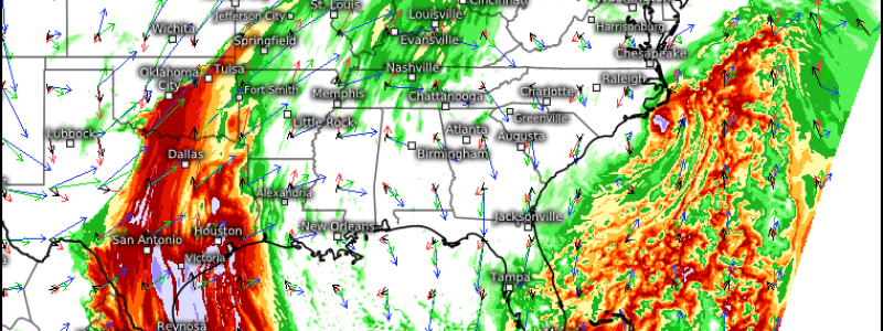
A digging trough over the West Coast states will move east throughout the day today. As it does so, it will split. While the northern stream trough will be pulled across the Northern Plains states into Canada, the southern stream trough will dig south. It will become rather potent by Sunday afternoon, as it approaches Oklahoma and Texas.
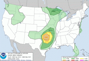
I’m including the Day 2 outlook for reference as it best illustrates the risk area. A word of caution though: Don’t get hung up on the scary colors. Though those inside the Enhanced Risk area will have the best ingredients for severe weather, it can happen in any of the defined areas. The atmosphere doesn’t read risk maps or care about lines drawn by humans.
So, what are the risks?
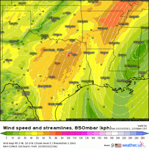
As the low slides into the TX/OK vicinity and deepens, the low level jet will really begin to crank by late afternoon/early evening.
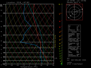
To answer the question on everyone’s minds: yes, tornadoes are possible. A strong LLJ, ample shear, and surface winds backing from the southeast will provide a good environment for supercells capable of tornadic development to form, especially earlier in the event. Cold air aloft and strong updrafts will allow for the possibility of large hail as well.
Over time, upscale growth is expected. Storm mode will shift from more discrete supercells to a convective line. Though rotation embedded in the line could lead to another tornado or two, the bigger risks at this time will be damaging straight-line winds.
With this event kicking off in the late afternoon/early evening and sunset times getting earlier every day, it’s important to point out that this event will, at least partially, occur after dark. Any tornadoes will be hard, if not impossible, to see. Be sure to have a weather radio plus at least one other way to receive warnings ready to go. Have a plan to shelter as well. If you live on the eastern periphery of the risk area, you may want to take further steps and sleep in your safe space to reduce the amount of scrambling you’ll need to do if you’re awoken by a warning.
Stay safe!
